White Sulphur Springs is a city in and the county seat of Meagher County, Montana, United States. The population was 955 at the 2020 census.
The center of population of Montana is located in White Sulphur Springs.
White Sulphur Springs was originally called Brewers Springs, after James Scott Brewer, who laid claim to the thermal springs in 1866. In 1876 the town name changed.
| Name: | White Sulphur Springs city |
|---|---|
| LSAD Code: | 25 |
| LSAD Description: | city (suffix) |
| State: | Montana |
| County: | Meagher County |
| Elevation: | 5,043 ft (1,537 m) |
| Total Area: | 0.99 sq mi (2.57 km²) |
| Land Area: | 0.99 sq mi (2.57 km²) |
| Water Area: | 0.00 sq mi (0.00 km²) |
| Total Population: | 955 |
| Population Density: | 964.65/sq mi (372.28/km²) |
| ZIP code: | 59645 |
| Area code: | 406 |
| FIPS code: | 3080050 |
| GNISfeature ID: | 0793216 |
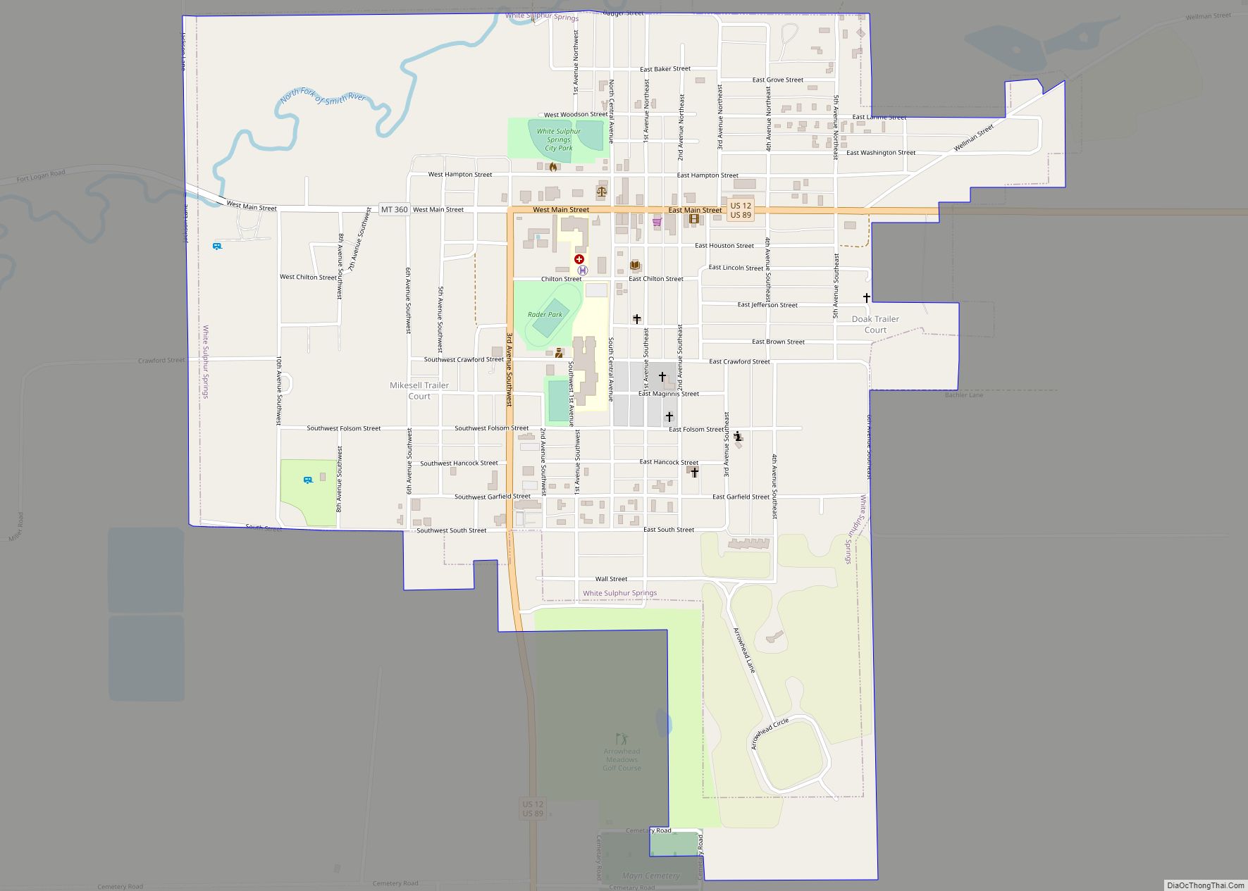
Online Interactive Map
Click on ![]() to view map in "full screen" mode.
to view map in "full screen" mode.
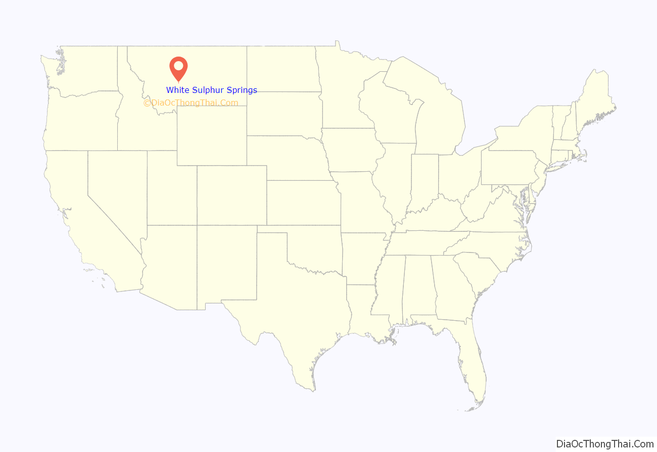
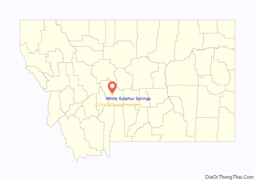
White Sulphur Springs location map. Where is White Sulphur Springs city?
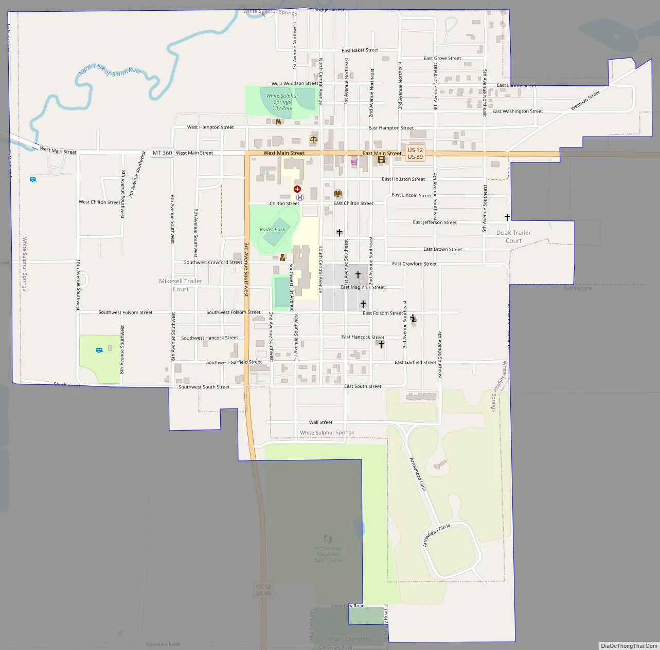
White Sulphur Springs Road Map
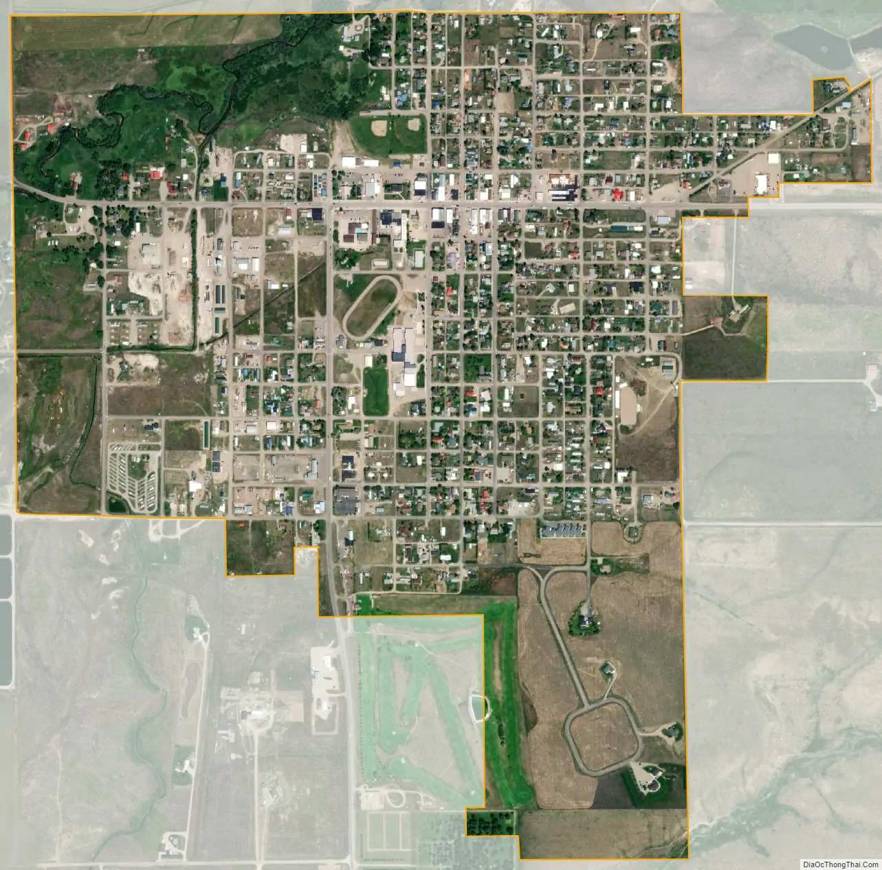
White Sulphur Springs city Satellite Map
Geography
White Sulphur Springs is located at 46°32′47″N 110°54′9″W / 46.54639°N 110.90250°W / 46.54639; -110.90250 (46.546396, -110.902552). The Castle Mountains are east of town.
According to the United States Census Bureau, the city has a total area of 1.01 square miles (2.62 km), all land.
See also
Map of Montana State and its subdivision:- Beaverhead
- Big Horn
- Blaine
- Broadwater
- Carbon
- Carter
- Cascade
- Chouteau
- Custer
- Daniels
- Dawson
- Deer Lodge
- Fallon
- Fergus
- Flathead
- Gallatin
- Garfield
- Glacier
- Golden Valley
- Granite
- Hill
- Jefferson
- Judith Basin
- Lake
- Lewis and Clark
- Liberty
- Lincoln
- Madison
- McCone
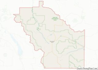
- Meagher
- Mineral
- Missoula
- Musselshell
- Park
- Petroleum
- Phillips
- Pondera
- Powder River
- Powell
- Prairie
- Ravalli
- Richland
- Roosevelt
- Rosebud
- Sanders
- Sheridan
- Silver Bow
- Stillwater
- Sweet Grass
- Teton
- Toole
- Treasure
- Valley
- Wheatland
- Wibaux
- Yellowstone
- Alabama
- Alaska
- Arizona
- Arkansas
- California
- Colorado
- Connecticut
- Delaware
- District of Columbia
- Florida
- Georgia
- Hawaii
- Idaho
- Illinois
- Indiana
- Iowa
- Kansas
- Kentucky
- Louisiana
- Maine
- Maryland
- Massachusetts
- Michigan
- Minnesota
- Mississippi
- Missouri
- Montana
- Nebraska
- Nevada
- New Hampshire
- New Jersey
- New Mexico
- New York
- North Carolina
- North Dakota
- Ohio
- Oklahoma
- Oregon
- Pennsylvania
- Rhode Island
- South Carolina
- South Dakota
- Tennessee
- Texas
- Utah
- Vermont
- Virginia
- Washington
- West Virginia
- Wisconsin
- Wyoming