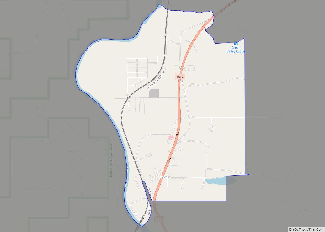
West Glacier is an unincorporated community and census-designated place (CDP) in eastern Flathead County, Montana, United States. As of the 2010 census it had a population of 227. The town is at the west entrance to Glacier National Park and is located on U.S. Route 2 and a main line of the BNSF Railway. The headquarters complex for Glacier National Park is located nearby.
| Name: | West Glacier CDP |
|---|---|
| LSAD Code: | 57 |
| LSAD Description: | CDP (suffix) |
| State: | Montana |
| County: | Flathead County |
| Elevation: | 3,163 ft (964 m) |
| Total Area: | 4.22 sq mi (10.92 km²) |
| Land Area: | 4.14 sq mi (10.73 km²) |
| Water Area: | 0.07 sq mi (0.19 km²) |
| Total Population: | 221 |
| Population Density: | 53.36/sq mi (20.60/km²) |
| ZIP code: | 59921, 59936 |
| Area code: | 406 |
| FIPS code: | 3079075 |
| GNISfeature ID: | 0793105 |
Online Interactive Map
Click on ![]() to view map in "full screen" mode.
to view map in "full screen" mode.
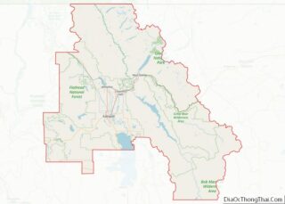
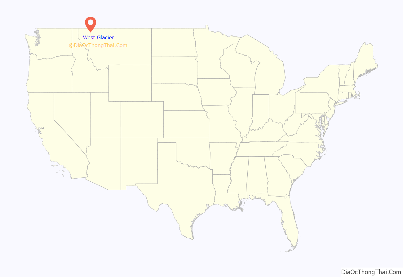
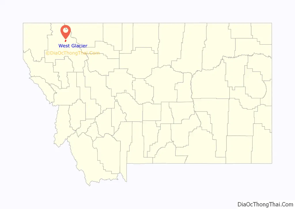
West Glacier location map. Where is West Glacier CDP?
History
Remote and almost inaccessible, the West Glacier area drew only limited attention by white settlers until the main line of the Great Northern Railway (GNR) reached the northern Rocky Mountains in 1890. The transcontinental GNR was completed on January 6, 1893, at Scenic, Washington.
The railroad established a station named “Belton” at the current West Glacier site, and a small community slowly began to develop in the area. A post office was established at Belton in 1900. The number of homesteaders and other settlers remained small, however, due to the region’s rugged, heavily forested terrain.
The community, heavily dependent on tourism, has a small permanent population that expands significantly during the summer tourist season; most area businesses are likewise seasonal—including the 18-hole golf course—and are primarily geared towards travelers. The elevation is 3,169 feet (966 m).
The Swiss-style Belton Chalets in West Glacier, originally built in 1910, was the first Great Northern Railway hotel at Glacier National Park and would welcome guests arriving by train to the park, before they would travel into the park’s back-country chalets and tent camps. During the Great Depression, the Belton Chalet housed the crews working on the Going-to-the-Sun Road. Over the years, the chalet housed many businesses, while today it is one of Montana’s grandest historic hotels. The chalet survives today under new ownership and is a registered National Historic Landmark.
In 1949 the town changed its name from Belton to West Glacier to promote the tourism potential.
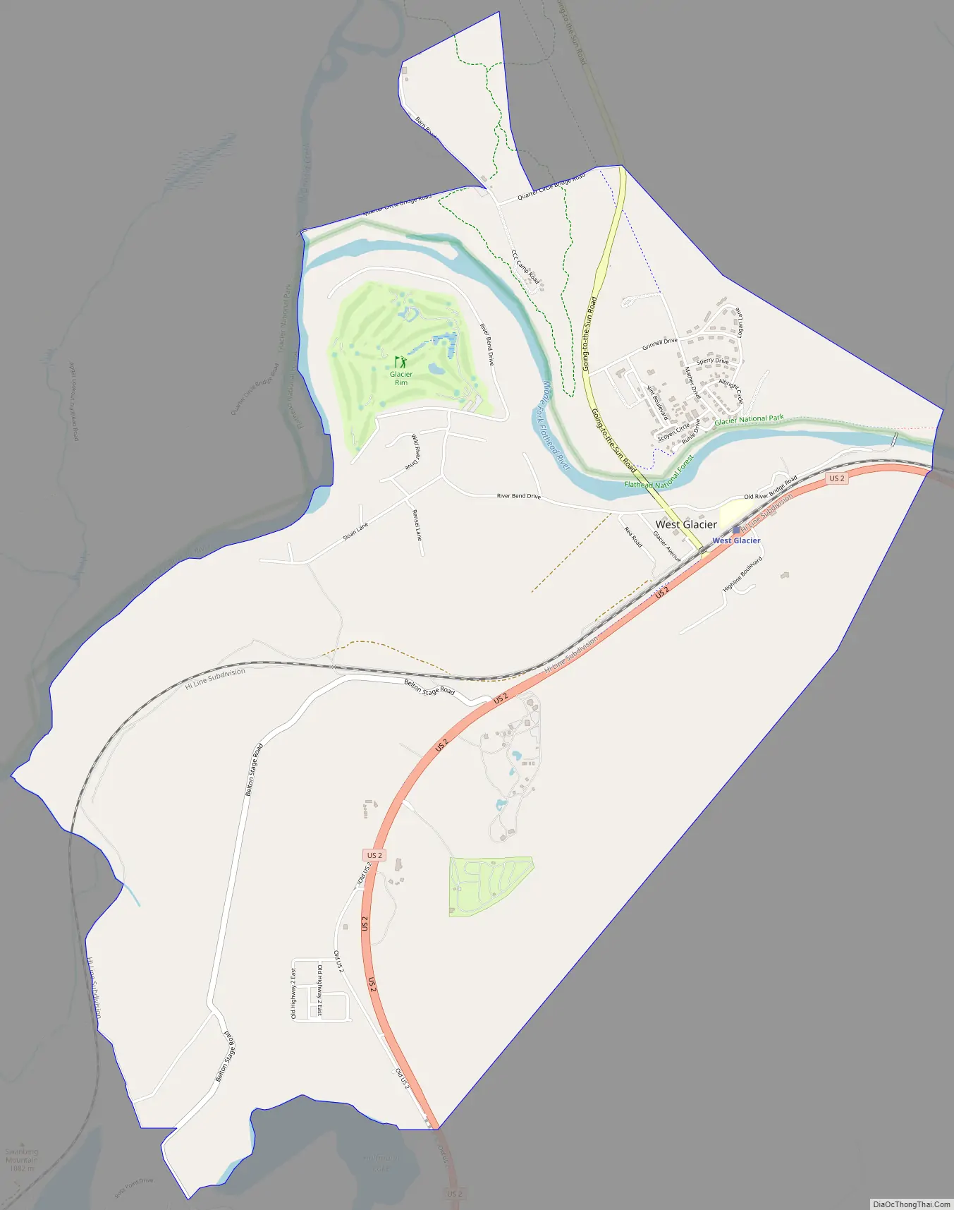
West Glacier Road Map
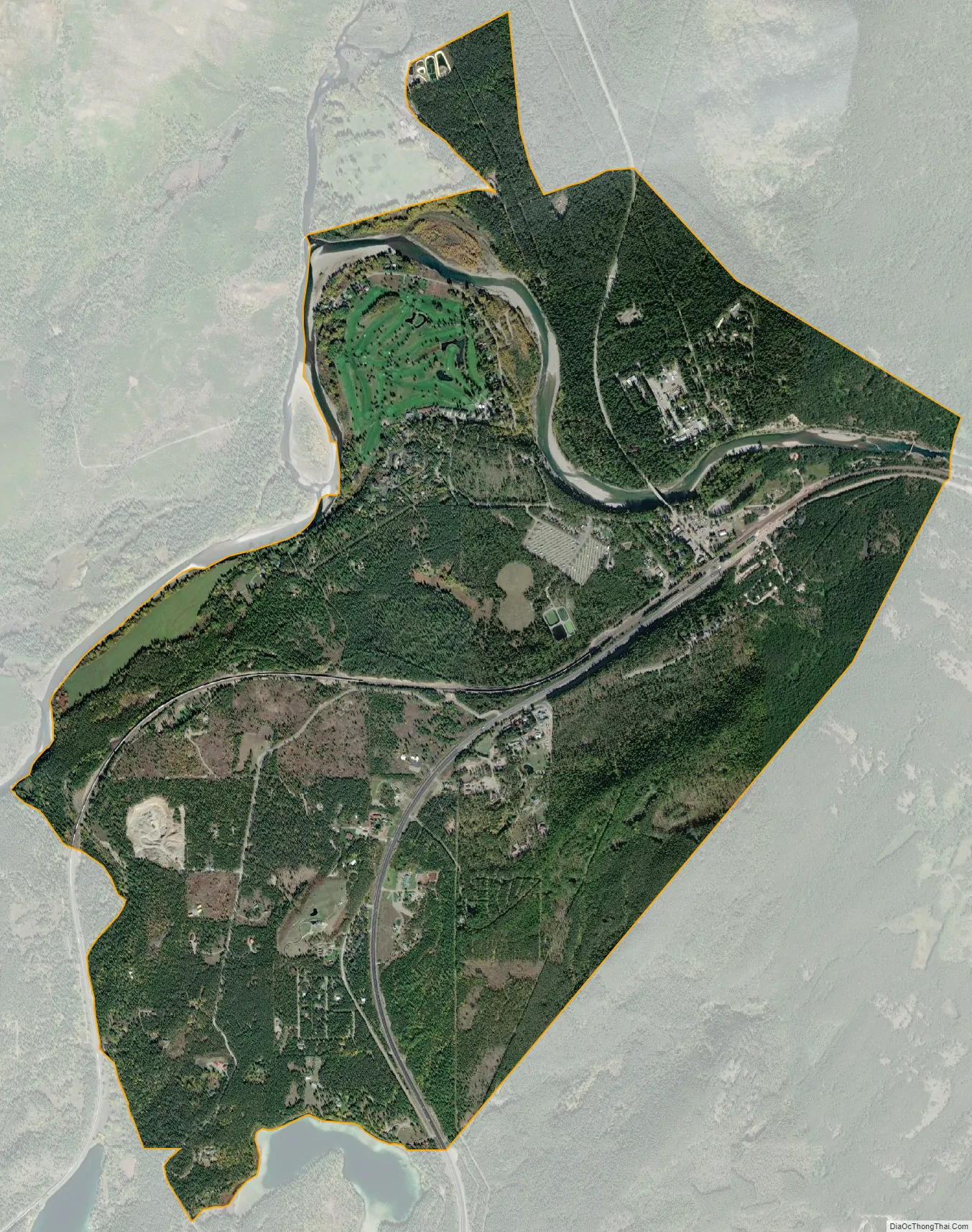
West Glacier city Satellite Map
See also
Map of Montana State and its subdivision:- Beaverhead
- Big Horn
- Blaine
- Broadwater
- Carbon
- Carter
- Cascade
- Chouteau
- Custer
- Daniels
- Dawson
- Deer Lodge
- Fallon
- Fergus
- Flathead
- Gallatin
- Garfield
- Glacier
- Golden Valley
- Granite
- Hill
- Jefferson
- Judith Basin
- Lake
- Lewis and Clark
- Liberty
- Lincoln
- Madison
- McCone
- Meagher
- Mineral
- Missoula
- Musselshell
- Park
- Petroleum
- Phillips
- Pondera
- Powder River
- Powell
- Prairie
- Ravalli
- Richland
- Roosevelt
- Rosebud
- Sanders
- Sheridan
- Silver Bow
- Stillwater
- Sweet Grass
- Teton
- Toole
- Treasure
- Valley
- Wheatland
- Wibaux
- Yellowstone
- Alabama
- Alaska
- Arizona
- Arkansas
- California
- Colorado
- Connecticut
- Delaware
- District of Columbia
- Florida
- Georgia
- Hawaii
- Idaho
- Illinois
- Indiana
- Iowa
- Kansas
- Kentucky
- Louisiana
- Maine
- Maryland
- Massachusetts
- Michigan
- Minnesota
- Mississippi
- Missouri
- Montana
- Nebraska
- Nevada
- New Hampshire
- New Jersey
- New Mexico
- New York
- North Carolina
- North Dakota
- Ohio
- Oklahoma
- Oregon
- Pennsylvania
- Rhode Island
- South Carolina
- South Dakota
- Tennessee
- Texas
- Utah
- Vermont
- Virginia
- Washington
- West Virginia
- Wisconsin
- Wyoming