Worden is a census-designated place (CDP) in Yellowstone County, Montana, United States. The population was 506 at the 2000 census. Worden, along with Ballantine, Huntley, and Pompey’s Pillar, is part of the Huntley Project, an irrigation district established by the United States Bureau of Reclamation in 1907.
Worden is home to a number of restaurants, bars, stores, churches, and other services. It is also the home of the Huntley Project School System, consisting of an elementary, junior high, and high school. Huntley Project High School’s team name is the “Red Devils.”
| Name: | Worden CDP |
|---|---|
| LSAD Code: | 57 |
| LSAD Description: | CDP (suffix) |
| State: | Montana |
| County: | Yellowstone County |
| Elevation: | 2,963 ft (903 m) |
| Total Area: | 1.98 sq mi (5.12 km²) |
| Land Area: | 1.98 sq mi (5.12 km²) |
| Water Area: | 0.00 sq mi (0.00 km²) |
| Total Population: | 582 |
| Population Density: | 294.53/sq mi (113.70/km²) |
| ZIP code: | 59088 |
| Area code: | 406 |
| FIPS code: | 3081925 |
| GNISfeature ID: | 0778696 |
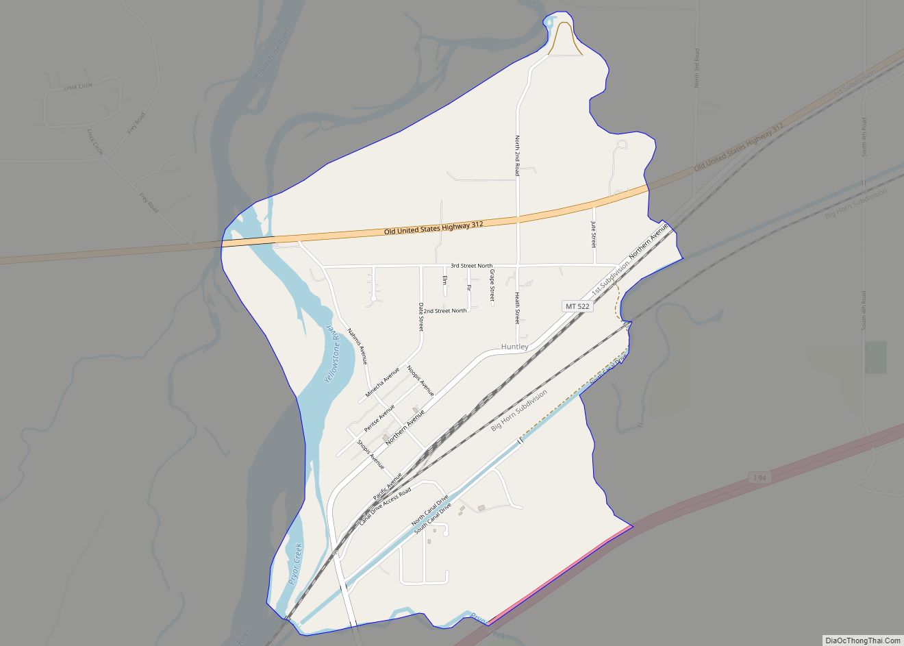
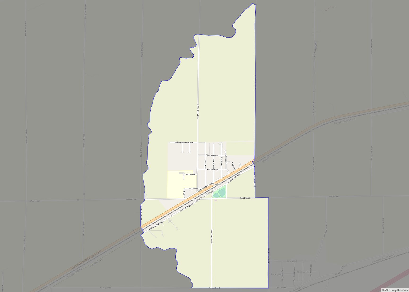
Online Interactive Map
Click on ![]() to view map in "full screen" mode.
to view map in "full screen" mode.
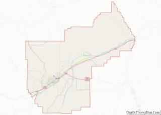
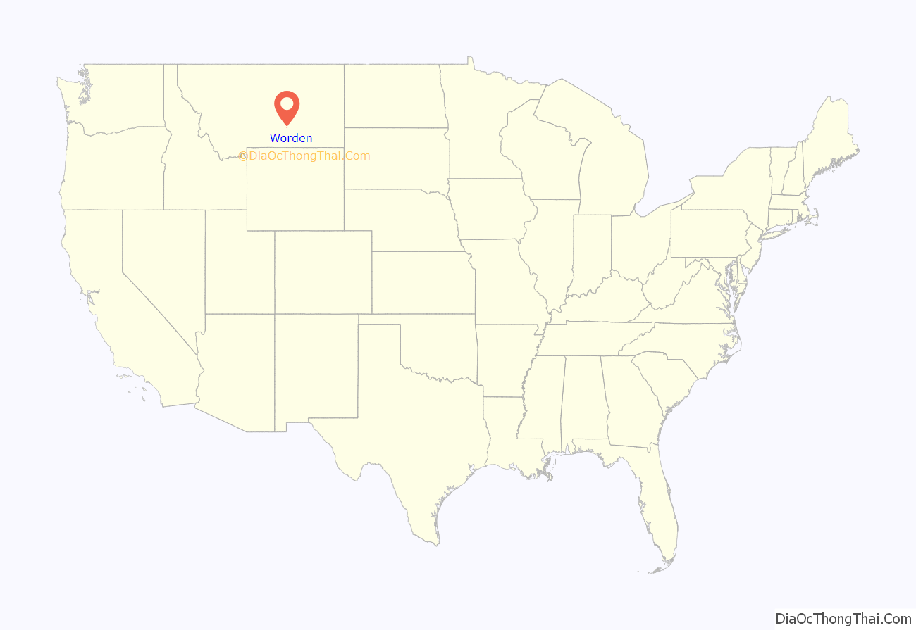
Worden location map. Where is Worden CDP?
History
Worden is located on land designated in 1868 as part of the Crow Indian Reservation. When the Northern Pacific Railroad was surveyed and built in the early 1880s, a station called “Clermont” was supposedly built 21 miles from Billings, just across the tracks from present-day Worden.
The town of Worden was mapped out in 1907 as part of the Huntley Project. Irrigation transformed the area into an agricultural district and attracted immigrants. The town had a German Congregational church and a Methodist church. A newspaper, The Yellowstone County News, was based here.
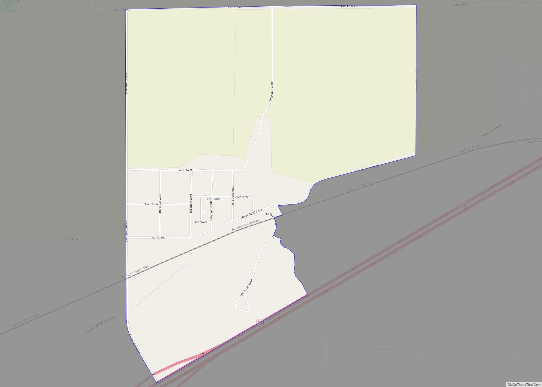
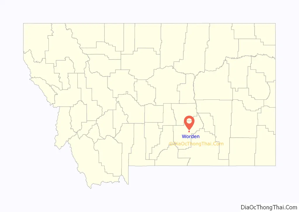
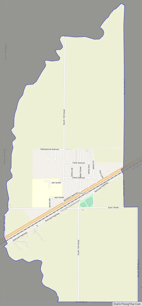
Worden Road Map
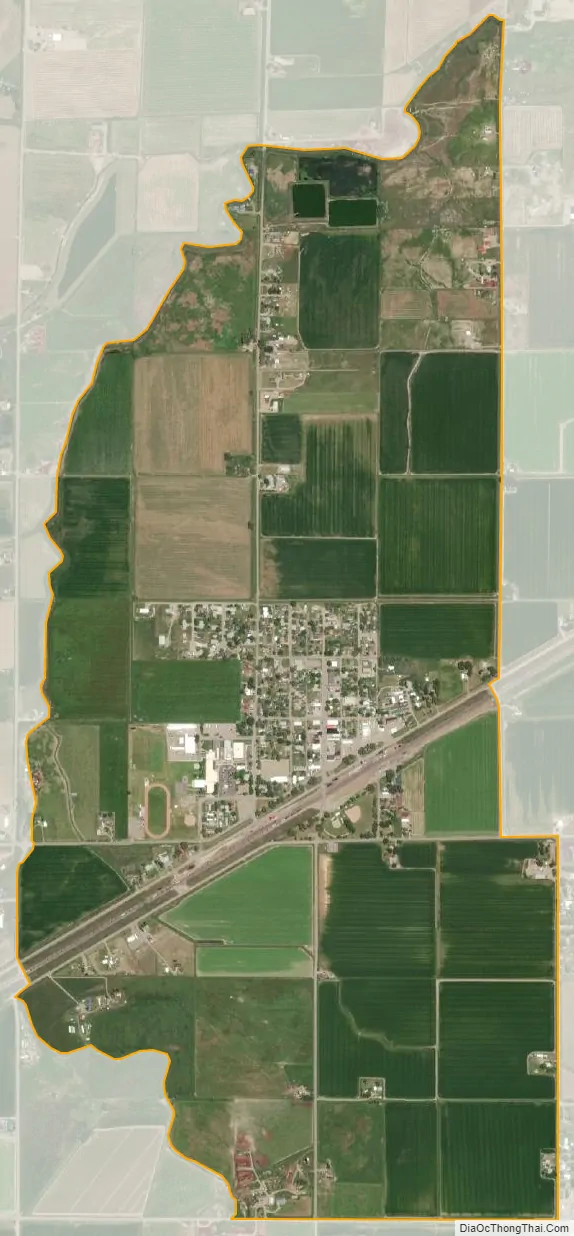
Worden city Satellite Map
Geography
Worden is located at 45°57′39″N 108°9′49″W / 45.96083°N 108.16361°W / 45.96083; -108.16361 (45.960697, -108.163568).
According to the United States Census Bureau, the CDP has a total area of 2.0 square miles (5.2 km), all land.
Worden is located along U.S. Route 312.
See also
Map of Montana State and its subdivision:- Beaverhead
- Big Horn
- Blaine
- Broadwater
- Carbon
- Carter
- Cascade
- Chouteau
- Custer
- Daniels
- Dawson
- Deer Lodge
- Fallon
- Fergus
- Flathead
- Gallatin
- Garfield
- Glacier
- Golden Valley
- Granite
- Hill
- Jefferson
- Judith Basin
- Lake
- Lewis and Clark
- Liberty
- Lincoln
- Madison
- McCone
- Meagher
- Mineral
- Missoula
- Musselshell
- Park
- Petroleum
- Phillips
- Pondera
- Powder River
- Powell
- Prairie
- Ravalli
- Richland
- Roosevelt
- Rosebud
- Sanders
- Sheridan
- Silver Bow
- Stillwater
- Sweet Grass
- Teton
- Toole
- Treasure
- Valley
- Wheatland
- Wibaux
- Yellowstone
- Alabama
- Alaska
- Arizona
- Arkansas
- California
- Colorado
- Connecticut
- Delaware
- District of Columbia
- Florida
- Georgia
- Hawaii
- Idaho
- Illinois
- Indiana
- Iowa
- Kansas
- Kentucky
- Louisiana
- Maine
- Maryland
- Massachusetts
- Michigan
- Minnesota
- Mississippi
- Missouri
- Montana
- Nebraska
- Nevada
- New Hampshire
- New Jersey
- New Mexico
- New York
- North Carolina
- North Dakota
- Ohio
- Oklahoma
- Oregon
- Pennsylvania
- Rhode Island
- South Carolina
- South Dakota
- Tennessee
- Texas
- Utah
- Vermont
- Virginia
- Washington
- West Virginia
- Wisconsin
- Wyoming