Mount Ivy is a hamlet and census-designated place in the Town of Haverstraw, in Rockland County, New York, United States. It is located north of New City, east of Pomona, south of Thiells, and west of Garnerville. The population was 6,878 at the 2010 census.
| Name: | Mount Ivy CDP |
|---|---|
| LSAD Code: | 57 |
| LSAD Description: | CDP (suffix) |
| State: | New York |
| County: | Rockland County |
| Elevation: | 459 ft (140 m) |
| Total Area: | 1.47 sq mi (3.82 km²) |
| Land Area: | 1.47 sq mi (3.82 km²) |
| Water Area: | 0.00 sq mi (0.00 km²) |
| Total Population: | 7,657 |
| Population Density: | 5,194.71/sq mi (2,006.28/km²) |
| ZIP code: | 10970 |
| Area code: | 845 |
| FIPS code: | 3648879 |
| GNISfeature ID: | 0957849 |
Online Interactive Map
Click on ![]() to view map in "full screen" mode.
to view map in "full screen" mode.
Mount Ivy location map. Where is Mount Ivy CDP?


History
For many years, the Ramapough Mountain Indians were the inhabitants of this region. It was also an important Quaker settlement.
The name Mount Ivy is said to have been given to the locality because of its elevation and ivy swamp.
Mount Ivy is the location where General Anthony Wayne’s troops rested and concealed themselves before the assault of Stony Point fortress.
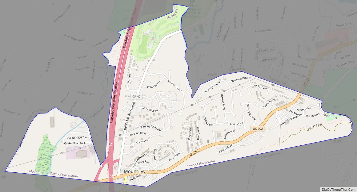
Mount Ivy Road Map
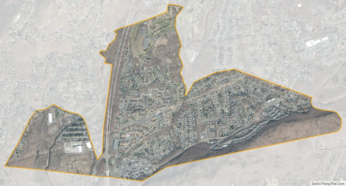
Mount Ivy city Satellite Map
Geography
Mount Ivy is located at 41°11′31″N 74°1′56″W / 41.19194°N 74.03222°W / 41.19194; -74.03222 (41.191839, -74.032162).
According to the United States Census Bureau, the CDP has a total area of 1.5 square miles (3.9 km), of which 1.5 square miles (3.9 km) is land and 0.68% is water.
Mount Ivy straddles the border between the towns of Ramapo and Haverstraw, lying within southernmost Haverstraw. The business center of Mount Ivy is located at the northern terminus of New York State Route 45, at its junction with U.S. Route 202, approximately ¼ mile east of the Mount Ivy exit of the Palisades Interstate Parkway.
Mount Ivy is primarily served by the Pomona post office. The hamlet is split between the North Rockland School District and The East Ramapo School District.
See also
Map of New York State and its subdivision:- Albany
- Allegany
- Bronx
- Broome
- Cattaraugus
- Cayuga
- Chautauqua
- Chemung
- Chenango
- Clinton
- Columbia
- Cortland
- Delaware
- Dutchess
- Erie
- Essex
- Franklin
- Fulton
- Genesee
- Greene
- Hamilton
- Herkimer
- Jefferson
- Kings
- Lake Ontario
- Lewis
- Livingston
- Madison
- Monroe
- Montgomery
- Nassau
- New York
- Niagara
- Oneida
- Onondaga
- Ontario
- Orange
- Orleans
- Oswego
- Otsego
- Putnam
- Queens
- Rensselaer
- Richmond
- Rockland
- Saint Lawrence
- Saratoga
- Schenectady
- Schoharie
- Schuyler
- Seneca
- Steuben
- Suffolk
- Sullivan
- Tioga
- Tompkins
- Ulster
- Warren
- Washington
- Wayne
- Westchester
- Wyoming
- Yates
- Alabama
- Alaska
- Arizona
- Arkansas
- California
- Colorado
- Connecticut
- Delaware
- District of Columbia
- Florida
- Georgia
- Hawaii
- Idaho
- Illinois
- Indiana
- Iowa
- Kansas
- Kentucky
- Louisiana
- Maine
- Maryland
- Massachusetts
- Michigan
- Minnesota
- Mississippi
- Missouri
- Montana
- Nebraska
- Nevada
- New Hampshire
- New Jersey
- New Mexico
- New York
- North Carolina
- North Dakota
- Ohio
- Oklahoma
- Oregon
- Pennsylvania
- Rhode Island
- South Carolina
- South Dakota
- Tennessee
- Texas
- Utah
- Vermont
- Virginia
- Washington
- West Virginia
- Wisconsin
- Wyoming


