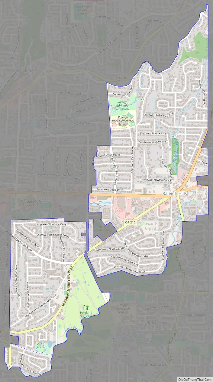
Raleigh Hills is a census-designated place and neighborhood in Washington County, Oregon within the metropolitan area of Portland, Oregon, United States. It is located in the southwest hills in Washington County, with Beaverton to the west, West Slope to the north, and Progress and Garden Home to the south. As of the 2000 census, the census-designated place had a total population of 5,865.
Raleigh Hills is located at the intersection of Oregon Routes 10 and 210. Fire protection and EMS services are provided through Tualatin Valley Fire and Rescue. Raleigh Hills is also the location of the first ever New Seasons Market.
| Name: | Raleigh Hills CDP |
|---|---|
| LSAD Code: | 57 |
| LSAD Description: | CDP (suffix) |
| State: | Oregon |
| County: | Washington County |
| Elevation: | 282 ft (86 m) |
| Total Area: | 1.52 sq mi (3.94 km²) |
| Land Area: | 1.52 sq mi (3.94 km²) |
| Water Area: | 0.00 sq mi (0.00 km²) |
| Total Population: | 6,196 |
| Population Density: | 4,073.64/sq mi (1,573.07/km²) |
| FIPS code: | 4160900 |
| GNISfeature ID: | 1158435 |
Online Interactive Map
Click on ![]() to view map in "full screen" mode.
to view map in "full screen" mode.
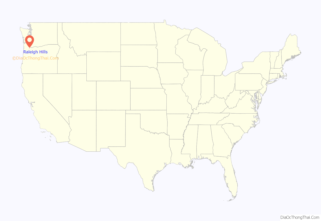
Raleigh Hills location map. Where is Raleigh Hills CDP?
History
Raleigh Hills was named after Raleigh Robinson, a resident of the neighborhood. A post office named Raleigh was established in the area in April 1892, and was closed twelve years later. Southern Pacific’s Red Electric line had a stop in Raleigh from 1914 until the line ceased operations in 1929. A Raleigh Hills branch of the Portland post office was opened in 1968.
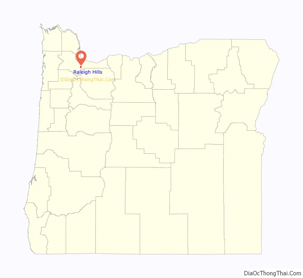
Raleigh Hills Road Map
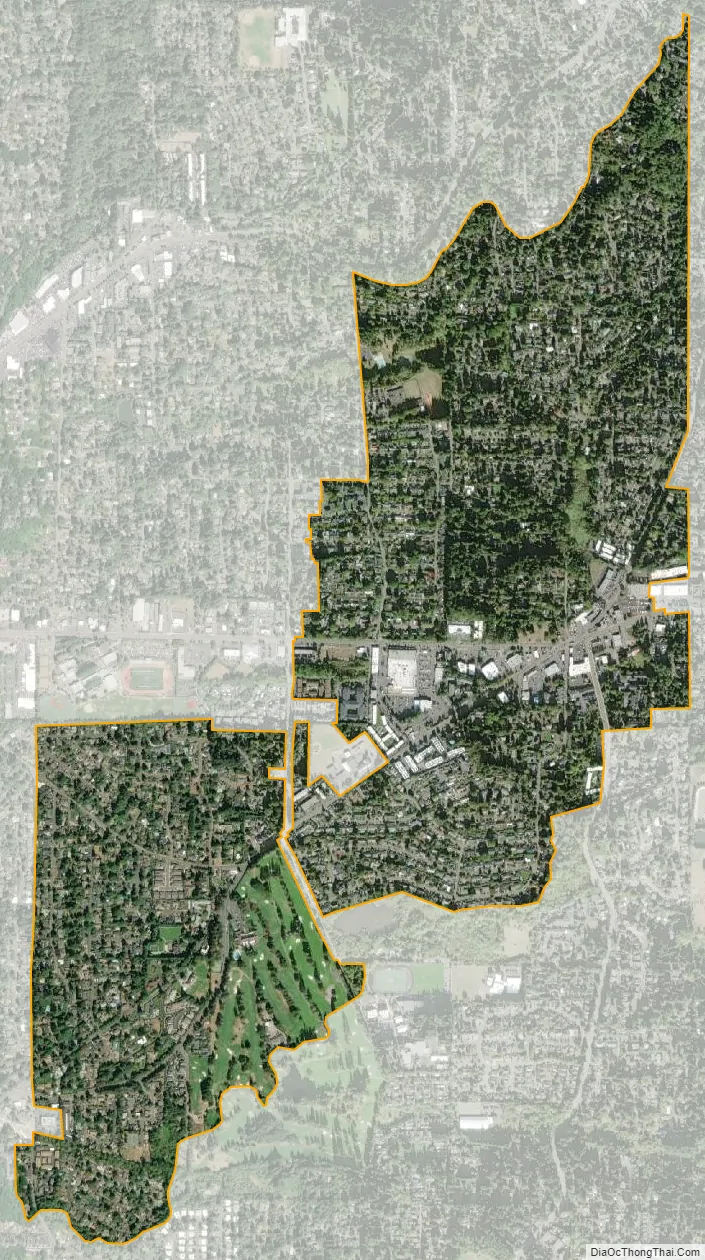
Raleigh Hills city Satellite Map
Geography
Raleigh Hills is located at 45°29’5″ North, 122°45’20” West (45.484790, -122.755575).
According to the United States Census Bureau, the neighborhood has a total area of four km (1.5 sq mi), all land.
See also
Map of Oregon State and its subdivision: Map of other states:- Alabama
- Alaska
- Arizona
- Arkansas
- California
- Colorado
- Connecticut
- Delaware
- District of Columbia
- Florida
- Georgia
- Hawaii
- Idaho
- Illinois
- Indiana
- Iowa
- Kansas
- Kentucky
- Louisiana
- Maine
- Maryland
- Massachusetts
- Michigan
- Minnesota
- Mississippi
- Missouri
- Montana
- Nebraska
- Nevada
- New Hampshire
- New Jersey
- New Mexico
- New York
- North Carolina
- North Dakota
- Ohio
- Oklahoma
- Oregon
- Pennsylvania
- Rhode Island
- South Carolina
- South Dakota
- Tennessee
- Texas
- Utah
- Vermont
- Virginia
- Washington
- West Virginia
- Wisconsin
- Wyoming