Sherwood is a city in Washington County, Oregon, United States. Located in the southeast corner of the county, it is a residential community in the Tualatin Valley, southwest of Portland. As of the 2010 census, Sherwood had a population of 18,194 residents. The city’s population for 2019 was estimated to be 19,879 by the U.S. Census. Sherwood was first incorporated in 1893 as a town. Originally named Smockville after its founder, James Christopher Smock, the town was given its current name by local businessman Robert Alexander in 1891. The name “Sherwood” may have come from Sherwood, Michigan or the Sherwood Forest in England.
| Name: | Sherwood city |
|---|---|
| LSAD Code: | 25 |
| LSAD Description: | city (suffix) |
| State: | Oregon |
| County: | Washington County |
| Incorporated: | 1893 |
| Elevation: | 193 ft (59 m) |
| Total Area: | 4.89 sq mi (12.67 km²) |
| Land Area: | 4.89 sq mi (12.67 km²) |
| Water Area: | 0.00 sq mi (0.00 km²) |
| Total Population: | 20,450 |
| Population Density: | 4,178.59/sq mi (1,613.51/km²) |
| ZIP code: | 97140 |
| Area code: | 503, 971 |
| FIPS code: | 4167100 |
| GNISfeature ID: | 1126877 |
| Website: | www.sherwoodoregon.gov |
Online Interactive Map
Click on ![]() to view map in "full screen" mode.
to view map in "full screen" mode.
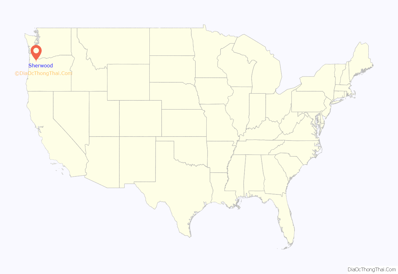
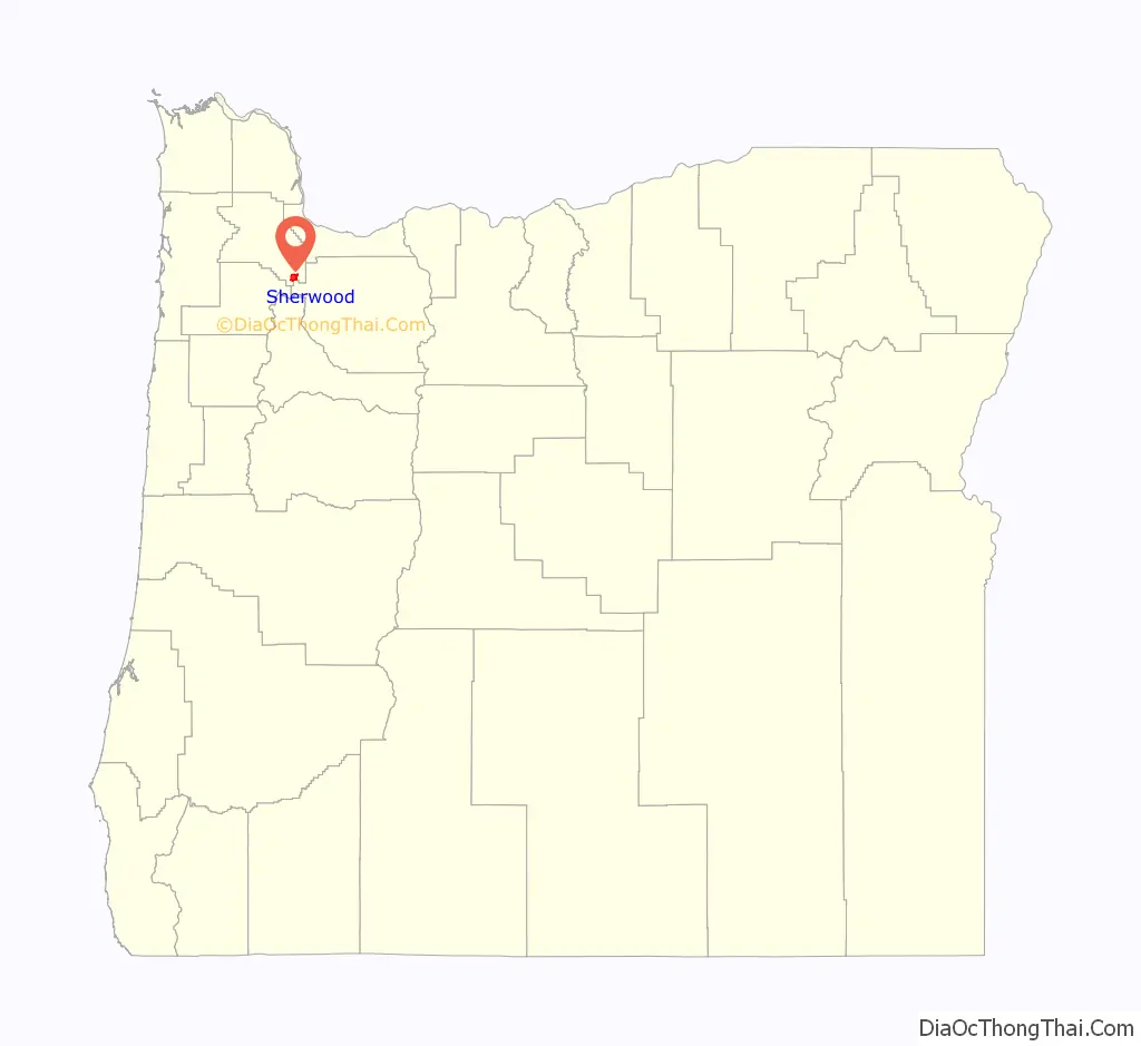
Sherwood location map. Where is Sherwood city?
History
What is now the Sherwood area was originally inhabited by the Atfalati band of the Kalapuya nation. Native Americans were relocated to reservations after the Donation Land Claim Act of 1850–55 gave American citizens exclusive ownership of these lands. The relocation process took place under the guidance of a series of federal employees, most notably Superintendent of Indian Affairs Joel Palmer, who was removed from office after being criticized for being too lenient with Indian policy.
The California Gold Rush of 1849 caused a dramatic shift in the area’s economy. Oregon City, Oregon is along a stretch of the Willamette River that had always been attractive to trade since prehistoric times, when trading activity was dominated by the Chinookan tribe.
The name “Sherwood” came either after Sherwood Forest in England or Sherwood, Michigan In 1885, the Smocks gave a right-of-way on their property to the Portland and Willamette Valley Railway. The Smocks platted the town in 1889, the same year rail service began. Tradition has it that no one, not even the town’s founders, liked the name “Smock Ville,” and so a public meeting was held to rename the town. Robert Alexander, who was both a local resident and prominent businessman, suggested the name “Sherwood.” According to post office records, Alexander was from Sherwood, Michigan, and also said the forest which surrounded the city was like Sherwood Forest in England. The U.S. Postal Department began sending mail to the Town of Sherwood, Oregon, on July 5, 1891. Smock was the first postmaster. The Town of Sherwood was incorporated under Oregon Senate Bill 36 in 1893.
The main industry in the 1890s was a pressed brick yard which closed in 1896, a victim of the deep recession of 1893. The Klondike Gold Rush of 1897 revived Sherwood’s economy. In 2014, Money ranked Sherwood fifth among the top fifty best places to live in the United States. In August 2009, Family Circle named the city one of America’s most “family friendly” small towns.
The population of the city in 1911 was 350 within a 1-square-mile (2.6 km) city limit. The city has since expanded to nearly 4.5 square miles (12 km).
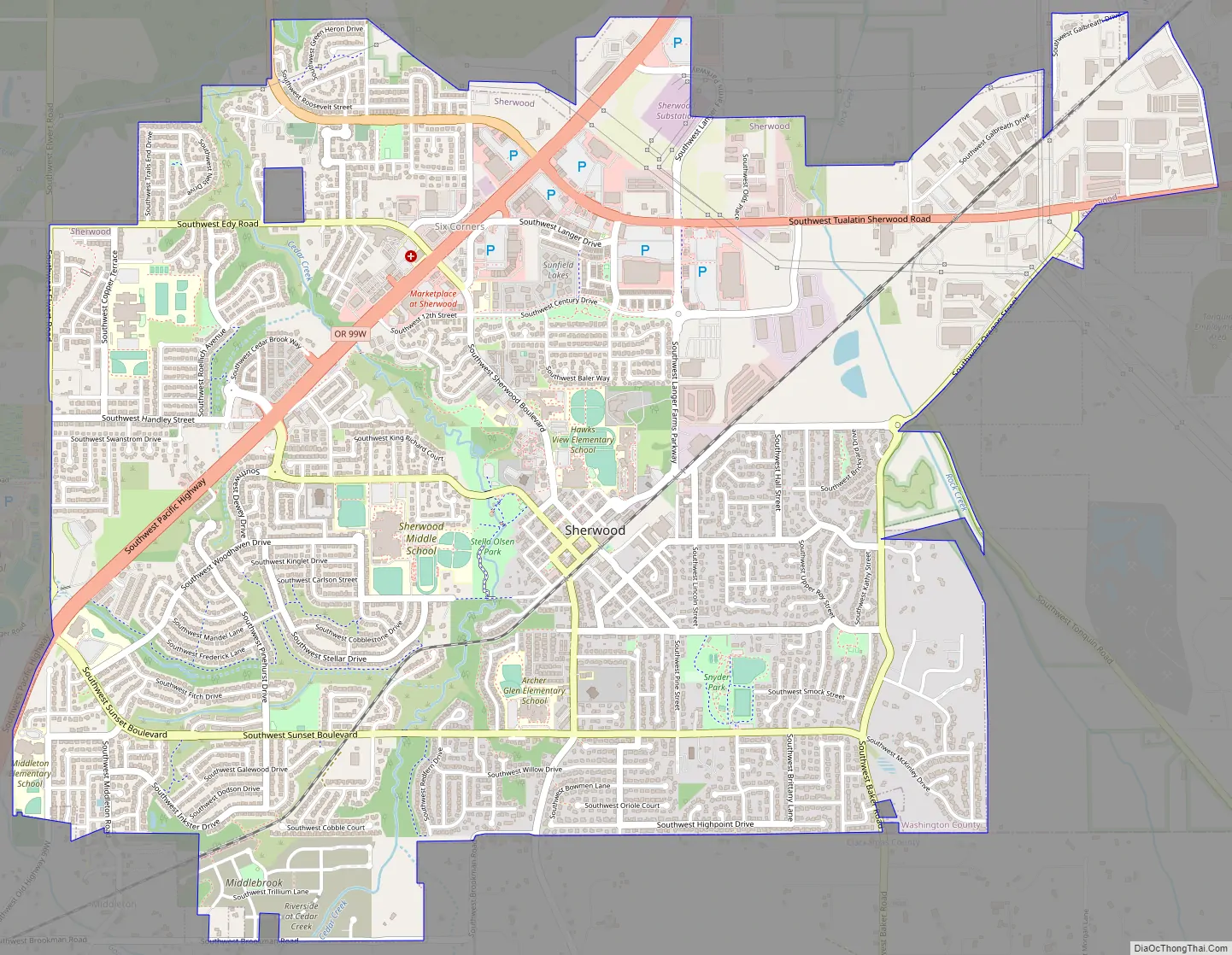
Sherwood Road Map
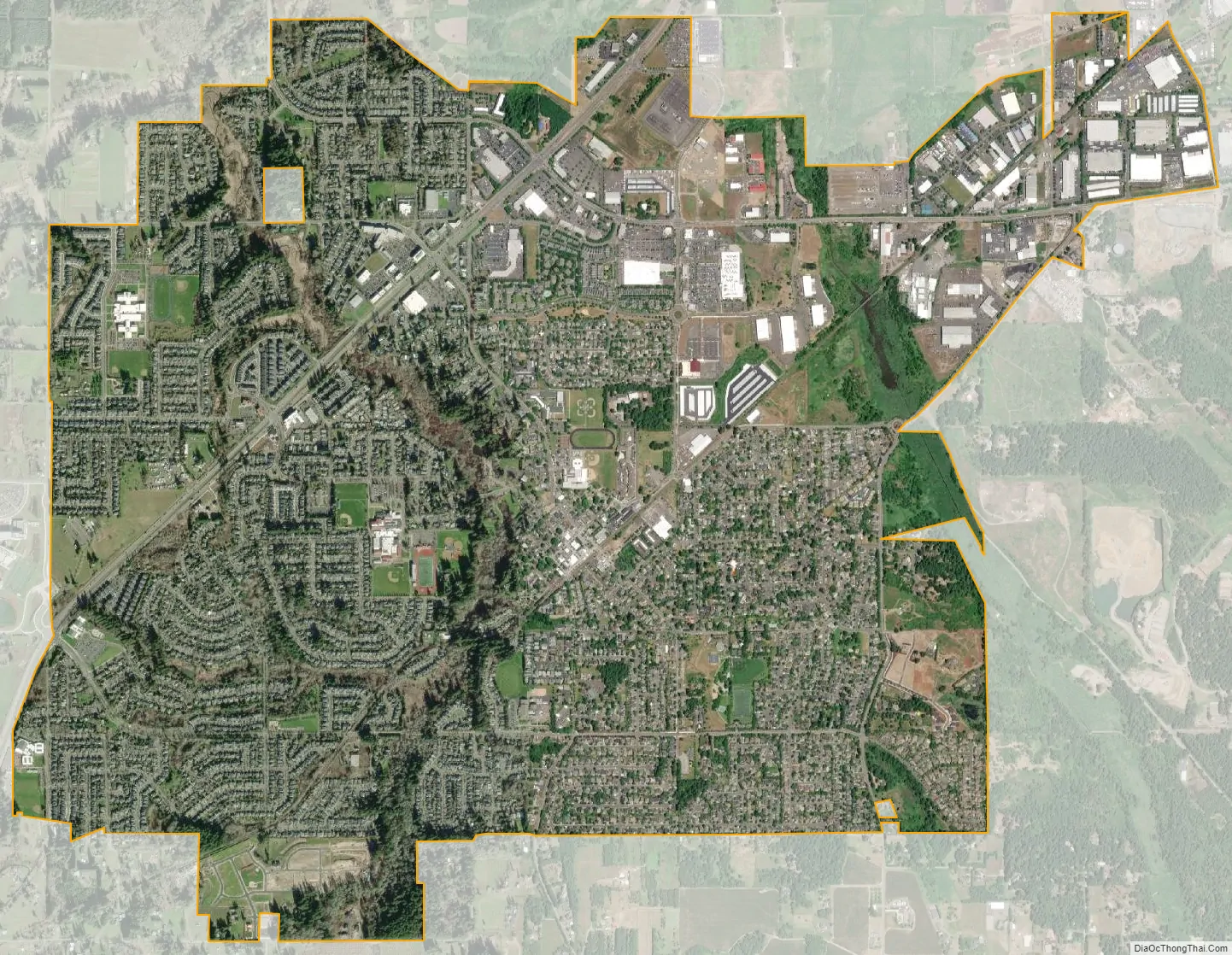
Sherwood city Satellite Map
Geography
According to the United States Census Bureau, the city has a total area of 4.31 square miles (11.16 km), all land.
See also
Map of Oregon State and its subdivision: Map of other states:- Alabama
- Alaska
- Arizona
- Arkansas
- California
- Colorado
- Connecticut
- Delaware
- District of Columbia
- Florida
- Georgia
- Hawaii
- Idaho
- Illinois
- Indiana
- Iowa
- Kansas
- Kentucky
- Louisiana
- Maine
- Maryland
- Massachusetts
- Michigan
- Minnesota
- Mississippi
- Missouri
- Montana
- Nebraska
- Nevada
- New Hampshire
- New Jersey
- New Mexico
- New York
- North Carolina
- North Dakota
- Ohio
- Oklahoma
- Oregon
- Pennsylvania
- Rhode Island
- South Carolina
- South Dakota
- Tennessee
- Texas
- Utah
- Vermont
- Virginia
- Washington
- West Virginia
- Wisconsin
- Wyoming