Conway is a city in Horry County, South Carolina, United States. The population was 24,849 at the 2020 census, up from 17,103 in 2010 census. It is the county seat of Horry County and is part of the Myrtle Beach metropolitan area. It is the home of Coastal Carolina University.
Numerous buildings and structures located in Conway are on the National Register of Historic Places. Among these is the City Hall building, designed by Robert Mills, architect of the Washington Monument. Since the completion of the Main Street USA project in the 1980s, Conway’s downtown has been revitalized with shops and bistros. Highlighting the renovation of the downtown area is the Riverwalk, an area of restaurants which follows a stretch of the Waccamaw River that winds through Conway.
| Name: | Conway city |
|---|---|
| LSAD Code: | 25 |
| LSAD Description: | city (suffix) |
| State: | South Carolina |
| County: | Horry County |
| Founded: | 1732 |
| Elevation: | 33 ft (10 m) |
| Total Area: | 25.41 sq mi (65.80 km²) |
| Land Area: | 24.51 sq mi (63.47 km²) |
| Water Area: | 0.90 sq mi (2.33 km²) |
| Total Population: | 24,849 |
| Population Density: | 1,013.96/sq mi (391.49/km²) |
| ZIP code: | 29526-29528 |
| Area code: | 843, 854 |
| FIPS code: | 4516405 |
| GNISfeature ID: | 1247370 |
| Website: | www.cityofconway.com |
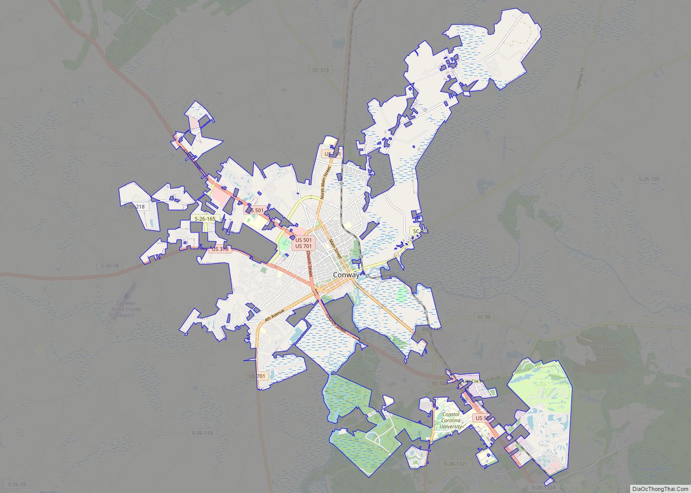
Online Interactive Map
Click on ![]() to view map in "full screen" mode.
to view map in "full screen" mode.
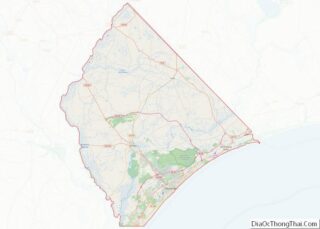
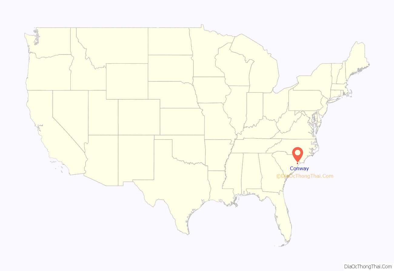
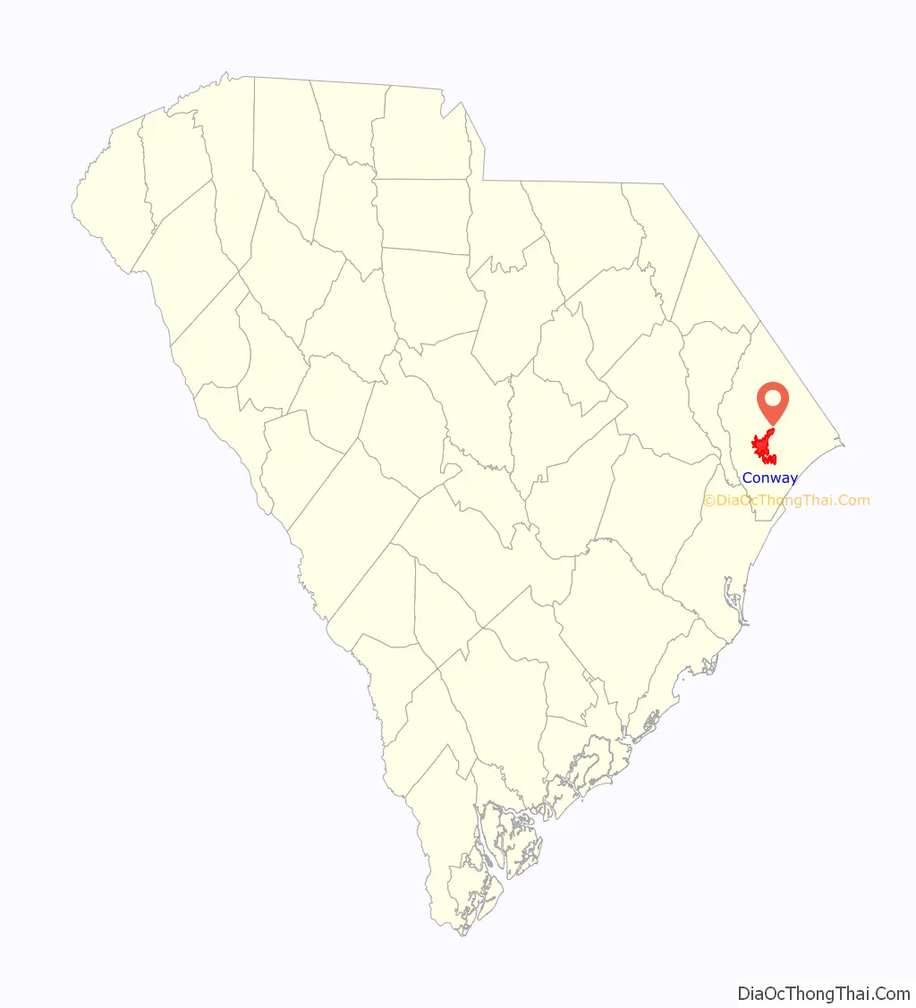
Conway location map. Where is Conway city?
History
Conway is one of the oldest towns in South Carolina. Early English colonists named the village “Kings Town” but soon changed it to “Kingston”. The town was founded in 1732 as part of Royal Governor Robert Johnson’s Township Scheme. It was laid out on a bluff overlooking the Waccamaw River in what is now known as Horry County.
For three decades, from the 1730s to the 1750s, King George II was very popular in the area. The King’s birthday was one of the most widely celebrated holidays during that time. However, his successor King George III quickly grew unpopular with the townspeople. By the 1770s, the region of South Carolina in which Kingston was located in was overwhelmingly English, though there were also small numbers of Huguenots and Scots-Irish people. English-Americans in Kingston were very sympathetic to rebels in Charleston over the issue of taxation without representation. When the Royal Governor Lord William Campbell fled Charleston, the people of Kingston celebrated.
Many area residents fought in the American Revolution, and small engagements were fought near Kingston at Bear Bluff and at Black Lake. Francis Marion, who was known as the “Swamp Fox”, had an encampment near Kingston just across the Waccamaw River. The areas of Kingston and Charles Town were communities with a higher population of Tories than many other Colonial American towns during the Revolutionary War era.
Horry County was created in 1801, and its courthouse was established in Kingston. The name “Kingston” was later changed to “Conwayborough”, to honor local hero General Robert Conway. In 1883, the South Carolina General Assembly changed the name of the town to “Conway”.
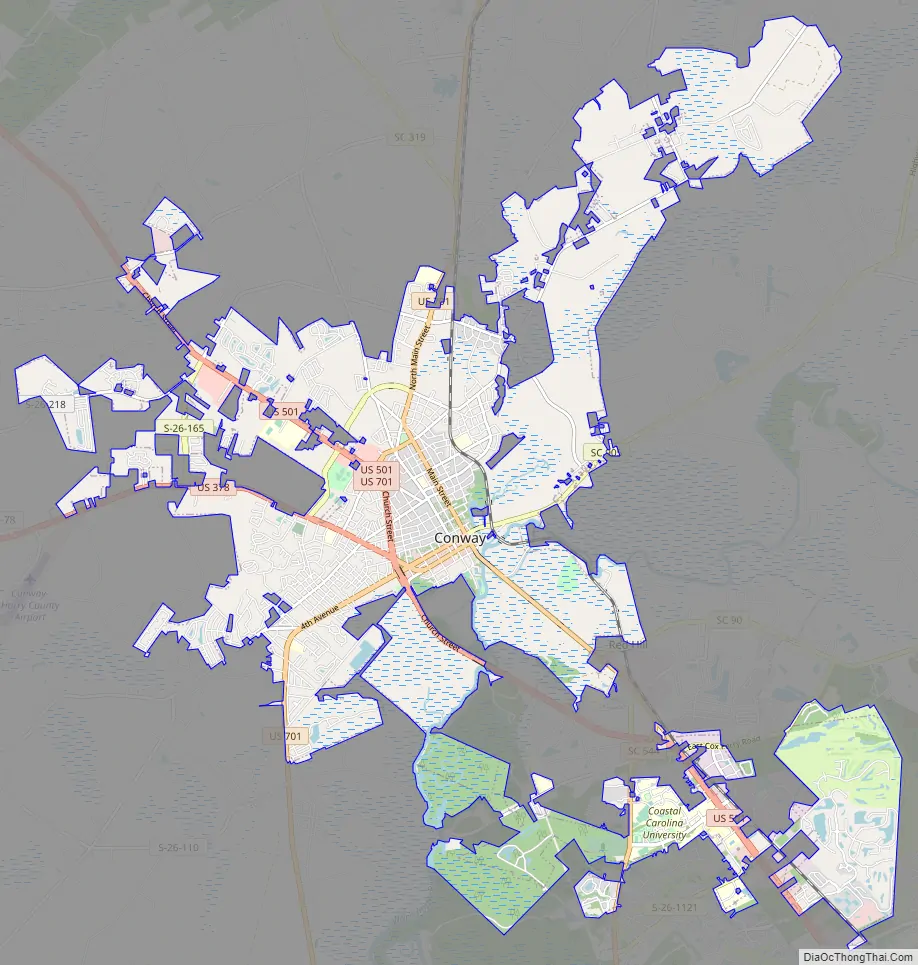
Conway Road Map
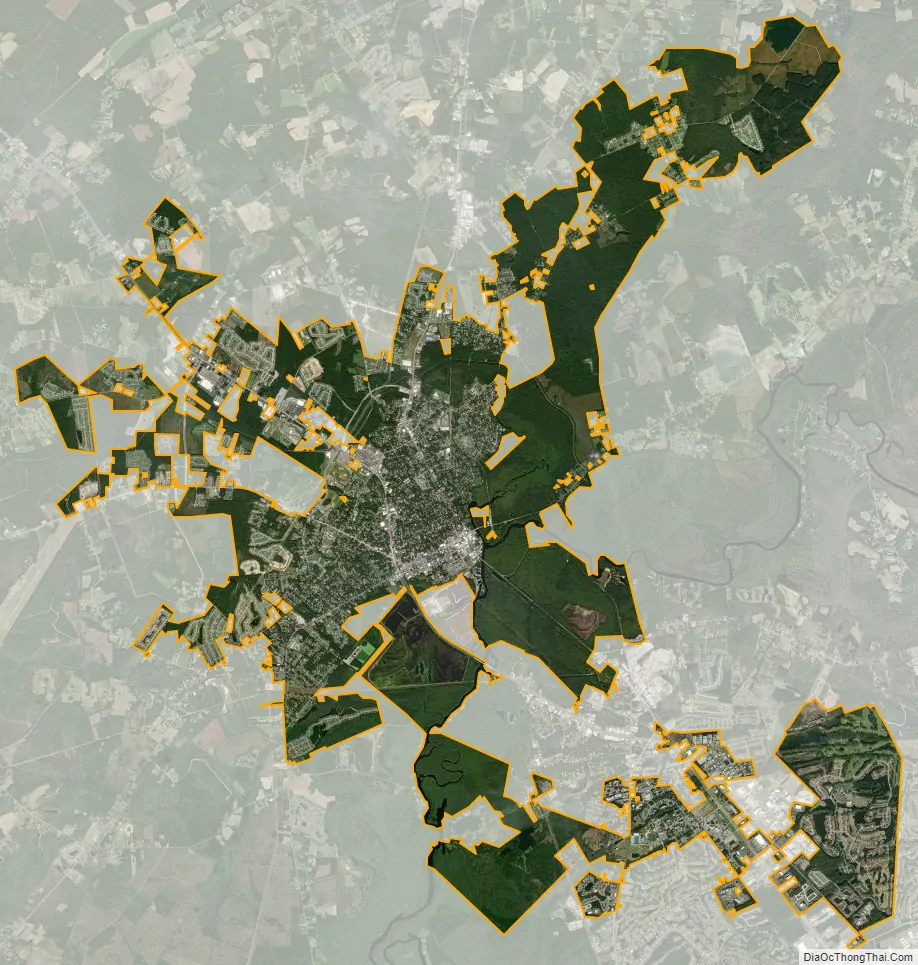
Conway city Satellite Map
Geography
Conway is situated on the South Carolina Coastal Plain on the western banks of the Waccamaw River, and is approximately 14 miles (23 km) from the Atlantic Ocean. U.S. Route 701, U.S. Route 501, and U.S. Route 378 pass through Conway.
According to the United States Census Bureau, the city has a total area of 22.8 square miles (59.0 km), of which 21.9 square miles (56.8 km) are land and 0.85 square miles (2.2 km), or 3.69%, are water. The downtown is sited on the west bank of the Waccamaw River where it is joined by a creek called Kingston Lake. The Waccamaw flows south to the Pee Dee River and ultimately Winyah Bay at Georgetown.
Climate
Conway has a humid subtropical climate, with mild winters and hot, humid summers. The local climate allows plants like kale to survive deep into the winter months, despite the lower amount of light. 60’s and 70’s weather are not rare during the months of December, January, and February. Spring starts in March, as usual for the climatic schedule of the area. Comparable major metro areas for this climate of Conway include Montgomery, Alabama and Jackson, Mississippi.
See also
Map of South Carolina State and its subdivision:- Abbeville
- Aiken
- Allendale
- Anderson
- Bamberg
- Barnwell
- Beaufort
- Berkeley
- Calhoun
- Charleston
- Cherokee
- Chester
- Chesterfield
- Clarendon
- Colleton
- Darlington
- Dillon
- Dorchester
- Edgefield
- Fairfield
- Florence
- Georgetown
- Greenville
- Greenwood
- Hampton
- Horry
- Jasper
- Kershaw
- Lancaster
- Laurens
- Lee
- Lexington
- Marion
- Marlboro
- McCormick
- Newberry
- Oconee
- Orangeburg
- Pickens
- Richland
- Saluda
- Spartanburg
- Sumter
- Union
- Williamsburg
- York
- Alabama
- Alaska
- Arizona
- Arkansas
- California
- Colorado
- Connecticut
- Delaware
- District of Columbia
- Florida
- Georgia
- Hawaii
- Idaho
- Illinois
- Indiana
- Iowa
- Kansas
- Kentucky
- Louisiana
- Maine
- Maryland
- Massachusetts
- Michigan
- Minnesota
- Mississippi
- Missouri
- Montana
- Nebraska
- Nevada
- New Hampshire
- New Jersey
- New Mexico
- New York
- North Carolina
- North Dakota
- Ohio
- Oklahoma
- Oregon
- Pennsylvania
- Rhode Island
- South Carolina
- South Dakota
- Tennessee
- Texas
- Utah
- Vermont
- Virginia
- Washington
- West Virginia
- Wisconsin
- Wyoming