Montgomery is the capital city of the U.S. state of Alabama and the county seat of Montgomery County. Named for the Irish soldier Richard Montgomery, it stands beside the Alabama River, on the coastal Plain of the Gulf of Mexico. In the 2020 census, Montgomery’s population was 200,603. It is the second most populous city in Alabama, after Huntsville, and is the 119th most populous in the United States. The Montgomery Metropolitan Statistical Area’s population in 2020 was 386,047; it is the fourth largest in the state and 142nd among United States metropolitan areas.
The city was incorporated in 1819 as a merger of two towns situated along the Alabama River. It became the state capital in 1846, representing the shift of power to the south-central area of Alabama with the growth of cotton as a commodity crop of the Black Belt and the rise of Mobile as a mercantile port on the Gulf Coast. In February 1861, Montgomery was chosen the first capital of the Confederate States of America, which it remained until the Confederate seat of government moved to Richmond, Virginia, in May of that year. In the middle of the 20th century, Montgomery was a major center of events and protests in the Civil Rights Movement, including the Montgomery bus boycott and the Selma to Montgomery marches.
In addition to housing many Alabama government agencies, Montgomery has a large military presence, due to Maxwell Air Force Base; public universities Alabama State University, Troy University (Montgomery campus), and Auburn University at Montgomery; two private post-secondary institutions, Faulkner University and Huntingdon College; high-tech manufacturing, including Hyundai Motor Manufacturing Alabama; and many cultural attractions, such as the Alabama Shakespeare Festival and the Montgomery Museum of Fine Arts.
Two ships of the United States Navy have been named after the city, including USS Montgomery.
Montgomery has also been recognized nationally for its downtown revitalization and new urbanism projects. It was one of the first cities in the nation to implement SmartCode Zoning.
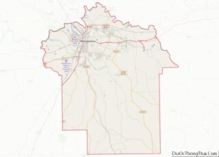
| Name: | Montgomery city |
|---|---|
| LSAD Code: | 25 |
| LSAD Description: | city (suffix) |
| State: | Alabama |
| County: | Montgomery County |
| Incorporated: | December 3, 1819 |
| Elevation: | 240 ft (73 m) |
| Land Area: | 159.86 sq mi (414.03 km²) |
| Water Area: | 2.41 sq mi (6.25 km²) |
| Population Density: | 1,254.89/sq mi (484.52/km²) |
| Area code: | 334 |
| FIPS code: | 0151000 |
| GNISfeature ID: | 165344 |
| Website: | montgomeryal.gov |
Online Interactive Map
Click on ![]() to view map in "full screen" mode.
to view map in "full screen" mode.
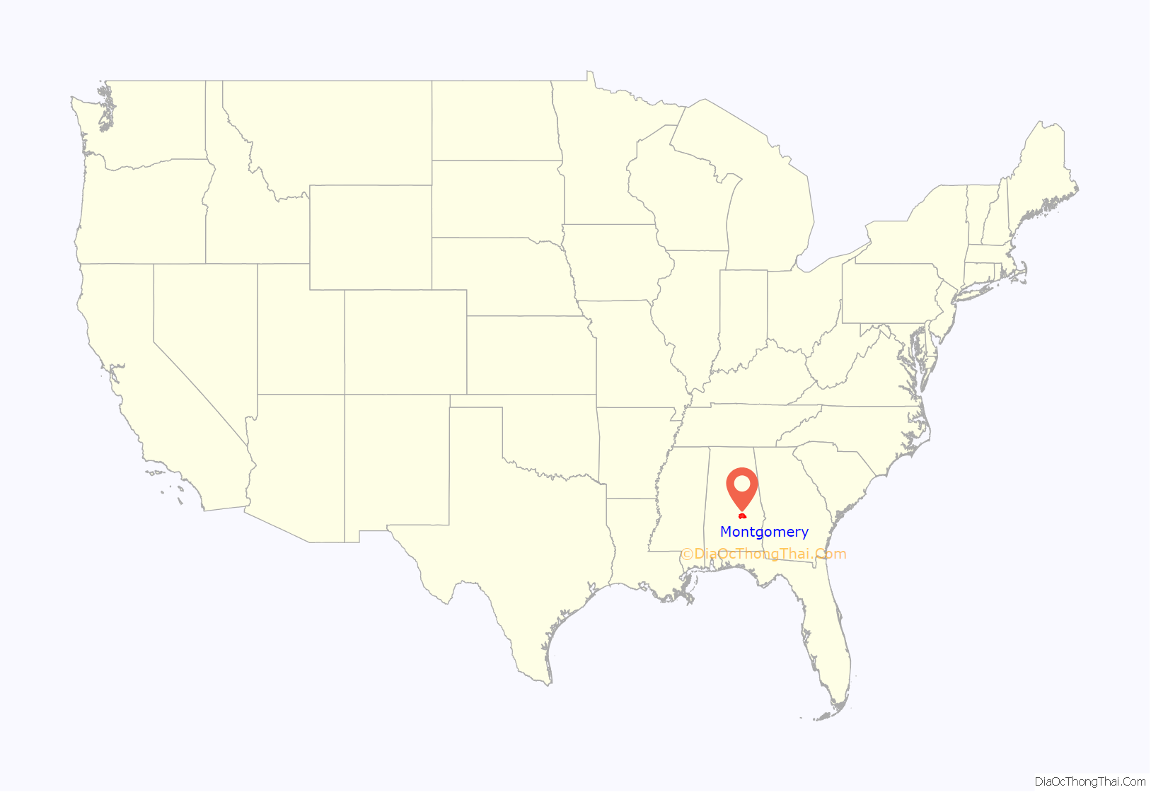
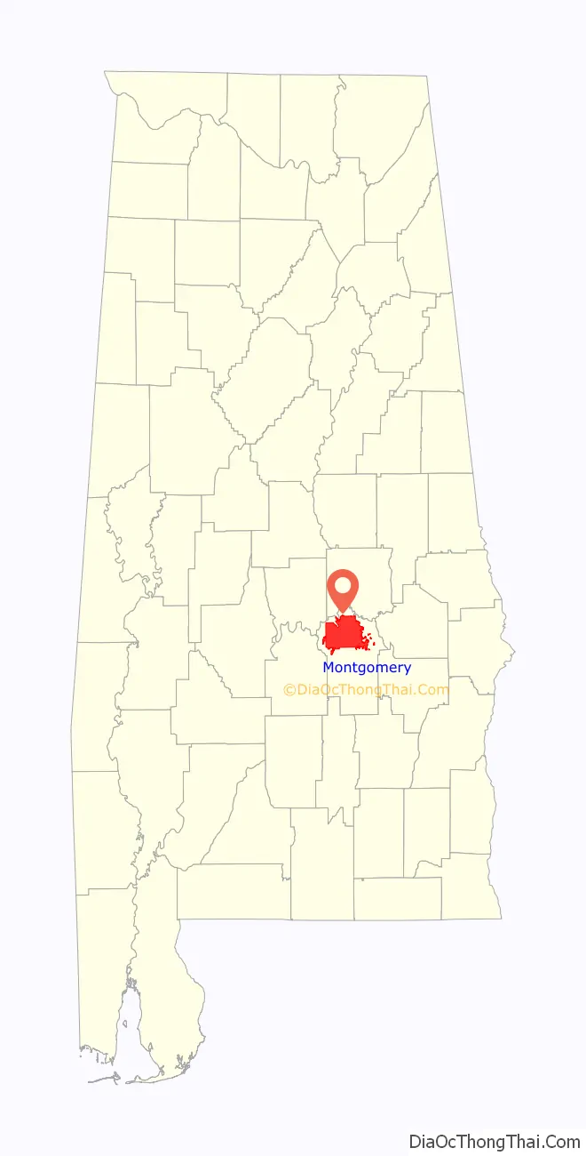
Montgomery location map. Where is Montgomery city?
History
Prior to European colonization, the east bank of the Alabama River was inhabited by the Alibamu tribe of Native Americans. The Alibamu and the Coushatta, who lived on the west side of the river, were descended from the Mississippian culture. This civilization had numerous chiefdoms throughout the Midwest and South along the Mississippi and its tributaries, and had built massive earthwork mounds as part of their society about 950–1250 AD. Its largest location was at Cahokia, in present-day Illinois east of St. Louis.
The historic tribes spoke mutually intelligible Muskogean languages, which were closely related. Present-day Montgomery is built on the site of two Alibamu towns: Ikanatchati (Ekanchattee or Ecunchatty or Econachatee), meaning “red earth;” and Towassa, built on a bluff called Chunnaanaauga Chatty. The first Europeans to travel through central Alabama were Hernando de Soto and his expedition, who in 1540 recorded going through Ikanatchati and camping for one week in Towassa.
The next recorded European encounter occurred more than a century later, when an English expedition from Carolina went down the Alabama River in 1697. The first permanent European settler in the Montgomery area was James McQueen, a Scots trader who settled there in 1716. He married a high-status woman in the Coushatta or Alabama tribe. Their mixed-race children were considered Muskogean, as both tribes had a matrilineal system of property and descent. The children were always considered born into their mother’s clan, and gained their status from her people.
In 1785, Abraham Mordecai, a war veteran from a Sephardic Jewish family of Philadelphia, Pennsylvania, established a trading post. The Coushatta and Alabama had gradually moved south and west in the tidal plain. After the French were defeated by the British in 1763 in the Seven Years’ War and ceded control of their lands, these Native American peoples moved to parts of present-day Mississippi, Louisiana, and Texas, then areas of Spanish rule, which they thought more favorable than British-held areas. By the time Mordecai arrived, Creek had migrated into and settled in the area, as they were moving away from Cherokee and Iroquois warfare to the north. Mordecai married a Creek woman. When her people had to cede most of their lands after the 1813-14 Creek War, she joined them in removal to Indian Territory. Mordecai brought the first cotton gin to Alabama.
The Upper Creek were able to discourage most white immigration until after the conclusion of the Creek War. Following their defeat by General Andrew Jackson in August 1814, the Creek tribes were forced to cede 23 million acres to the United States, including remaining land in today’s Georgia and most of today’s central and southern Alabama. In 1816, the Mississippi Territory (1798–1817) organized Montgomery County. Its former Creek lands were sold off the next year at the federal land office in Milledgeville, Georgia.
The first group of white settlers to come to the Montgomery area was headed by General John Scott. This group founded Alabama Town about 2 miles (3 km) downstream on the Alabama River from present-day downtown Montgomery. In June 1818, county courts were moved from Fort Jackson to Alabama Town. Alabama was admitted to the Union in December 1819.
Soon after, Andrew Dexter Jr. founded New Philadelphia, the present-day eastern part of downtown. He envisioned a prominent future for his town; he set aside a hilltop known as “Goat Hill” as the future site of the state capitol building. New Philadelphia soon prospered, and Scott and his associates built a new town adjacent, calling it East Alabama Town. Originally rivals, the towns merged on December 3, 1819, and were incorporated as the town of Montgomery.
The name Montgomery came from Richard Montgomery, a Revolutionary War general.
Slave traders used the Alabama River to deliver slaves to planters as laborers to work the cotton. Buoyed by the revenues of the cotton trade at a time of high market demand, the newly united Montgomery grew quickly. In 1822, the city was designated as the county seat. A new courthouse was built at the present location of Court Square, at the foot of Market Street (now Dexter Avenue). Court Square had one of the largest slave markets in the South. The state capital was moved from Tuscaloosa to Montgomery, on January 28, 1846.
As state capital, Montgomery began to influence state politics, and it would also play a prominent role on the national stage. Beginning February 4, 1861, representatives from Alabama, Georgia, Florida, Louisiana, Mississippi, and South Carolina met in Montgomery, host of the Southern Convention, to form the Confederate States of America. Montgomery was named the first capital of the nation, and Jefferson Davis was inaugurated as president on the steps of the State Capitol. (The capital was later moved to Richmond, Virginia.)
On April 12, 1865, following the Battle of Selma, Major General James H. Wilson captured Montgomery for the Union.
In 1886 Montgomery became the first city in the United States to install citywide electric streetcars along a system that was nicknamed the Lightning Route. Residents followed the streetcar lines to settle in new housing in what were then “suburban” locations.
As the Reconstruction era ended, mayor W. L. Moses asked the state legislature to gerrymander city boundaries. It complied and removed the districts where African Americans lived, restoring white supremacy to the city’s demographics and electorate. This prevented African Americans from being elected in the municipality and denied them city services.
In the post-World War II era, returning African-American veterans were among those who became active in pushing to regain their civil rights in the South: to be allowed to vote and participate in politics, to freely use public places, to end segregation. According to the historian David Beito of the University of Alabama, African Americans in Montgomery “nurtured the modern civil rights movement.” African Americans comprised most of the customers on the city buses, but were forced to give up seats and even stand in order to make room for whites. On December 1, 1955, Rosa Parks was arrested for refusing to give up her bus seat to a white man, sparking the Montgomery bus boycott. Martin Luther King Jr., then the pastor of Dexter Avenue Baptist Church, and E.D. Nixon, a local civil rights advocate, founded the Montgomery Improvement Association to organize the boycott. In June 1956, the US District Court Judge Frank M. Johnson ruled that Montgomery’s bus racial segregation was unconstitutional. After the US Supreme Court upheld the ruling in November, the city desegregated the bus system, and the boycott was ended.
In separate action, integrated teams of Freedom Riders rode South on interstate buses. In violation of federal law and the constitution, bus companies had for decades acceded to state laws and required passengers to occupy segregated seating in Southern states. Opponents of the push for integration organized mob violence at stops along the Freedom Ride. In Montgomery, there was police collaboration when a white mob attacked Freedom Riders at the Greyhound Bus Station in May 1961. Outraged national reaction resulted in the enforcement of desegregation of interstate public transportation.
Martin Luther King Jr. returned to Montgomery in 1965. Local civil rights leaders in Selma had been protesting Jim Crow laws and practices that raised barriers to blacks registering to vote. Following the shooting of a man after a civil rights rally, the leaders decided to march to Montgomery to petition Governor George Wallace to allow free voter registration. The violence they encountered from county and state highway police outraged the country. The federal government ordered National Guard and troops to protect the marchers. Thousands more joined the marchers on the way to Montgomery, and an estimated 25,000 marchers entered the capital to press for voting rights. These actions contributed to Congressional passage of the Voting Rights Act of 1965, to authorize federal supervision and enforcement of the rights of African Americans and other minorities to vote.
On February 7, 1967, a devastating fire broke out at Dale’s Penthouse, a restaurant and lounge on the top floor of the Walter Bragg Smith apartment building (now called Capital Towers) at 7 Clayton Street downtown. Twenty-six people died.
In recent years, Montgomery has grown and diversified its economy. Active in downtown revitalization, the city adopted a master plan in 2007; it includes the revitalization of Court Square and the riverfront, renewing the city’s connection to the river. Many other projects under construction include the revitalization of Historic Dexter Avenue, pedestrian and infrastructure improvements along the Selma to Montgomery National Historic Trail, and the construction of a new environmental park on West Fairview Avenue.
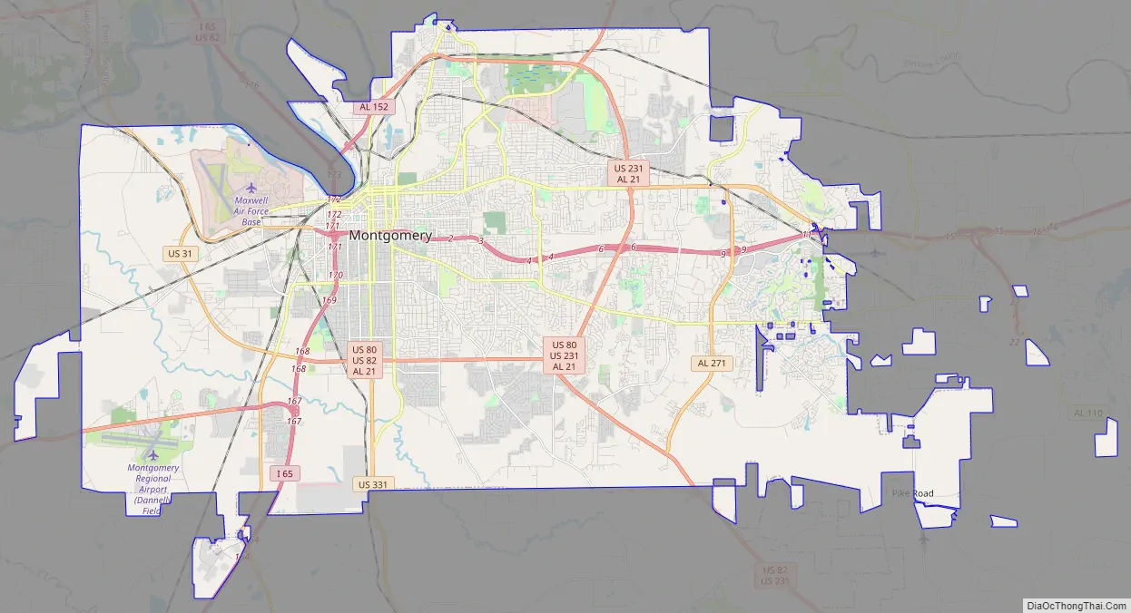
Montgomery Road Map
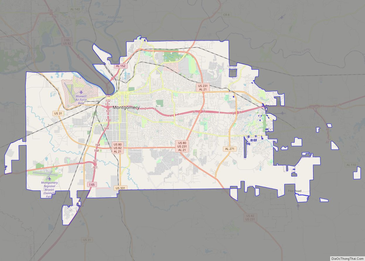
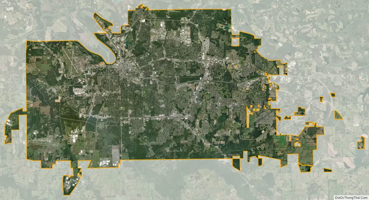
Montgomery city Satellite Map
Geography
Montgomery is located at 32°21′42″N 86°16′45″W / 32.36167°N 86.27917°W / 32.36167; -86.27917. According to the U.S. Census Bureau, the city has a total area of 156.2 square miles (405 km), of which 155.4 square miles (402 km) is land and 0.8 square miles (2.1 km) (0.52%) is water. The city is built over rolling terrain at an elevation of about 220 feet (67 m) above sea level.
Cityscape
Downtown Montgomery lies along the southern bank of the Alabama River, about 6 miles (10 km) downstream from the confluence of the Coosa and Tallapoosa rivers. The most prominent feature of Montgomery’s skyline is the 375 ft (114 m), RSA Tower, built in 1996 by the Retirement Systems of Alabama. Other prominent buildings include 60 Commerce Street, 8 Commerce Street, and the RSA Dexter Avenue Building. Downtown also contains many state and local government buildings, including the Alabama State Capitol. The Capitol is located atop a hill at one end of Dexter Avenue, along which also lies the Dexter Avenue Baptist Church, where Martin Luther King Jr. was pastor. Both the Capitol and Dexter Baptist Church are recognized as National Historic Landmarks by the U.S. Department of the Interior. Other notable buildings include RSA Dexter Avenue, RSA Headquarters, Alabama Center for Commerce, RSA Union, and the Renaissance Hotel and Spa.
One block south of the Capitol is the First White House of the Confederacy, the 1835 Italianate-style house in which President Jefferson Davis and family lived while the Confederate capital was in Montgomery. Montgomery’s third National Historic Landmark is Union Station. Passenger train service to Montgomery ceased in 1989. Today Union Station is part of the Riverfront Park development, which includes an amphitheater, a riverboat dock, a river walk, and Riverwalk Stadium.
The completion of a 112,000-square-foot (10,400 m) space in 2007, the Convention Center, has encouraged growth and activity in the downtown area and attracted more high-end retail and restaurants. Three blocks east of the Convention Center, Old Alabama Town showcases more than 50 restored buildings from the 19th century. The Riverwalk is part of a larger plan to revitalize the downtown area and connect it to the waterfront. The plan includes urban forestry, infill development, and façade renovation to encourage business and residential growth.
Other downtown developments include historic Dexter Avenue, which will be the center of a Market District. A $6 million streetscape project is improving its design. Maxwell Boulevard is home to the newly built Wright Brothers Park. High-end apartments are planned for this area. The Bell Building, located across from the Rosa Parks Library and Museum, is being redeveloped for mixed-use retail and residential space.
The National Memorial for Peace and Justice opened in downtown Montgomery on April 26, 2018. Founded by the Equal Justice Initiative, it acknowledges the historic past of racial terrorism and lynching in America.
South of downtown, across Interstate 85, lies Alabama State University. ASU’s campus was built in Colonial Revival architectural style from 1906 until the beginning of World War II. Surrounding ASU are the Garden District and Cloverdale Historic District. Houses in these areas date from around 1875 until 1949, and are in Late Victorian and Gothic Revival styles. Huntingdon College is on the southwestern edge of Cloverdale. The campus was built in the 1900s in Tudor Revival and Gothic Revival styles. ASU, the Garden District, Cloverdale, and Huntingdon are all listed on the National Register of Historic Places as historic districts.
Montgomery’s east side is the fastest-growing part of the city. Development of the Dalraida neighborhood, along Atlanta Highway, began in 1909, when developers Cook and Laurie bought land from the Ware plantation. A Scotsman, Georgie Laurie named the area for Dál Riata, a 6th-7th century Gaelic overkingdom; a subsequent misspelling in an advertisement led to the current spelling. The first lots were sold in 1914. The city’s two largest shopping malls (Eastdale Mall and The Shoppes at Eastchase), as well as many big-box stores and residential developments, are on the east side.
The area is also home of the Wynton M. Blount Cultural Park. This 240-acre (1.0 km) park contains the Alabama Shakespeare Festival and Montgomery Museum of Fine Arts.
Revitalization
Montgomery has been recognized nationally for its continuing downtown revitalization. In the early 2000s, the city constructed the Montgomery Biscuits minor league baseball stadium and Riverfront Park. Following those developments, hundreds of millions of dollars have been invested by private companies that have adapted old warehouses and office buildings into loft apartments, restaurants, retail, hotels, and businesses. The demand for downtown living space has risen, as people want to have walkable, lively neighborhoods. More than 500 apartment units are under construction, including The Heights on Maxwell Boulevard, The Market District on Dexter Avenue, the Kress Building on Dexter Avenue, The Bell Building on Montgomery Street, and a new complex by the convention center. Additionally, Montgomery has begun construction of a 50 million dollar white water park located off Air Force Boulevard.
Climate
Montgomery has a humid subtropical climate (Köppen Cfa), with short, mild winters, warm springs and autumns, and long, hot, humid summers. The daily average temperature in January is 46.6 °F (8.1 °C), and there are 3.4 days of sub 20 °F (−7 °C) lows; 10 °F (−12 °C) and below is extremely rare. The daily average in July is 81.8 °F (27.7 °C), with highs exceeding 90 °F (32.2 °C) on 86 days per year and 100 °F (37.8 °C) on 3.9. Summer afternoon heat indices, much more often than the actual air temperature, are frequently at or above 100 °F. The diurnal temperature variation tends to be large in spring and autumn. Rainfall is well-distributed throughout the year, though February, March and July are the wettest months, while October is significantly the driest month. Snowfall occurs only during some winters, and even then is usually light. Substantial snowstorms are rare, but do occur approximately once every 10 years. Extremes range from −5 °F (−21 °C) on February 13, 1899 to 107 °F (42 °C) on July 7, 1881.
Thunderstorms bring much of Montgomery’s rainfall. These are common during the summer months but occur throughout the year. Severe thunderstorms – producing large hail and damaging winds in addition to the usual hazards of lightning and heavy rain – can occasionally occur, particularly during the spring. Severe storms also bring a risk of tornadoes. Sometimes, tropical disturbances – some of which strike the Gulf Coast as hurricanes before losing intensity as they move inland – can bring very heavy rains.
See also
Map of Alabama State and its subdivision:- Autauga
- Baldwin
- Barbour
- Bibb
- Blount
- Bullock
- Butler
- Calhoun
- Chambers
- Cherokee
- Chilton
- Choctaw
- Clarke
- Clay
- Cleburne
- Coffee
- Colbert
- Conecuh
- Coosa
- Covington
- Crenshaw
- Cullman
- Dale
- Dallas
- De Kalb
- Elmore
- Escambia
- Etowah
- Fayette
- Franklin
- Geneva
- Greene
- Hale
- Henry
- Houston
- Jackson
- Jefferson
- Lamar
- Lauderdale
- Lawrence
- Lee
- Limestone
- Lowndes
- Macon
- Madison
- Marengo
- Marion
- Marshall
- Mobile
- Monroe
- Montgomery
- Morgan
- Perry
- Pickens
- Pike
- Randolph
- Russell
- Saint Clair
- Shelby
- Sumter
- Talladega
- Tallapoosa
- Tuscaloosa
- Walker
- Washington
- Wilcox
- Winston
- Alabama
- Alaska
- Arizona
- Arkansas
- California
- Colorado
- Connecticut
- Delaware
- District of Columbia
- Florida
- Georgia
- Hawaii
- Idaho
- Illinois
- Indiana
- Iowa
- Kansas
- Kentucky
- Louisiana
- Maine
- Maryland
- Massachusetts
- Michigan
- Minnesota
- Mississippi
- Missouri
- Montana
- Nebraska
- Nevada
- New Hampshire
- New Jersey
- New Mexico
- New York
- North Carolina
- North Dakota
- Ohio
- Oklahoma
- Oregon
- Pennsylvania
- Rhode Island
- South Carolina
- South Dakota
- Tennessee
- Texas
- Utah
- Vermont
- Virginia
- Washington
- West Virginia
- Wisconsin
- Wyoming