Hartsville is the largest city in Darlington County, South Carolina, United States. It was chartered on December 11, 1891. The population was 7,764 at the 2010 census. Hartsville was chosen as an All-America City in 1996 and again in 2016. Hartsville has also been a National Arbor Day Foundation Tree City since 1986.
Hartsville is home of Coker University and a branch of Florence–Darlington Technical College. It is also the home of the South Carolina Governor’s School for Science and Mathematics, a public boarding high school.
The city is served by the Hartsville Regional Airport.
Hartsville is home to several major corporations including Sonoco Products Company, Duke Energy’s H. B. Robinson Nuclear Generating Station, Novolex, and Stingray Boats.
| Name: | Hartsville city |
|---|---|
| LSAD Code: | 25 |
| LSAD Description: | city (suffix) |
| State: | South Carolina |
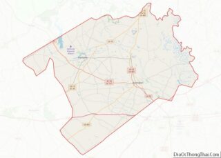
| County: | Darlington County |
| Elevation: | 217 ft (66 m) |
| Total Area: | 5.99 sq mi (15.51 km²) |
| Land Area: | 5.98 sq mi (15.49 km²) |
| Water Area: | 0.01 sq mi (0.03 km²) |
| Total Population: | 7,446 |
| Population Density: | 1,244.94/sq mi (480.71/km²) |
| ZIP code: | 29550, 29551 |
| Area code: | 843, 854 |
| FIPS code: | 4532560 |
| GNISfeature ID: | 1231367 |
| Website: | www.hartsvillesc.gov |
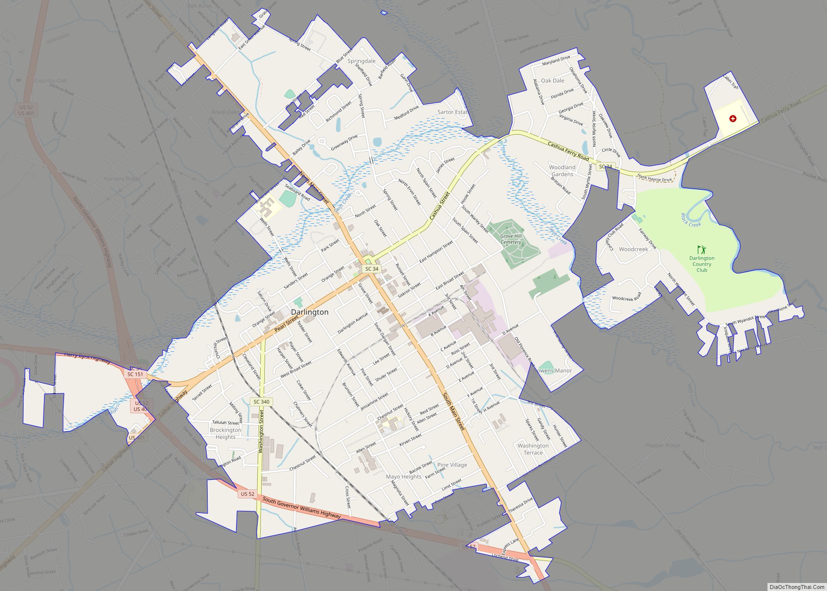
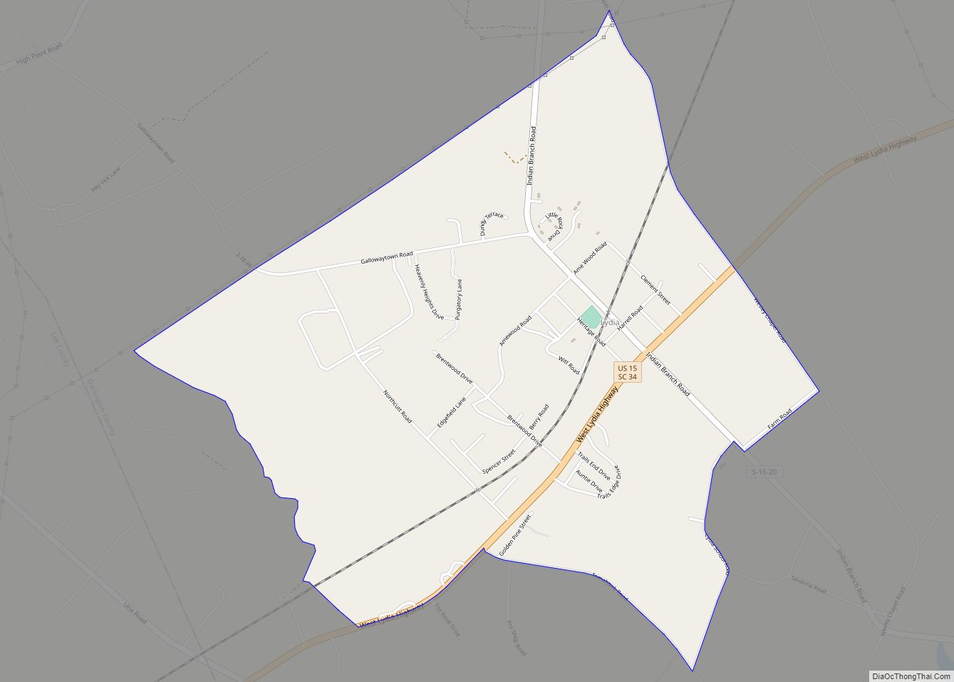
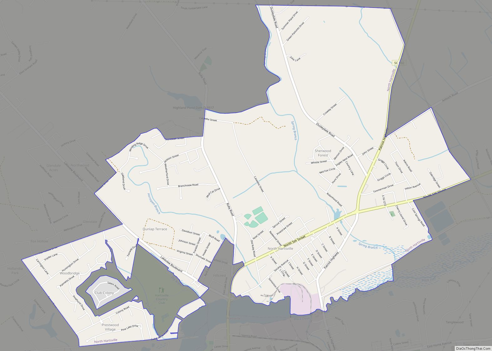
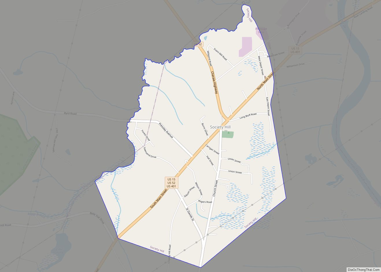
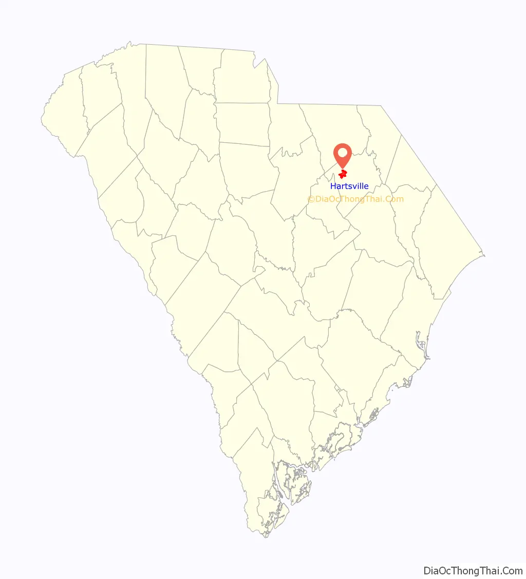
Online Interactive Map
Click on ![]() to view map in "full screen" mode.
to view map in "full screen" mode.
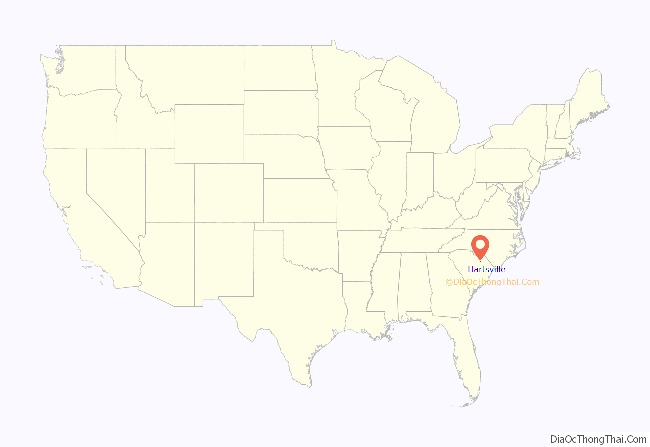
Hartsville location map. Where is Hartsville city?
History
The area surrounding Hartsville was once home to several Native American tribes, including the Pee Dee, Catawba, Chicora, Edisto, Sane, and Chicora-Waccamaw, who inhabited the region until European settlers arrived.
Hartsville’s first settlement began around 1760. The town is named for Captain Thomas E. Hart, who eventually owned most of the land in the community. Hart started a successful mercantile business, but lost his business and his land during the economic depression of 1837–1838.
In 1845, Thomas Hart’s son, John Lide Hart, purchased 495 acres (200 ha) of land in what is now downtown Hartsville from Colonel Law. John Hart went on to establish a carriage factory, steam-powered saw mill, grist mill, general store, and Hartsville Baptist Church. Caleb Coker purchased the carriage factory for his son James Lide Coker in 1855.
James Lide Coker came to Hartsville in 1857 with plans to implement new farming methods he had learned at Harvard College. This was interrupted by the start of the Civil War, in which he became a major for the Confederacy. He returned to Hartsville injured and found that his plantation was in shambles. He planned to reconstruct his plantation and bring prosperity to the town of Hartsville. Major Coker established Welsh Neck High School, which later became Coker College. He also established a seed company, oil mill, fertilizer plant, the Coker and Company General Store, a bank, and the Southern Novelty Company, now known as Sonoco Products Company. Even with his own successes in business, Coker and his family were unable to convince other business owners in the area to build a railroad spur, so they decided to build their own, which became the Hartsville Railroad, completed in 1889.
The Town of Hartsville received its first charter on December 11, 1891, during a period of bustling economic activity and growth.
The railroad eventually became part of the South Carolina Central Railroad, and the Southern Novelty Company and Carolina Fiber Company merged to form Sonoco Products Company. Sonoco eventually expanded to a global scale and became a Fortune 500 company.
Historic sites
Locations listed on the National Register of Historic Places:
Points of interest
- Center Theater
- Coker University
- Hartsville Museum
- Kalmia Gardens
- Sonoco Products
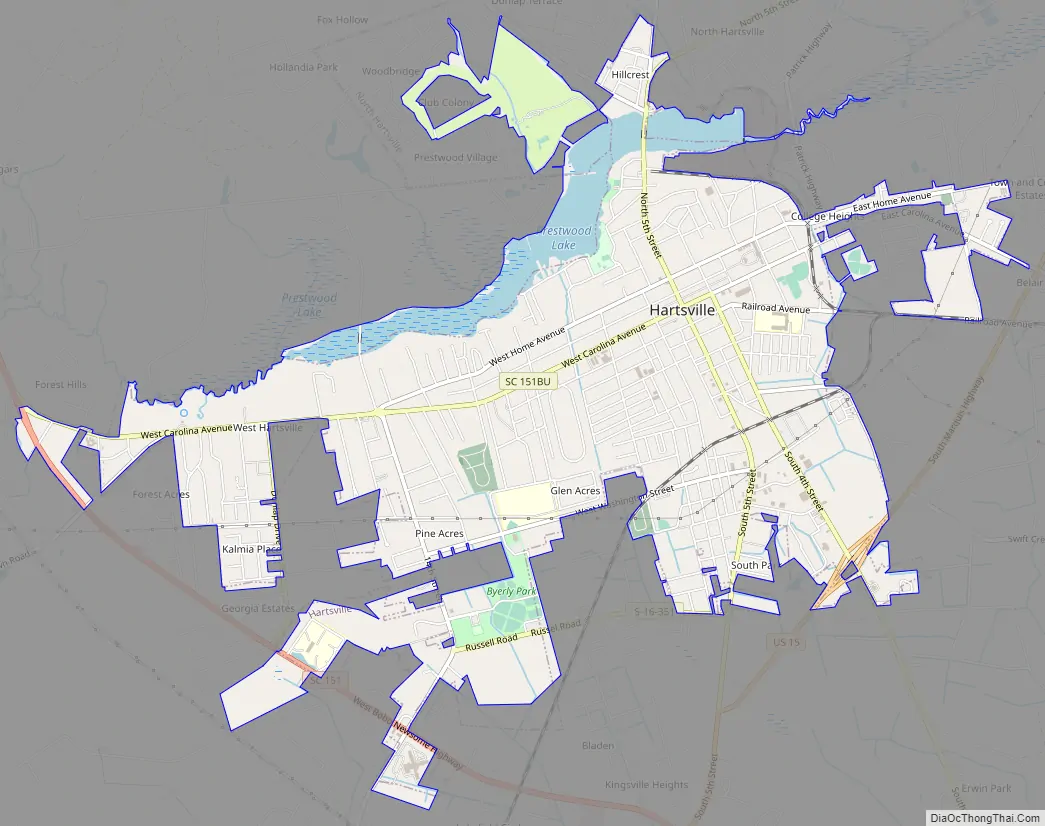
Hartsville Road Map
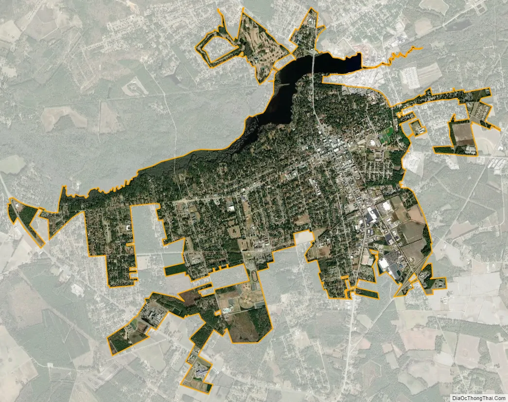
Hartsville city Satellite Map
Geography
Hartsville is located in northwestern Darlington County at 34°22′10″N 80°4′51″W / 34.36944°N 80.08083°W / 34.36944; -80.08083 (34.369474, −80.080783). U.S. Route 15 bypasses the city to the southeast; it leads northeast 17 miles (27 km) to Society Hill and 47 miles (76 km) to Laurinburg, North Carolina, and southwest 40 miles (64 km) to Sumter. South Carolina Highway 151 bypasses the city to the southwest; it leads southeast 14 miles (23 km) to Darlington, the county seat, and northwest 14 miles (23 km) to McBee. Columbia, the state capital, is 70 miles (110 km) to the southwest.
According to the United States Census Bureau, Hartsville has a total area of 6.2 square miles (16.0 km), of which 5.7 square miles (14.8 km) is land and 0.4 square miles (1.1 km), or 7.11%, is water. Prestwood Lake, an impoundment on Black Creek, is on the northern border of the city. Black Creek is part of the Pee Dee River watershed.
Climate
Hartsville enjoys a mild climate year-round. It experiences 213 sunny days on average. The number of days with measurable precipitation is 106, and the city receives about 46 inches (1,200 mm) of rainfall per year. The average low is 31 °F (−1 °C) in January, and the average high is 92 °F (33 °C) in July. During the winter months, Hartsville can receive snowfall.
See also
Map of South Carolina State and its subdivision:- Abbeville
- Aiken
- Allendale
- Anderson
- Bamberg
- Barnwell
- Beaufort
- Berkeley
- Calhoun
- Charleston
- Cherokee
- Chester
- Chesterfield
- Clarendon
- Colleton
- Darlington
- Dillon
- Dorchester
- Edgefield
- Fairfield
- Florence
- Georgetown
- Greenville
- Greenwood
- Hampton
- Horry
- Jasper
- Kershaw
- Lancaster
- Laurens
- Lee
- Lexington
- Marion
- Marlboro
- McCormick
- Newberry
- Oconee
- Orangeburg
- Pickens
- Richland
- Saluda
- Spartanburg
- Sumter
- Union
- Williamsburg
- York
- Alabama
- Alaska
- Arizona
- Arkansas
- California
- Colorado
- Connecticut
- Delaware
- District of Columbia
- Florida
- Georgia
- Hawaii
- Idaho
- Illinois
- Indiana
- Iowa
- Kansas
- Kentucky
- Louisiana
- Maine
- Maryland
- Massachusetts
- Michigan
- Minnesota
- Mississippi
- Missouri
- Montana
- Nebraska
- Nevada
- New Hampshire
- New Jersey
- New Mexico
- New York
- North Carolina
- North Dakota
- Ohio
- Oklahoma
- Oregon
- Pennsylvania
- Rhode Island
- South Carolina
- South Dakota
- Tennessee
- Texas
- Utah
- Vermont
- Virginia
- Washington
- West Virginia
- Wisconsin
- Wyoming