Jenkinsville is an incorporated town in western Fairfield County, South Carolina, United States, between the Broad and the Little rivers. It is located east of Monticello Reservoir and is near the Virgil C. Summer Nuclear Generating Station. Also in the area is the Kincaid-Anderson House and quarry. The town was incorporated in 2008. Jenkinsville’s population at the 2010 census was 46, making it South Carolina’s second smallest town.
In addition to the Kincaid-Anderson House, the Ebenezer Associate Reformed Presbyterian Church, Dr. John Glenn House, High Point, Little River Baptist Church, and Mayfair are listed on the National Register of Historic Places.
| Name: | Jenkinsville town |
|---|---|
| LSAD Code: | 43 |
| LSAD Description: | town (suffix) |
| State: | South Carolina |
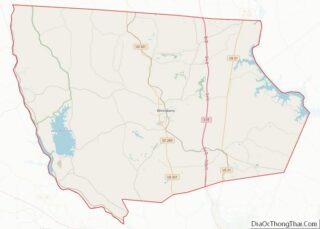
| County: | Fairfield County |
| Elevation: | 466 ft (142 m) |
| Total Area: | 0.09 sq mi (0.23 km²) |
| Land Area: | 0.09 sq mi (0.23 km²) |
| Water Area: | 0.00 sq mi (0.00 km²) |
| Total Population: | 40 |
| Population Density: | 449.44/sq mi (173.14/km²) |
| ZIP code: | 29065 |
| Area code: | 803, 839 |
| FIPS code: | 4536655 |
| GNISfeature ID: | 1246161 |
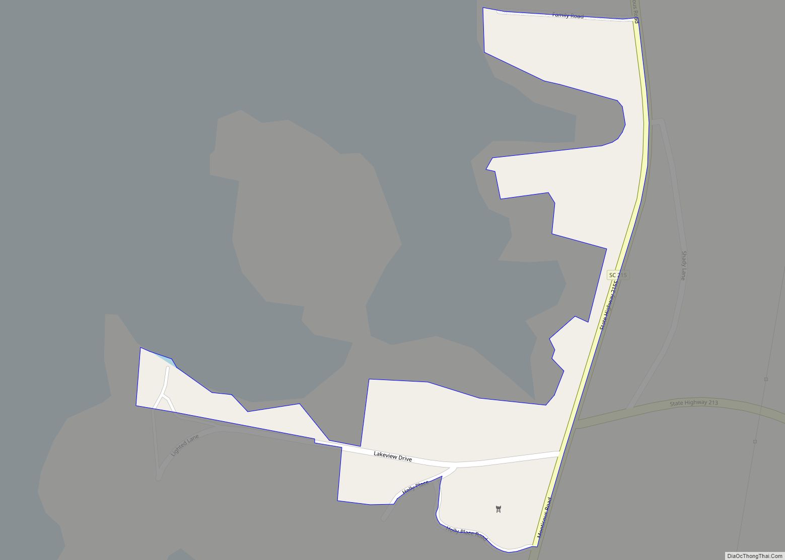
Online Interactive Map
Click on ![]() to view map in "full screen" mode.
to view map in "full screen" mode.
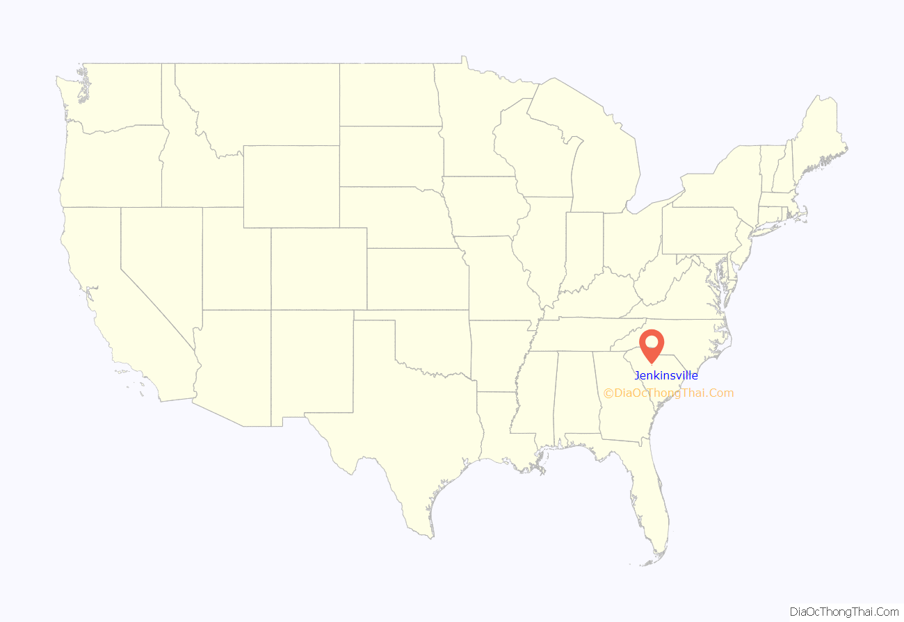
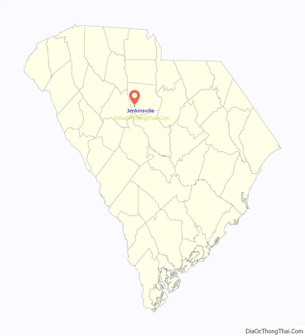
Jenkinsville location map. Where is Jenkinsville town?
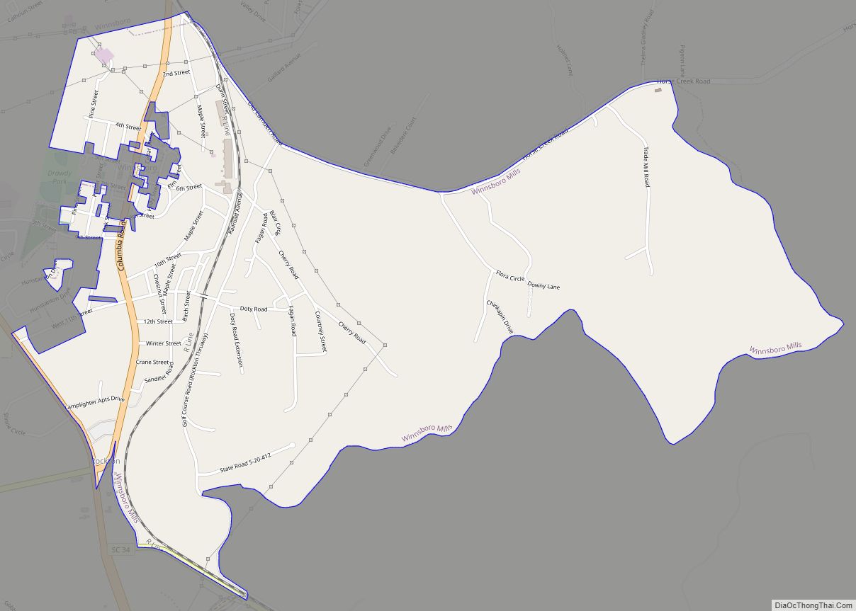
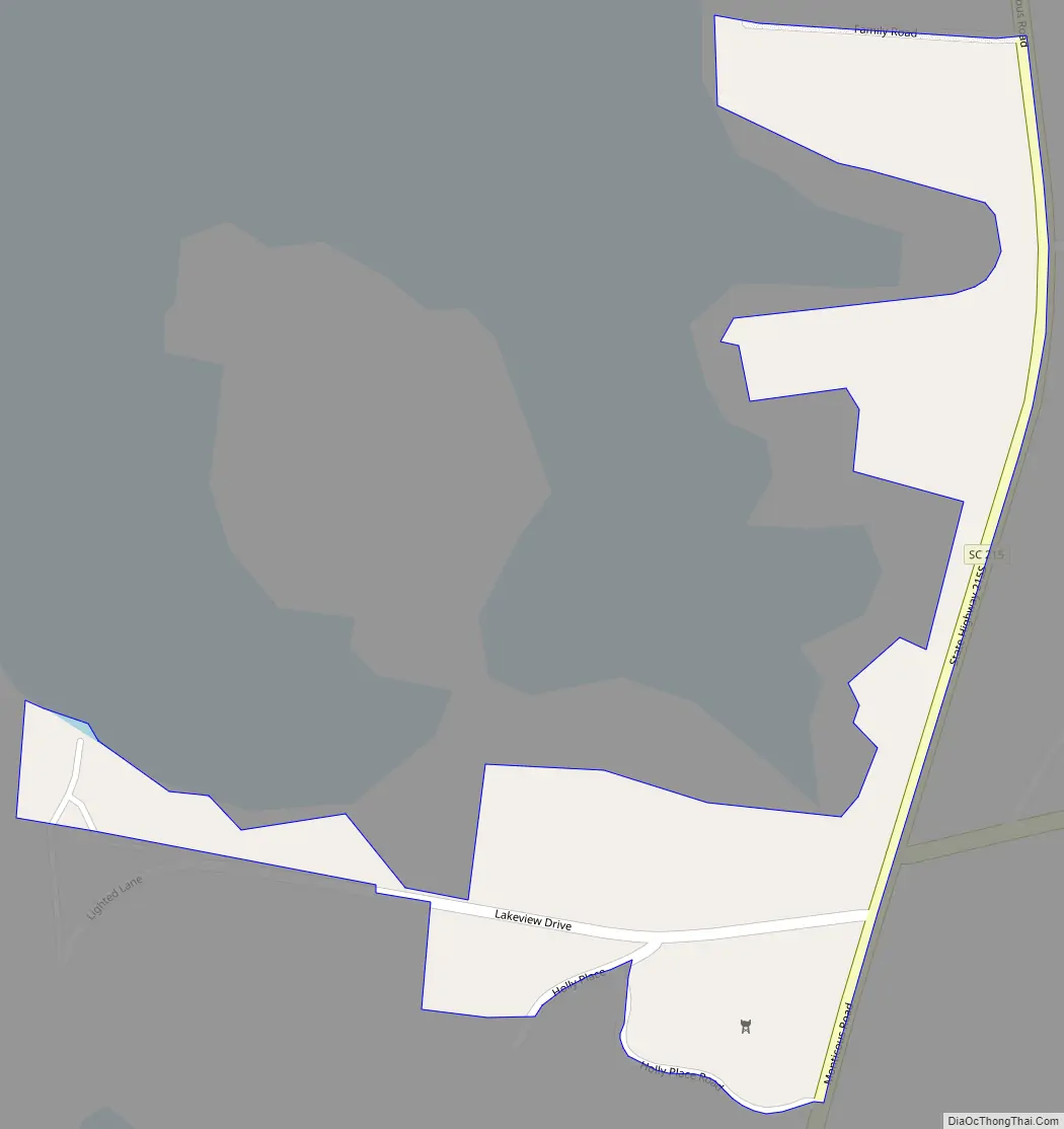
Jenkinsville Road Map
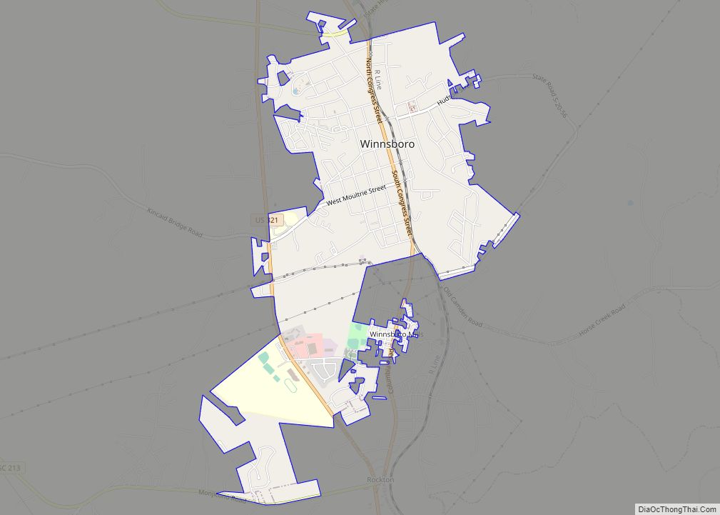
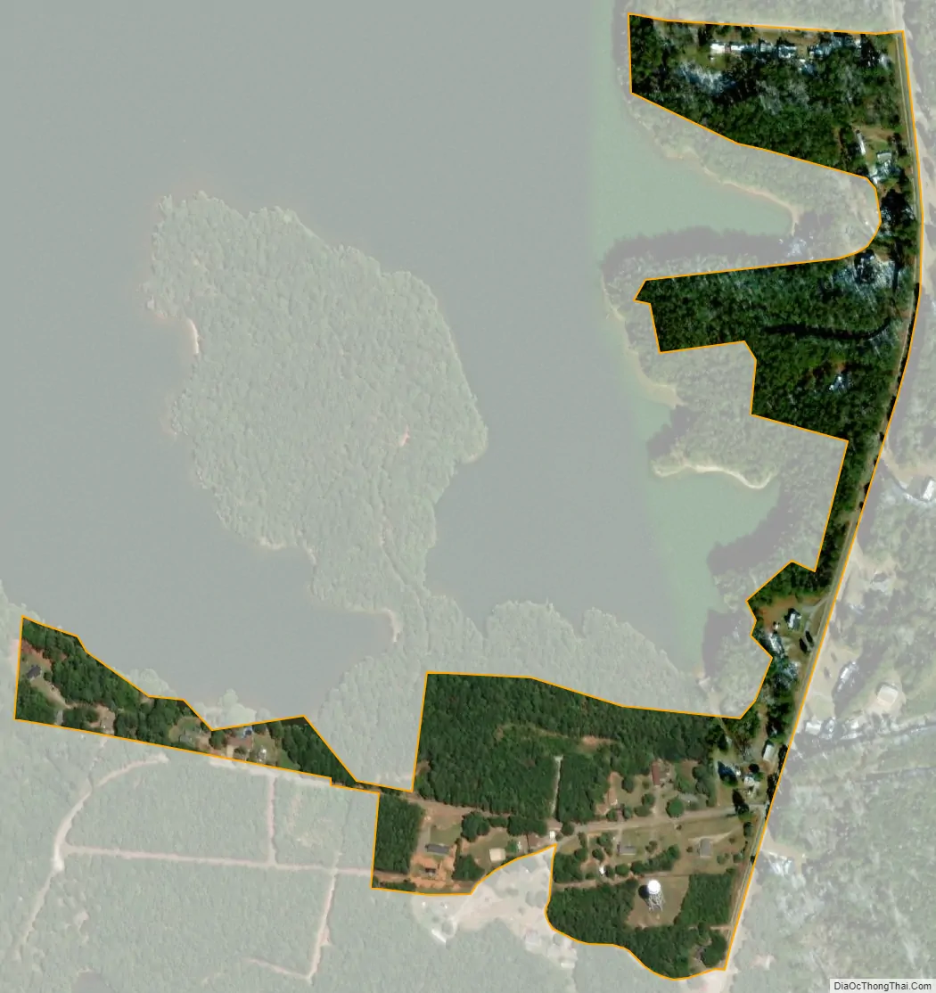
Jenkinsville city Satellite Map
See also
Map of South Carolina State and its subdivision:- Abbeville
- Aiken
- Allendale
- Anderson
- Bamberg
- Barnwell
- Beaufort
- Berkeley
- Calhoun
- Charleston
- Cherokee
- Chester
- Chesterfield
- Clarendon
- Colleton
- Darlington
- Dillon
- Dorchester
- Edgefield
- Fairfield
- Florence
- Georgetown
- Greenville
- Greenwood
- Hampton
- Horry
- Jasper
- Kershaw
- Lancaster
- Laurens
- Lee
- Lexington
- Marion
- Marlboro
- McCormick
- Newberry
- Oconee
- Orangeburg
- Pickens
- Richland
- Saluda
- Spartanburg
- Sumter
- Union
- Williamsburg
- York
- Alabama
- Alaska
- Arizona
- Arkansas
- California
- Colorado
- Connecticut
- Delaware
- District of Columbia
- Florida
- Georgia
- Hawaii
- Idaho
- Illinois
- Indiana
- Iowa
- Kansas
- Kentucky
- Louisiana
- Maine
- Maryland
- Massachusetts
- Michigan
- Minnesota
- Mississippi
- Missouri
- Montana
- Nebraska
- Nevada
- New Hampshire
- New Jersey
- New Mexico
- New York
- North Carolina
- North Dakota
- Ohio
- Oklahoma
- Oregon
- Pennsylvania
- Rhode Island
- South Carolina
- South Dakota
- Tennessee
- Texas
- Utah
- Vermont
- Virginia
- Washington
- West Virginia
- Wisconsin
- Wyoming