St. Matthews is a town in Calhoun County, South Carolina, United States. The population was 2,021 at the 2010 census, a decline from 2,107 in 2000. It is the county seat of Calhoun County.
St. Matthews is part of the Columbia, South Carolina Metropolitan Statistical Area.
The town holds an annual Purple Martin festival in April which includes food, music, cars, and more.
| Name: | St. Matthews town |
|---|---|
| LSAD Code: | 43 |
| LSAD Description: | town (suffix) |
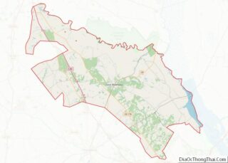
| State: | South Carolina |
| County: | Calhoun County |
| Founded: | 1841 |
| Elevation: | 279 ft (85 m) |
| Total Area: | 1.93 sq mi (4.99 km²) |
| Land Area: | 1.92 sq mi (4.98 km²) |
| Water Area: | 0.01 sq mi (0.02 km²) |
| Total Population: | 1,841 |
| Population Density: | 957.86/sq mi (369.88/km²) |
| ZIP code: | 29135 |
| Area code: | 803 |
| FIPS code: | 4562620 |
| GNISfeature ID: | 1250621 |
| Website: | stmatthews.sc.gov |
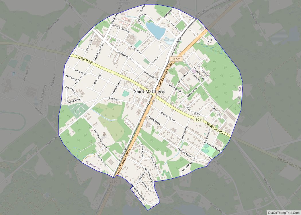
Online Interactive Map
Click on ![]() to view map in "full screen" mode.
to view map in "full screen" mode.
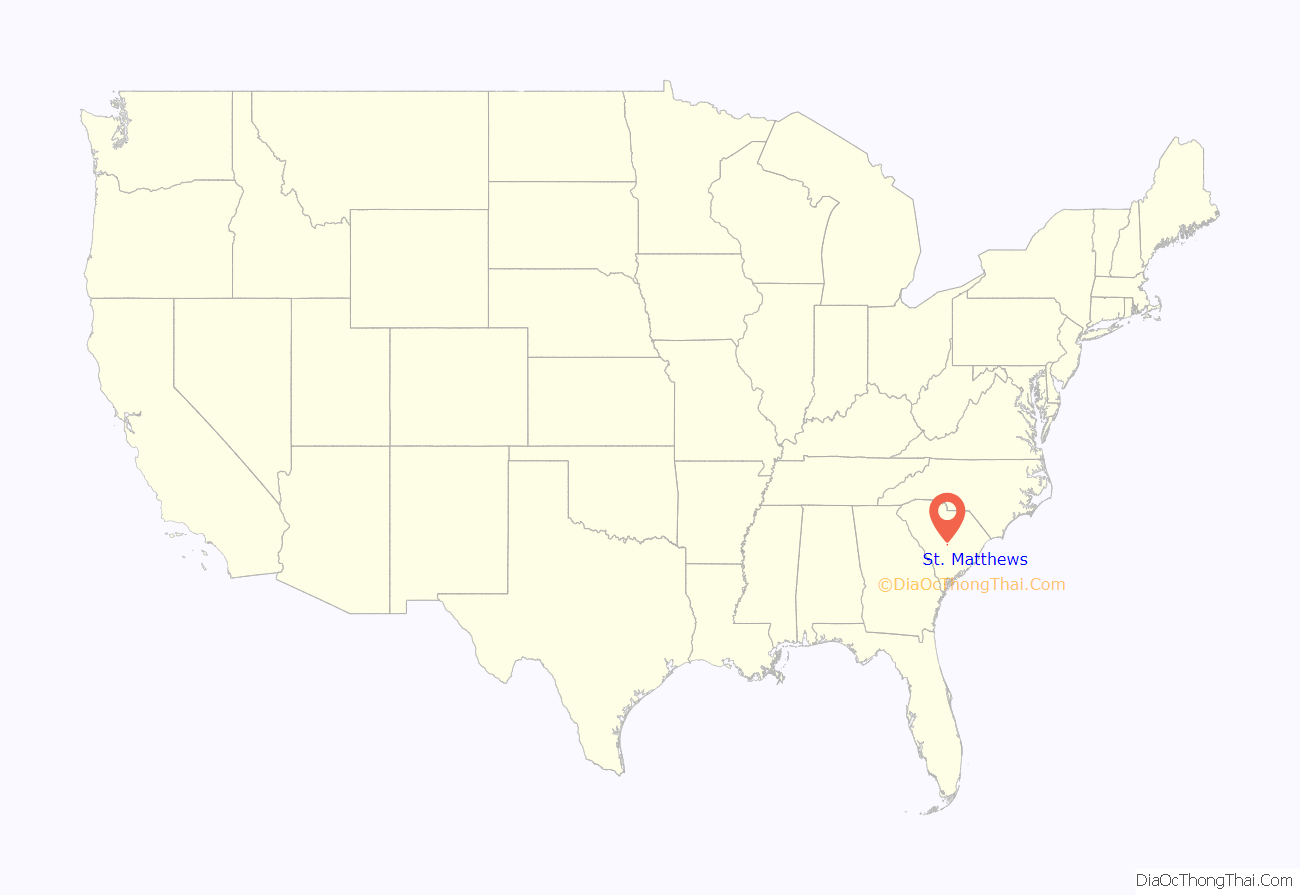
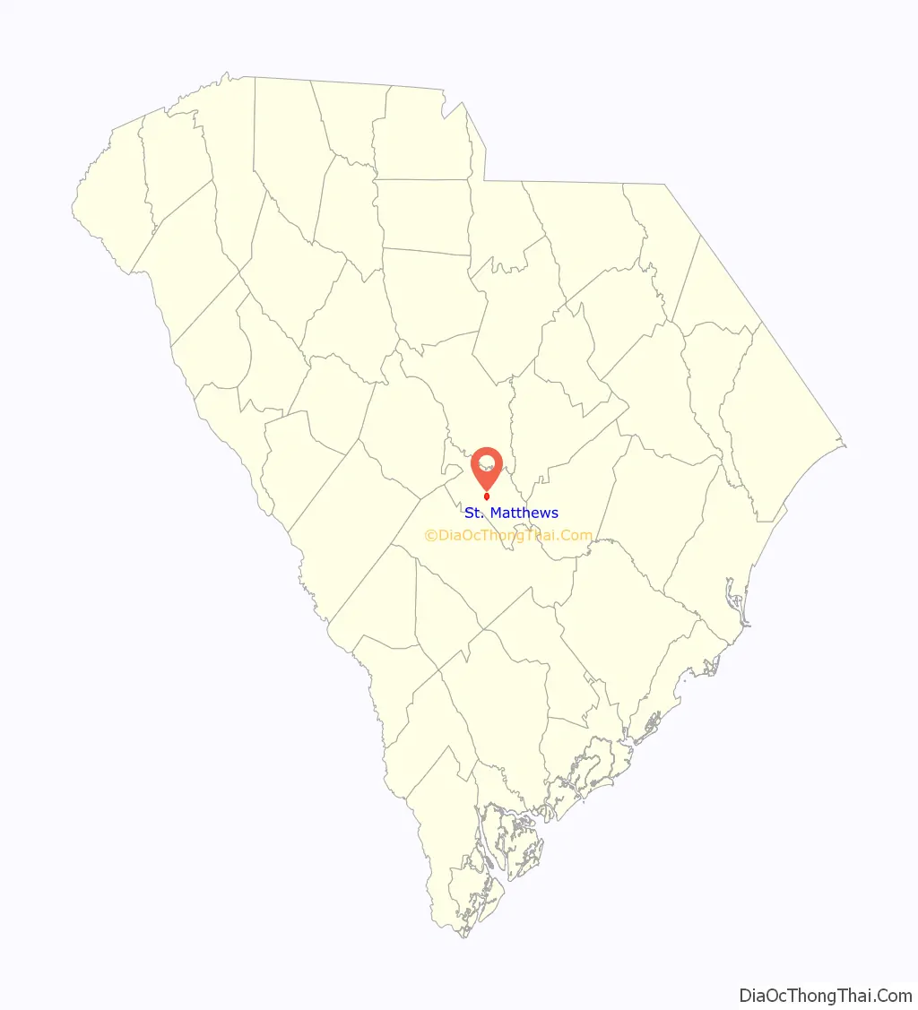
St. Matthews location map. Where is St. Matthews town?
History
St. Matthews was established as the township of Amelia by Gov. Robert Johnson in the 1730s. The Col. J.A. Banks House, Buyck’s Bluff Archeological Site, Calhoun County Courthouse, Calhoun County Library, Cherokee Path, Sterling Land Grant, Col. Olin M. Dantzler House, David Houser House, Prehistoric Indian Village, and Puritan Farm are listed on the National Register of Historic Places.
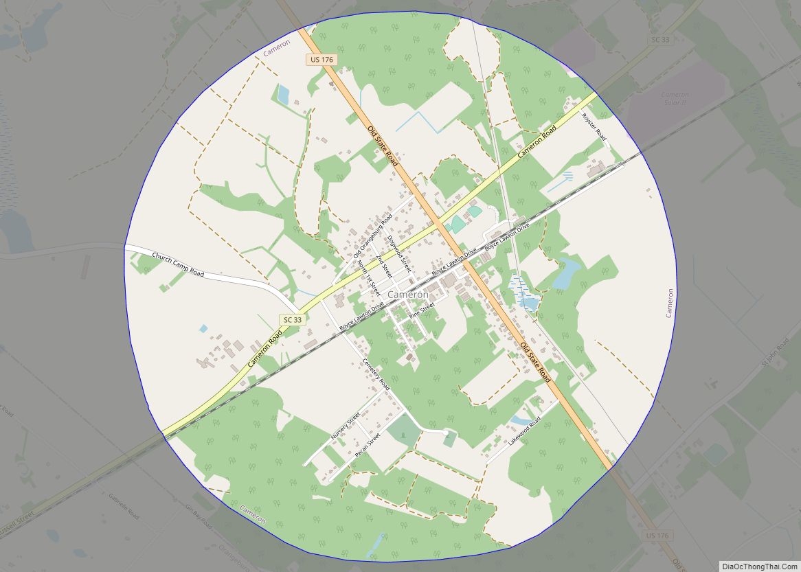
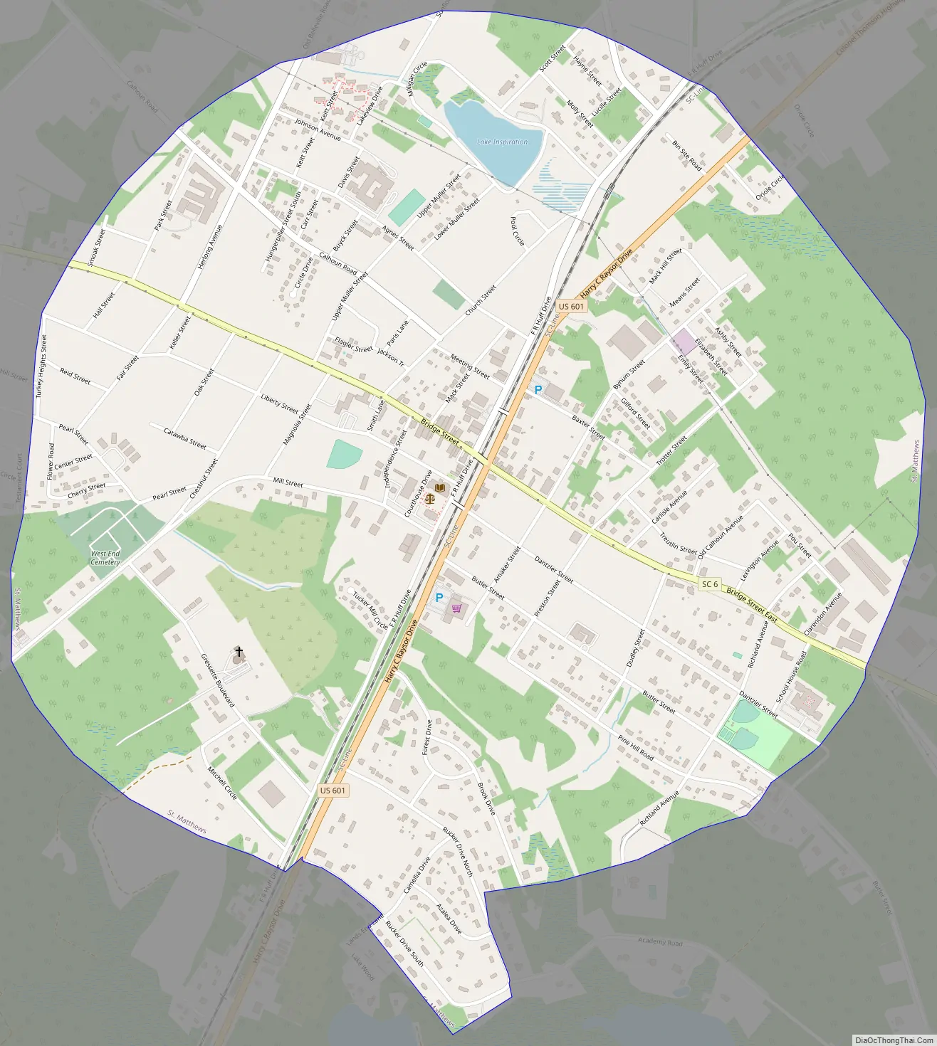
St. Matthews Road Map
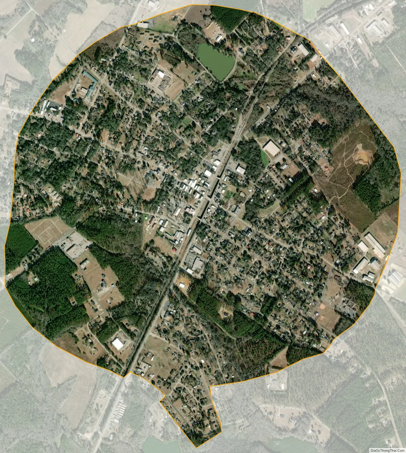
St. Matthews city Satellite Map
Geography
St. Matthews is located in the center of Calhoun County at 33°39′53″N 80°46′44″W / 33.66472°N 80.77889°W / 33.66472; -80.77889 (33.664734, -80.778976). U.S. Route 601 passes through the town, leading northeast 51 miles (82 km) to Camden and southwest 13 miles (21 km) to Orangeburg. South Carolina Highway 6 crosses US 601 in the center of town and leads west 7 miles (11 km) to Interstate 26 and southeast 22 miles (35 km) to Interstate 95 near Santee.
According to the United States Census Bureau, St. Matthews has a total area of 1.93 square miles (4.99 km), of which 1.92 square miles (4.97 km) is land and 0.01 square miles (0.02 km), or 0.35%, is water.
See also
Map of South Carolina State and its subdivision:- Abbeville
- Aiken
- Allendale
- Anderson
- Bamberg
- Barnwell
- Beaufort
- Berkeley
- Calhoun
- Charleston
- Cherokee
- Chester
- Chesterfield
- Clarendon
- Colleton
- Darlington
- Dillon
- Dorchester
- Edgefield
- Fairfield
- Florence
- Georgetown
- Greenville
- Greenwood
- Hampton
- Horry
- Jasper
- Kershaw
- Lancaster
- Laurens
- Lee
- Lexington
- Marion
- Marlboro
- McCormick
- Newberry
- Oconee
- Orangeburg
- Pickens
- Richland
- Saluda
- Spartanburg
- Sumter
- Union
- Williamsburg
- York
- Alabama
- Alaska
- Arizona
- Arkansas
- California
- Colorado
- Connecticut
- Delaware
- District of Columbia
- Florida
- Georgia
- Hawaii
- Idaho
- Illinois
- Indiana
- Iowa
- Kansas
- Kentucky
- Louisiana
- Maine
- Maryland
- Massachusetts
- Michigan
- Minnesota
- Mississippi
- Missouri
- Montana
- Nebraska
- Nevada
- New Hampshire
- New Jersey
- New Mexico
- New York
- North Carolina
- North Dakota
- Ohio
- Oklahoma
- Oregon
- Pennsylvania
- Rhode Island
- South Carolina
- South Dakota
- Tennessee
- Texas
- Utah
- Vermont
- Virginia
- Washington
- West Virginia
- Wisconsin
- Wyoming