Whitmire is a town in Newberry County, South Carolina, United States, along the Enoree River. The population was 1,441 at the 2010 census. The town was named for George Fredrick Whitmire, who came from Stuttgart, Germany.
| Name: | Whitmire town |
|---|---|
| LSAD Code: | 43 |
| LSAD Description: | town (suffix) |
| State: | South Carolina |
| County: | Newberry County |
| Elevation: | 436 ft (133 m) |
| Total Area: | 1.25 sq mi (3.24 km²) |
| Land Area: | 1.25 sq mi (3.24 km²) |
| Water Area: | 0.00 sq mi (0.00 km²) |
| Total Population: | 1,390 |
| Population Density: | 1,112.00/sq mi (429.38/km²) |
| ZIP code: | 29178 |
| Area code: | 803, 839 |
| FIPS code: | 4577380 |
| GNISfeature ID: | 1251440 |
| Website: | townofwhitmire.godaddysites.com |
Online Interactive Map
Click on ![]() to view map in "full screen" mode.
to view map in "full screen" mode.
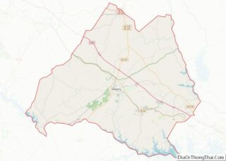
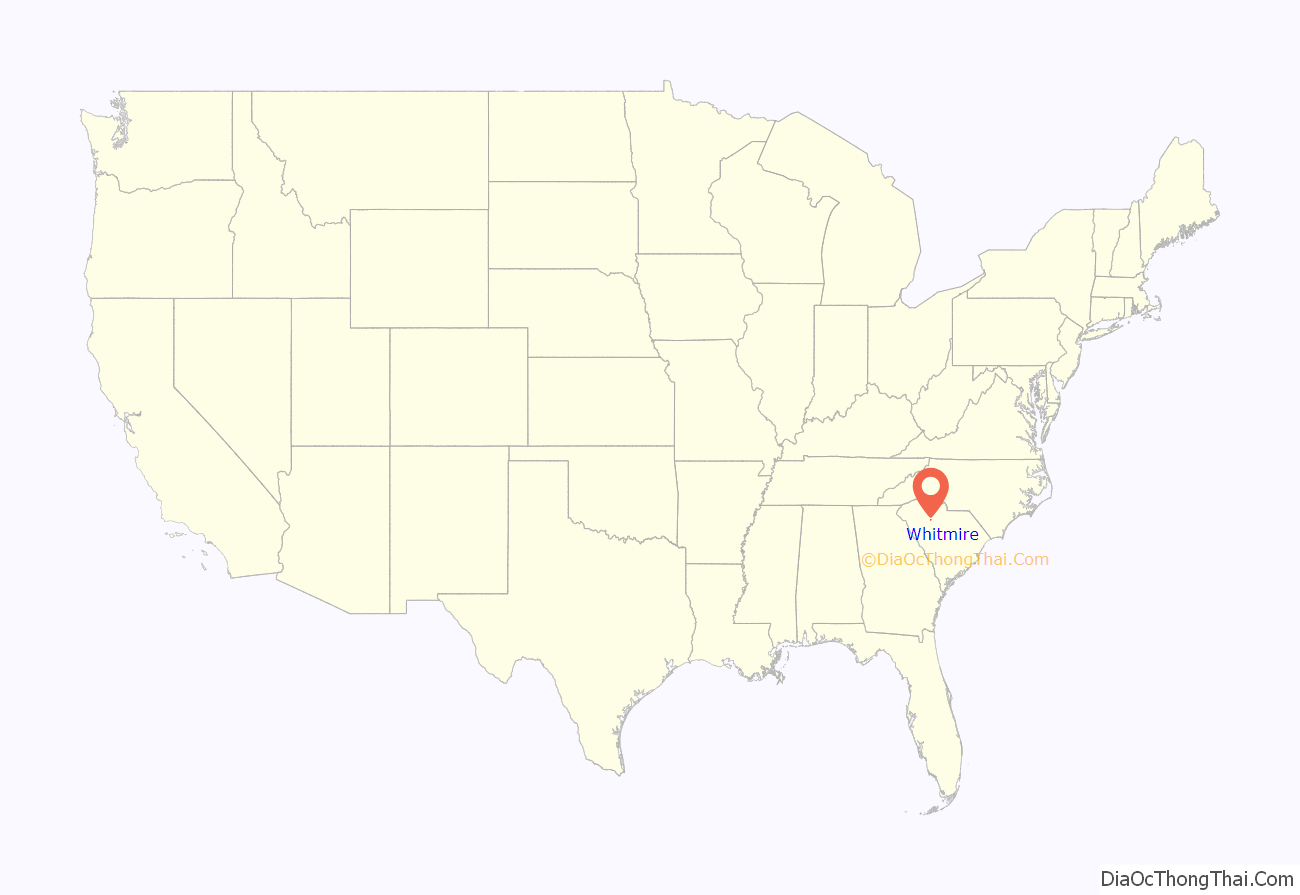
Whitmire location map. Where is Whitmire town?

History
The earliest settler in what is now Whitmire was John Duncan, who built a house along the creek that now bears his name. The George Frederick Whitmire family arrived prior to the 1790s (1790 Census) and established a tavern and post office. The arrival of the Georgia, Carolina and Northern Railway in 1890 led to the town’s rapid growth. Whitmire incorporated in 1891.
In 1902, William Coleman and several associates established a large textile factory known as the Glenn-Lowery Mill, which included 900 looms and 33,000 spindles. By 1911, the mill had nearly doubled in size. Later owners continued to expand the mill, and it would remain a major source of revenue for Whitmire throughout the 20th century.
A fire in 1916 destroyed much of downtown Whitmire, which consisted primarily of wooden buildings. The town passed a series of new fire ordinances, and the business district was rebuilt with brick. Many of these buildings are still standing.
In 1924, Whitmire attempted to “secede” from Newberry County and form a new county known as Carlisle County. The new county would have consisted of parts of Newberry County, Laurens County, and Union County, with Whitmire as the county seat. The county’s organizers failed to acquire the necessary amount of land, however, and the initiative failed.
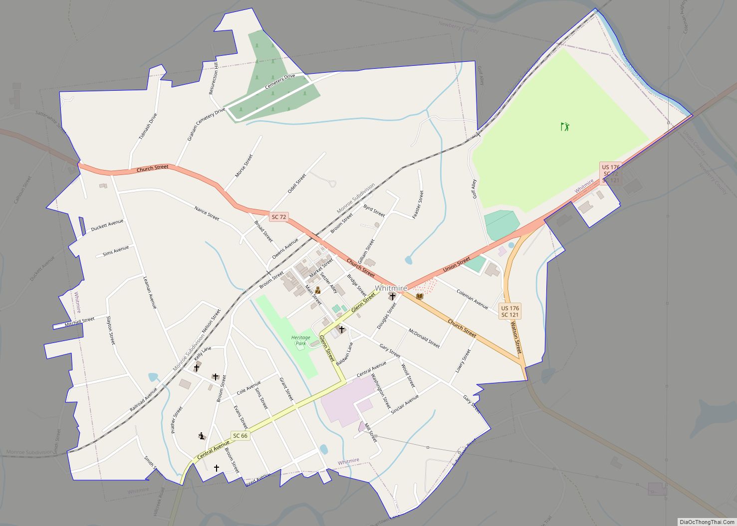
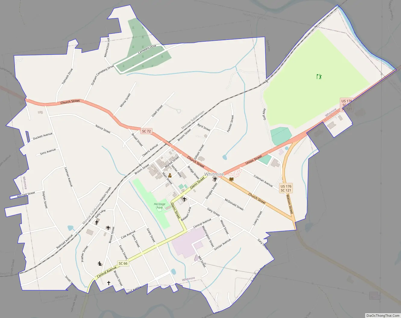
Whitmire Road Map
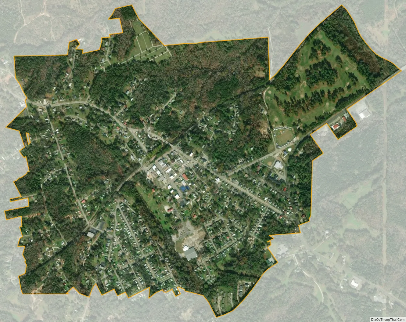
Whitmire city Satellite Map
Geography
Whitmire is located at 34°30′8″N 81°36′51″W / 34.50222°N 81.61417°W / 34.50222; -81.61417 (34.502227, -81.614162). The town is concentrated around the intersection of U.S. Route 176 and South Carolina Highway 72, northwest of Columbia and southeast of Spartanburg. The town’s eastern boundary lies along the Enoree River.
According to the United States Census Bureau, the town has a total area of 1.3 square miles (3.3 km), all land.
See also
Map of South Carolina State and its subdivision:- Abbeville
- Aiken
- Allendale
- Anderson
- Bamberg
- Barnwell
- Beaufort
- Berkeley
- Calhoun
- Charleston
- Cherokee
- Chester
- Chesterfield
- Clarendon
- Colleton
- Darlington
- Dillon
- Dorchester
- Edgefield
- Fairfield
- Florence
- Georgetown
- Greenville
- Greenwood
- Hampton
- Horry
- Jasper
- Kershaw
- Lancaster
- Laurens
- Lee
- Lexington
- Marion
- Marlboro
- McCormick
- Newberry
- Oconee
- Orangeburg
- Pickens
- Richland
- Saluda
- Spartanburg
- Sumter
- Union
- Williamsburg
- York
- Alabama
- Alaska
- Arizona
- Arkansas
- California
- Colorado
- Connecticut
- Delaware
- District of Columbia
- Florida
- Georgia
- Hawaii
- Idaho
- Illinois
- Indiana
- Iowa
- Kansas
- Kentucky
- Louisiana
- Maine
- Maryland
- Massachusetts
- Michigan
- Minnesota
- Mississippi
- Missouri
- Montana
- Nebraska
- Nevada
- New Hampshire
- New Jersey
- New Mexico
- New York
- North Carolina
- North Dakota
- Ohio
- Oklahoma
- Oregon
- Pennsylvania
- Rhode Island
- South Carolina
- South Dakota
- Tennessee
- Texas
- Utah
- Vermont
- Virginia
- Washington
- West Virginia
- Wisconsin
- Wyoming