Yolo County (/ˈjoʊloʊ/ (listen); Wintun: Yo-loy), officially the County of Yolo, is a county located in the northern portion of the U.S. state of California. As of the 2020 census, the population was 216,403. Its county seat is Woodland.
Yolo County is included in the Greater Sacramento metropolitan area and is located in the Sacramento Valley.
The majority of Yolo County remains a relatively rural agricultural region.
| Name: | Yolo County |
|---|---|
| FIPS code: | 06-113 |
| State: | California |
| Largest city: | Davis (population) West Sacramento (area) |
| Total Area: | 1,024 sq mi (2,650 km²) |
| Land Area: | 1,015 sq mi (2,630 km²) |
| Total Population: | 216,403 |
| Population Density: | 210/sq mi (82/km²) |
| Time zone: | UTC-8 (Pacific Time Zone) |
| Summer Time Zone (DST): | UTC-7 (Pacific Daylight Time) |
| Website: | www.yolocounty.org |
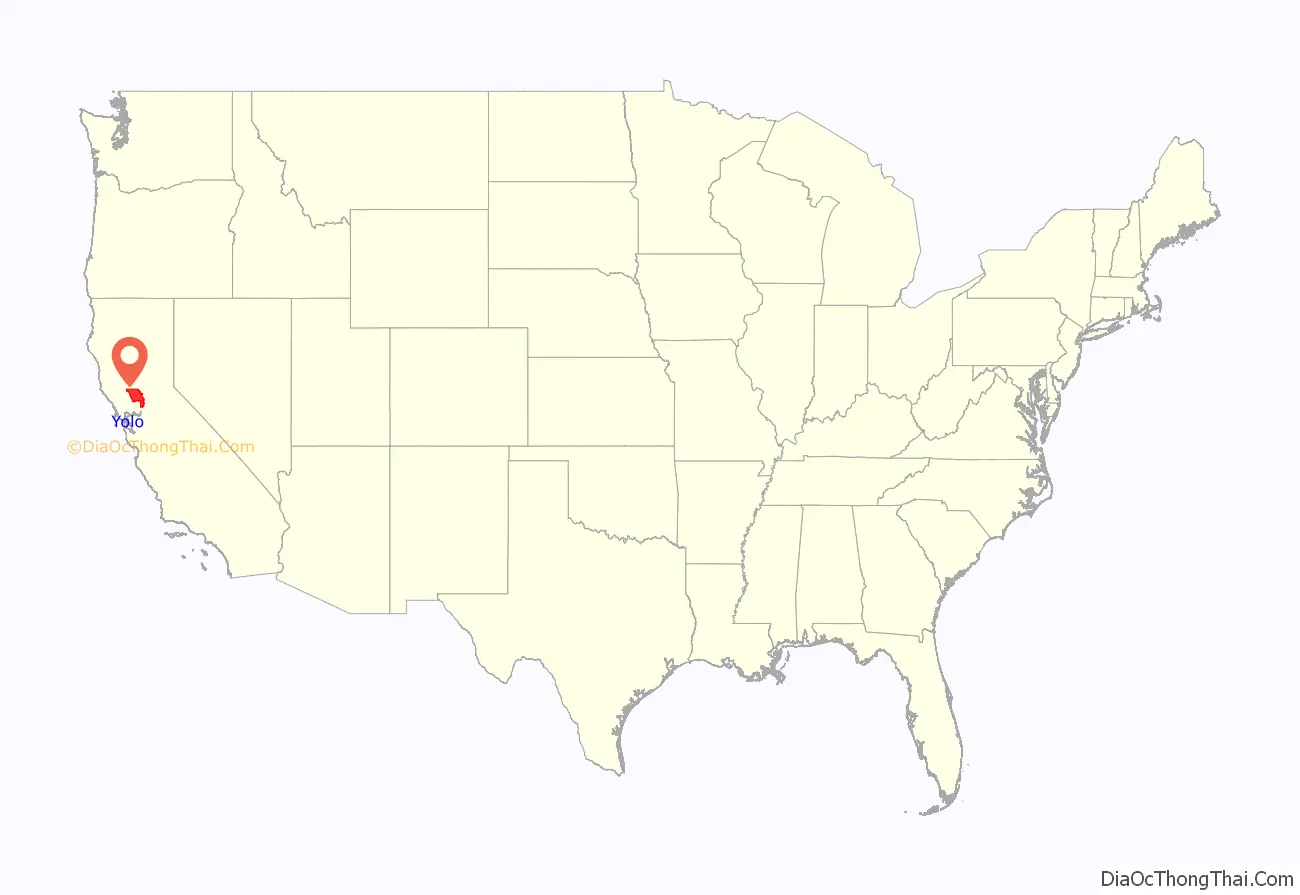
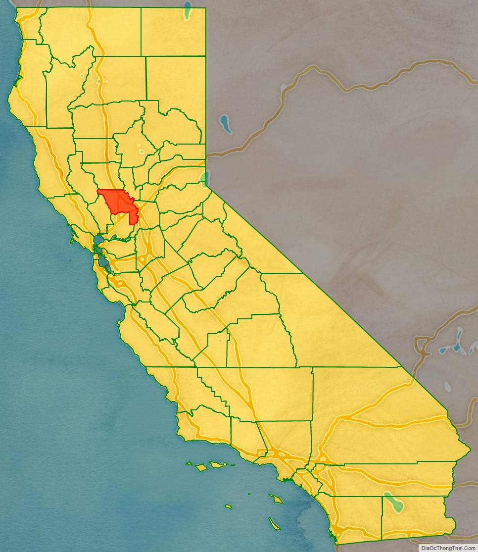
Yolo County location map. Where is Yolo County?
History
Yolo County was one of the original counties of California, created in 1850 at the time of statehood.
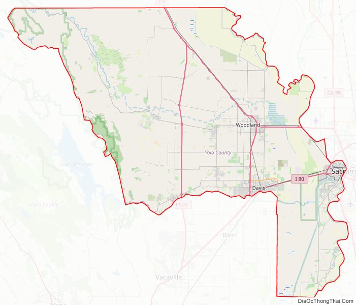
Yolo County Road Map
Geography
According to the U.S. Census Bureau, the county has a total area of 1,024 square miles (2,650 km), of which 1,015 square miles (2,630 km) is land and 8.9 square miles (23 km) (0.9%) is water.
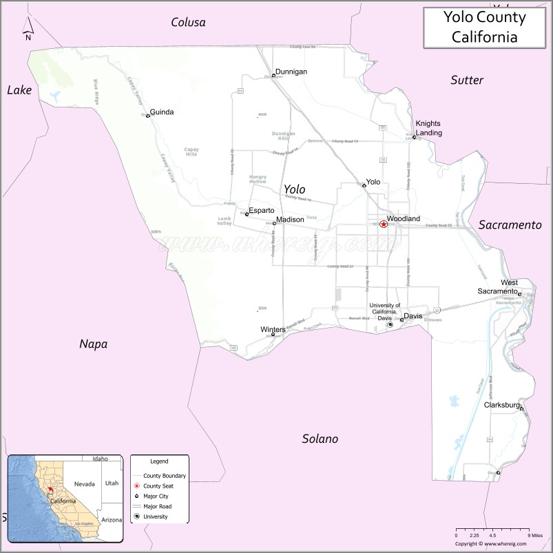
Adjacent counties
- Colusa County – north
- Sutter County – northeast
- Sacramento County – east
- Solano County – south
- Napa County – west
- Lake County – northwest
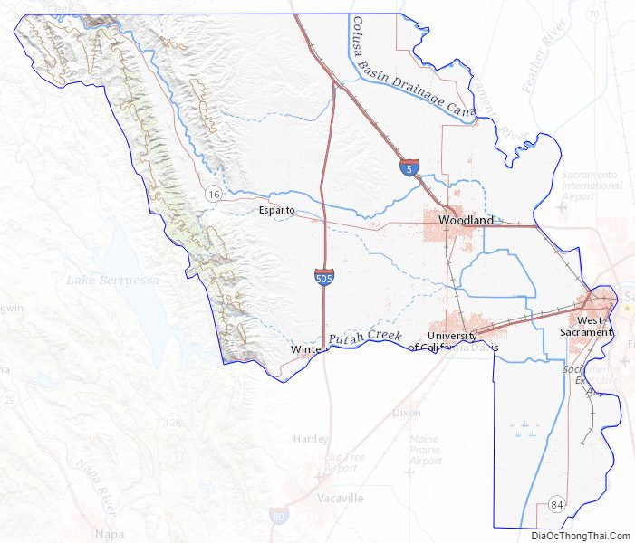
Yolo County Topographic Map
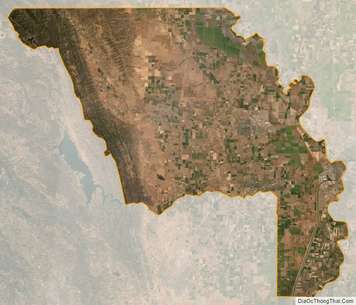
Yolo County Satellite Map
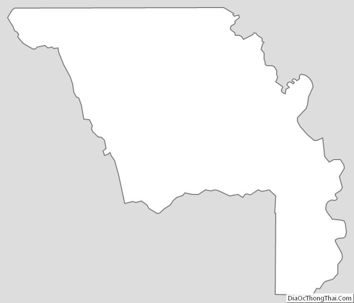
Yolo County Outline Map
See also
Map of California State and its subdivision:- Alameda
- Alpine
- Amador
- Butte
- Calaveras
- Colusa
- Contra Costa
- Del Norte
- El Dorado
- Fresno
- Glenn
- Humboldt
- Imperial
- Inyo
- Kern
- Kings
- Lake
- Lassen
- Los Angeles
- Madera
- Marin
- Mariposa
- Mendocino
- Merced
- Modoc
- Mono
- Monterey
- Napa
- Nevada
- Orange
- Placer
- Plumas
- Riverside
- Sacramento
- San Benito
- San Bernardino
- San Diego
- San Francisco
- San Joaquin
- San Luis Obispo
- San Mateo
- Santa Barbara
- Santa Clara
- Santa Cruz
- Shasta
- Sierra
- Siskiyou
- Solano
- Sonoma
- Stanislaus
- Sutter
- Tehama
- Trinity
- Tulare
- Tuolumne
- Ventura
- Yolo
- Yuba
- Alabama
- Alaska
- Arizona
- Arkansas
- California
- Colorado
- Connecticut
- Delaware
- District of Columbia
- Florida
- Georgia
- Hawaii
- Idaho
- Illinois
- Indiana
- Iowa
- Kansas
- Kentucky
- Louisiana
- Maine
- Maryland
- Massachusetts
- Michigan
- Minnesota
- Mississippi
- Missouri
- Montana
- Nebraska
- Nevada
- New Hampshire
- New Jersey
- New Mexico
- New York
- North Carolina
- North Dakota
- Ohio
- Oklahoma
- Oregon
- Pennsylvania
- Rhode Island
- South Carolina
- South Dakota
- Tennessee
- Texas
- Utah
- Vermont
- Virginia
- Washington
- West Virginia
- Wisconsin
- Wyoming