Davis is the most populous city in Yolo County, California. Located in the Sacramento Valley region of Northern California, the city had a population of 66,850 in 2020, not including the on-campus population of the University of California, Davis, which was over 9,400 (not including students’ families) in 2016. As of 2019, there were 38,369 students enrolled at the university.
| Name: | Davis city |
|---|---|
| LSAD Code: | 25 |
| LSAD Description: | city (suffix) |
| State: | California |
| County: | Yolo County |
| Incorporated: | March 28, 1917 |
| Elevation: | 52 ft (16 m) |
| Total Area: | 10.01 sq mi (25.92 km²) |
| Land Area: | 9.97 sq mi (25.83 km²) |
| Water Area: | 0.04 sq mi (0.09 km²) 0.32% |
| Total Population: | 66,850 |
| Population Density: | 6,703.77/sq mi (2,588.44/km²) |
| Area code: | 530 |
| FIPS code: | 0618100 |
| Website: | cityofdavis.org |
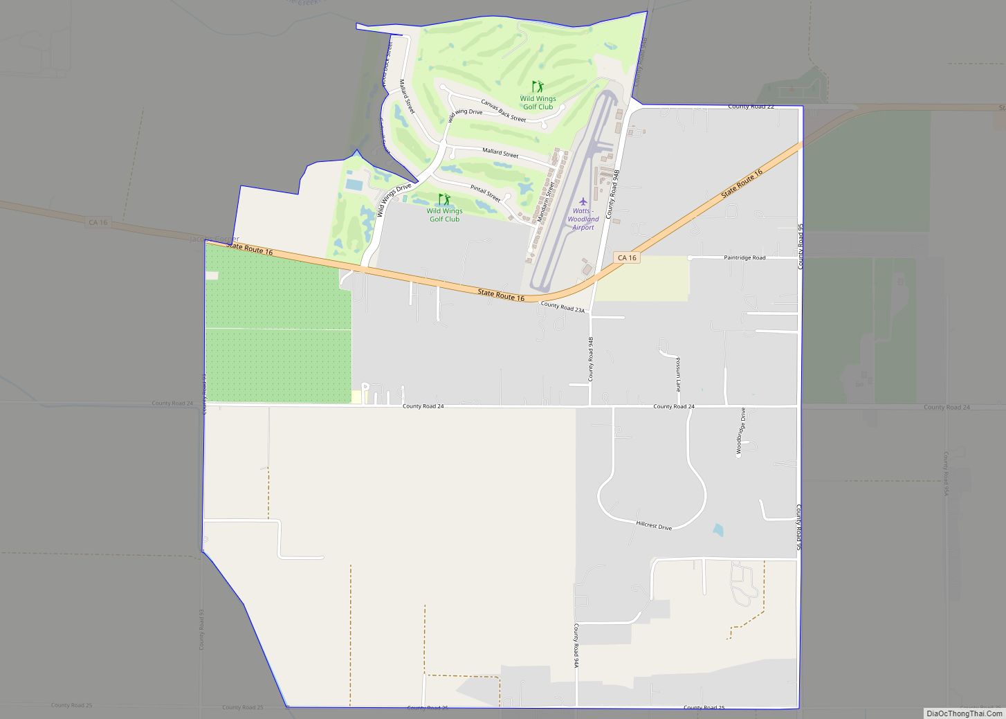
Online Interactive Map
Click on ![]() to view map in "full screen" mode.
to view map in "full screen" mode.
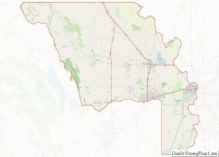
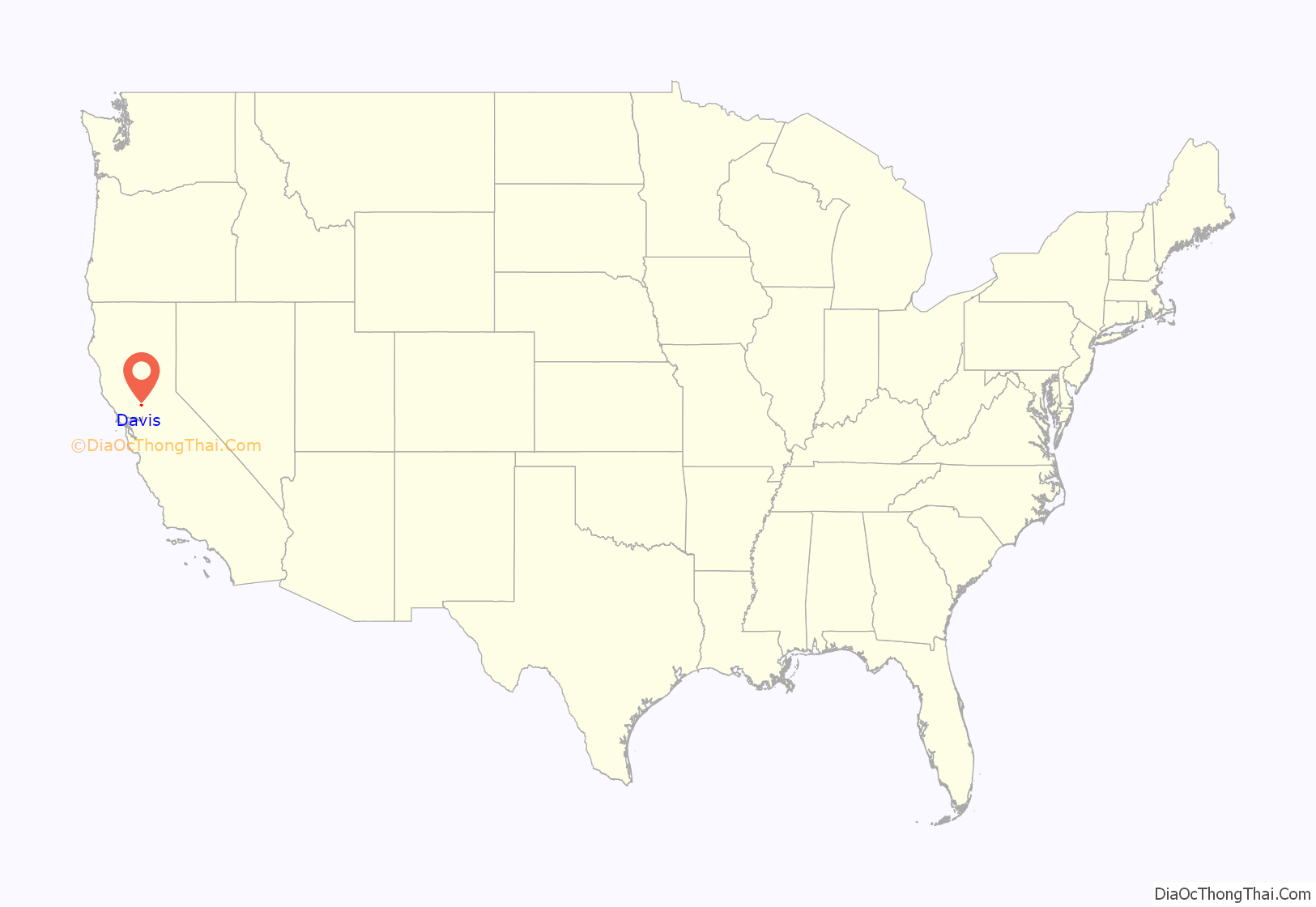
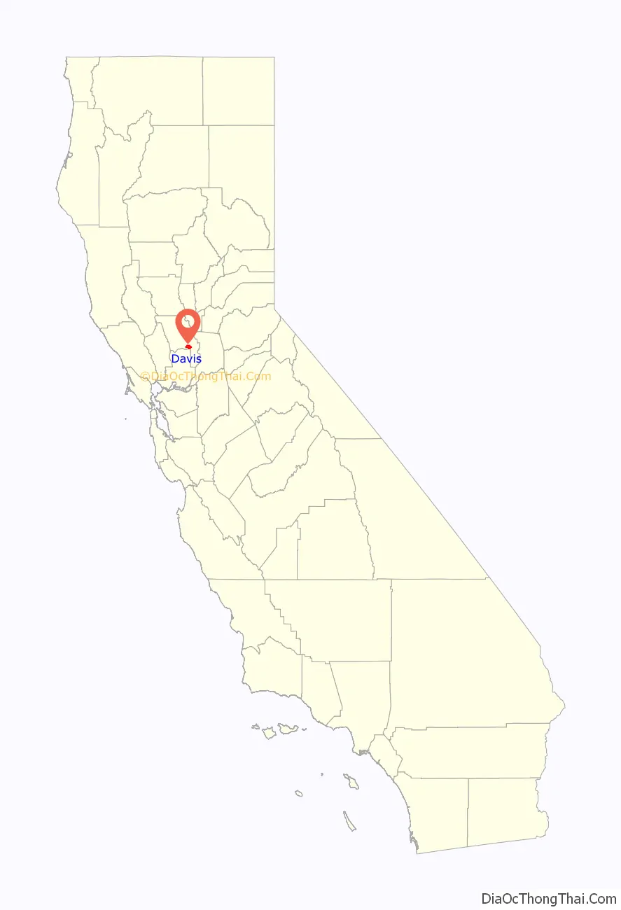
Davis location map. Where is Davis city?
History
Davis sits on land that originally belonged to the Indigenous Patwin, a southern branch of Wintun people, who were killed or forced from their lands by the 1830s as part of the California Genocide through a combination of mass murders, smallpox and other diseases, and both Mexican and American systems of Indigenous slavery. Patwin burial grounds have been found across Davis, including on the site of the UC Davis Mondavi Center. After the killing and expulsion of the Patwin, territory that eventually became Davis emerged from one of California’s most complicated, Laguna de Santos Callé. The 1852 Land Commission concurred with US Attorneys who argued that the grant was “fraudulent in all its parts,” and in his 1860 District Court ruling Justice Ogden Hoffman observed that “It is impossible to contemplate without disgust the series of perjuries which compose the record” of the land grant. Nevertheless, Jerome C. Davis, a prominent farmer and one of the early claimants to land in Laguna de Santos Callé, lobbied all the way to the United States Congress in order to retain the land that eventually became Davis. Davis became a depot on the Southern Pacific Railroad in 1868, when it was named “Davisville” after Jerome C. Davis. However, the post office at Davisville shortened the town name to “Davis” in 1907. The name stuck, and the city of Davis was incorporated on March 28, 1917.
From its inception as a farming community, Davis is known primarily for its contributions to agricultural policy along with veterinary care and animal husbandry. Following the passage of the University Farm Bill in 1905 by the California State Legislature, Governor George Pardee selected Davis out of 50 other sites as the future home to the University of California’s University Farm, officially opening to students in 1908. The farm, later renamed the Northern Branch of the College of Agriculture in 1922, was upgraded to become the seventh UC general campus, the University of California, Davis, in 1959.
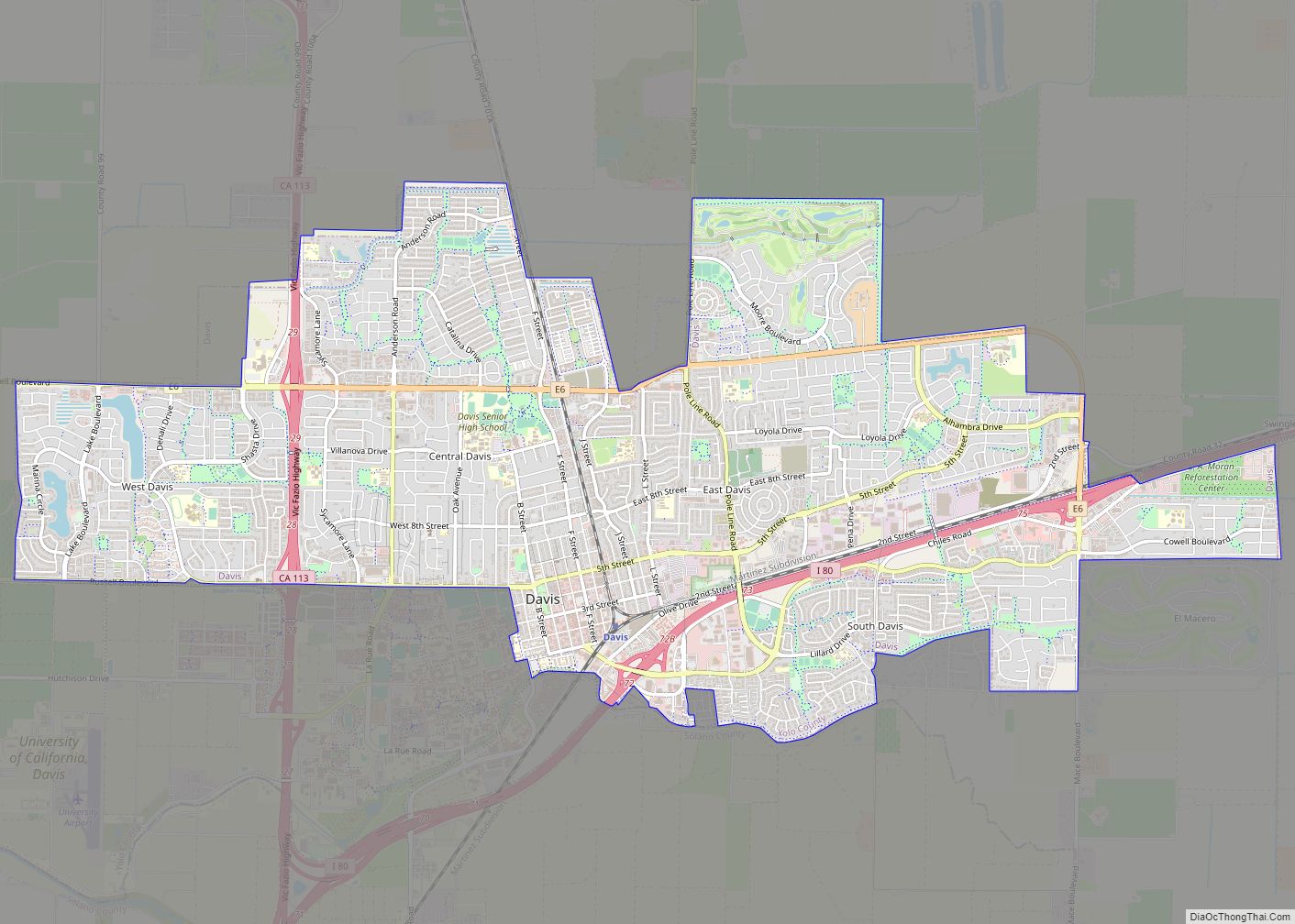
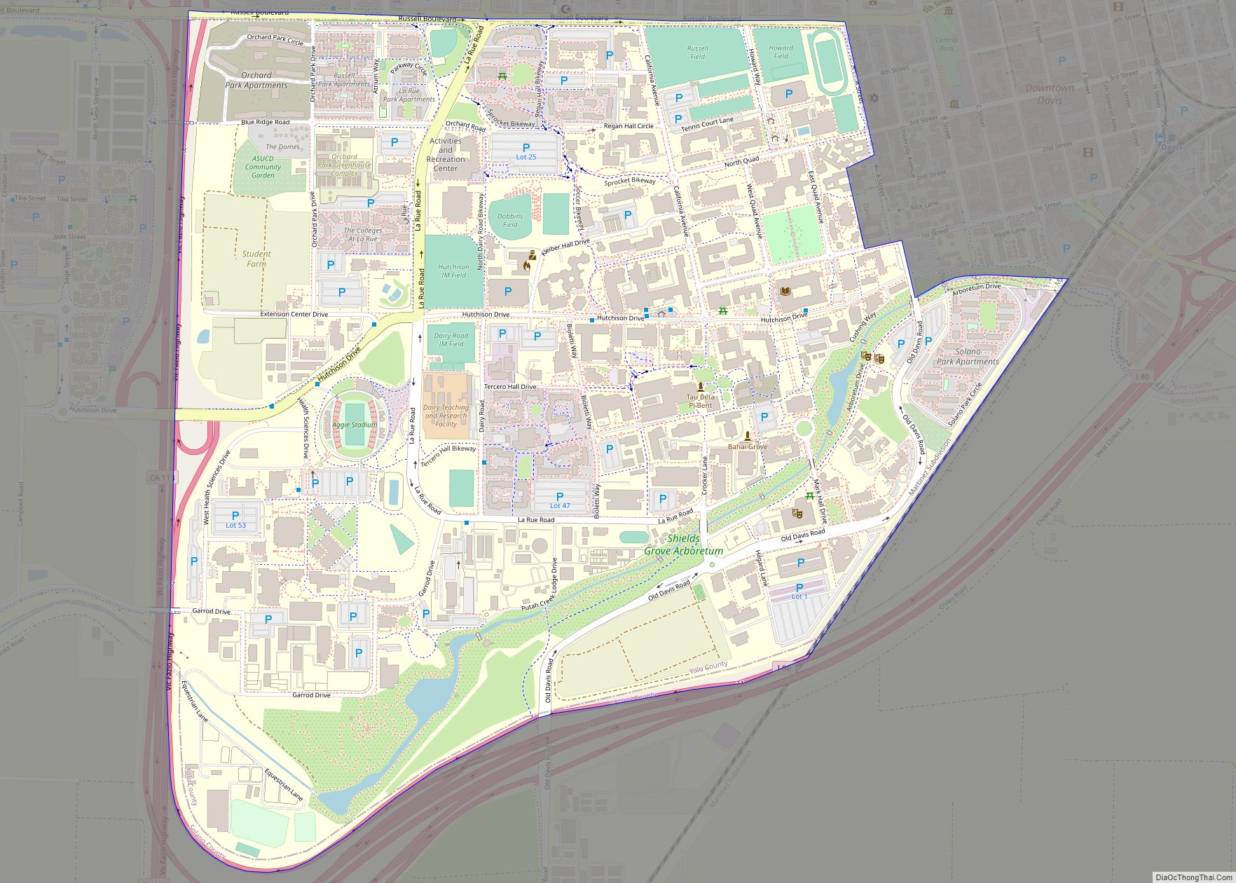
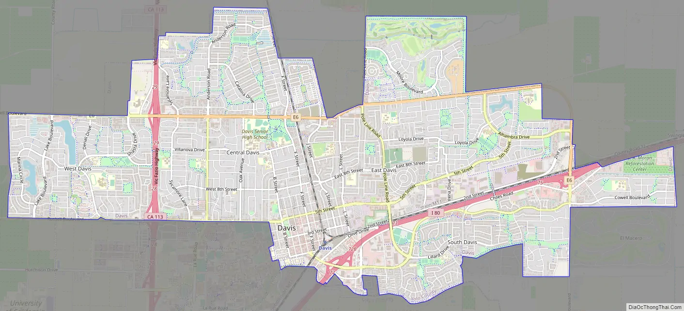
Davis Road Map
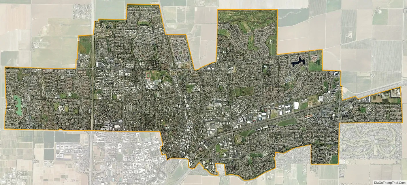
Davis city Satellite Map
Geography
Location
Davis is located in Yolo County, California, 11 mi (18 km) west of Sacramento, 70 mi (113 km) northeast of San Francisco, 385 mi (619 km) north of Los Angeles, at the intersection of Interstate 80 and State Route 113. Neighboring towns include Dixon, Winters, Woodland, and West Sacramento.
Davis lies in the Sacramento Valley, the northern portion of the Central Valley, in Northern California, at an elevation of about 52 feet (16 m) above sea level.
According to the United States Census Bureau, the city has a total area of 10.5 square miles (27 km). 10.4 square miles (27 km) of it is land and 0.04 square miles (0.10 km) of it (0.19%) is water.
The topography is flat, which has helped Davis to become known as a haven for bicyclists.
Climate
The Davis climate resembles that of nearby Sacramento and is typical of California’s Central Valley Mediterranean climate region: warm and dry in the spring, summer and autumn, and cool and wet in the winter. It is classified as a Köppen Csa climate. Summer days are hot, ranging from 85 to 105 °F (29 to 41 °C), but the nights turn pleasantly cool, almost always dropping below 70 °F (21 °C). The Delta Breeze, a flow of cool marine air originating from the Pacific Ocean via San Francisco Bay and the Sacramento–San Joaquin River Delta, frequently provides relief in the evening. Winter temperatures generally reach between 45 and 65 °F (7 and 18 °C) in the afternoon; nights average at about 35 to 40 °F (2 to 4 °C), but often fall below freezing.
Average temperatures range from 46 °F (8 °C) in December and January to 75 °F (24 °C) in July and August. Thick ground fog called tule fog settles into Davis during late fall and winter. This fog can be dense, with visibility nearly zero. As in other areas of northern California, the tule fog is a leading cause of road accidents in the winter season.
Mean rainfall per annum is about 20 inches (510 mm). The bulk of rain occurs between about mid-November to mid-March, with typically no precipitation falling from mid-June to mid-September.
Record temperatures range from a high of 116 °F (47 °C) on July 17, 1925, to a low of 12 °F (−11 °C) on December 11, 1932.
Neighborhoods
Davis is internally divided by two freeways (Interstate 80 and State Route 113), a north–south railroad (California Northern), an east–west mainline (Union Pacific) and several major streets. The city is unofficially divided into six main districts made up of smaller neighborhoods (often originally named as housing subdivisions):
- Central Davis, north of Fifth Street and Russell Boulevard, south of Covell Blvd., east of SR 113, and west of the railroad tracks running along G Street. Within these boundaries is the officially denoted neighborhood of Old North Davis, which is sometimes also considered part of Downtown.
- Downtown Davis, roughly the numbered-and-lettered grid north of I-80, south of Fifth Street, east of A Street, and west of the railroad tracks, including the Aggie Village and Olive Drive areas.
- East Davis, north of I-80, south of Covell Blvd., and east of the railroad tracks. It includes the older, ‘inner’ East Davis of lettered streets and neighborhoods such as Davis Manor, Chestnut, and Rancho Yolo, as well as more distinctly identified (in some cases walled-in) subdivisions such as Mace Ranch, Lake Alhambra Estates, and Wildhorse.
- North Davis, north of Covell Blvd. North Davis includes Covell Park, Senda Nueva, Northstar, and North Davis Farms.
- South Davis, south of I-80, and includes Willowbank. El Macero, California, although outside the city limits, is sometimes considered part of South Davis; El Macero is part of the Davis Joint Unified School District, and El Macero children who attend public schools attend Davis’ public schools.
- West Davis, north of I-80 and west of SR 113. West Davis includes Westwood, Evergreen, Aspen, Stonegate (west of Lake Boulevard and including Stonegate Lake and the Stonegate Country Club) and the eco-friendly Village Homes development, known for its solar-powered houses.
The University of California, Davis is located south of Russell Boulevard and west of A Street and then south of 1st Street. The land occupied by the university is not incorporated within the boundaries of the city of Davis and lies within both Yolo and Solano Counties.
Environment
Local energy planning began in Davis after the energy crisis of 1973. A new building code promoted energy efficiency. Energy use in buildings decreased dramatically and in 1981 Davis citizens won a $100,000 prize from utility PG&E, for cutting electricity use during the summer peak.
On November 14, 1984, the Davis City Council declared the city to be a nuclear-free zone. In 1998, the City passed a “Dark Skies” ordinance in an effort to reduce light pollution in the night sky.
In 2013, Davis became part of the state Cool Roof Initiative with the “CoolDavis” campaign, requiring all new roofing projects to meet Cool Roof Rating Council (CRRC) requirements, including the installation of light-colored roofs. The aim is to reflect more sunlight back into space via the albedo effect, and reduce the amount of heat absorbed in hopes of limiting climate change.
See also
Map of California State and its subdivision:- Alameda
- Alpine
- Amador
- Butte
- Calaveras
- Colusa
- Contra Costa
- Del Norte
- El Dorado
- Fresno
- Glenn
- Humboldt
- Imperial
- Inyo
- Kern
- Kings
- Lake
- Lassen
- Los Angeles
- Madera
- Marin
- Mariposa
- Mendocino
- Merced
- Modoc
- Mono
- Monterey
- Napa
- Nevada
- Orange
- Placer
- Plumas
- Riverside
- Sacramento
- San Benito
- San Bernardino
- San Diego
- San Francisco
- San Joaquin
- San Luis Obispo
- San Mateo
- Santa Barbara
- Santa Clara
- Santa Cruz
- Shasta
- Sierra
- Siskiyou
- Solano
- Sonoma
- Stanislaus
- Sutter
- Tehama
- Trinity
- Tulare
- Tuolumne
- Ventura
- Yolo
- Yuba
- Alabama
- Alaska
- Arizona
- Arkansas
- California
- Colorado
- Connecticut
- Delaware
- District of Columbia
- Florida
- Georgia
- Hawaii
- Idaho
- Illinois
- Indiana
- Iowa
- Kansas
- Kentucky
- Louisiana
- Maine
- Maryland
- Massachusetts
- Michigan
- Minnesota
- Mississippi
- Missouri
- Montana
- Nebraska
- Nevada
- New Hampshire
- New Jersey
- New Mexico
- New York
- North Carolina
- North Dakota
- Ohio
- Oklahoma
- Oregon
- Pennsylvania
- Rhode Island
- South Carolina
- South Dakota
- Tennessee
- Texas
- Utah
- Vermont
- Virginia
- Washington
- West Virginia
- Wisconsin
- Wyoming