West Covina is a suburban city in Los Angeles County, California, United States. Located 19 miles (31 km) east of Downtown Los Angeles in the eastern San Gabriel Valley, it is part of Greater Los Angeles. The population for the city was 106,098 at the 2010 census.
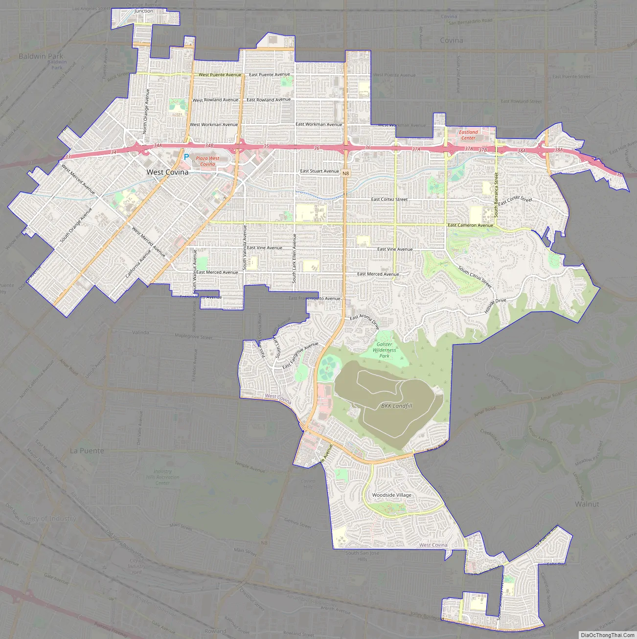
West Covina is bordered by Covina to the northeast, Baldwin Park and Irwindale to the northwest, La Puente and Valinda to the southwest, Industry to the south, Ramona to the east, and Walnut to the southeast.
| Name: | West Covina city |
|---|---|
| LSAD Code: | 25 |
| LSAD Description: | city (suffix) |
| State: | California |
| County: | Los Angeles County |
| Incorporated: | February 17, 1923 |
| Elevation: | 384 ft (117 m) |
| Total Area: | 16.09 sq mi (41.67 km²) |
| Land Area: | 16.04 sq mi (41.55 km²) |
| Water Area: | 0.05 sq mi (0.12 km²) 0.30% |
| Population Density: | 6,800/sq mi (2,600/km²) |
| ZIP code: | 91790–91793 |
| FIPS code: | 0684200 |
| Website: | www.westcovina.org |
Online Interactive Map
Click on ![]() to view map in "full screen" mode.
to view map in "full screen" mode.
West Covina location map. Where is West Covina city?


History
West Covina was incorporated as an independent city in 1923 to prevent the city of Covina from building a sewage farm in the area. Benjamin Franklin Maxson, Jr., (1897-1928) initiated the incorporation process and was the first mayor. Walnut groves and orange groves continued to flourish. The population in 1930 was 769 and blossomed to 1,549 in 1940. As a result of remarkable expansion during the post World War II building boom, West Covina became one of the fastest-growing U.S. cities between 1950 and 1960, experiencing a growth in population of 1025.69% from less than 5,000 to more than 50,000 citizens. the decades 1960 and 2000 demonstrated steady growth for the West Covina, which had slowed significantly by the time of the 2010 census.
The City of West Covina began the second half of the 20th century with new developments and projects, mostly brought on by big business. The City Hall and police facility were built in 1969 as the first phase of an example of a Joint Powers Authority in the County of Los Angeles. The Civic Center Joint Powers Authority, consisting of the County of Los Angeles and the City of West Covina, also completed a three-level parking structure in the Civic Center complex. The Civic Center complex includes the Los Angeles County Regional Library and the Citrus Municipal Court building and the city offices.
The first Redevelopment Agency project included a regional shopping center, the West Covina Fashion Plaza, with three major department stores and 150 shops in an air-conditioned, enclosed mall. It also included the revitalization of the older sections of the shopping center. The Fashion Plaza has provided the citizens of the San Gabriel Valley with convenient access to all shopping needs. In 1991 the mall was renovated adding a food court and additional shops, as well as the redecorating of the entire mall. The mall was renamed “The Plaza at West Covina”. The Plaza opened a new 100,000 sq ft (9,300 m). wing in October 1993 featuring 50 new stores including a new Robinson’s-May and interior renovation throughout The Plaza.
The Redevelopment Agency’s efforts have also resulted in several major office buildings in the city, such as “The Lakes”, in addition to two new community shopping centers, freestanding retail developments, restaurants, residential projects, and the Auto Plaza.
West Covina was the shooting for scenes of Mondo Burger and the title role of the restaurant in the 1997 family comedy film, Good Burger, directed by Brian Robbins.
A 2020 ranking of the fiscal health of California cities issued by State Auditor Elaine Howle’s office placed West Covina as the ninth-worst in the state The city was also audited by the state the same year, as the state auditor had determined that the city’s poor finances put it at high risk for default.
West Covina was incorporated in 1923 to prevent Covina from establishing a sewage farm within the current city boundaries. Walnut groves and orange groves continued to flourish decades later.
West Covina Road Map
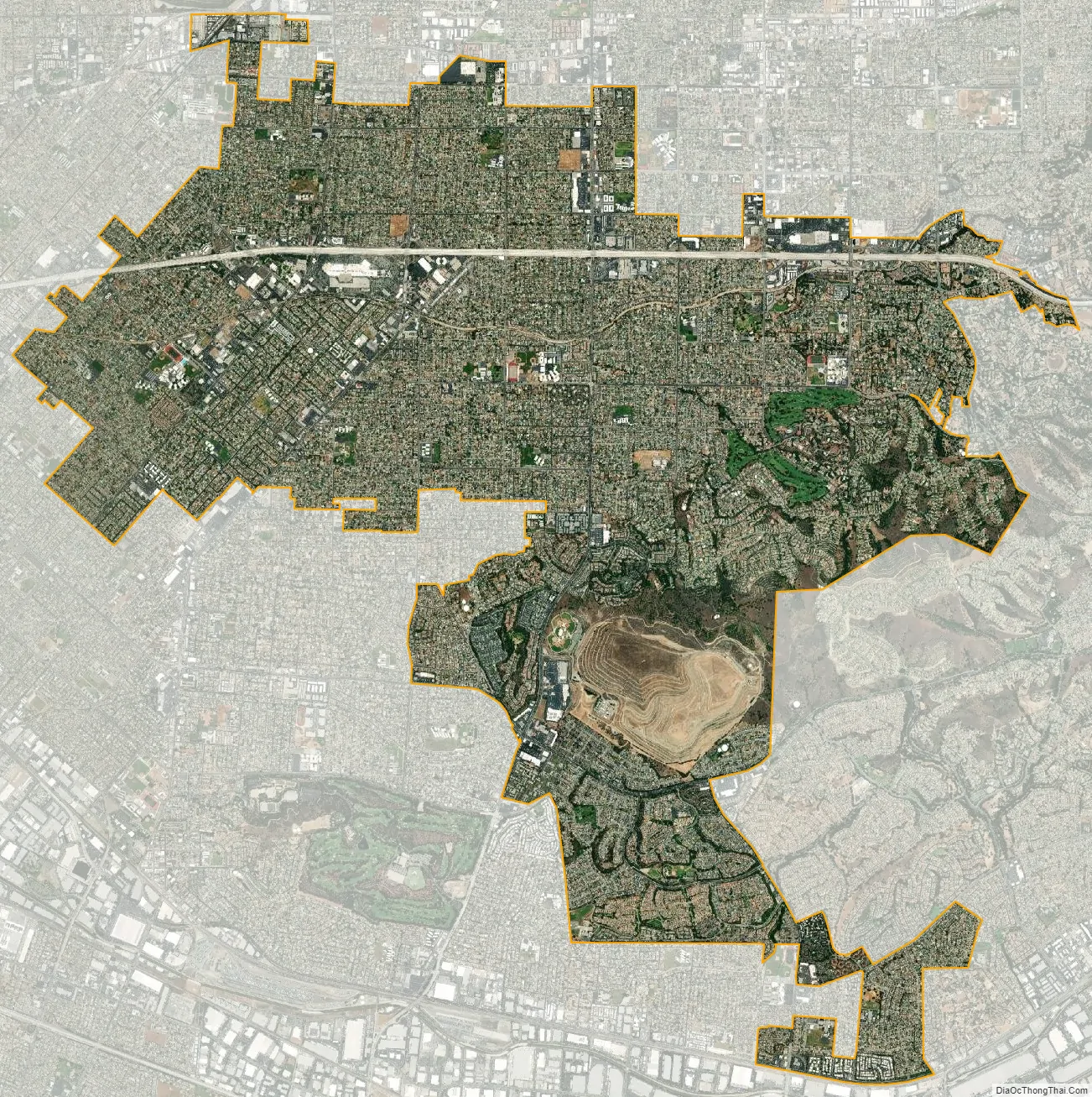
West Covina city Satellite Map
Geography
Climate
The San Gabriel Valley region has a hot-summer Mediterranean climate, with summer temperatures averaging above 23 °C (73 °F).
See also
Map of California State and its subdivision:- Alameda
- Alpine
- Amador
- Butte
- Calaveras
- Colusa
- Contra Costa
- Del Norte
- El Dorado
- Fresno
- Glenn
- Humboldt
- Imperial
- Inyo
- Kern
- Kings
- Lake
- Lassen
- Los Angeles
- Madera
- Marin
- Mariposa
- Mendocino
- Merced
- Modoc
- Mono
- Monterey
- Napa
- Nevada
- Orange
- Placer
- Plumas
- Riverside
- Sacramento
- San Benito
- San Bernardino
- San Diego
- San Francisco
- San Joaquin
- San Luis Obispo
- San Mateo
- Santa Barbara
- Santa Clara
- Santa Cruz
- Shasta
- Sierra
- Siskiyou
- Solano
- Sonoma
- Stanislaus
- Sutter
- Tehama
- Trinity
- Tulare
- Tuolumne
- Ventura
- Yolo
- Yuba
- Alabama
- Alaska
- Arizona
- Arkansas
- California
- Colorado
- Connecticut
- Delaware
- District of Columbia
- Florida
- Georgia
- Hawaii
- Idaho
- Illinois
- Indiana
- Iowa
- Kansas
- Kentucky
- Louisiana
- Maine
- Maryland
- Massachusetts
- Michigan
- Minnesota
- Mississippi
- Missouri
- Montana
- Nebraska
- Nevada
- New Hampshire
- New Jersey
- New Mexico
- New York
- North Carolina
- North Dakota
- Ohio
- Oklahoma
- Oregon
- Pennsylvania
- Rhode Island
- South Carolina
- South Dakota
- Tennessee
- Texas
- Utah
- Vermont
- Virginia
- Washington
- West Virginia
- Wisconsin
- Wyoming


