Irwindale is a city in the San Gabriel Valley, in Los Angeles County, California. The population was 1,422 at the 2010 census, down from 1,446 at the 2000 census. The ZIP Codes serving the area are 91010, which is shared with Duarte, 91702, which is shared with Azusa, and 91706, which is shared with Baldwin Park.
With relatively few residents, Irwindale consists mostly of rock quarries, which are the major revenue source for the city. The Irwindale Event Center is also located in the city, as is the Santa Fe Dam Recreation Area near the San Gabriel River, a plant of the Miller Brewing Company, and a plant of the Huy Fong Foods sriracha sauce company.
The city became the new permanent site for the annual Renaissance Pleasure Faire of Southern California in 2005, after it moved from its previous home at the Glen Helen Regional Park in Devore. Irwindale, is a full-service city, it has local police and library services. There is a skate park, a teen center, a senior center, public gymnasium and a public pool. The majority of the housing is found on the southeastern portion of the city, near Arrow Highway and north of Cypress Street near Irwindale Avenue. There is also a tract of housing on the southeastern corner of Meridian St in the northwestern portion of the city, being distant from the rest of the housing.
| Name: | Irwindale city |
|---|---|
| LSAD Code: | 25 |
| LSAD Description: | city (suffix) |
| State: | California |
| County: | Los Angeles County |
| Founded: | 1860 |
| Incorporated: | August 6, 1957 |
| Elevation: | 469 ft (143 m) |
| Total Area: | 9.61 sq mi (24.88 km²) |
| Land Area: | 8.82 sq mi (22.84 km²) |
| Water Area: | 0.79 sq mi (2.04 km²) 8.19% |
| Total Population: | 1,422 |
| Population Density: | 163.95/sq mi (63.30/km²) |
| ZIP code: | 91010, 91702, 91706 |
| Area code: | 626 |
| FIPS code: | 0636826 |
| Website: | www.irwindaleca.gov |
Online Interactive Map
Click on ![]() to view map in "full screen" mode.
to view map in "full screen" mode.
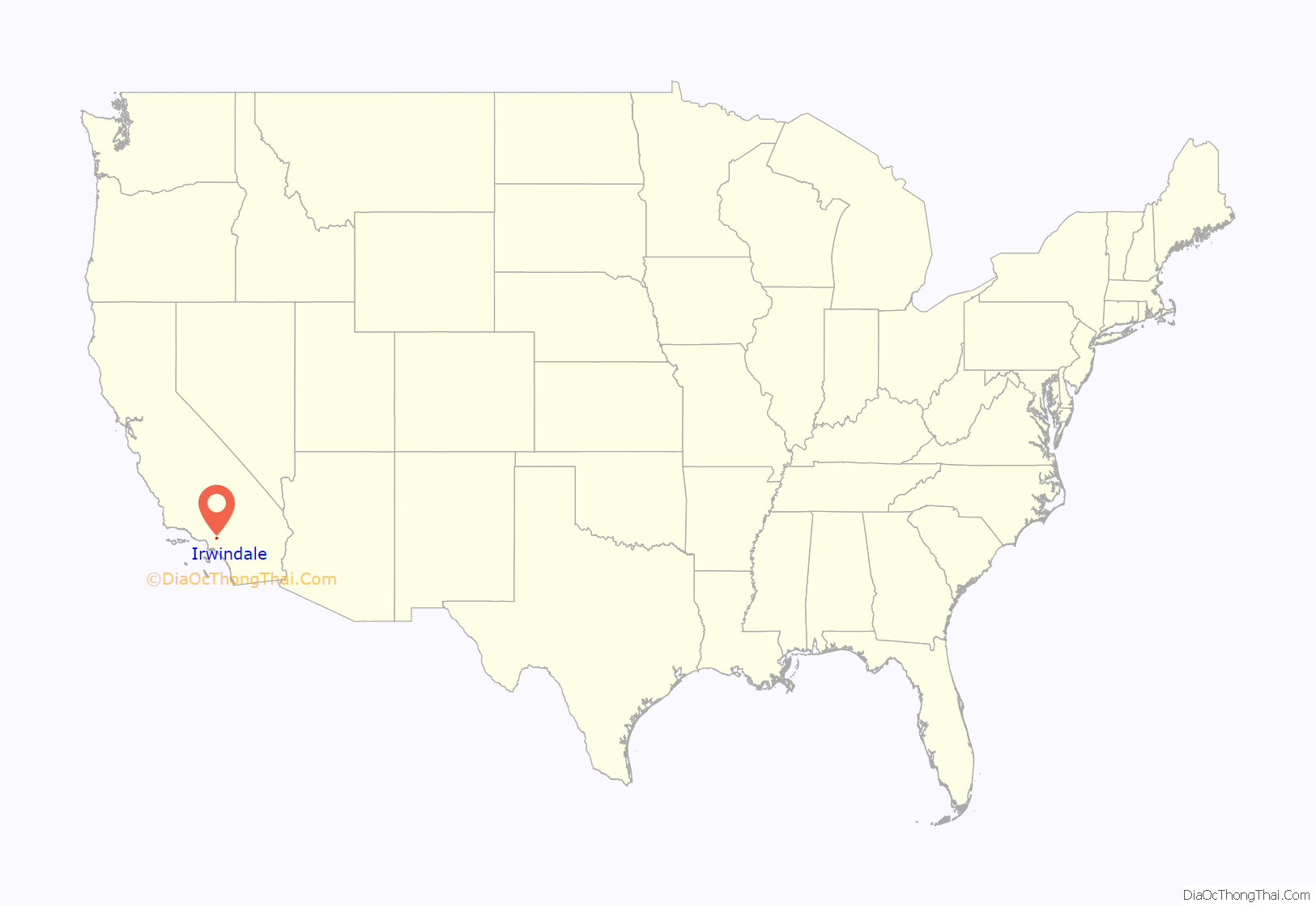
Irwindale location map. Where is Irwindale city?

History
Irwindale was part of the Mexican land grants by Alta California Governor Juan Alvarado of Rancho La Puente, Rancho Azusa de Dalton, Rancho Azusa de Duarte, and Rancho San Francisquito. The families of Gregorio Fraijo and Fecundo Ayon settled here in the 1850s. Significant economic growth did not arrive until the advent of the automobile, which drove up demand for the area’s rocks and sand for the paving of roads. The city was incorporated on August 6, 1957.
Irwindale took advantage of urban redevelopment laws starting in 1976, and prospered in the following decade; it attracted a 200-acre (81 ha) Miller Brewing Company plant, the corporate headquarters of Home Savings of America, and other companies.
Irwindale Road Map
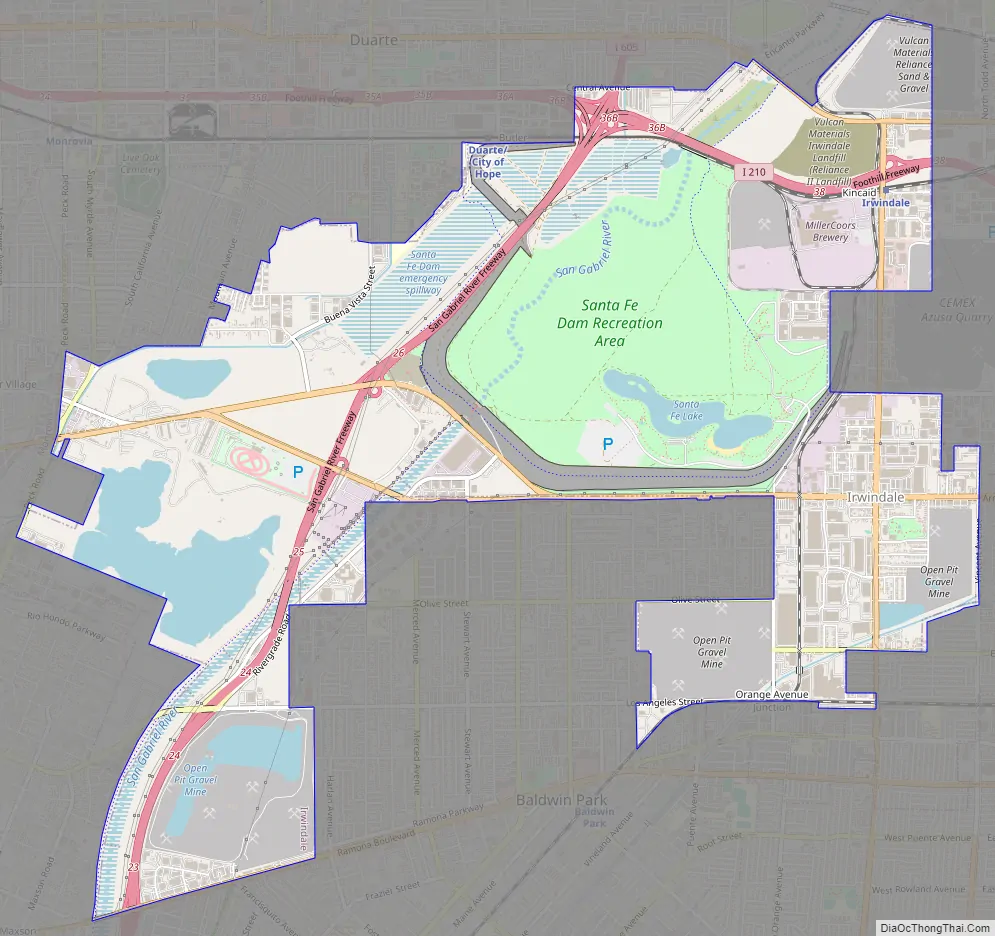
Irwindale city Satellite Map

Geography
Irwindale is located at 34°7′N 117°58′W / 34.117°N 117.967°W / 34.117; -117.967 (34.112, -117.964). According to the United States Census Bureau, the city has a total area of 9.6 square miles (25 km). 8.8 square miles (23 km) of it is land and 0.8 square miles (2.1 km) of it (8.19%) is water.
Climate
This region experiences warm (but not hot) and dry summers, with no average monthly temperatures above 71.6 °F. According to the Köppen Climate Classification system, Irwindale has a warm-summer Mediterranean climate, abbreviated “Csb” on climate maps.
See also
Map of California State and its subdivision:- Alameda
- Alpine
- Amador
- Butte
- Calaveras
- Colusa
- Contra Costa
- Del Norte
- El Dorado
- Fresno
- Glenn
- Humboldt
- Imperial
- Inyo
- Kern
- Kings
- Lake
- Lassen
- Los Angeles
- Madera
- Marin
- Mariposa
- Mendocino
- Merced
- Modoc
- Mono
- Monterey
- Napa
- Nevada
- Orange
- Placer
- Plumas
- Riverside
- Sacramento
- San Benito
- San Bernardino
- San Diego
- San Francisco
- San Joaquin
- San Luis Obispo
- San Mateo
- Santa Barbara
- Santa Clara
- Santa Cruz
- Shasta
- Sierra
- Siskiyou
- Solano
- Sonoma
- Stanislaus
- Sutter
- Tehama
- Trinity
- Tulare
- Tuolumne
- Ventura
- Yolo
- Yuba
- Alabama
- Alaska
- Arizona
- Arkansas
- California
- Colorado
- Connecticut
- Delaware
- District of Columbia
- Florida
- Georgia
- Hawaii
- Idaho
- Illinois
- Indiana
- Iowa
- Kansas
- Kentucky
- Louisiana
- Maine
- Maryland
- Massachusetts
- Michigan
- Minnesota
- Mississippi
- Missouri
- Montana
- Nebraska
- Nevada
- New Hampshire
- New Jersey
- New Mexico
- New York
- North Carolina
- North Dakota
- Ohio
- Oklahoma
- Oregon
- Pennsylvania
- Rhode Island
- South Carolina
- South Dakota
- Tennessee
- Texas
- Utah
- Vermont
- Virginia
- Washington
- West Virginia
- Wisconsin
- Wyoming


