Silver Lake is a city in Shawnee County, Kansas, United States. As of the 2020 census, the population of the city was 1,345.
| Name: | Silver Lake city |
|---|---|
| LSAD Code: | 25 |
| LSAD Description: | city (suffix) |
| State: | Kansas |
| County: | Shawnee County |
| Founded: | 1868 |
| Incorporated: | 1871 |
| Elevation: | 912 ft (278 m) |
| Total Area: | 0.59 sq mi (1.52 km²) |
| Land Area: | 0.56 sq mi (1.45 km²) |
| Water Area: | 0.03 sq mi (0.07 km²) |
| Total Population: | 1,345 |
| Population Density: | 2,300/sq mi (880/km²) |
| ZIP code: | 66539 |
| Area code: | 785 |
| FIPS code: | 2065600 |
| Website: | www.silverlakeks.gov |
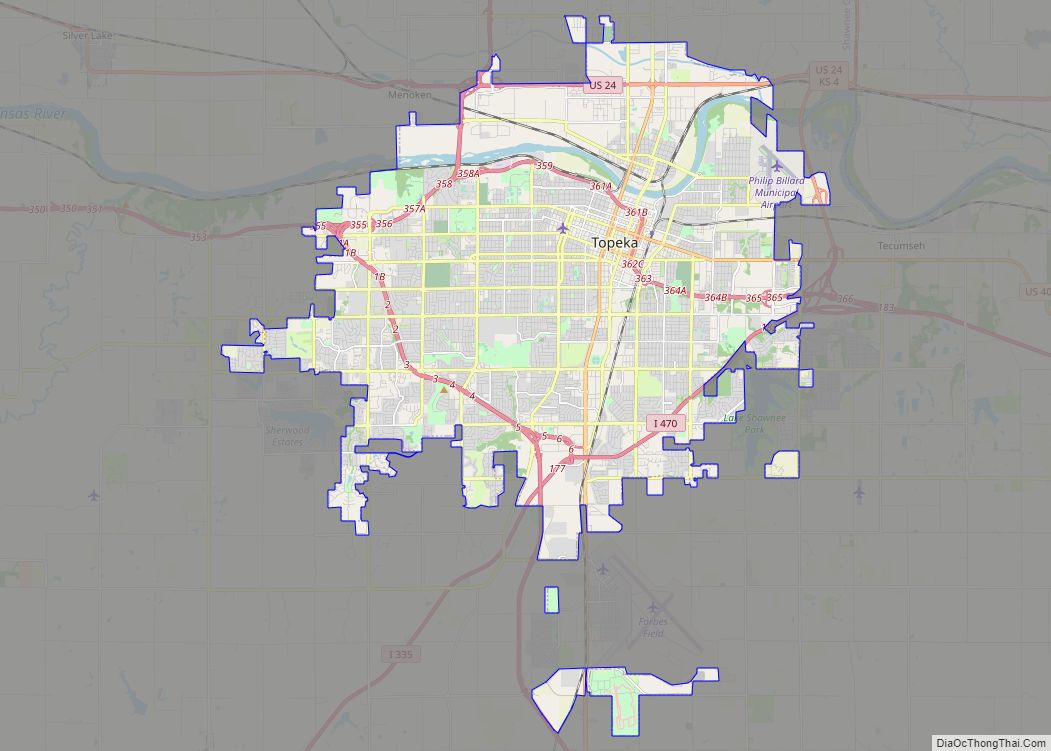
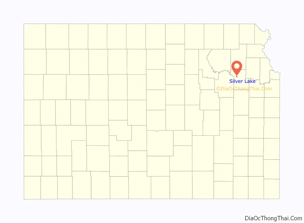
Online Interactive Map
Click on ![]() to view map in "full screen" mode.
to view map in "full screen" mode.
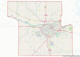
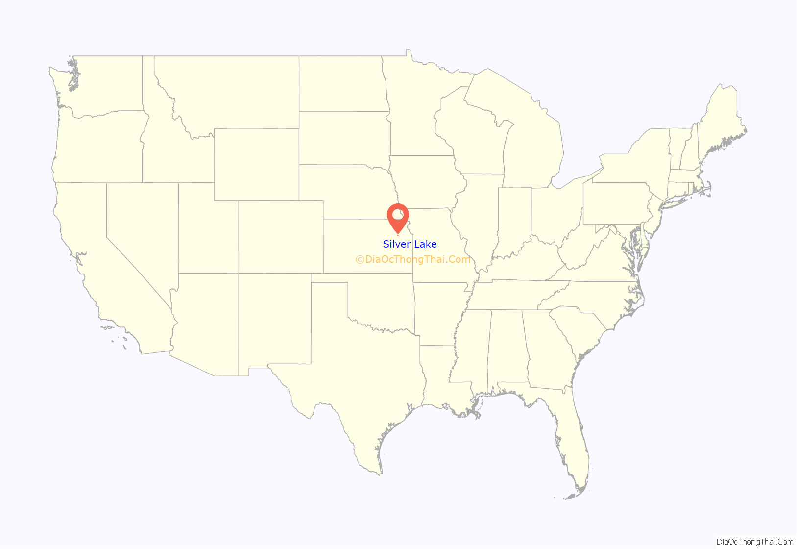
Silver Lake location map. Where is Silver Lake city?
History
19th century
Silver Lake was founded in 1868. It was named from the lake upon which it was situated. In the spring of 1871, the city of Silver Lake was incorporated.
20th century
In 1911, a new six room brick school building replaced the original two room structure and the first high school class was organized. In 1928, that building became the elementary school. In 1952, the high school burned and a new high school was completed in 1953. In 1961, a new elementary school was completed.
In 1928, a two-lane hard-surfaced road was completed through the city. It was later known as US Highway 40 and later became US Highway 24.
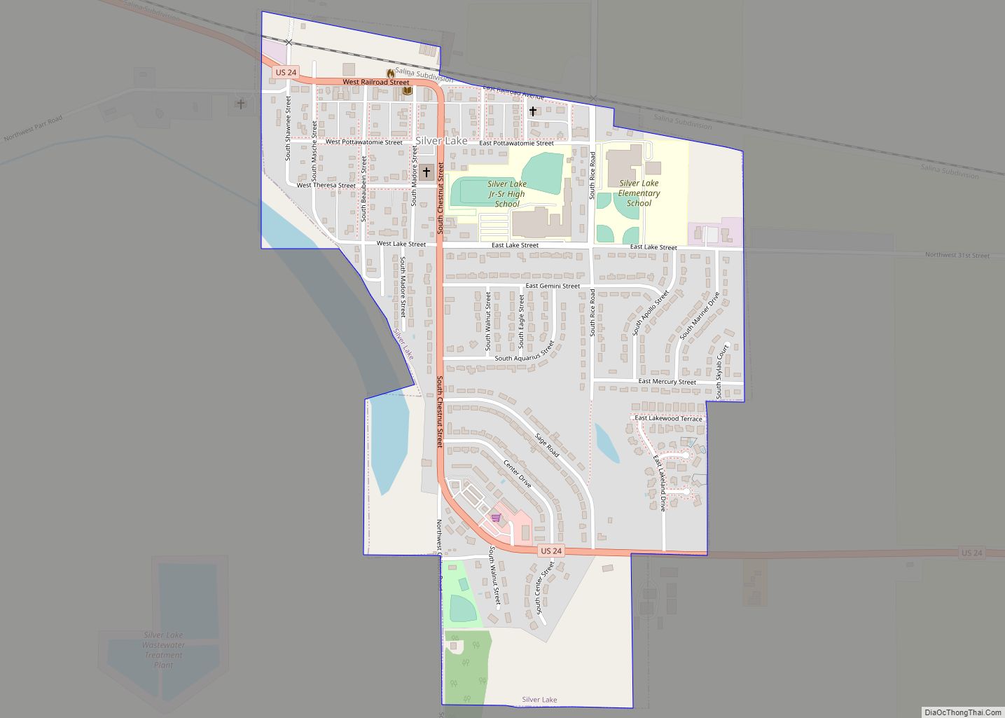
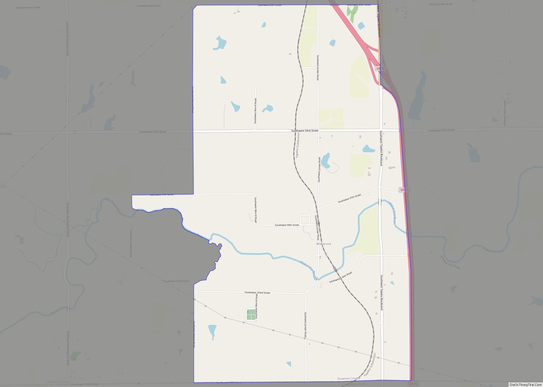
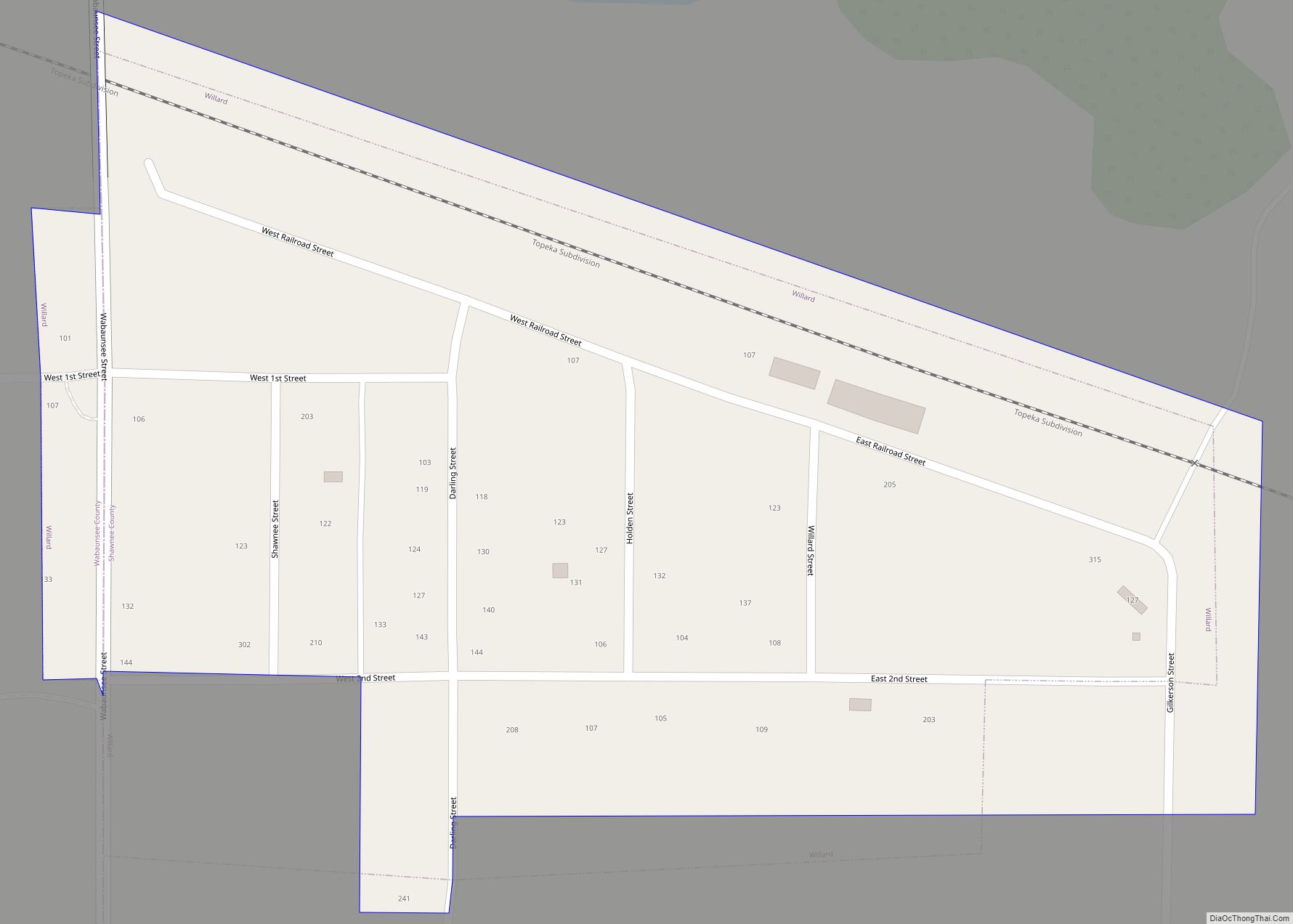
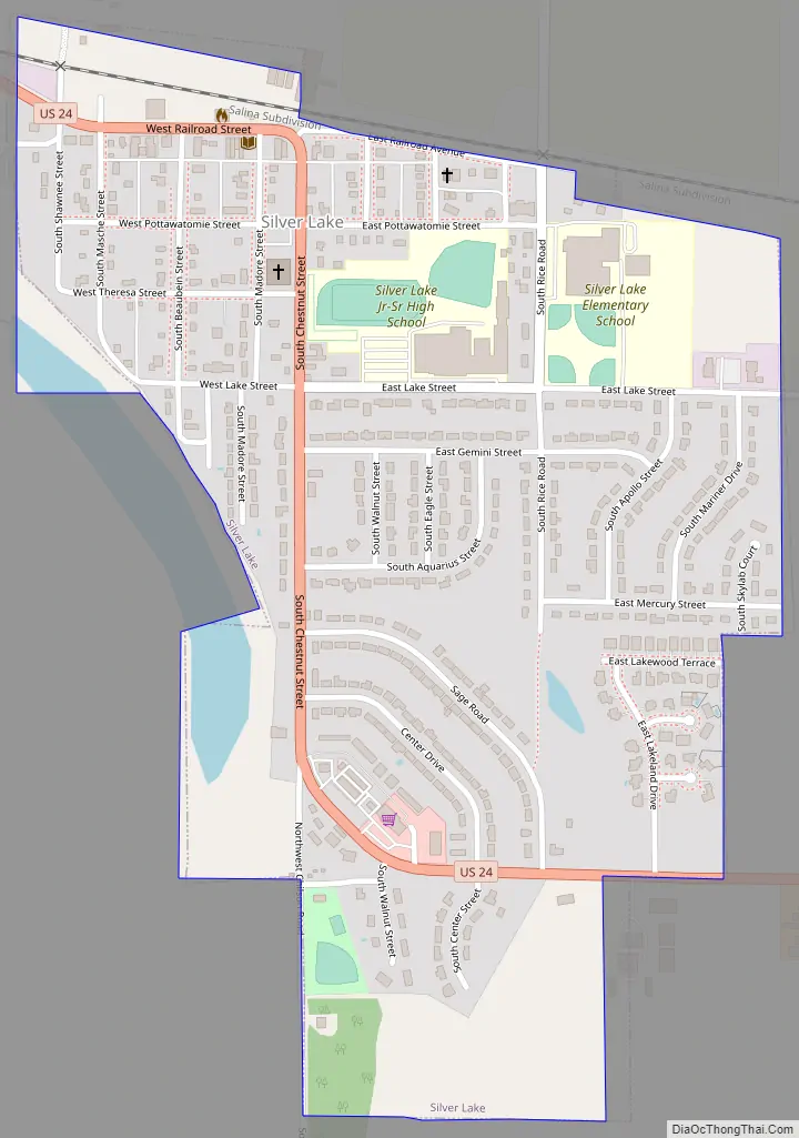
Silver Lake Road Map
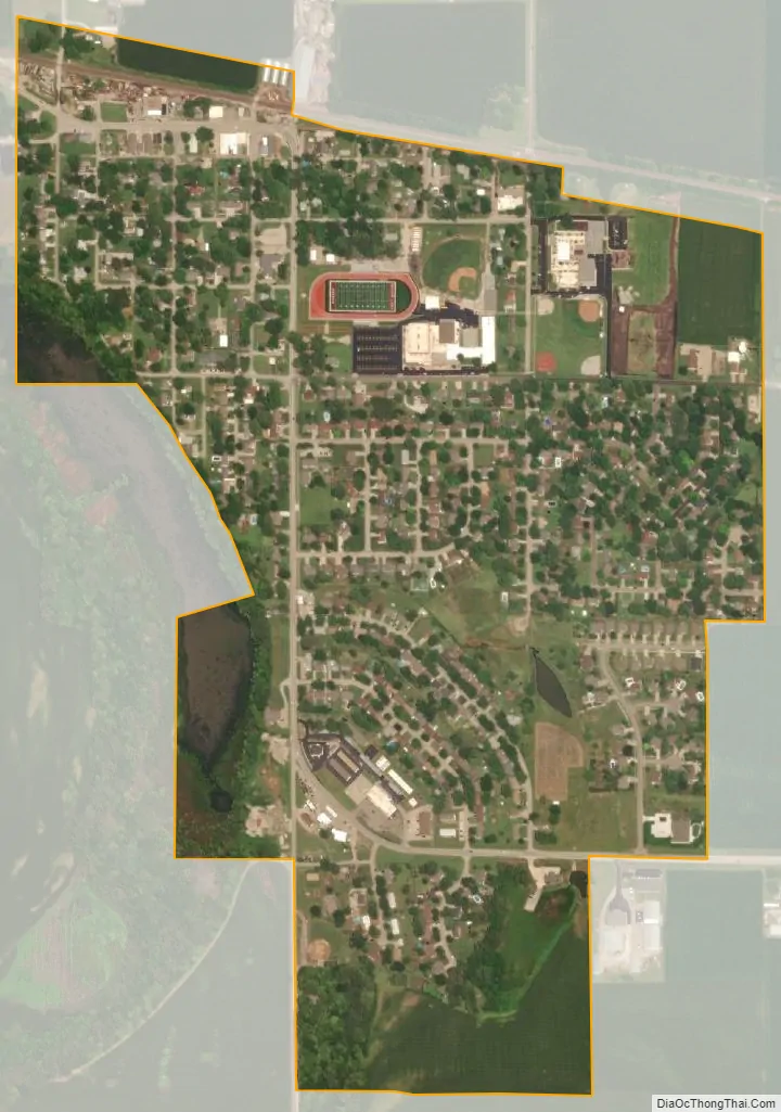
Silver Lake city Satellite Map
Geography
Silver Lake is located at 39°6′9″N 95°51′33″W / 39.10250°N 95.85917°W / 39.10250; -95.85917 (39.102431, -95.859047). According to the United States Census Bureau, the city has a total area of 0.60 square miles (1.55 km), of which, 0.58 square miles (1.50 km) is land and 0.02 square miles (0.05 km) is water.
Silver Lake is the nearest city to Topeka to the west, along U.S. Route 24. Recently Silver Lake has had a higher proportion of its citizens commuting into Topeka. The next city west along US 24 is Rossville.
Silver Lake was originally settled along the northern shore of the Kansas River, however in the time since the town’s founding, the river has changed course and is located a quarter of a mile south of the town.
See also
Map of Kansas State and its subdivision:- Allen
- Anderson
- Atchison
- Barber
- Barton
- Bourbon
- Brown
- Butler
- Chase
- Chautauqua
- Cherokee
- Cheyenne
- Clark
- Clay
- Cloud
- Coffey
- Comanche
- Cowley
- Crawford
- Decatur
- Dickinson
- Doniphan
- Douglas
- Edwards
- Elk
- Ellis
- Ellsworth
- Finney
- Ford
- Franklin
- Geary
- Gove
- Graham
- Grant
- Gray
- Greeley
- Greenwood
- Hamilton
- Harper
- Harvey
- Haskell
- Hodgeman
- Jackson
- Jefferson
- Jewell
- Johnson
- Kearny
- Kingman
- Kiowa
- Labette
- Lane
- Leavenworth
- Lincoln
- Linn
- Logan
- Lyon
- Marion
- Marshall
- McPherson
- Meade
- Miami
- Mitchell
- Montgomery
- Morris
- Morton
- Nemaha
- Neosho
- Ness
- Norton
- Osage
- Osborne
- Ottawa
- Pawnee
- Phillips
- Pottawatomie
- Pratt
- Rawlins
- Reno
- Republic
- Rice
- Riley
- Rooks
- Rush
- Russell
- Saline
- Scott
- Sedgwick
- Seward
- Shawnee
- Sheridan
- Sherman
- Smith
- Stafford
- Stanton
- Stevens
- Sumner
- Thomas
- Trego
- Wabaunsee
- Wallace
- Washington
- Wichita
- Wilson
- Woodson
- Wyandotte
- Alabama
- Alaska
- Arizona
- Arkansas
- California
- Colorado
- Connecticut
- Delaware
- District of Columbia
- Florida
- Georgia
- Hawaii
- Idaho
- Illinois
- Indiana
- Iowa
- Kansas
- Kentucky
- Louisiana
- Maine
- Maryland
- Massachusetts
- Michigan
- Minnesota
- Mississippi
- Missouri
- Montana
- Nebraska
- Nevada
- New Hampshire
- New Jersey
- New Mexico
- New York
- North Carolina
- North Dakota
- Ohio
- Oklahoma
- Oregon
- Pennsylvania
- Rhode Island
- South Carolina
- South Dakota
- Tennessee
- Texas
- Utah
- Vermont
- Virginia
- Washington
- West Virginia
- Wisconsin
- Wyoming