French Settlement (historically French: La Côte-Française) is a village in Livingston Parish, Louisiana, United States. The population was 1,116 at the 2010 census. It is part of the Baton Rouge Metropolitan Statistical Area.
| Name: | French Settlement village |
|---|---|
| LSAD Code: | 47 |
| LSAD Description: | village (suffix) |
| State: | Louisiana |
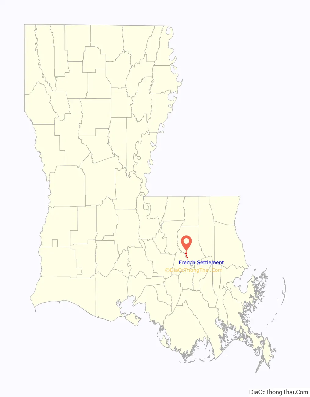
| County: | Livingston Parish |
| Incorporated: | June 13, 1965 |
| Elevation: | 13 ft (4 m) |
| Total Area: | 2.76 sq mi (7.15 km²) |
| Land Area: | 2.73 sq mi (7.06 km²) |
| Water Area: | 0.04 sq mi (0.09 km²) |
| Total Population: | 1,073 |
| Population Density: | 393.47/sq mi (151.93/km²) |
| ZIP code: | 70733 |
| Area code: | 225 |
| FIPS code: | 2227435 |
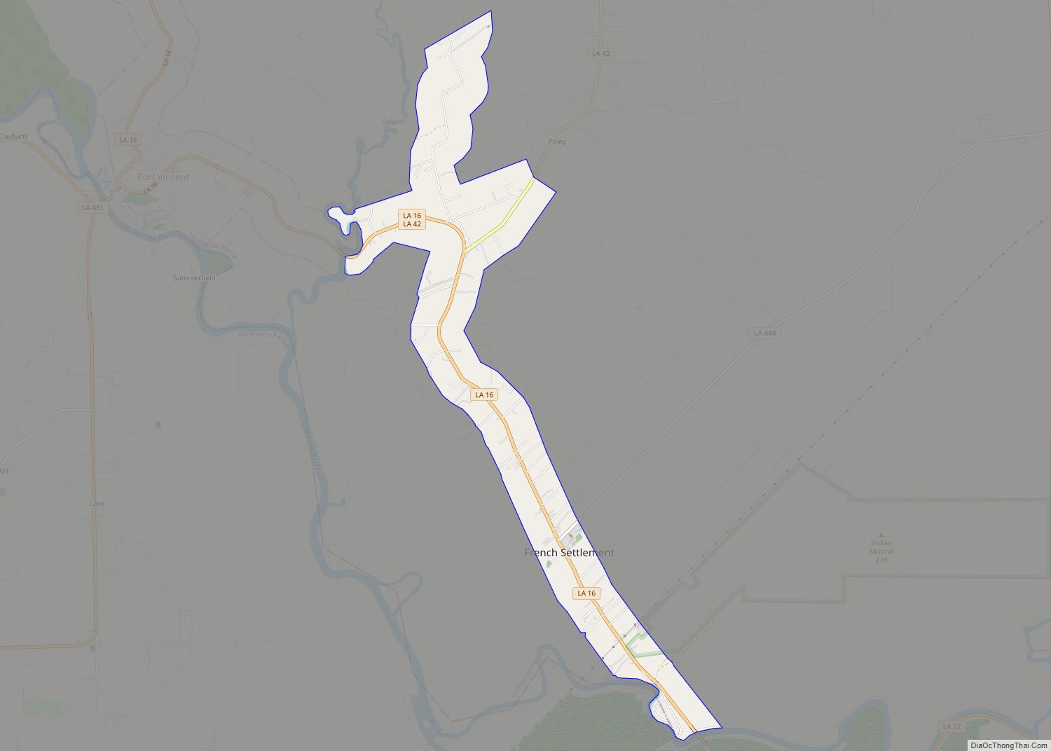
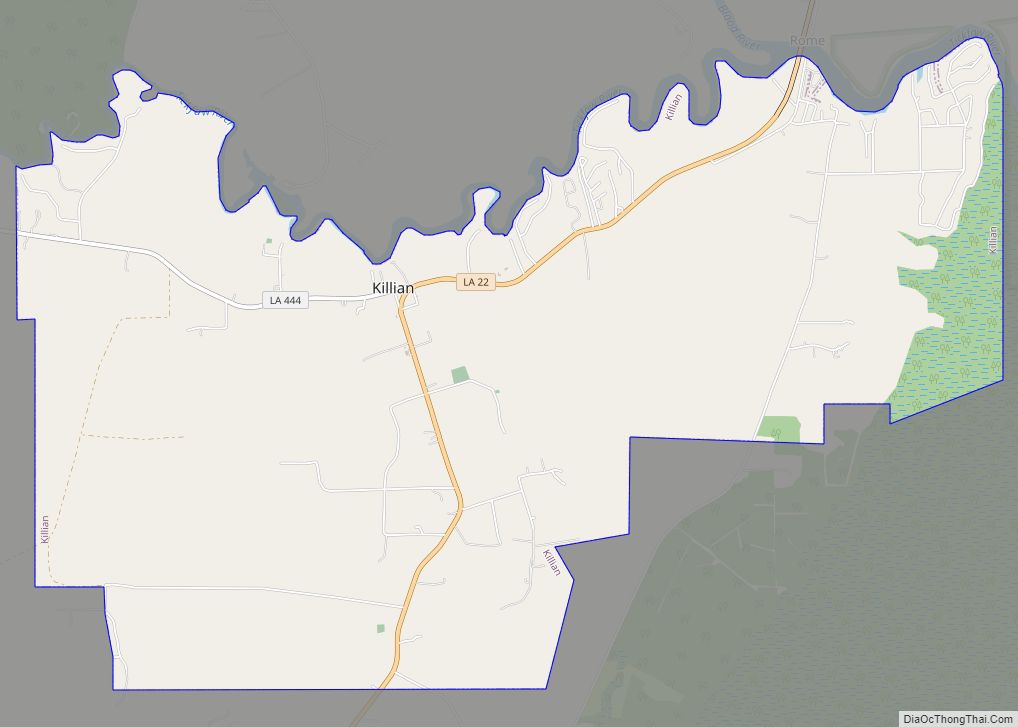
Online Interactive Map
Click on ![]() to view map in "full screen" mode.
to view map in "full screen" mode.
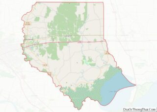
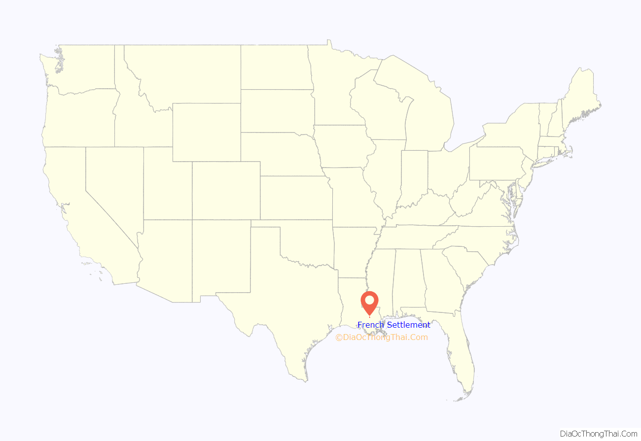
French Settlement location map. Where is French Settlement village?
History
French Settlement was settled in 1800 via the Amite River by French, German, and Italian immigrants. The area was a thriving center of commerce, including cypress sawmills, animal trappers, shingle-making, farms, and a steamboat port.
French Settlement has four properties on the National Register of Historic Places listings in Livingston Parish, Louisiana.
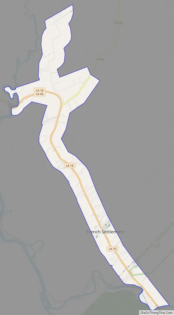
French Settlement Road Map
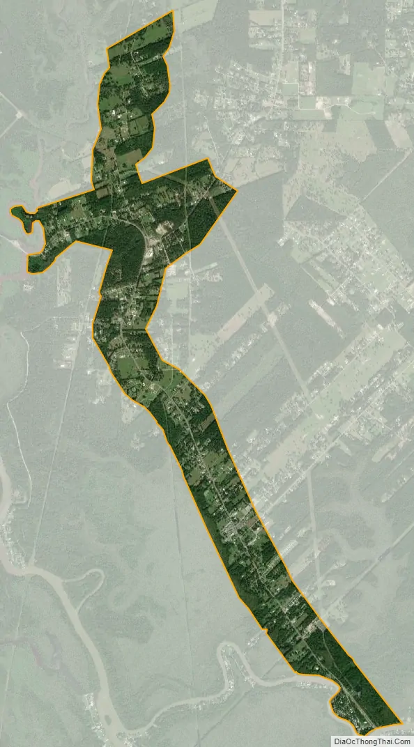
French Settlement city Satellite Map
Geography
French Settlement is located at 30°18′16″N 90°47′56″W / 30.30444°N 90.79889°W / 30.30444; -90.79889 (30.304395, -90.798881).
According to the United States Census Bureau, the village has a total area of 2.7 square miles (7.0 km), of which 2.7 square miles (7.0 km) is land and 0.37% is water.
See also
Map of Louisiana State and its subdivision:- Acadia
- Allen
- Ascension
- Assumption
- Avoyelles
- Beauregard
- Bienville
- Bossier
- Caddo
- Calcasieu
- Caldwell
- Cameron
- Catahoula
- Claiborne
- Concordia
- De Soto
- East Baton Rouge
- East Carroll
- East Feliciana
- Evangeline
- Franklin
- Grant
- Iberia
- Iberville
- Jackson
- Jefferson
- Jefferson Davis
- La Salle
- Lafayette
- Lafourche
- Lincoln
- Livingston
- Madison
- Morehouse
- Natchitoches
- Orleans
- Ouachita
- Plaquemines
- Pointe Coupee
- Rapides
- Red River
- Richland
- Sabine
- Saint Bernard
- Saint Charles
- Saint Helena
- Saint James
- Saint John the Baptist
- Saint Landry
- Saint Martin
- Saint Mary
- Saint Tammany
- Tangipahoa
- Tensas
- Terrebonne
- Union
- Vermilion
- Vernon
- Washington
- Webster
- West Baton Rouge
- West Carroll
- West Feliciana
- Winn
- Alabama
- Alaska
- Arizona
- Arkansas
- California
- Colorado
- Connecticut
- Delaware
- District of Columbia
- Florida
- Georgia
- Hawaii
- Idaho
- Illinois
- Indiana
- Iowa
- Kansas
- Kentucky
- Louisiana
- Maine
- Maryland
- Massachusetts
- Michigan
- Minnesota
- Mississippi
- Missouri
- Montana
- Nebraska
- Nevada
- New Hampshire
- New Jersey
- New Mexico
- New York
- North Carolina
- North Dakota
- Ohio
- Oklahoma
- Oregon
- Pennsylvania
- Rhode Island
- South Carolina
- South Dakota
- Tennessee
- Texas
- Utah
- Vermont
- Virginia
- Washington
- West Virginia
- Wisconsin
- Wyoming