Larose is an unincorporated community and census-designated place (CDP) in Lafourche Parish, Louisiana, United States. The population was 6,763 in 2020. It is part of the Houma–Bayou Cane–Thibodaux metropolitan statistical area.
| Name: | Larose CDP |
|---|---|
| LSAD Code: | 57 |
| LSAD Description: | CDP (suffix) |
| State: | Louisiana |
| County: | Lafourche Parish |
| Elevation: | 8 ft (2 m) |
| Total Area: | 11.17 sq mi (28.92 km²) |
| Land Area: | 10.87 sq mi (28.15 km²) |
| Water Area: | 0.30 sq mi (0.77 km²) |
| Total Population: | 6,763 |
| Population Density: | 622.29/sq mi (240.27/km²) |
| Area code: | 985 |
| FIPS code: | 2242135 |
Online Interactive Map
Click on ![]() to view map in "full screen" mode.
to view map in "full screen" mode.
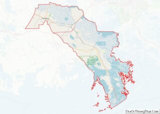
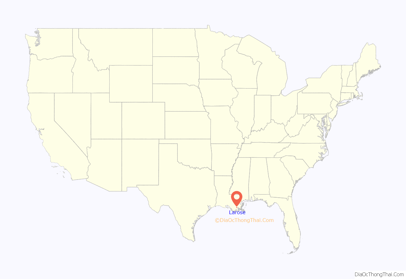
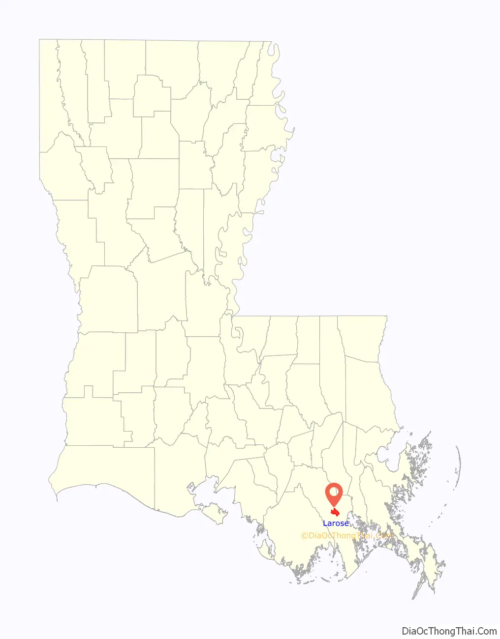
Larose location map. Where is Larose CDP?
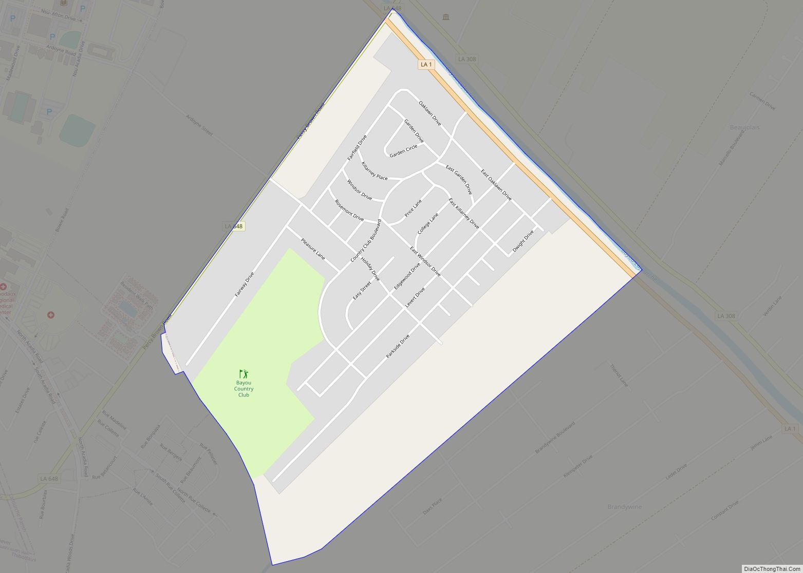
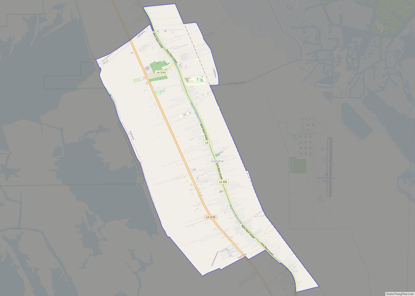
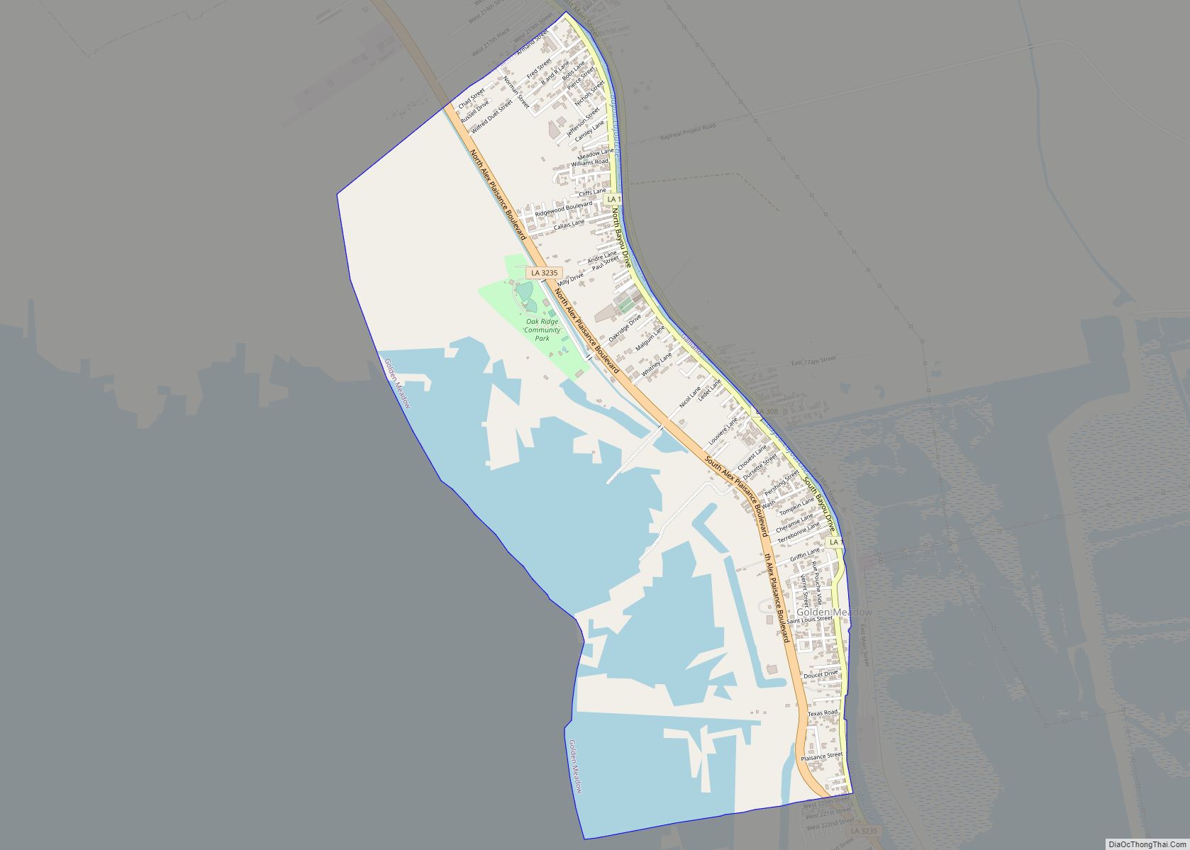
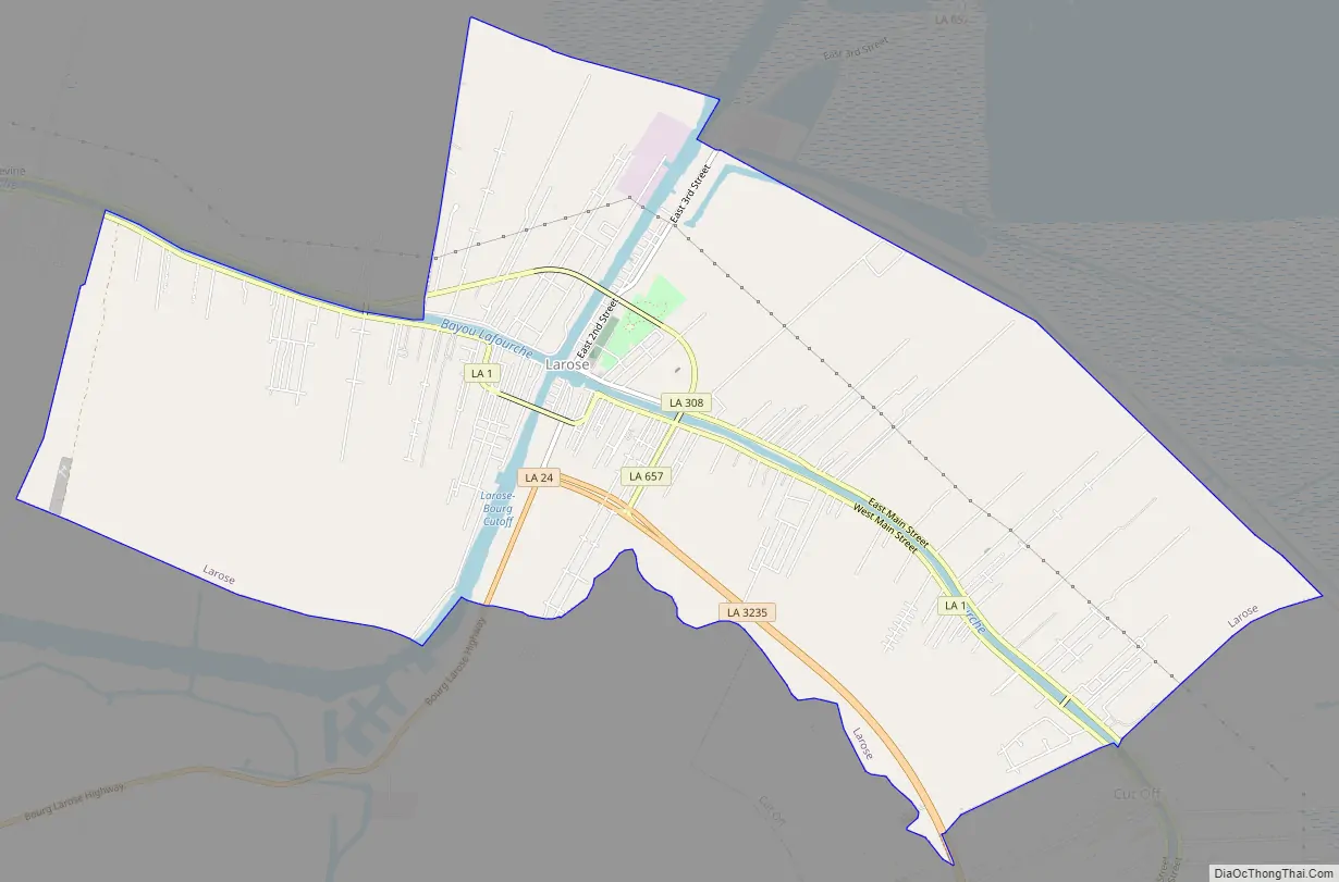
Larose Road Map
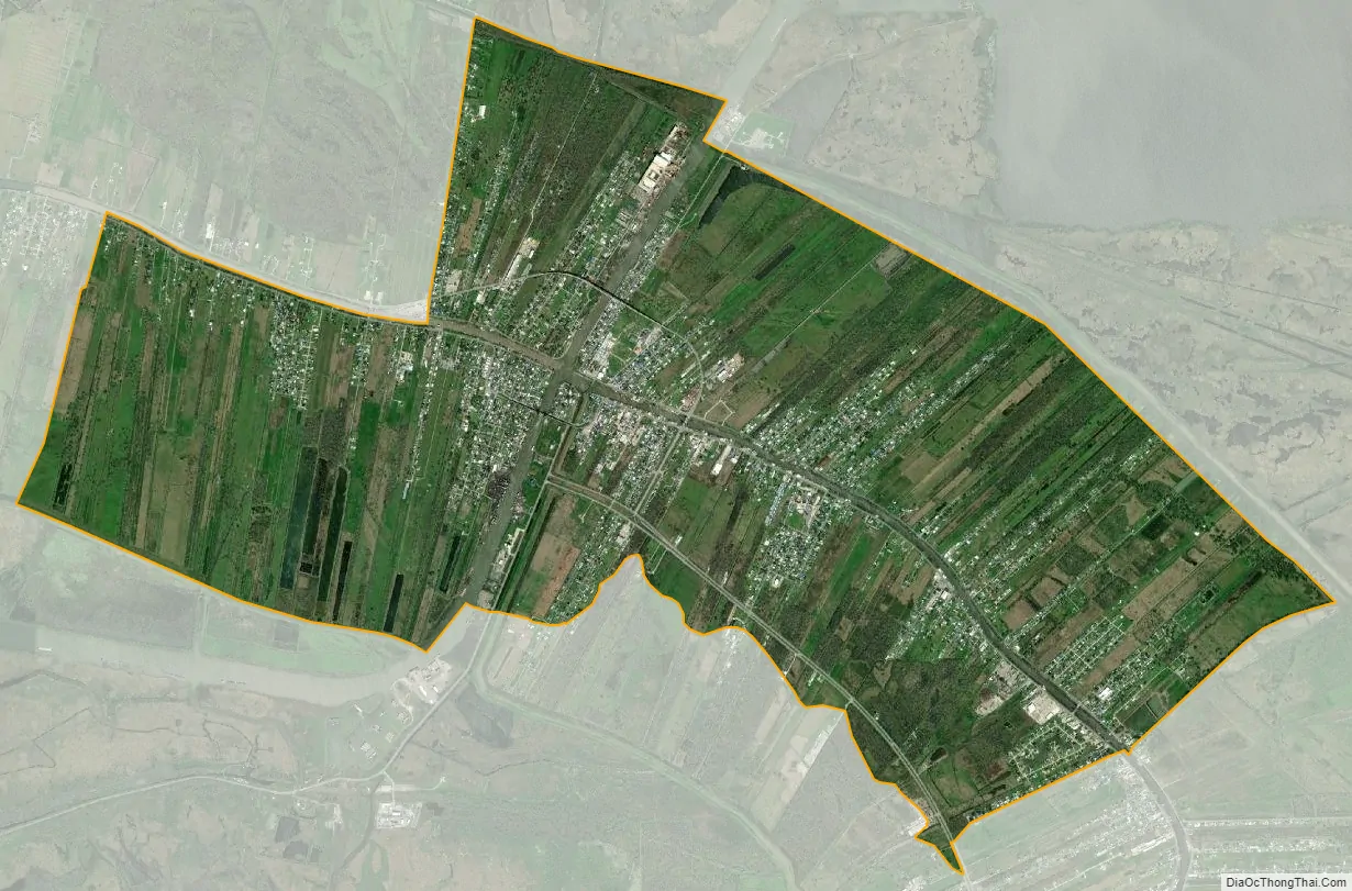
Larose city Satellite Map
Geography
Larose is located in south-central Lafourche Parish at 29°34′2″N 90°22′34″W / 29.56722°N 90.37611°W / 29.56722; -90.37611 (29.567328, -90.376074). It is bordered to the southeast by the community of Cut Off. Bayou Lafourche and the Gulf Intracoastal Waterway intersect in the center of Larose.
Louisiana Highways 1 and 308 run through Larose on opposite sides of Bayou Lafourche, Highway 1 to the south and Highway 308 to the north. Both highways lead northwest along Bayou Lafourche 12 miles (19 km) to Lockport and southeast 16 miles (26 km) to Golden Meadow. Louisiana Highway 3235, a four-lane bypass, leads southeast from Larose to Golden Meadow as well. Louisiana Highway 24 leads west from Larose 24 miles (39 km) to Houma.
According to the United States Census Bureau, the Larose CDP has a total area of 11.2 square miles (28.9 km), of which 10.8 square miles (28.1 km) are land and 0.3 square miles (0.8 km), or 2.67%, are water.
See also
Map of Louisiana State and its subdivision:- Acadia
- Allen
- Ascension
- Assumption
- Avoyelles
- Beauregard
- Bienville
- Bossier
- Caddo
- Calcasieu
- Caldwell
- Cameron
- Catahoula
- Claiborne
- Concordia
- De Soto
- East Baton Rouge
- East Carroll
- East Feliciana
- Evangeline
- Franklin
- Grant
- Iberia
- Iberville
- Jackson
- Jefferson
- Jefferson Davis
- La Salle
- Lafayette
- Lafourche
- Lincoln
- Livingston
- Madison
- Morehouse
- Natchitoches
- Orleans
- Ouachita
- Plaquemines
- Pointe Coupee
- Rapides
- Red River
- Richland
- Sabine
- Saint Bernard
- Saint Charles
- Saint Helena
- Saint James
- Saint John the Baptist
- Saint Landry
- Saint Martin
- Saint Mary
- Saint Tammany
- Tangipahoa
- Tensas
- Terrebonne
- Union
- Vermilion
- Vernon
- Washington
- Webster
- West Baton Rouge
- West Carroll
- West Feliciana
- Winn
- Alabama
- Alaska
- Arizona
- Arkansas
- California
- Colorado
- Connecticut
- Delaware
- District of Columbia
- Florida
- Georgia
- Hawaii
- Idaho
- Illinois
- Indiana
- Iowa
- Kansas
- Kentucky
- Louisiana
- Maine
- Maryland
- Massachusetts
- Michigan
- Minnesota
- Mississippi
- Missouri
- Montana
- Nebraska
- Nevada
- New Hampshire
- New Jersey
- New Mexico
- New York
- North Carolina
- North Dakota
- Ohio
- Oklahoma
- Oregon
- Pennsylvania
- Rhode Island
- South Carolina
- South Dakota
- Tennessee
- Texas
- Utah
- Vermont
- Virginia
- Washington
- West Virginia
- Wisconsin
- Wyoming