Jeanerette (/ˈdʒɪnˌrɛt/) is a city in Iberia Parish, Louisiana, United States. Known as “Sugar City”, it had a population of 5,530 at the 2010 census, a decrease of 467 from the 2000 tabulation of 5,997. It is two thirds African American, many of them Creoles of color. Jeanerette is the part of the Lafayette metropolitan statistical area; its parish is also one of the 22 included in the Acadiana region, which has had a high proportion of Francophones.
| Name: | Jeanerette city |
|---|---|
| LSAD Code: | 25 |
| LSAD Description: | city (suffix) |
| State: | Louisiana |
| County: | Iberia Parish |
| Elevation: | 16 ft (5 m) |
| Total Area: | 2.36 sq mi (6.12 km²) |
| Land Area: | 2.31 sq mi (5.98 km²) |
| Water Area: | 0.05 sq mi (0.14 km²) |
| Total Population: | 4,813 |
| Population Density: | 2,085.36/sq mi (805.09/km²) |
| ZIP code: | 70544 |
| Area code: | 337 |
| FIPS code: | 2238075 |
| Website: | www.jeanerette.com |
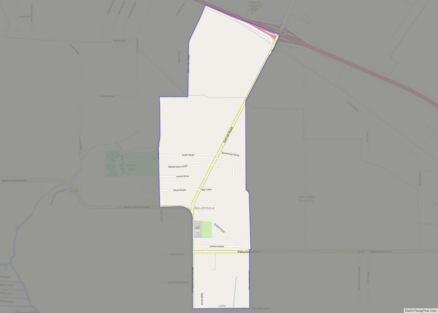
Online Interactive Map
Click on ![]() to view map in "full screen" mode.
to view map in "full screen" mode.
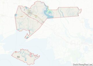
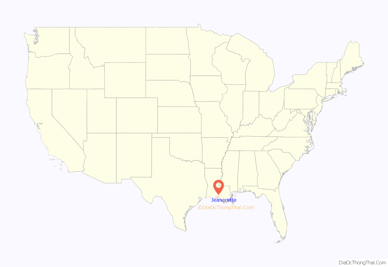
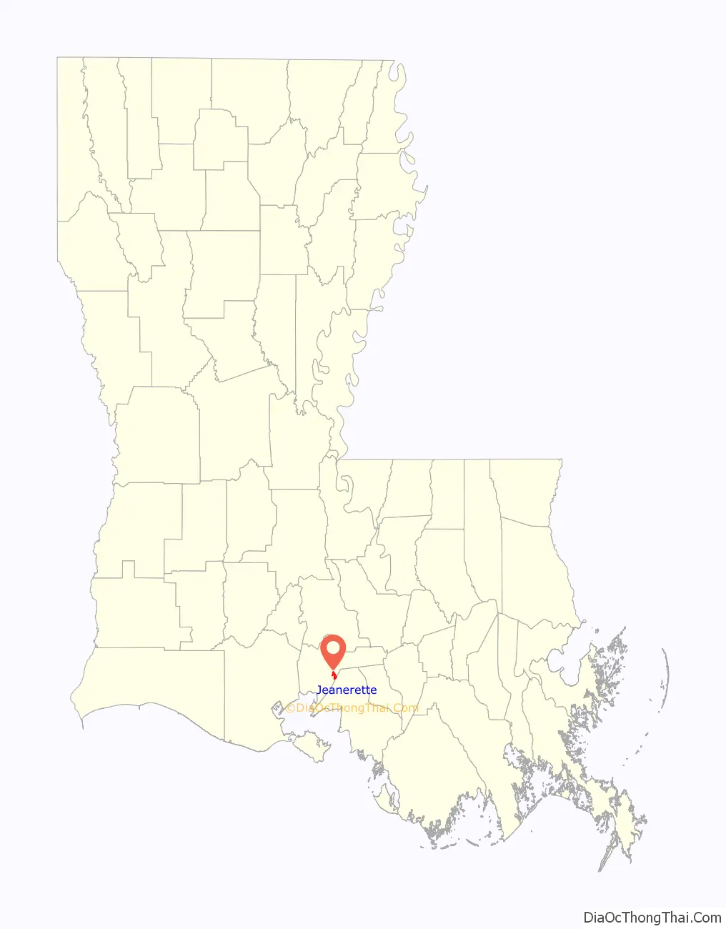
Jeanerette location map. Where is Jeanerette city?
History
Early years
In the 18th century, French colonist Pierre Zerangue acquired the land where Jeanerette developed from the Spanish government. Zerangue received an “order of survey and settlement” from Spain for 1,052 acres (4.26 km). Under Spanish law, if a person occupied a piece of property for two years, they could apply for title to the land under an “order of survey settlement.”
Colonist Nicholas Provost acquired property extending from the present-day experimental farm to the St. Mary Parish line. He engaged in sugar cultivation, based on the labor of enslaved Americans and African Americans, until his death in 1816.
The town derived its name from John W. Jeanerette, a native of South Carolina who had moved to the developing area in the 1820s. First he worked as a tutor for a planter’s family, as did numerous educated young adults from northern states in the antebellum period. He opened a store and saloon. Having saved some money, Jeanerette purchased Pine Grove Plantation circa 1830, which was formerly known as Beau Pré (meaning lovely meadow/pasture).
Jeanerette offered a portion of his house to be used as a mail depository for local residents. Later Jeanerette was appointed as the town’s first postmaster (he dropped his middle initial in official records.) The name Jeanerette was later adopted for the post office and town.
In 1871, Lazard Wormser, an early Jewish settler to the area emigrating from Alsace, France. He opened a small general store in downtown Jeanerette. He was soon joined by other members of the Wormser family, who later established branches of Wormser’s Department Store in downtown New Iberia and Franklin.
During the 19th century, to the north along the Bayou Teche a settlement was developed by free Créoles of color; it is now known as Grand Marais. These free people of color were descended from African and European ancestors. They had largely adopted French culture, Catholicism and language, and were often still French speakers into the 20th century.
Incorporation
Jeanerette was incorporated as a town in 1878 and Joseph E. Provost became the first mayor; its economy was based on the cypress lumber and sugar industries. Its nickname has been “Sugar City”. Although its major growth was after the Civil War, it has some surviving antebellum houses in the city and region.
Sugarcane continues as a key factor in the economy. There were until the 21st century three active sugar mills. The one located in the city was closed, dismantled, and its equipment sold in the first decade of the 21st century. Jeanerette is the home of manufacturers of equipment for the cultivation, harvesting and processing of sugarcane. Today, additional sources of income include oil and natural gas, salt, carbon black, a garment distribution center, and fishing.
Jeanerette was the home of dentist and politician Paul N. Cyr, Huey P. Long’s lieutenant governor and political opponent. Cyr had a dental office there.
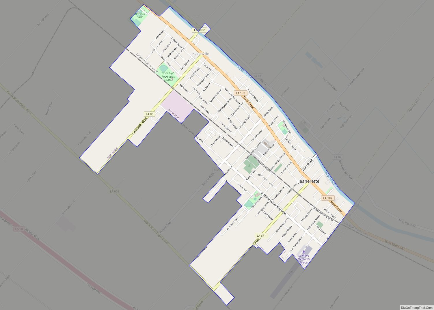
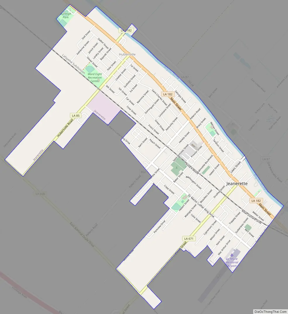
Jeanerette Road Map
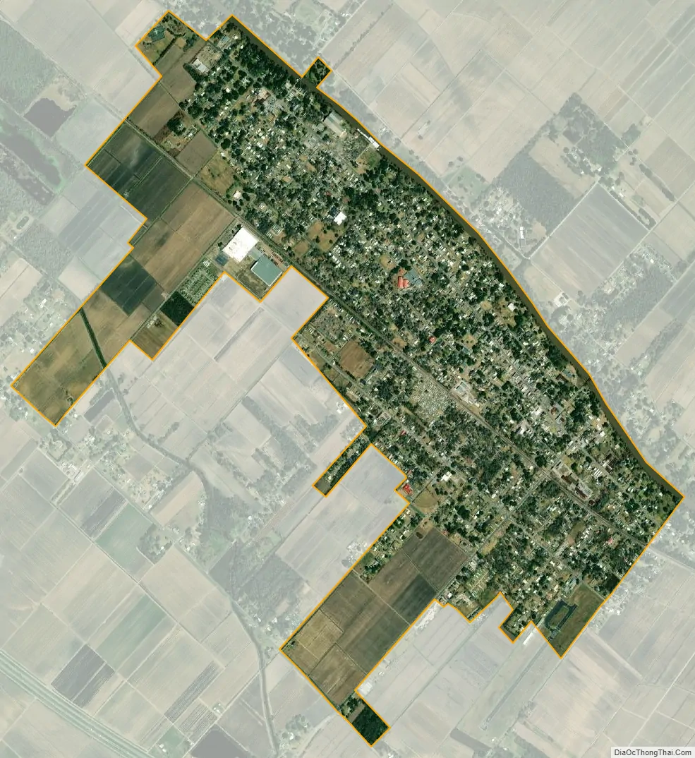
Jeanerette city Satellite Map
Geography
The city of Jeanerette is located at 29°54′59″N 91°40′21″W / 29.91639°N 91.67250°W / 29.91639; -91.67250 (29.916438, −91.672483). The southeastern border of the city is at the Iberia/St. Mary parish line.
Louisiana Highways 182 and 87, which both parallel the Bayou Teche, pass through the city with U.S. Highway 90 running parallel outside the city limits all heading northwest to the cities of New Iberia, the Iberia Parish seat, 12 miles (19 km), Lafayette, the Lafayette Parish seat, 35 miles (56 km), and southeast to the St. Mary Parish cities of Franklin, the parish seat, 14 miles (23 km), and Morgan City, 36 miles (58 km).
According to the United States Census Bureau, the city has a total area of 2.2 square miles (5.7 km), all land.
Climate
The climate in this area is characterized by hot, humid summers and generally mild to cool winters. According to the Köppen Climate Classification system, Jeanerette has a humid subtropical climate, abbreviated “Cfa” on climate maps.
See also
Map of Louisiana State and its subdivision:- Acadia
- Allen
- Ascension
- Assumption
- Avoyelles
- Beauregard
- Bienville
- Bossier
- Caddo
- Calcasieu
- Caldwell
- Cameron
- Catahoula
- Claiborne
- Concordia
- De Soto
- East Baton Rouge
- East Carroll
- East Feliciana
- Evangeline
- Franklin
- Grant
- Iberia
- Iberville
- Jackson
- Jefferson
- Jefferson Davis
- La Salle
- Lafayette
- Lafourche
- Lincoln
- Livingston
- Madison
- Morehouse
- Natchitoches
- Orleans
- Ouachita
- Plaquemines
- Pointe Coupee
- Rapides
- Red River
- Richland
- Sabine
- Saint Bernard
- Saint Charles
- Saint Helena
- Saint James
- Saint John the Baptist
- Saint Landry
- Saint Martin
- Saint Mary
- Saint Tammany
- Tangipahoa
- Tensas
- Terrebonne
- Union
- Vermilion
- Vernon
- Washington
- Webster
- West Baton Rouge
- West Carroll
- West Feliciana
- Winn
- Alabama
- Alaska
- Arizona
- Arkansas
- California
- Colorado
- Connecticut
- Delaware
- District of Columbia
- Florida
- Georgia
- Hawaii
- Idaho
- Illinois
- Indiana
- Iowa
- Kansas
- Kentucky
- Louisiana
- Maine
- Maryland
- Massachusetts
- Michigan
- Minnesota
- Mississippi
- Missouri
- Montana
- Nebraska
- Nevada
- New Hampshire
- New Jersey
- New Mexico
- New York
- North Carolina
- North Dakota
- Ohio
- Oklahoma
- Oregon
- Pennsylvania
- Rhode Island
- South Carolina
- South Dakota
- Tennessee
- Texas
- Utah
- Vermont
- Virginia
- Washington
- West Virginia
- Wisconsin
- Wyoming