Mathews is a census-designated place (CDP) on Bayou Lafourche in Lafourche Parish, Louisiana, United States. The population was 2,273 in 2020. It is part of the Houma–Bayou Cane–Thibodaux metropolitan statistical area.
| Name: | Mathews CDP |
|---|---|
| LSAD Code: | 57 |
| LSAD Description: | CDP (suffix) |
| State: | Louisiana |
| County: | Lafourche Parish |
| Elevation: | 10 ft (3 m) |
| Total Area: | 3.98 sq mi (10.31 km²) |
| Land Area: | 3.98 sq mi (10.31 km²) |
| Water Area: | 0.00 sq mi (0.00 km²) |
| Total Population: | 2,273 |
| Population Density: | 570.96/sq mi (220.43/km²) |
| Area code: | 985 |
| FIPS code: | 2249170 |
Online Interactive Map
Click on ![]() to view map in "full screen" mode.
to view map in "full screen" mode.
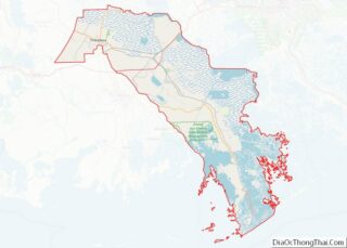
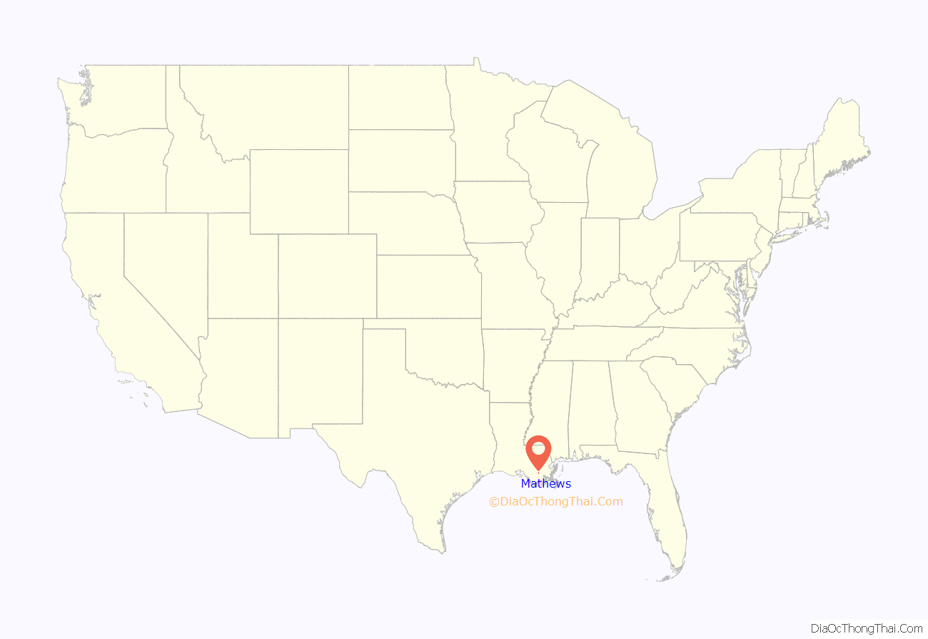
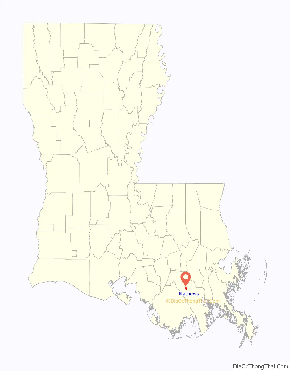
Mathews location map. Where is Mathews CDP?
History
On August 20, 2007, school paraprofessional Amy Hebert fatally stabbed her children, Camille Catherine Hebert, age 9; and Braxton John Hebert, age 7; and the family dog. She was sentenced to life in prison.
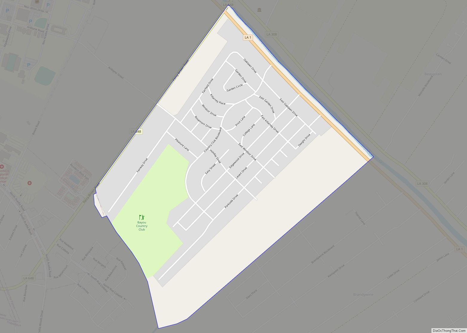
Mathews Road Map
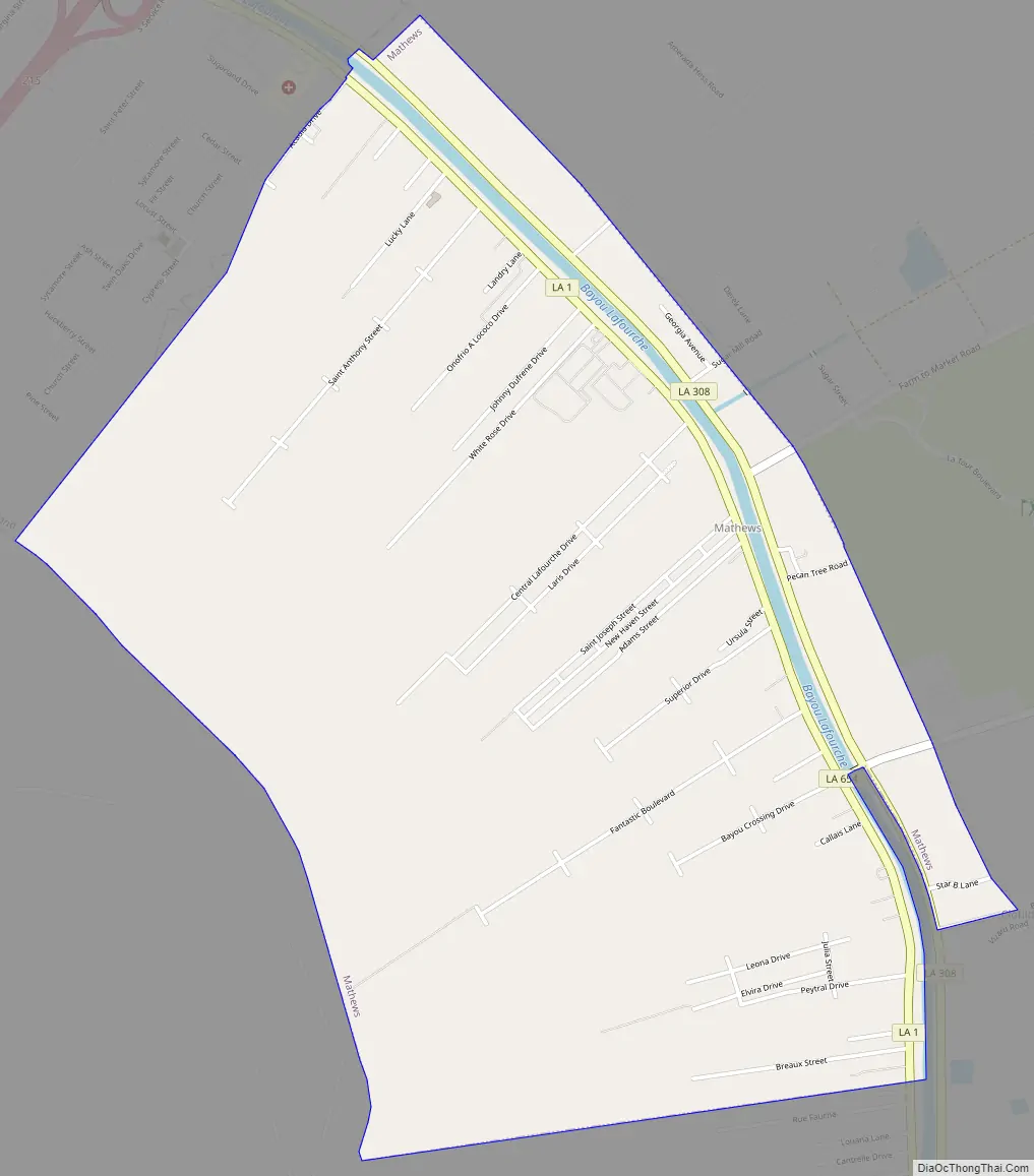
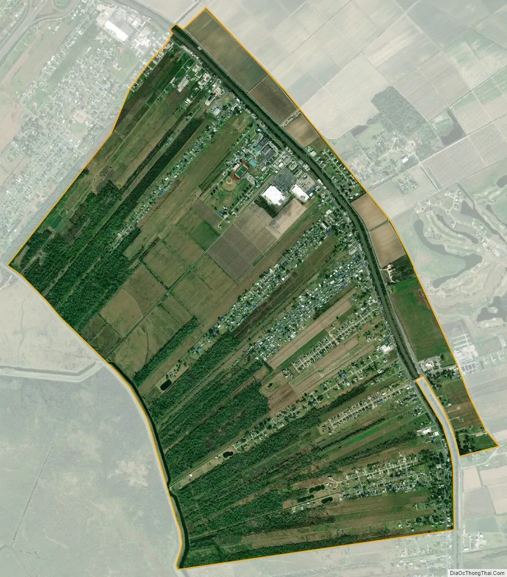
Mathews city Satellite Map
Geography
Mathews is located at 29°41′2″N 90°33′2″W / 29.68389°N 90.55056°W / 29.68389; -90.55056 (29.683825, -90.550470).
According to the United States Census Bureau, the CDP has a total area of 4.0 square miles (10.3 km), all land.
It is in the central part of the parish and is bordered by Lockport and Raceland.
See also
Map of Louisiana State and its subdivision:- Acadia
- Allen
- Ascension
- Assumption
- Avoyelles
- Beauregard
- Bienville
- Bossier
- Caddo
- Calcasieu
- Caldwell
- Cameron
- Catahoula
- Claiborne
- Concordia
- De Soto
- East Baton Rouge
- East Carroll
- East Feliciana
- Evangeline
- Franklin
- Grant
- Iberia
- Iberville
- Jackson
- Jefferson
- Jefferson Davis
- La Salle
- Lafayette
- Lafourche
- Lincoln
- Livingston
- Madison
- Morehouse
- Natchitoches
- Orleans
- Ouachita
- Plaquemines
- Pointe Coupee
- Rapides
- Red River
- Richland
- Sabine
- Saint Bernard
- Saint Charles
- Saint Helena
- Saint James
- Saint John the Baptist
- Saint Landry
- Saint Martin
- Saint Mary
- Saint Tammany
- Tangipahoa
- Tensas
- Terrebonne
- Union
- Vermilion
- Vernon
- Washington
- Webster
- West Baton Rouge
- West Carroll
- West Feliciana
- Winn
- Alabama
- Alaska
- Arizona
- Arkansas
- California
- Colorado
- Connecticut
- Delaware
- District of Columbia
- Florida
- Georgia
- Hawaii
- Idaho
- Illinois
- Indiana
- Iowa
- Kansas
- Kentucky
- Louisiana
- Maine
- Maryland
- Massachusetts
- Michigan
- Minnesota
- Mississippi
- Missouri
- Montana
- Nebraska
- Nevada
- New Hampshire
- New Jersey
- New Mexico
- New York
- North Carolina
- North Dakota
- Ohio
- Oklahoma
- Oregon
- Pennsylvania
- Rhode Island
- South Carolina
- South Dakota
- Tennessee
- Texas
- Utah
- Vermont
- Virginia
- Washington
- West Virginia
- Wisconsin
- Wyoming