Saint Rose (usually written as St. Rose) is a census-designated place (CDP) in St. Charles Parish, Louisiana, United States. St. Rose is on the east bank of the Mississippi River, two miles (3 km) north of the Jefferson Parish border and is part of the Greater New Orleans metropolitan area. The population was 6,540 in the 2000 census, and 7,504 in 2020.
| Name: | St. Rose CDP |
|---|---|
| LSAD Code: | 57 |
| LSAD Description: | CDP (suffix) |
| State: | Louisiana |
| County: | St. Charles Parish |
| Elevation: | 10 ft (3 m) |
| Total Area: | 7.45 sq mi (19.31 km²) |
| Land Area: | 6.34 sq mi (16.42 km²) |
| Water Area: | 1.11 sq mi (2.89 km²) |
| Total Population: | 7,504 |
| Population Density: | 1,183.78/sq mi (457.04/km²) |
| ZIP code: | 70087 |
| Area code: | 504 |
| FIPS code: | 2267740 |
Online Interactive Map
Click on ![]() to view map in "full screen" mode.
to view map in "full screen" mode.
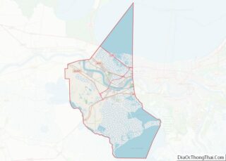
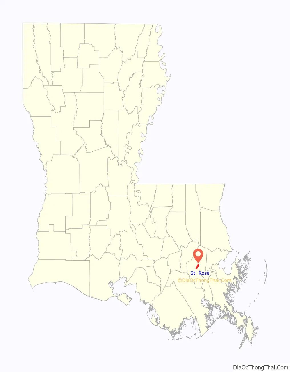
St. Rose location map. Where is St. Rose CDP?

History
The LaBranche Plantation Dependency House is located in St. Rose. It is a surviving building of the LaBranche Plantation. The main house was the plantation home built by the Zweig family in 1792. The plantation was based on the cultivation and processing of sugar cane and was dependent on slave labor. The big house was destroyed during the Civil War. One of the few buildings left on the property after the Civil War was the dependency house, also called a garconnière (French for bachelor quarters). The property also has a preserved slave quarters building.
In 1873, Palmer Elkins purchased property in St. Rose. In 1880, Elkins invited freedman and their families to move onto his property to receive training. He established what became known as “Elkinsville” or “Freetown”.
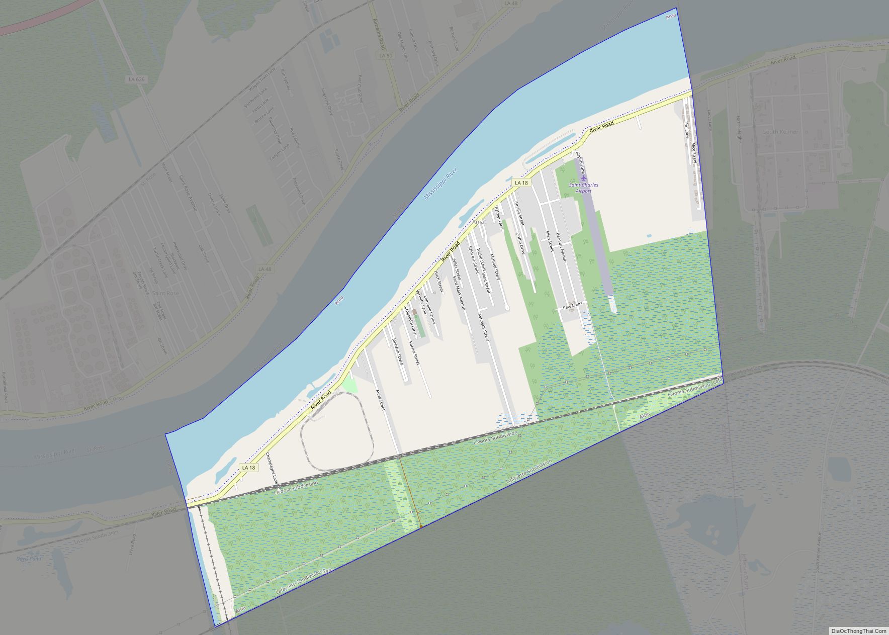
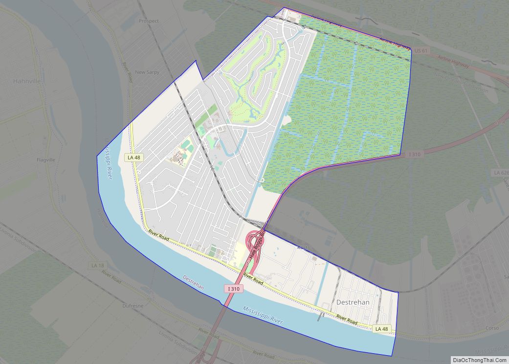
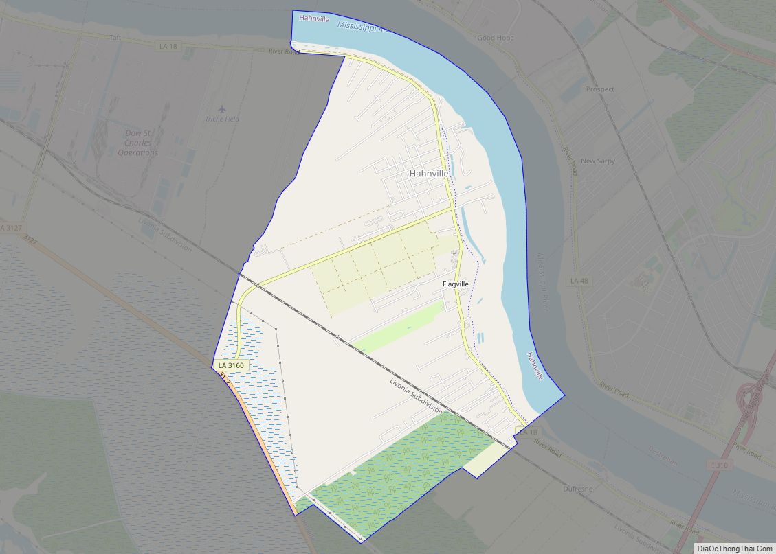
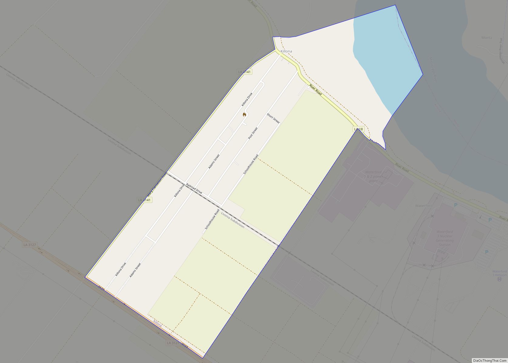
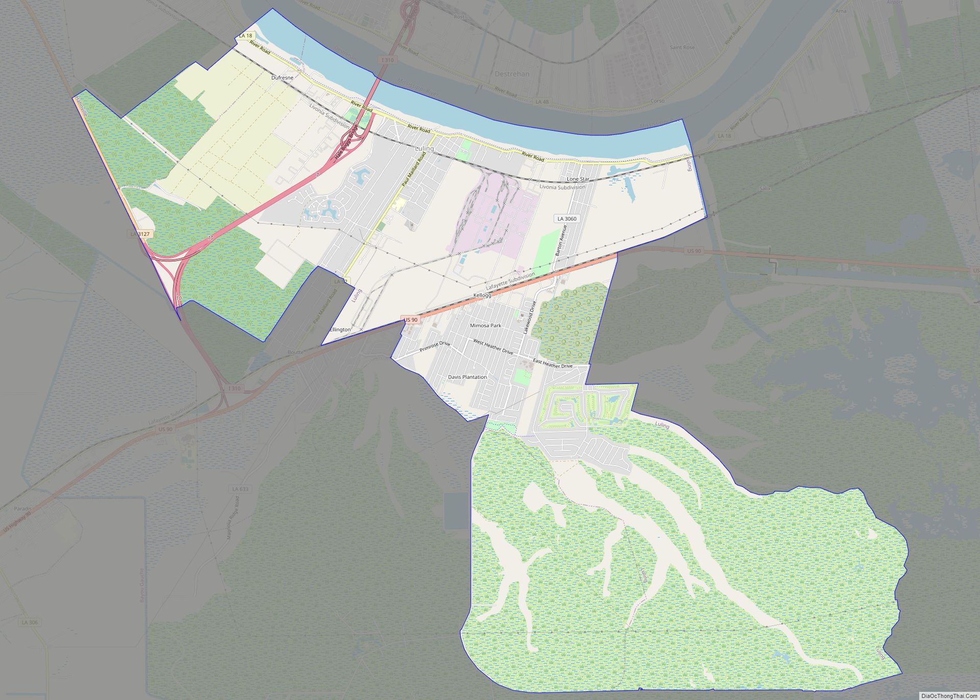
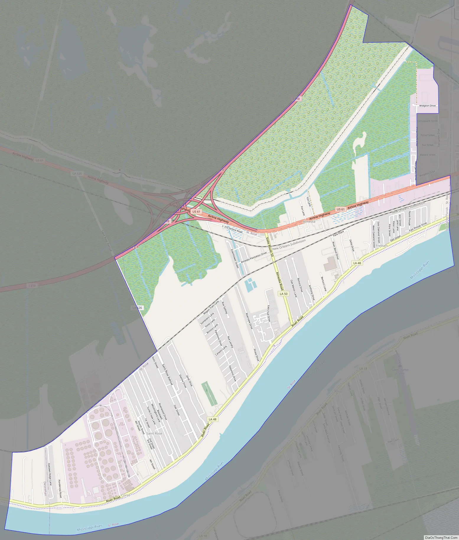
St. Rose Road Map
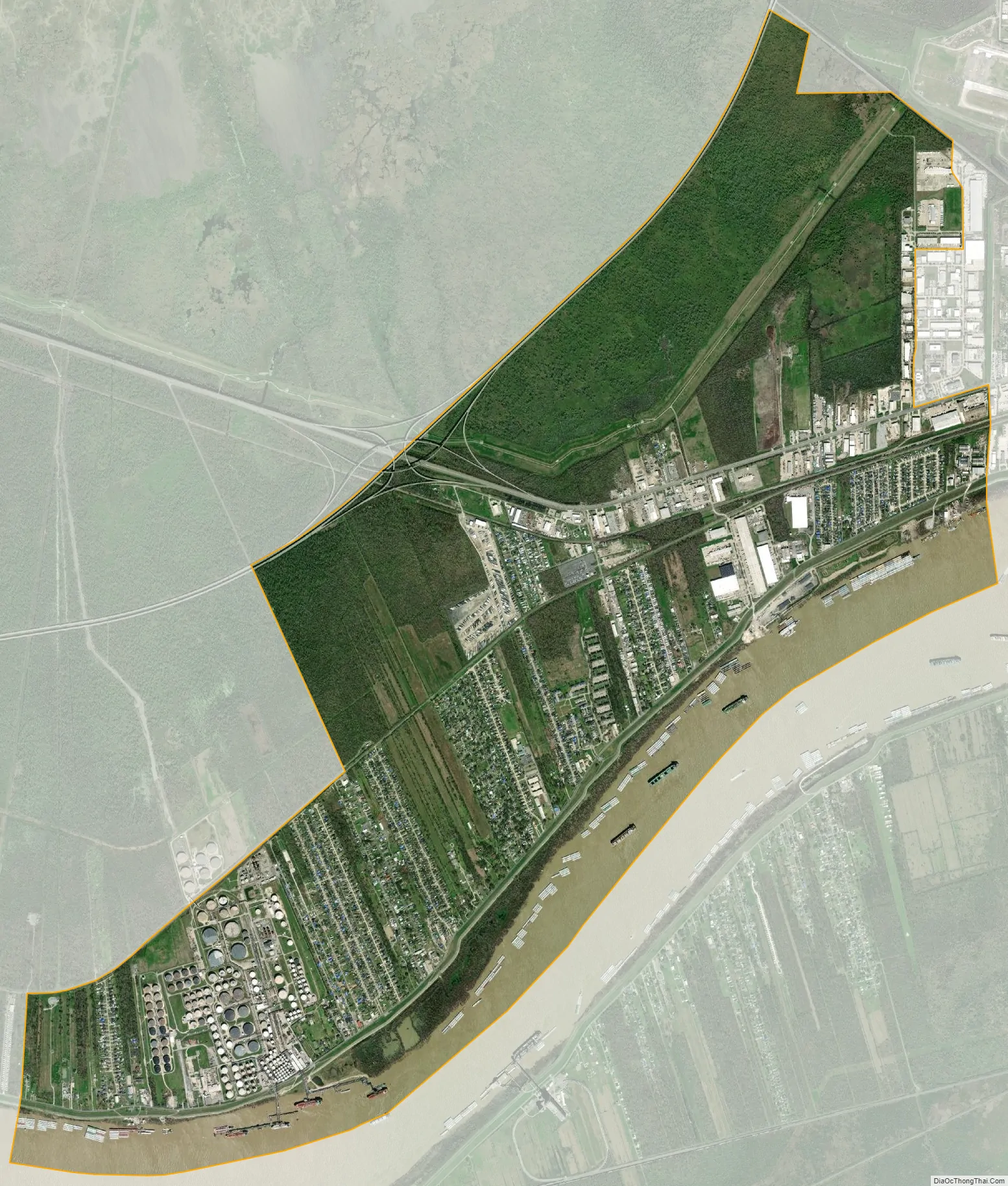
St. Rose city Satellite Map
Geography
St. Rose is located at 29°57′38″N 90°18′47″W / 29.96056°N 90.31306°W / 29.96056; -90.31306 (29.960421, -90.313094).
According to the United States Census Bureau, the CDP has a total area of 5.0 square miles (13.0 km), of which 4.0 square miles (10.5 km) is land and 1.0 square mile (2.6 km) (19.88%) is water.
See also
Map of Louisiana State and its subdivision:- Acadia
- Allen
- Ascension
- Assumption
- Avoyelles
- Beauregard
- Bienville
- Bossier
- Caddo
- Calcasieu
- Caldwell
- Cameron
- Catahoula
- Claiborne
- Concordia
- De Soto
- East Baton Rouge
- East Carroll
- East Feliciana
- Evangeline
- Franklin
- Grant
- Iberia
- Iberville
- Jackson
- Jefferson
- Jefferson Davis
- La Salle
- Lafayette
- Lafourche
- Lincoln
- Livingston
- Madison
- Morehouse
- Natchitoches
- Orleans
- Ouachita
- Plaquemines
- Pointe Coupee
- Rapides
- Red River
- Richland
- Sabine
- Saint Bernard
- Saint Charles
- Saint Helena
- Saint James
- Saint John the Baptist
- Saint Landry
- Saint Martin
- Saint Mary
- Saint Tammany
- Tangipahoa
- Tensas
- Terrebonne
- Union
- Vermilion
- Vernon
- Washington
- Webster
- West Baton Rouge
- West Carroll
- West Feliciana
- Winn
- Alabama
- Alaska
- Arizona
- Arkansas
- California
- Colorado
- Connecticut
- Delaware
- District of Columbia
- Florida
- Georgia
- Hawaii
- Idaho
- Illinois
- Indiana
- Iowa
- Kansas
- Kentucky
- Louisiana
- Maine
- Maryland
- Massachusetts
- Michigan
- Minnesota
- Mississippi
- Missouri
- Montana
- Nebraska
- Nevada
- New Hampshire
- New Jersey
- New Mexico
- New York
- North Carolina
- North Dakota
- Ohio
- Oklahoma
- Oregon
- Pennsylvania
- Rhode Island
- South Carolina
- South Dakota
- Tennessee
- Texas
- Utah
- Vermont
- Virginia
- Washington
- West Virginia
- Wisconsin
- Wyoming