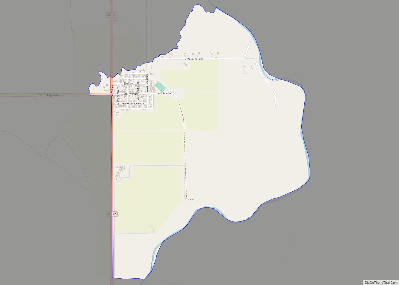
Belfry is a census-designated place (CDP) in Carbon County, Montana, United States. It is part of the Billings, Montana Metropolitan Statistical Area. The population was 218 at the 2010 census. It is located approximately 11 miles (18 km) from the Wyoming border, roughly halfway between Billings, Montana and Cody, Wyoming.
Belfry is predominantly an agricultural community. The primary crops are sugar beets, alfalfa, and feed corn. Ranchers raise cattle and sheep. Water for agricultural use comes mostly from the Clarks Fork of the Yellowstone River through several cooperative ditch companies, with water rights dating back 100 years or more.
At its peak in the early 1900s, a railway line came into Belfry, with a spur running up to the coal mines in Bearcreek. When the mines closed down and the railway line was removed, Belfry’s population dropped to its current level. Currently, the community has a general store, a bar, a restaurant, and a small bar/restaurant/casino.
The town was named for a local doctor. The post office was established on February 26, 1906, with Mary Hall as the first postmaster. The town was created by the construction of the Yellowstone Park Railroad.
| Name: | Belfry CDP |
|---|---|
| LSAD Code: | 57 |
| LSAD Description: | CDP (suffix) |
| State: | Montana |
| County: | Carbon County |
| Elevation: | 3,862 ft (1,177 m) |
| Total Area: | 1.72 sq mi (4.45 km²) |
| Land Area: | 1.67 sq mi (4.31 km²) |
| Water Area: | 0.05 sq mi (0.14 km²) |
| Total Population: | 193 |
| Population Density: | 115.92/sq mi (44.76/km²) |
| ZIP code: | 59008 |
| Area code: | 406 |
| FIPS code: | 3004900 |
| GNISfeature ID: | 0802021 |
Online Interactive Map
Click on ![]() to view map in "full screen" mode.
to view map in "full screen" mode.
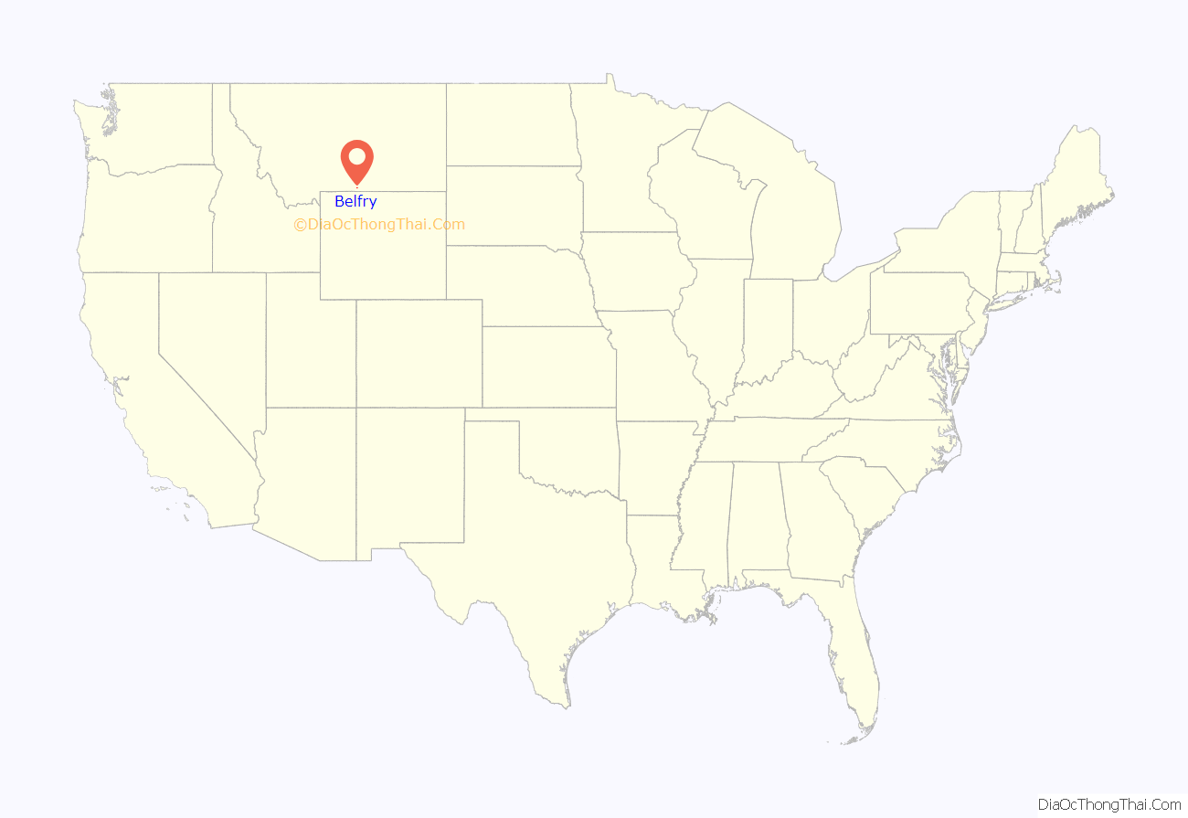
Belfry location map. Where is Belfry CDP?
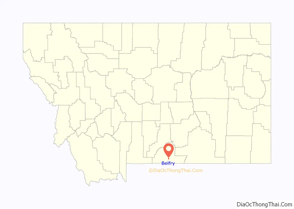
Belfry Road Map
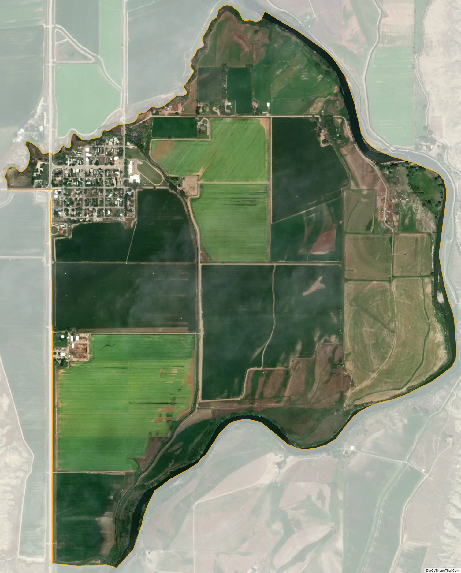
Belfry city Satellite Map
Geography
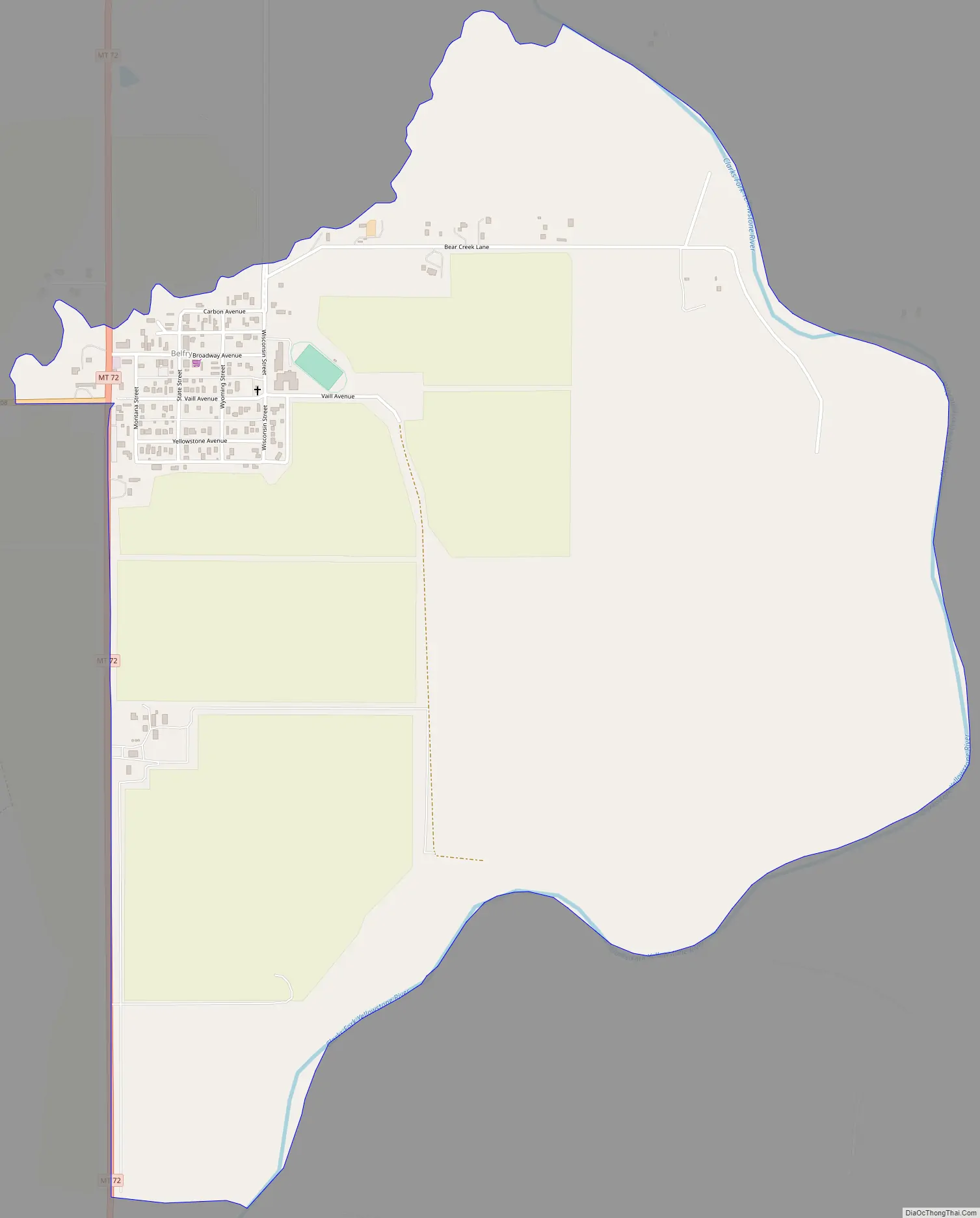
Belfry is located in south-central Carbon County at 45°8′29″N 109°0′28″W / 45.14139°N 109.00778°W / 45.14139; -109.00778 (45.141506, -109.007779).
According to the United States Census Bureau, the CDP has a total area of 1.72 square miles (4.45 km), of which 1.66 square miles (4.31 km) is land and 0.054 square miles (0.14 km), or 3.10%, is water. The Clarks Fork of the Yellowstone River runs just east of the main part of the town.
See also
Map of Montana State and its subdivision:- Beaverhead
- Big Horn
- Blaine
- Broadwater
- Carbon
- Carter
- Cascade
- Chouteau
- Custer
- Daniels
- Dawson
- Deer Lodge
- Fallon
- Fergus
- Flathead
- Gallatin
- Garfield
- Glacier
- Golden Valley
- Granite
- Hill
- Jefferson
- Judith Basin
- Lake
- Lewis and Clark
- Liberty
- Lincoln
- Madison
- McCone
- Meagher
- Mineral
- Missoula
- Musselshell
- Park
- Petroleum
- Phillips
- Pondera
- Powder River
- Powell
- Prairie
- Ravalli
- Richland
- Roosevelt
- Rosebud
- Sanders
- Sheridan
- Silver Bow
- Stillwater
- Sweet Grass
- Teton
- Toole
- Treasure
- Valley
- Wheatland
- Wibaux
- Yellowstone
- Alabama
- Alaska
- Arizona
- Arkansas
- California
- Colorado
- Connecticut
- Delaware
- District of Columbia
- Florida
- Georgia
- Hawaii
- Idaho
- Illinois
- Indiana
- Iowa
- Kansas
- Kentucky
- Louisiana
- Maine
- Maryland
- Massachusetts
- Michigan
- Minnesota
- Mississippi
- Missouri
- Montana
- Nebraska
- Nevada
- New Hampshire
- New Jersey
- New Mexico
- New York
- North Carolina
- North Dakota
- Ohio
- Oklahoma
- Oregon
- Pennsylvania
- Rhode Island
- South Carolina
- South Dakota
- Tennessee
- Texas
- Utah
- Vermont
- Virginia
- Washington
- West Virginia
- Wisconsin
- Wyoming