Ekalaka is a town in and the county seat of Carter County, Montana, United States. The population was 399 at the 2020 census.
| Name: | Ekalaka town |
|---|---|
| LSAD Code: | 43 |
| LSAD Description: | town (suffix) |
| State: | Montana |
| County: | Carter County |
| Elevation: | 3,425 ft (1,044 m) |
| Total Area: | 1.03 sq mi (2.67 km²) |
| Land Area: | 1.03 sq mi (2.67 km²) |
| Water Area: | 0.00 sq mi (0.00 km²) |
| Total Population: | 399 |
| Population Density: | 387.76/sq mi (149.64/km²) |
| ZIP code: | 59324 |
| Area code: | 406 |
| FIPS code: | 3023650 |
| GNISfeature ID: | 0771161 |
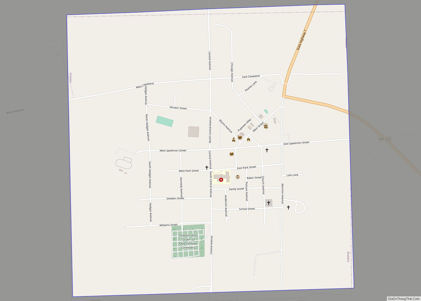
Online Interactive Map
Click on ![]() to view map in "full screen" mode.
to view map in "full screen" mode.
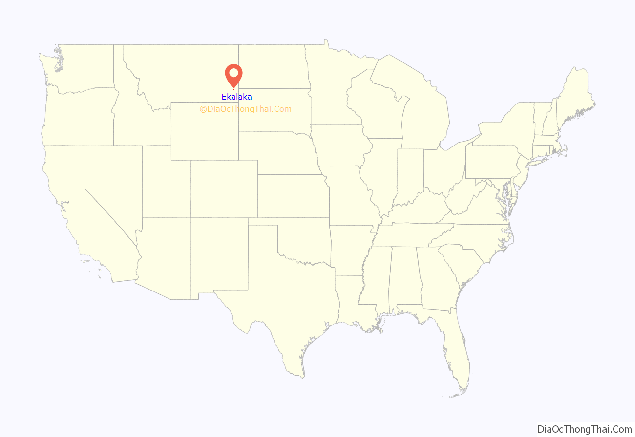
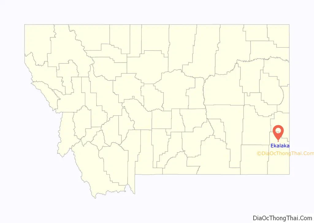
Ekalaka location map. Where is Ekalaka town?
History
Ekalaka was named after a Sioux girl, Ijkalaka, who was the wife of David Harrison Russell, a scout.
Ijkalaka (Restless or Moving About) was an Oglala Lakota and the daughter of Wombalee We-chosh (Eagle Man). She was born in 1858 on the Powder River., while she was living with a cousin, Hi Kelly, at a ranch on Chugwater Creek, near Laramie Wyoming. She was 16 when she met Russell, who was a scout and frontiersman.
The town was created by Russell on the edge of his ranch. A man named Carter bogged down in mud the spring of 1885 opened a saloon and is credited with saying “Anyplace in Montana is a good place to open a saloon”. The site became a trade center for cattle ranchers and sheepherders. He put up houses to house freight workers and hunters who ran the local freight line (team and horses), and other added to it.
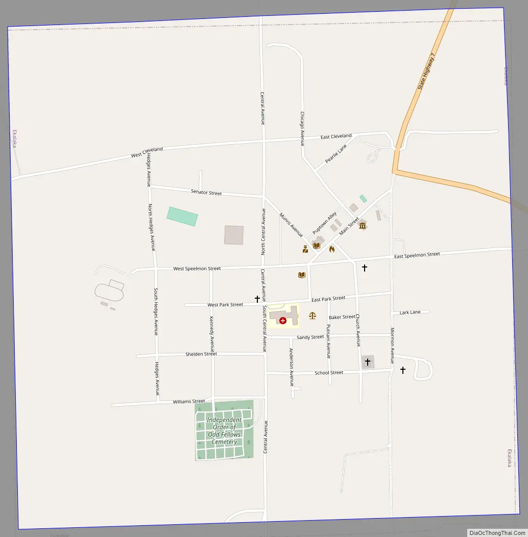
Ekalaka Road Map
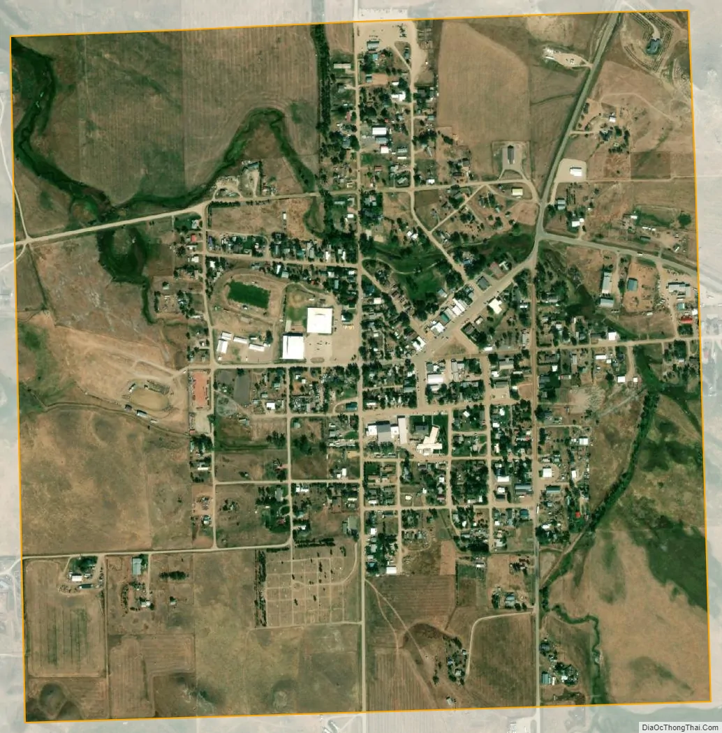
Ekalaka city Satellite Map
Geography
Ekalaka is located at 45°53′21″N 104°32′59″W / 45.88917°N 104.54972°W / 45.88917; -104.54972 (45.889231, −104.549716). According to the United States Census Bureau, the town has a total area of 1.04 square miles (2.69 km), all land. Ekalaka is the southern start of Montana Highway 7 and the northern end of Montana Secondary Highway 323.
Known for its sandstone rock and open plains, Ekalaka is part of the Montana Dinosaur Trail, and is home to the Carter County Museum, which is known for its dinosaur collection. Nearby is the Custer National Forest. Russell Creek flows through town.
Climate
Ekalaka experiences a dry continental climate (Köppen Dfb) with cold, dry winters and hot, wetter summers.
See also
Map of Montana State and its subdivision:- Beaverhead
- Big Horn
- Blaine
- Broadwater
- Carbon
- Carter
- Cascade
- Chouteau
- Custer
- Daniels
- Dawson
- Deer Lodge
- Fallon
- Fergus
- Flathead
- Gallatin
- Garfield
- Glacier
- Golden Valley
- Granite
- Hill
- Jefferson
- Judith Basin
- Lake
- Lewis and Clark
- Liberty
- Lincoln
- Madison
- McCone
- Meagher
- Mineral
- Missoula
- Musselshell
- Park
- Petroleum
- Phillips
- Pondera
- Powder River
- Powell
- Prairie
- Ravalli
- Richland
- Roosevelt
- Rosebud
- Sanders
- Sheridan
- Silver Bow
- Stillwater
- Sweet Grass
- Teton
- Toole
- Treasure
- Valley
- Wheatland
- Wibaux
- Yellowstone
- Alabama
- Alaska
- Arizona
- Arkansas
- California
- Colorado
- Connecticut
- Delaware
- District of Columbia
- Florida
- Georgia
- Hawaii
- Idaho
- Illinois
- Indiana
- Iowa
- Kansas
- Kentucky
- Louisiana
- Maine
- Maryland
- Massachusetts
- Michigan
- Minnesota
- Mississippi
- Missouri
- Montana
- Nebraska
- Nevada
- New Hampshire
- New Jersey
- New Mexico
- New York
- North Carolina
- North Dakota
- Ohio
- Oklahoma
- Oregon
- Pennsylvania
- Rhode Island
- South Carolina
- South Dakota
- Tennessee
- Texas
- Utah
- Vermont
- Virginia
- Washington
- West Virginia
- Wisconsin
- Wyoming