Judith Gap is a city in Wheatland County, Montana, United States. The population was 110 at the 2020 census.
| Name: | Judith Gap city |
|---|---|
| LSAD Code: | 25 |
| LSAD Description: | city (suffix) |
| State: | Montana |
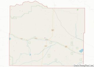
| County: | Wheatland County |
| Elevation: | 4,639 ft (1,414 m) |
| Total Area: | 0.33 sq mi (0.86 km²) |
| Land Area: | 0.33 sq mi (0.86 km²) |
| Water Area: | 0.00 sq mi (0.00 km²) |
| Total Population: | 110 |
| Population Density: | 331.33/sq mi (127.77/km²) |
| ZIP code: | 59453 |
| Area code: | 406 |
| FIPS code: | 3040000 |
| GNISfeature ID: | 0785581 |
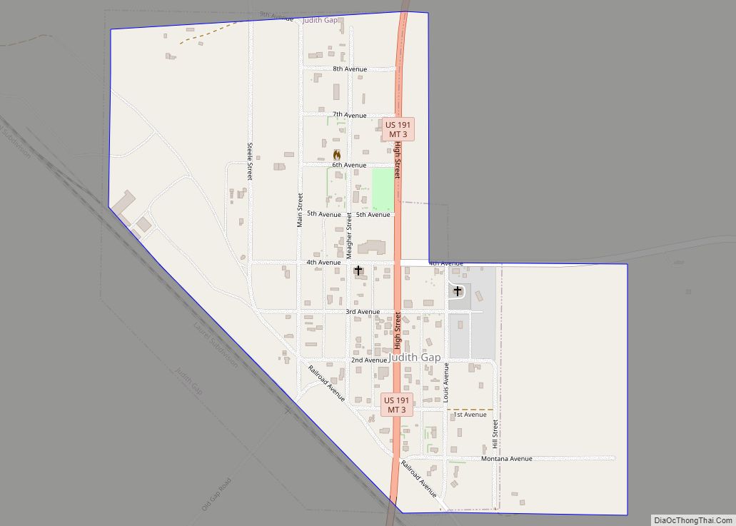
Online Interactive Map
Click on ![]() to view map in "full screen" mode.
to view map in "full screen" mode.
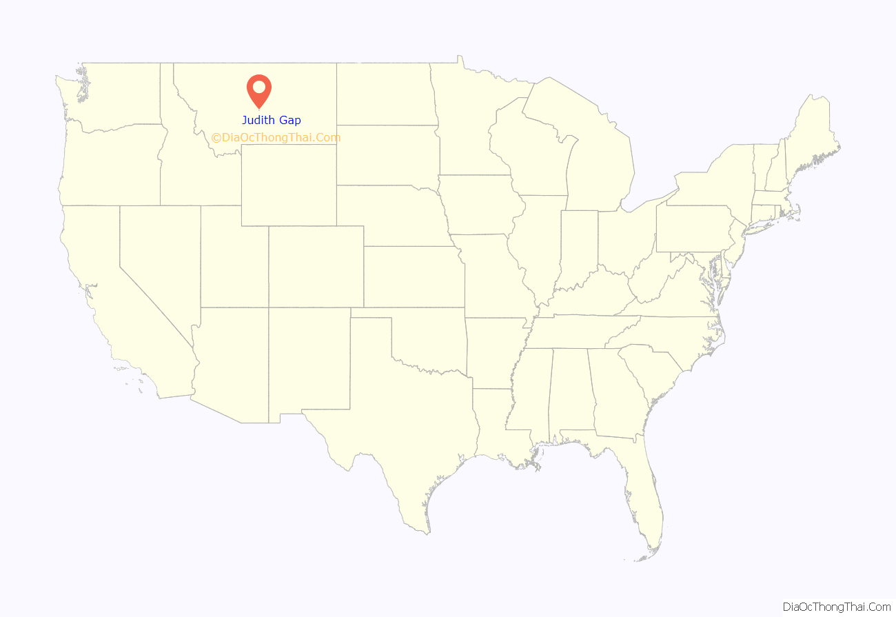
Judith Gap location map. Where is Judith Gap city?

History
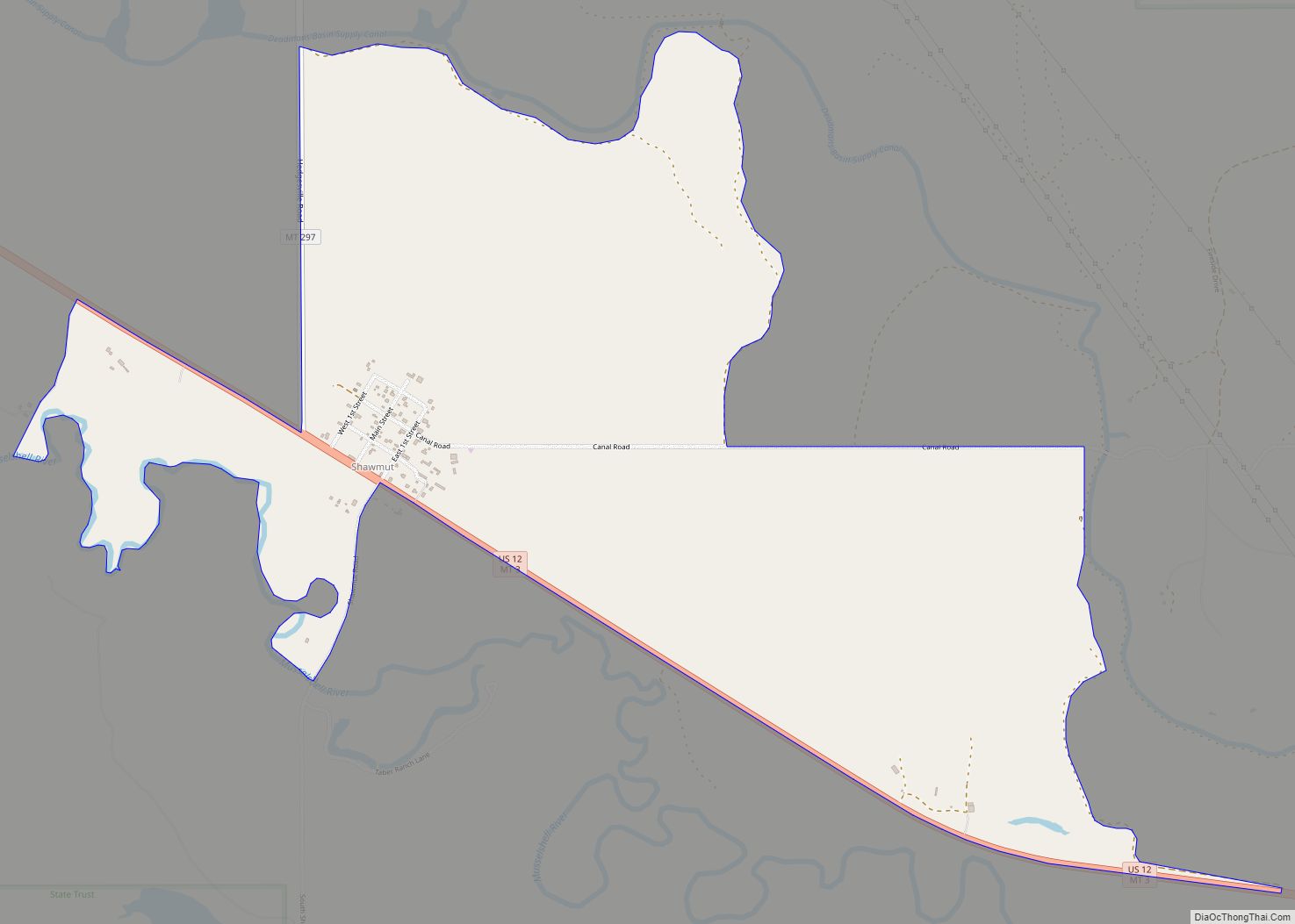
The railway station here was initially named “Ubet”, after A. R. Barrows’ nearby stage stop settlement Ubet, Montana. Judith Gap, like the river and mountains, derives its name from Capt. William Clark’s fiancée, Julia (Judith) Hancock.
Judith Gap’s economic prospects soared in 2005 with the construction of a major wind farm.
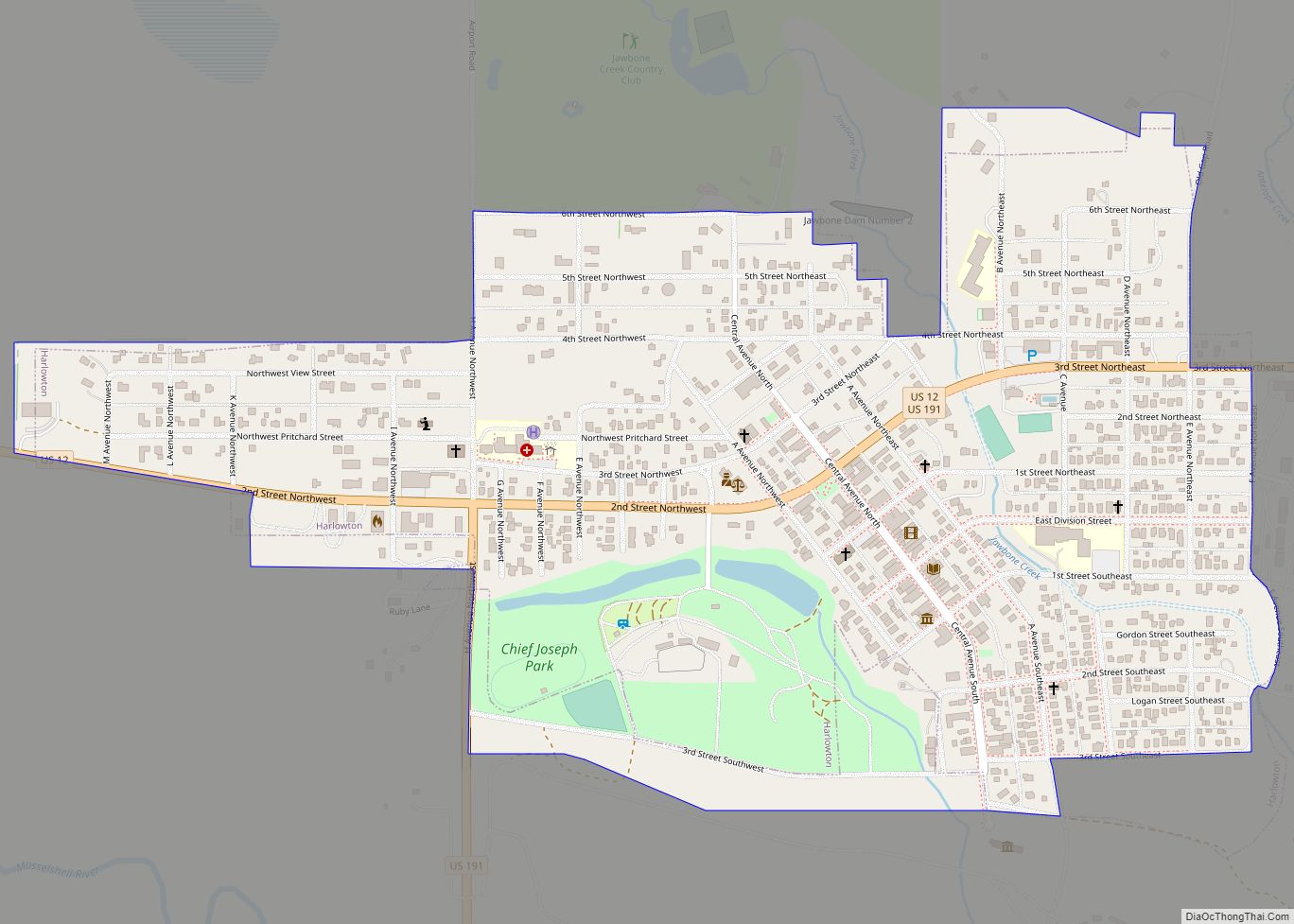
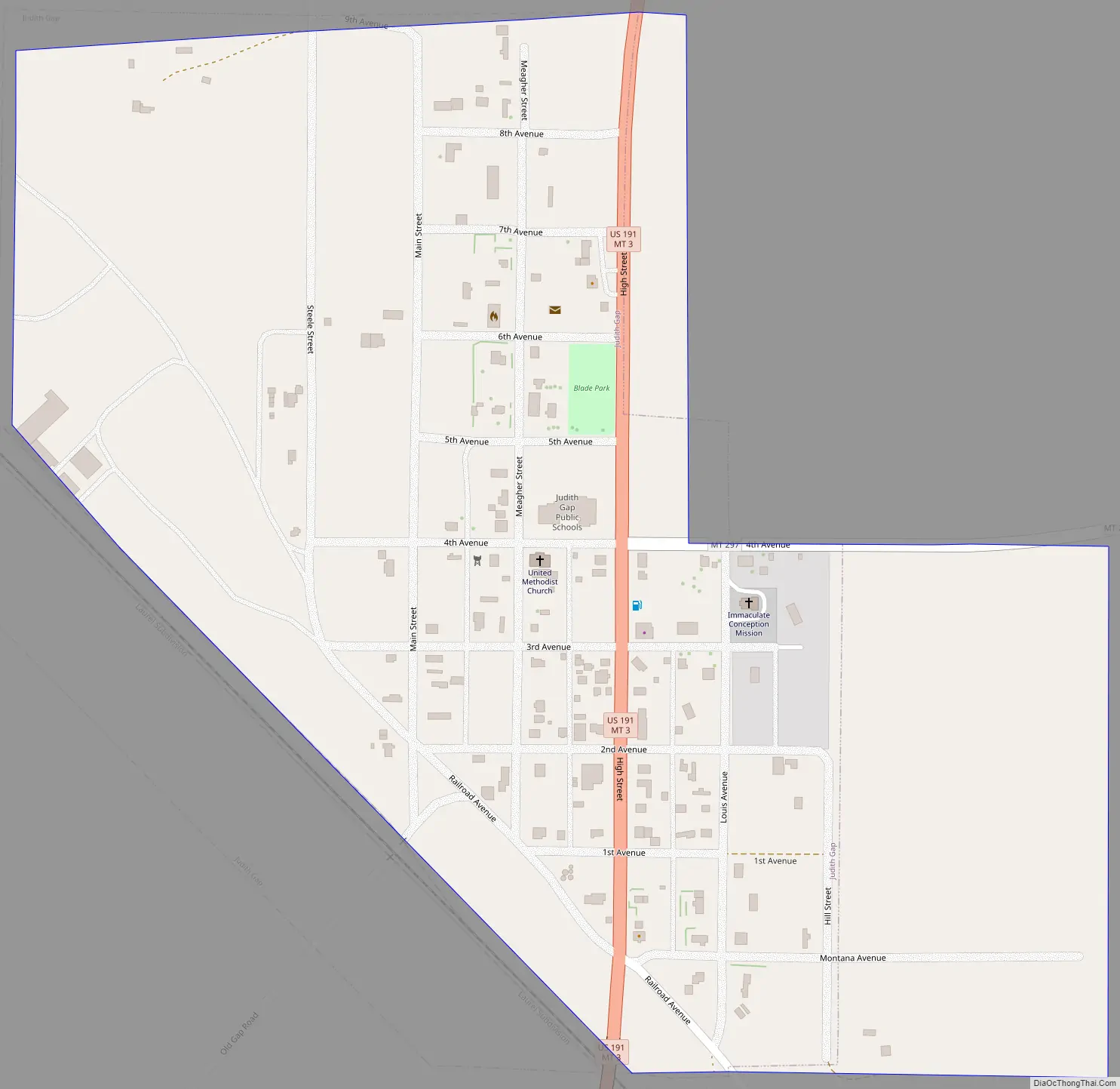
Judith Gap Road Map
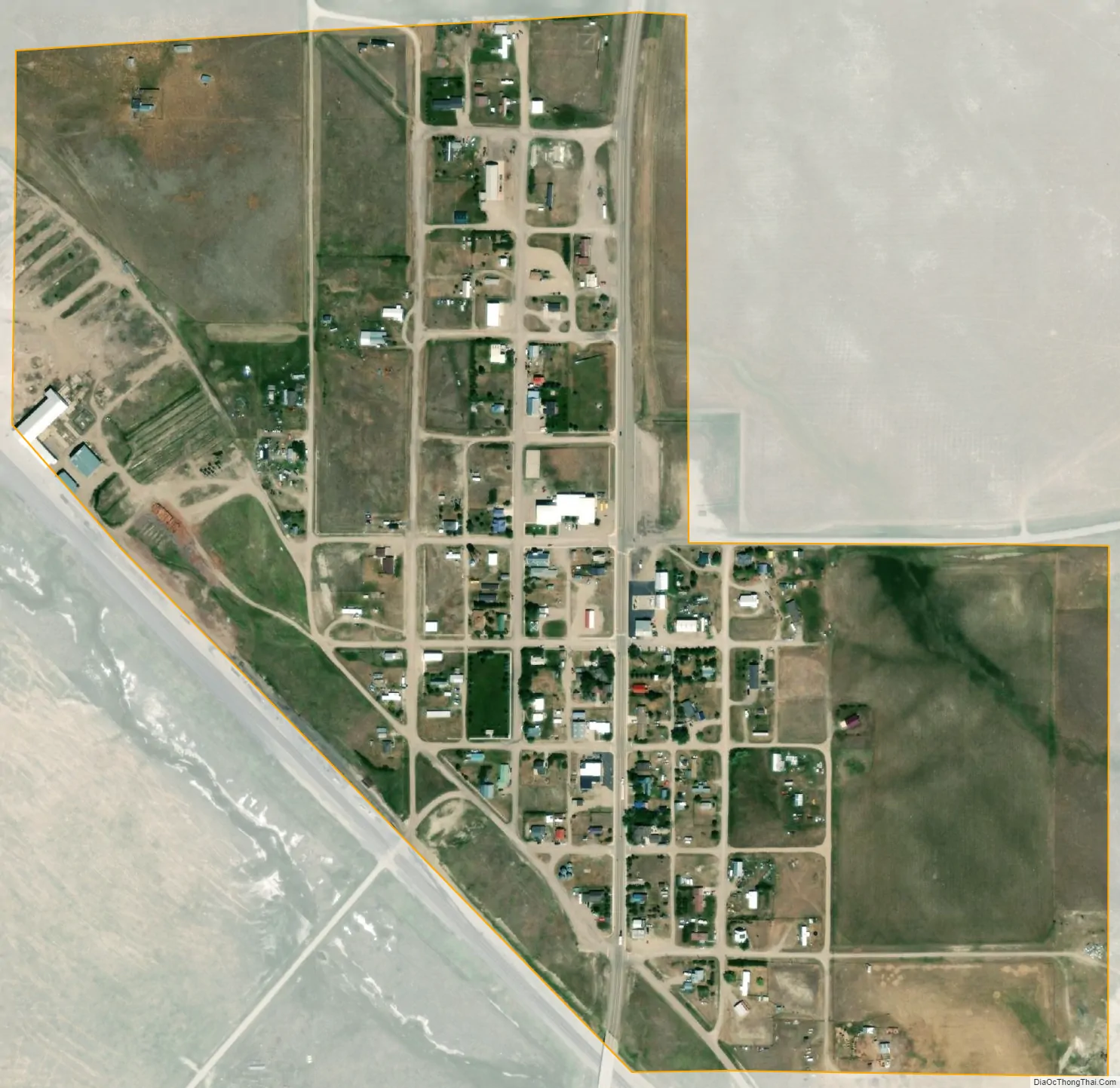
Judith Gap city Satellite Map
Geography
Judith Gap is located at 46°40′44″N 109°45′11″W / 46.678874°N 109.753151°W / 46.678874; -109.753151 (46.678874, -109.753151).
The city is situated in the historic Judith Gap, which is a small gap between the two towering mountain ranges (Big Snowy Mountains and Little Belt Mountains) that separate Central Montana from Southern Montana. This gap has been used by settlers and Native Americans for centuries, including Chief Joseph and the Nez Perce during their famous 1877 flight to Canada.
According to the United States Census Bureau, the city has a total area of 0.38 square miles (0.98 km), all land.
See also
Map of Montana State and its subdivision:- Beaverhead
- Big Horn
- Blaine
- Broadwater
- Carbon
- Carter
- Cascade
- Chouteau
- Custer
- Daniels
- Dawson
- Deer Lodge
- Fallon
- Fergus
- Flathead
- Gallatin
- Garfield
- Glacier
- Golden Valley
- Granite
- Hill
- Jefferson
- Judith Basin
- Lake
- Lewis and Clark
- Liberty
- Lincoln
- Madison
- McCone
- Meagher
- Mineral
- Missoula
- Musselshell
- Park
- Petroleum
- Phillips
- Pondera
- Powder River
- Powell
- Prairie
- Ravalli
- Richland
- Roosevelt
- Rosebud
- Sanders
- Sheridan
- Silver Bow
- Stillwater
- Sweet Grass
- Teton
- Toole
- Treasure
- Valley
- Wheatland
- Wibaux
- Yellowstone
- Alabama
- Alaska
- Arizona
- Arkansas
- California
- Colorado
- Connecticut
- Delaware
- District of Columbia
- Florida
- Georgia
- Hawaii
- Idaho
- Illinois
- Indiana
- Iowa
- Kansas
- Kentucky
- Louisiana
- Maine
- Maryland
- Massachusetts
- Michigan
- Minnesota
- Mississippi
- Missouri
- Montana
- Nebraska
- Nevada
- New Hampshire
- New Jersey
- New Mexico
- New York
- North Carolina
- North Dakota
- Ohio
- Oklahoma
- Oregon
- Pennsylvania
- Rhode Island
- South Carolina
- South Dakota
- Tennessee
- Texas
- Utah
- Vermont
- Virginia
- Washington
- West Virginia
- Wisconsin
- Wyoming