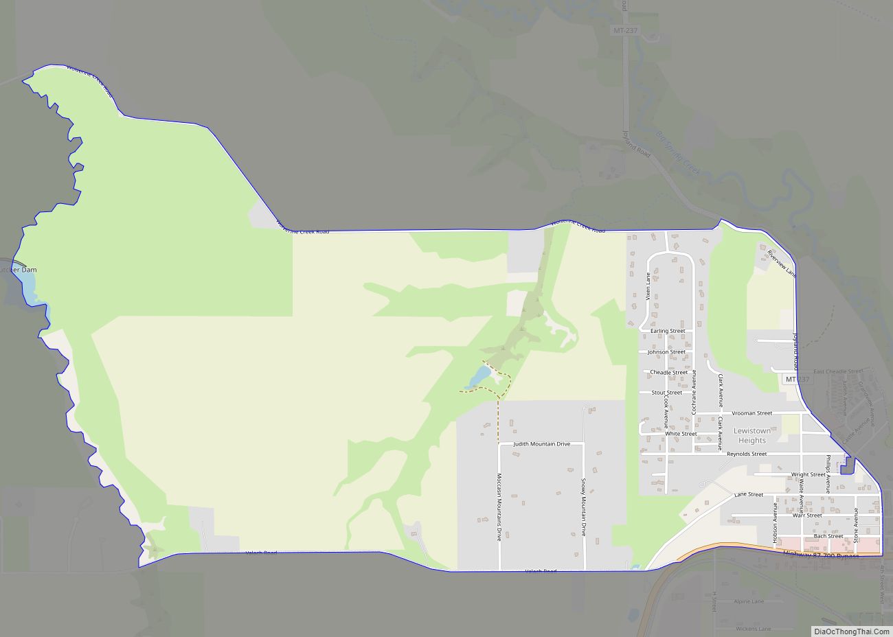
Lewistown is a city in and the county seat of Fergus County, Montana, United States. The population was 5,952 at the 2020 census. Lewistown is located in the geographic center of the state, southeast of Great Falls and northwest of Billings. First planned in 1882, it was the site of an 1880s gold rush, and served as an important railway destination, supplying surrounding communities with bricks via rail.
| Name: | Lewistown city |
|---|---|
| LSAD Code: | 25 |
| LSAD Description: | city (suffix) |
| State: | Montana |
| County: | Fergus County |
| Elevation: | 3,947 ft (1,203 m) |
| Total Area: | 5.72 sq mi (14.82 km²) |
| Land Area: | 5.72 sq mi (14.82 km²) |
| Water Area: | 0.00 sq mi (0.00 km²) |
| Total Population: | 5,952 |
| Population Density: | 1,040.20/sq mi (401.60/km²) |
| ZIP code: | 59457 |
| Area code: | 406 |
| FIPS code: | 3043375 |
| GNISfeature ID: | 0798996 |
| Website: | http://www.cityoflewistown.com |
Online Interactive Map
Click on ![]() to view map in "full screen" mode.
to view map in "full screen" mode.
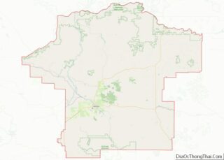
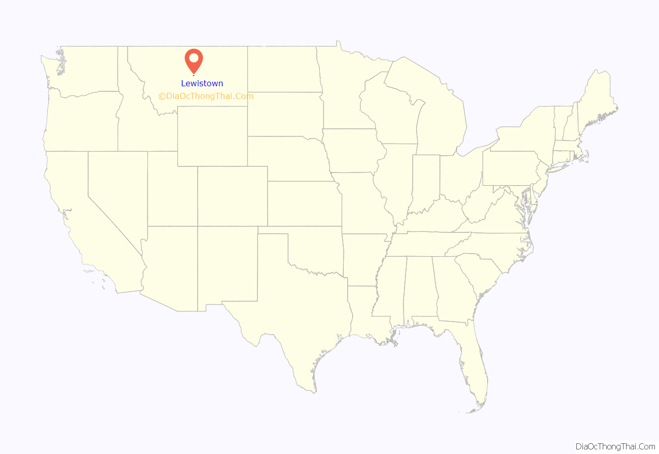
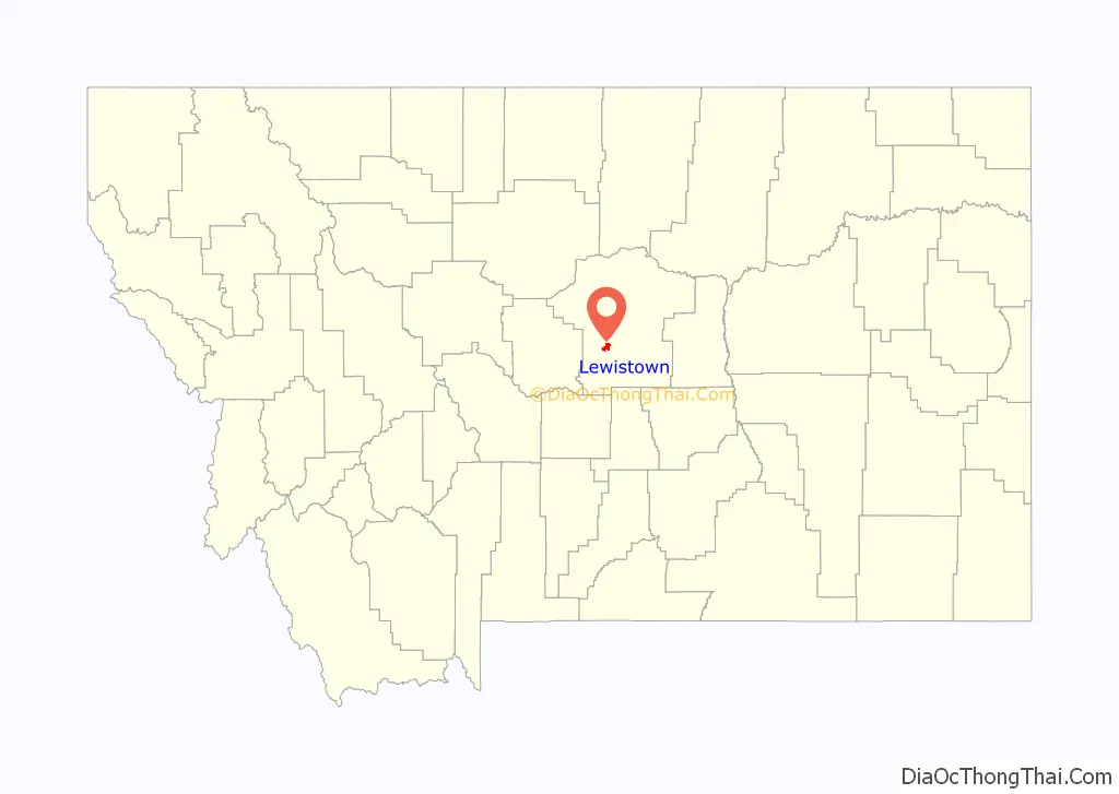
Lewistown location map. Where is Lewistown city?
History
The area was the territory of the Blackfoot Native Americans. In 1874, Fort Lewis was established there by Company “F” of the 7th U.S. Infantry to provide military protection for people traveling on the Carroll Trail, then the shortest route between Carroll, Montana and Helena. Lewistown is named after this fort.
The first permanent settlers of Lewistown were Métis. The Metis established Lewistown in 1879. Pierre Berger is credited with being the founder of Lewistown. Berger, along with his wife Judith Wilkie Berger, son Isadore Berger, Isaie Berger, Jean Baptiste Berger and Jacques Berger, as well as several other families made the trek into the Lewistown area in 1879. Francis Janeaux came with the second group. Janeaux founded the first public school house in 1883. Lewistown became an incorporated city in 1899.
Lewistown was the site of a gold rush when gold was discovered in the nearby Judith Mountains in 1880. Before the gold rush, Maiden was the largest city in central Montana. When the gold supply ran out, many of the miners gained new employment in Lewistown and settled there permanently.
Lewistown was the eastern terminus of the Montana Railroad which connected with Lombard, Montana, a distance of approximately 157 miles (253 km). The railroad connected with the national railway network via a connection with the Northern Pacific Railway at Lombard. The Montana Railroad line was constructed between 1895 and 1903, and operated independently until 1908, when it was acquired by the Chicago, Milwaukee, St. Paul and Pacific Railroad (“the Milwaukee Road”).
During World War II, in 1942 the US Army Air Corps established a Boeing B-17 Flying Fortress training base just west of Lewistown to train aircrews for missions in North Africa and Europe. The former airbase is now the Lewistown Municipal Airport, which is home to the last remaining Norden bombsight storage facility, used to keep the device safe from theft by enemy spies during World War II . The city park displays a Minuteman III ballistic missile.
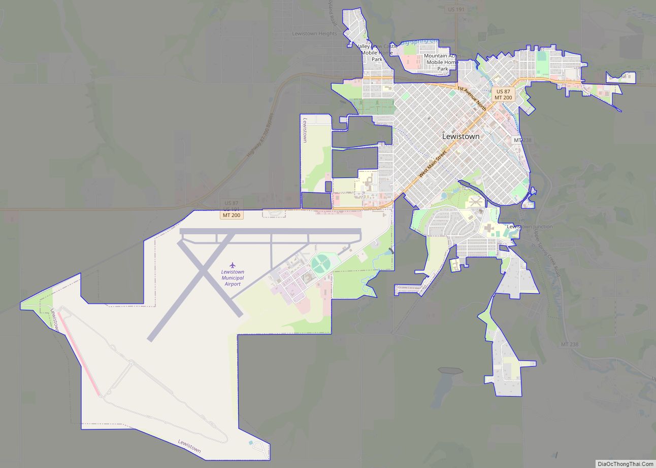
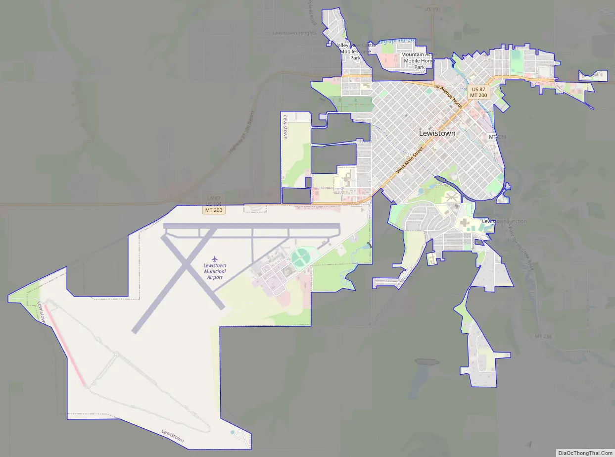
Lewistown Road Map
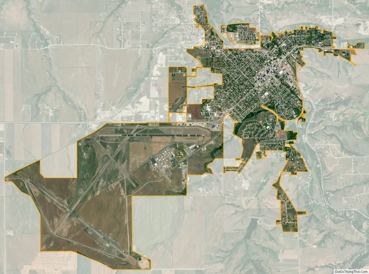
Lewistown city Satellite Map
Geography
U.S. Highway 87 intersects with U.S. Route 191 in town.
According to the United States Census Bureau, the city has a total area of 5.32 square miles (13.78 km), all land.
The city is located in the exact center of the state of Montana and is part of the Rocky Mountains. The city’s water source is Big Spring Creek, which originates in the foothills of the Big Snowy Mountains 6 miles (9.7 km) south of Lewistown.
Climate
Lewistown experiences a relatively dry humid continental climate (Köppen Dfb) with long, dry and usually cold winters and short, warm, wetter summers. Winter weather can either be severe due to the movement of cold polar air from Canada, or occasionally very mild or even warm due to gusty chinook winds. On average 9.3 afternoons will reach 50 °F (10 °C) during the three winter months, but on the other hand, 46.6 afternoons during a full year will fail to top freezing, 0 °F (−17.8 °C) is reached on 21.5 mornings and −25 °F (−31.7 °C) on two mornings each winter, with as many as twelve this cold during the severe winter of 1928–29. Temperatures do not consistently stay above freezing until June: the average window for freezing temperatures is from September 19 to May 23 – allowing a “growing season” of 92 days – and for subfreezing maxima from October 26 to April 2. The hottest temperature at Lewistown has been 105 °F (40.6 °C) on June 21, 1900 and July 31, 1900, and the coldest −46 °F (−43.3 °C) on 28 January 1929. The hottest minimum has been 71 °F (21.7 °C) on July 17, 1925, and the coldest maximum −28 °F (−33.3 °C) on January 29, 1916; the coldest month was January 1950 which averaged −1.8 °F (−18.8 °C).
During the summer, days are very warm, but nights remain cool and rare freezes have occurred. Most precipitation is from spring thunderstorms: the wettest calendar year has been 1953 with 28.61 inches (726.7 mm) and the driest 2021 with 10.91 inches (277.1 mm). Despite the dry conditions, winter snowfall is substantial with an average of 63.1 inches (1.60 m); however the frequent chinooks keep mean snow cover down to 9 inches (0.23 m) in January. The most snow on the ground has been 33 inches (0.84 m) on February 1 and 2, 1978. February 1978 also had the highest mean snow cover at 27.1 inches or 0.69 metres; the snowiest year has been 1955 with 172.5 inches (4.38 m) and the least snowy was 1992 with only 30.2 inches (0.77 m), and the most snow in a month 41.0 inches (1.04 m) during March 1954.
See also
Map of Montana State and its subdivision:- Beaverhead
- Big Horn
- Blaine
- Broadwater
- Carbon
- Carter
- Cascade
- Chouteau
- Custer
- Daniels
- Dawson
- Deer Lodge
- Fallon
- Fergus
- Flathead
- Gallatin
- Garfield
- Glacier
- Golden Valley
- Granite
- Hill
- Jefferson
- Judith Basin
- Lake
- Lewis and Clark
- Liberty
- Lincoln
- Madison
- McCone
- Meagher
- Mineral
- Missoula
- Musselshell
- Park
- Petroleum
- Phillips
- Pondera
- Powder River
- Powell
- Prairie
- Ravalli
- Richland
- Roosevelt
- Rosebud
- Sanders
- Sheridan
- Silver Bow
- Stillwater
- Sweet Grass
- Teton
- Toole
- Treasure
- Valley
- Wheatland
- Wibaux
- Yellowstone
- Alabama
- Alaska
- Arizona
- Arkansas
- California
- Colorado
- Connecticut
- Delaware
- District of Columbia
- Florida
- Georgia
- Hawaii
- Idaho
- Illinois
- Indiana
- Iowa
- Kansas
- Kentucky
- Louisiana
- Maine
- Maryland
- Massachusetts
- Michigan
- Minnesota
- Mississippi
- Missouri
- Montana
- Nebraska
- Nevada
- New Hampshire
- New Jersey
- New Mexico
- New York
- North Carolina
- North Dakota
- Ohio
- Oklahoma
- Oregon
- Pennsylvania
- Rhode Island
- South Carolina
- South Dakota
- Tennessee
- Texas
- Utah
- Vermont
- Virginia
- Washington
- West Virginia
- Wisconsin
- Wyoming