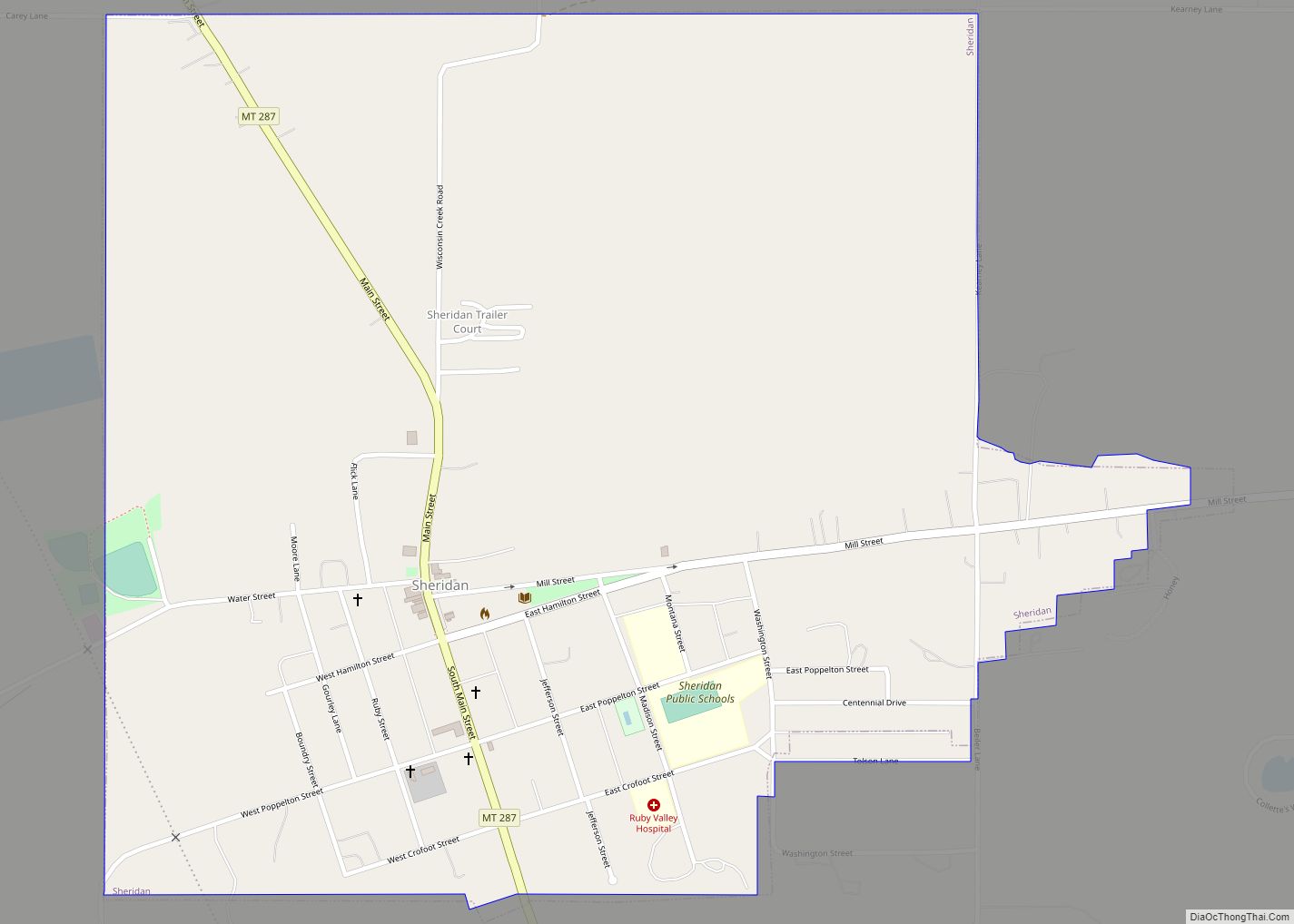
Sheridan is a town in Madison County, Montana, United States named after the Civil War general Philip Sheridan. The population was 694 at the 2020 census. Sheridan is known as the “heart of the Ruby Valley.” Seven mountain ranges surround the town: Tobacco Root Mountains, Highland Mountains, McCartney Mountain, The Pioneers, The Ruby Range, The Gravelly Range and the Snowcrest Range. The Ruby River winds through the valley just west of the town.
Sheridan traces its beginnings to the construction of a sawmill on Mill Creek by James Gammell in 1863.
| Name: | Sheridan town |
|---|---|
| LSAD Code: | 43 |
| LSAD Description: | town (suffix) |
| State: | Montana |
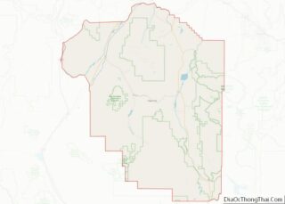
| County: | Madison County |
| Elevation: | 5,115 ft (1,559 m) |
| Total Area: | 1.01 sq mi (2.62 km²) |
| Land Area: | 1.01 sq mi (2.62 km²) |
| Water Area: | 0.00 sq mi (0.00 km²) |
| Total Population: | 694 |
| Population Density: | 686.45/sq mi (264.92/km²) |
| ZIP code: | 59749 |
| Area code: | 406 |
| FIPS code: | 3067600 |
| GNISfeature ID: | 0776478 |
Online Interactive Map
Click on ![]() to view map in "full screen" mode.
to view map in "full screen" mode.
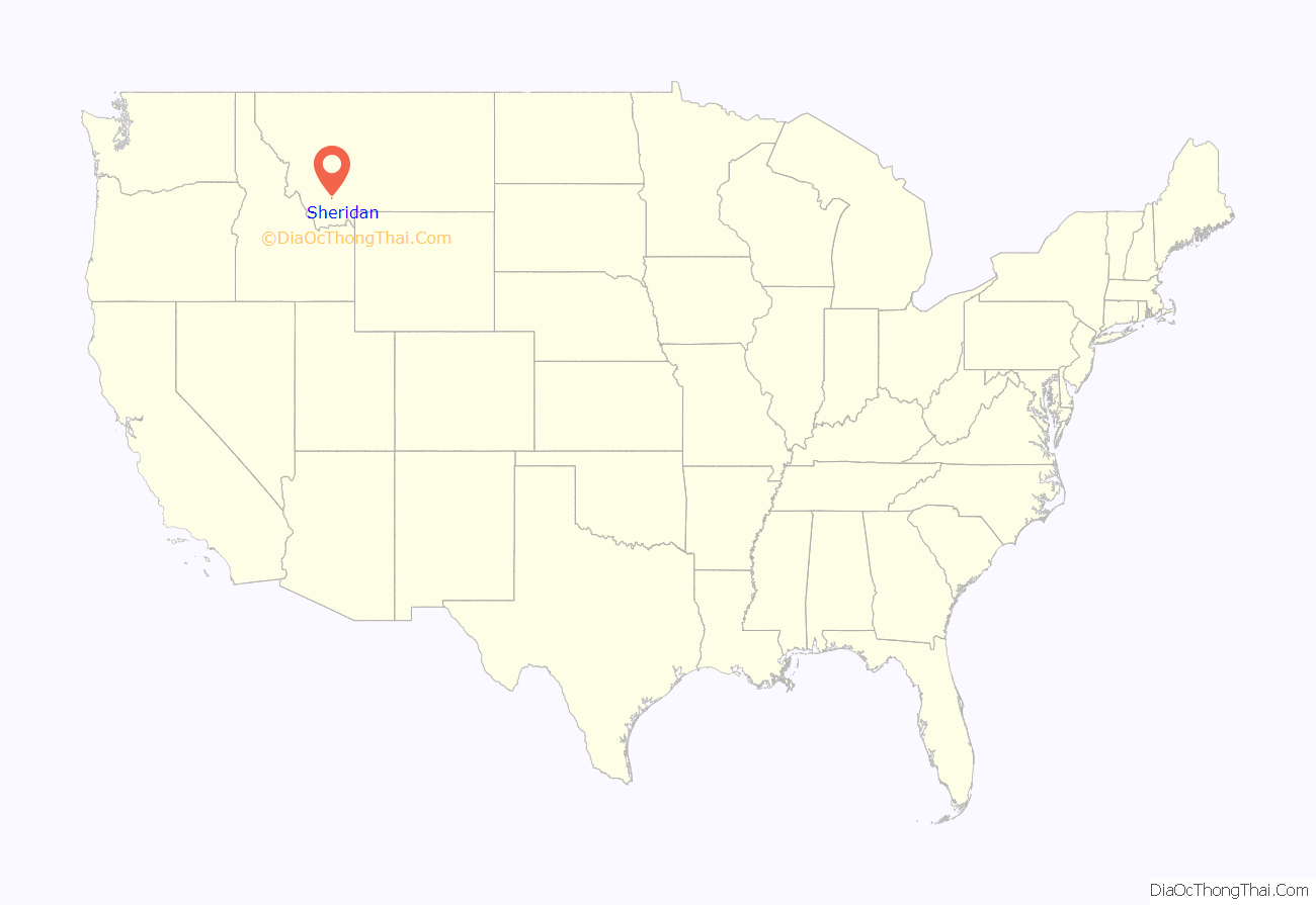
Sheridan location map. Where is Sheridan town?
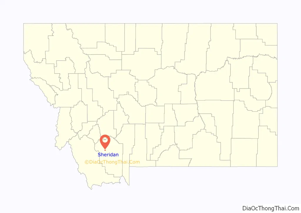
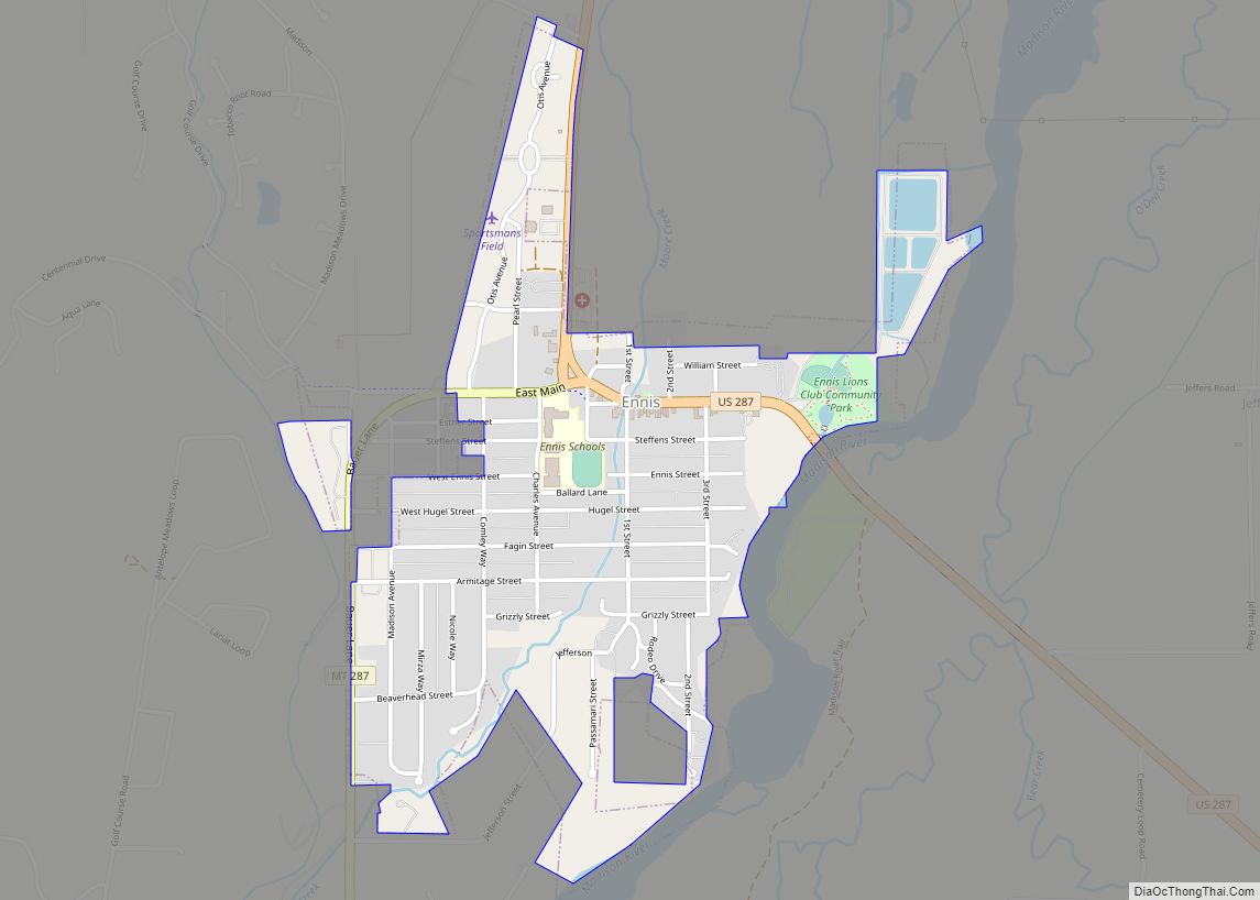
Sheridan Road Map
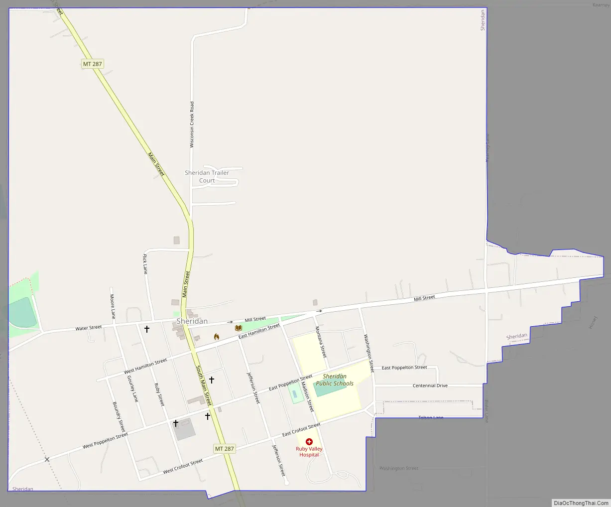
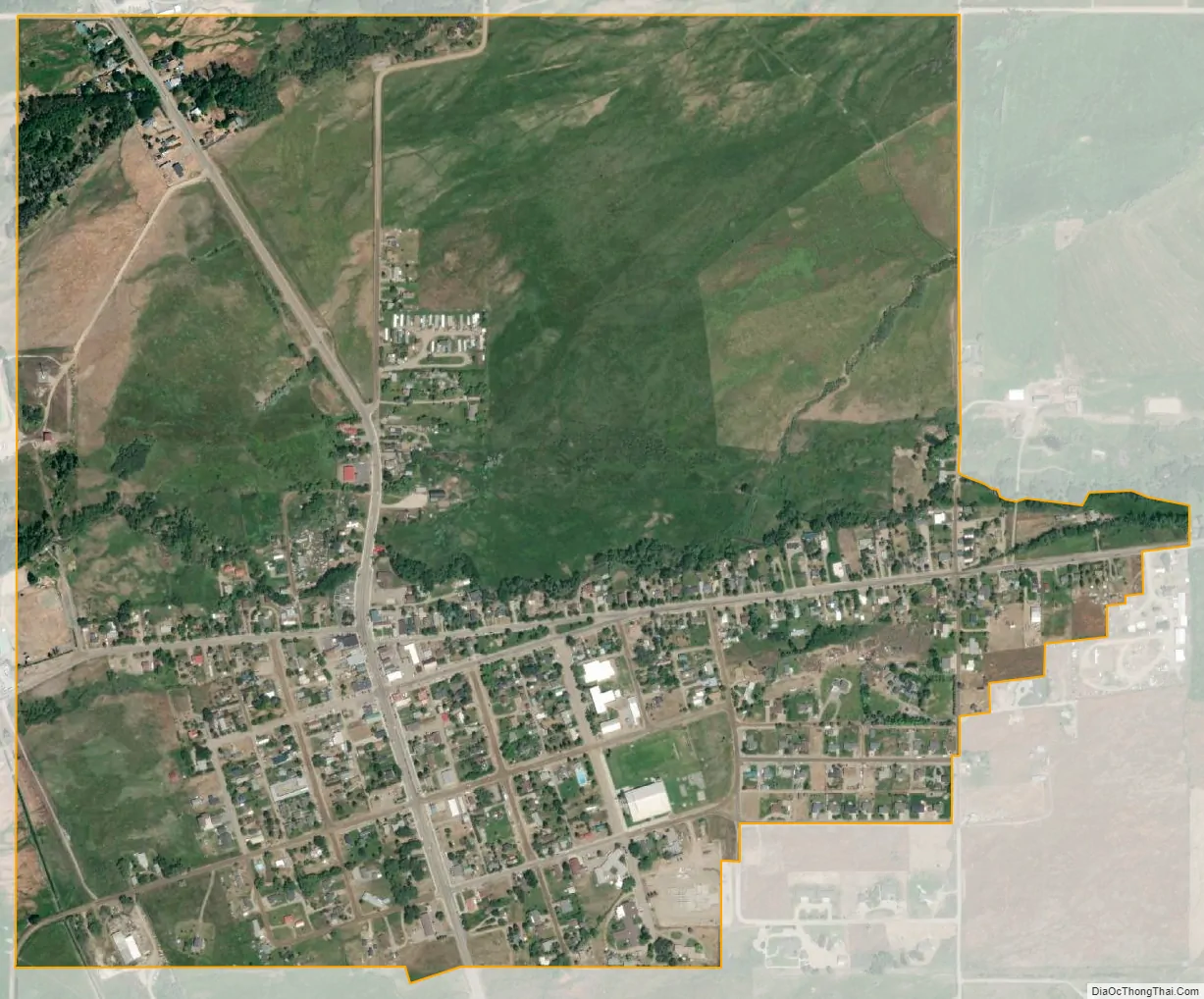
Sheridan city Satellite Map
Geography
Sheridan is located at 45°27′22″N 112°11′45″W / 45.45611°N 112.19583°W / 45.45611; -112.19583 (45.456173, -112.195793). Montana Highway 287 passes through town.
According to the United States Census Bureau, the town has a total area of 1.02 square miles (2.64 km), all land.
Climate
According to the Köppen Climate Classification system, Sheridan has a semi-arid climate, abbreviated “BSk” on climate maps.
See also
Map of Montana State and its subdivision:- Beaverhead
- Big Horn
- Blaine
- Broadwater
- Carbon
- Carter
- Cascade
- Chouteau
- Custer
- Daniels
- Dawson
- Deer Lodge
- Fallon
- Fergus
- Flathead
- Gallatin
- Garfield
- Glacier
- Golden Valley
- Granite
- Hill
- Jefferson
- Judith Basin
- Lake
- Lewis and Clark
- Liberty
- Lincoln
- Madison
- McCone
- Meagher
- Mineral
- Missoula
- Musselshell
- Park
- Petroleum
- Phillips
- Pondera
- Powder River
- Powell
- Prairie
- Ravalli
- Richland
- Roosevelt
- Rosebud
- Sanders
- Sheridan
- Silver Bow
- Stillwater
- Sweet Grass
- Teton
- Toole
- Treasure
- Valley
- Wheatland
- Wibaux
- Yellowstone
- Alabama
- Alaska
- Arizona
- Arkansas
- California
- Colorado
- Connecticut
- Delaware
- District of Columbia
- Florida
- Georgia
- Hawaii
- Idaho
- Illinois
- Indiana
- Iowa
- Kansas
- Kentucky
- Louisiana
- Maine
- Maryland
- Massachusetts
- Michigan
- Minnesota
- Mississippi
- Missouri
- Montana
- Nebraska
- Nevada
- New Hampshire
- New Jersey
- New Mexico
- New York
- North Carolina
- North Dakota
- Ohio
- Oklahoma
- Oregon
- Pennsylvania
- Rhode Island
- South Carolina
- South Dakota
- Tennessee
- Texas
- Utah
- Vermont
- Virginia
- Washington
- West Virginia
- Wisconsin
- Wyoming