Ennis is a town in Madison County, Montana, United States, in the southwestern part of the state. The population was 917 at the 2020 census.
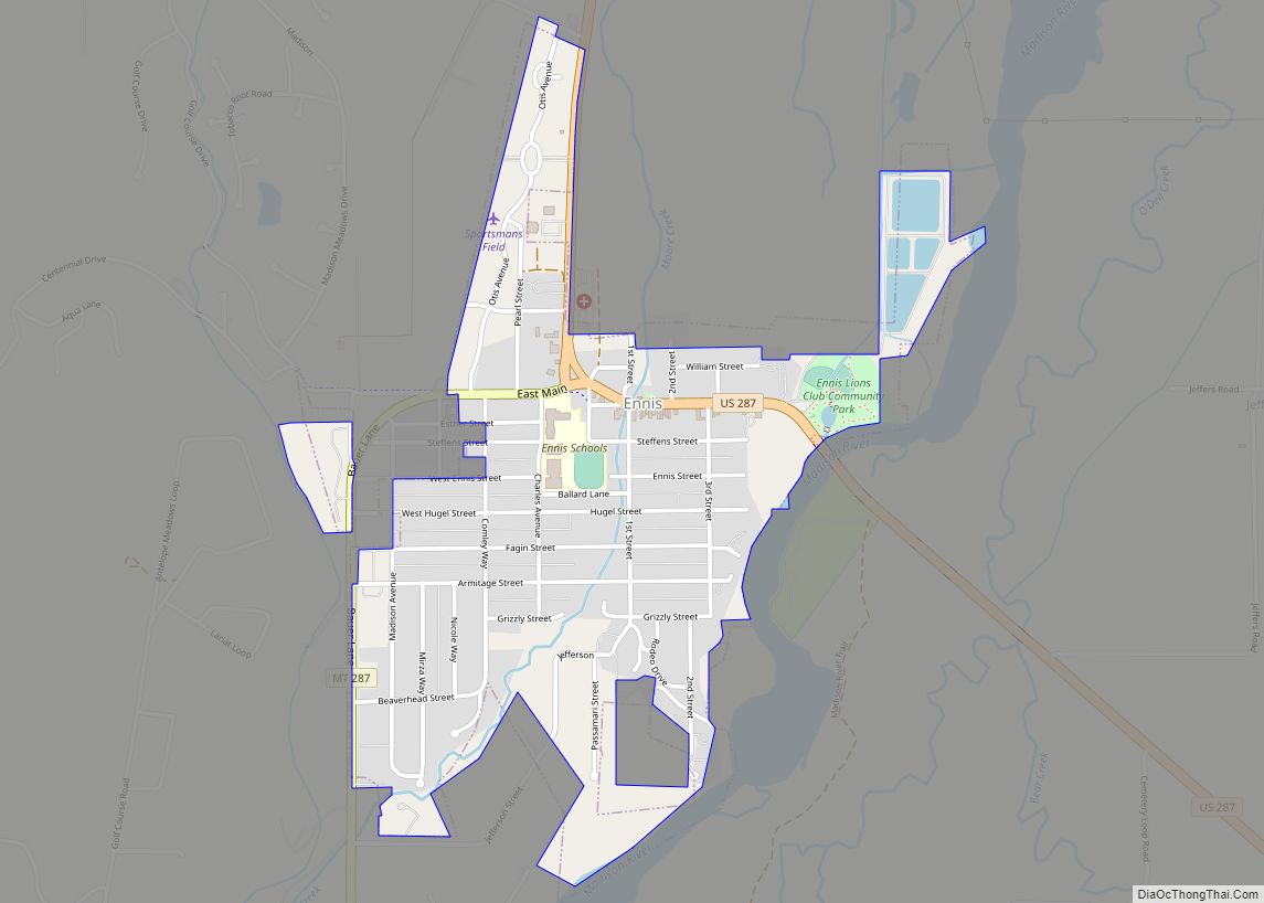
U.S. Route 287 runs through town, following the Madison River as it descends from the town of West Yellowstone.
| Name: | Ennis town |
|---|---|
| LSAD Code: | 43 |
| LSAD Description: | town (suffix) |
| State: | Montana |
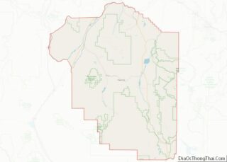
| County: | Madison County |
| Elevation: | 4,941 ft (1,506 m) |
| Total Area: | 0.74 sq mi (1.92 km²) |
| Land Area: | 0.74 sq mi (1.91 km²) |
| Water Area: | 0.00 sq mi (0.00 km²) |
| Total Population: | 917 |
| Population Density: | 1,242.55/sq mi (479.52/km²) |
| ZIP code: | 59729 |
| Area code: | 406 |
| FIPS code: | 3024475 |
| GNISfeature ID: | 783212 |
| Website: | www.ennismontana.org |
Online Interactive Map
Click on ![]() to view map in "full screen" mode.
to view map in "full screen" mode.
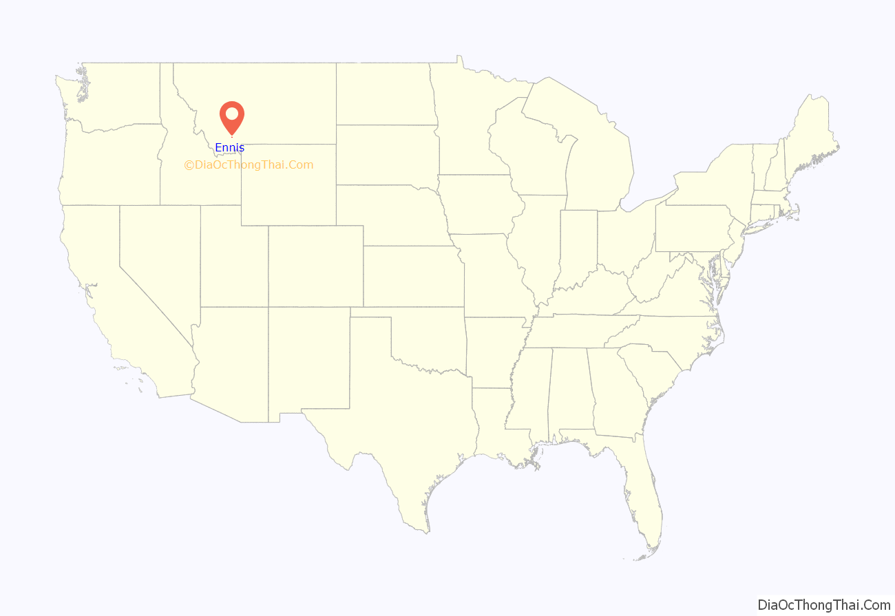
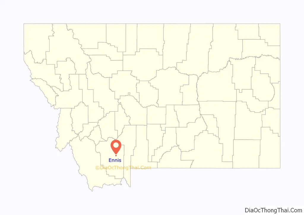
Ennis location map. Where is Ennis town?
History
In 1863, gold was discovered in Alder Gulch. This brought on “the rush.” Two months later, William Ennis homesteaded the site along the Madison River that was soon to become the town of Ennis, his namesake.
In 1886, a mystery creature was noted for making livestock kills in the Madison Valley. A local rancher, Israel Ammon Hutchins, finally shot and killed the beast, after accidentally shooting one of his cattle, which was on the other side of some brush. A local taxidermist stuffed the canine. Jack Kirby (Hutchins’ Grandson) tracked the mount to a Museum in Pocatello, Idaho, circa 2007.
Avid Aircraft, a manufacturer of homebuilt aircraft, was located in Ennis. The company ceased operations in 2003.
The 2003 Ennis shootings took place on June 14 of that year, when 44-year-old George Harold Davis opened fire outside the Silver Dollar Saloon bar on Main Street. He killed one man and injured six others. He then fled to Missoula County, where he was finally stopped and arrested by police. He was sentenced to eleven life terms for the crime.
The Thexton Ranch is located approximately 7 miles (11 km) south of Ennis, and is listed on the National Register of Historic Places.
Ennis Road Map
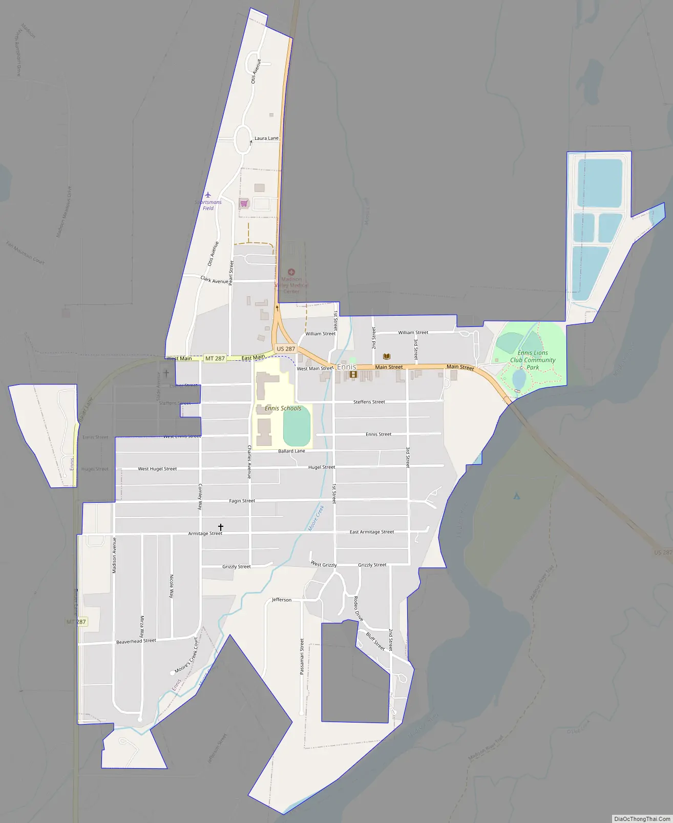
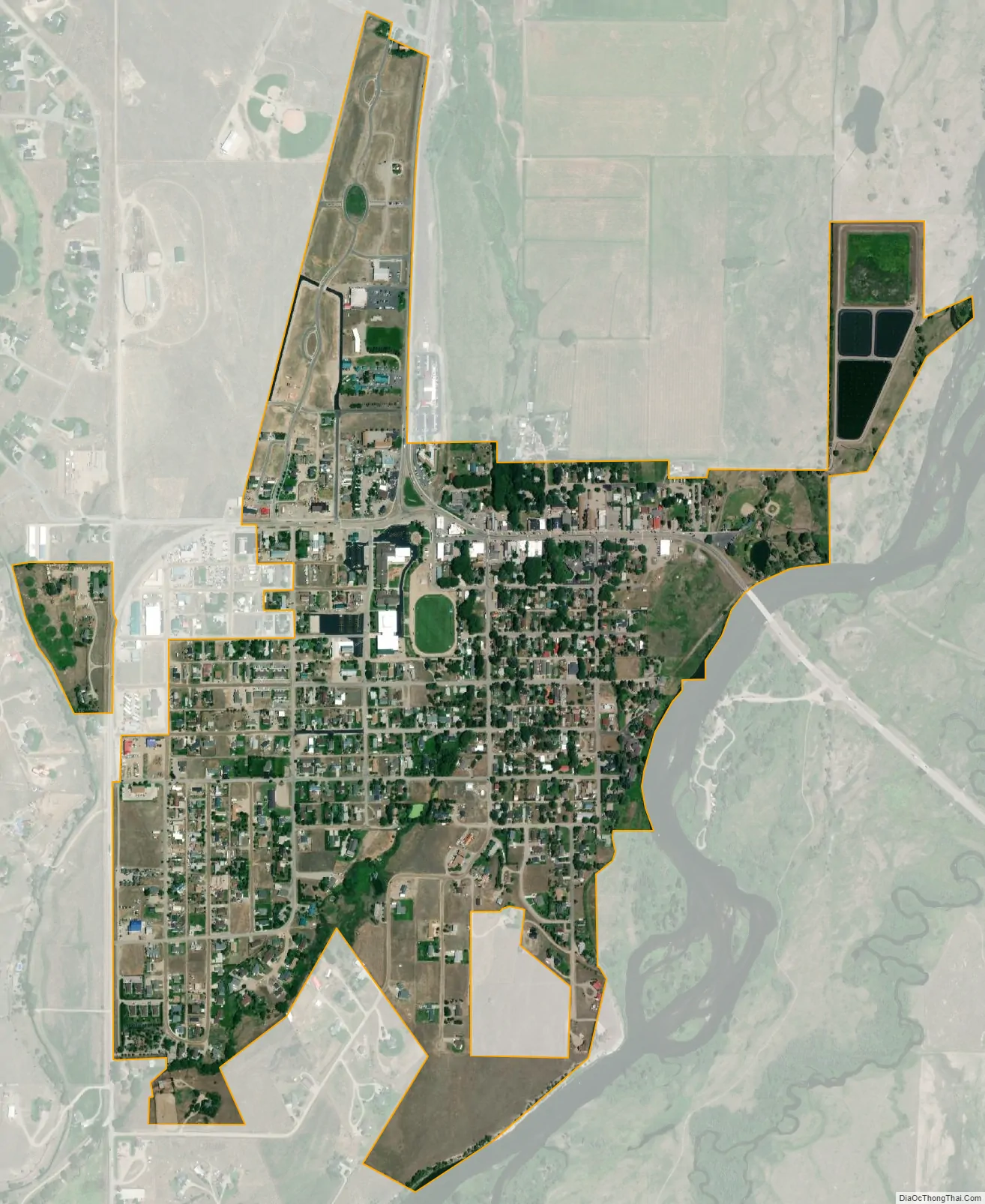
Ennis city Satellite Map
Geography
The town is flanked by Tobacco Root Mountains to the northwest, the Gravelly Range to the southwest and the Madison Range to the east. Approximately 12 miles (19 km) north of town, the Madison Dam creates Ennis Lake at the head of Bear Trap Canyon. A large “E” has been placed in a hill west of the town at this location: 45°21′02″N 111°44′52″W / 45.3505°N 111.7478°W / 45.3505; -111.7478 (Ennis)
According to the United States Census Bureau, the town has a total area of 0.79 square miles (2.05 km), of which 0.78 square miles (2.02 km) is land and 0.01 square miles (0.03 km) is water.
Climate
According to the Köppen Climate Classification system, Ennis has a warm-summer humid continental climate, abbreviated Dfb” on climate maps.
See also
Map of Montana State and its subdivision:- Beaverhead
- Big Horn
- Blaine
- Broadwater
- Carbon
- Carter
- Cascade
- Chouteau
- Custer
- Daniels
- Dawson
- Deer Lodge
- Fallon
- Fergus
- Flathead
- Gallatin
- Garfield
- Glacier
- Golden Valley
- Granite
- Hill
- Jefferson
- Judith Basin
- Lake
- Lewis and Clark
- Liberty
- Lincoln
- Madison
- McCone
- Meagher
- Mineral
- Missoula
- Musselshell
- Park
- Petroleum
- Phillips
- Pondera
- Powder River
- Powell
- Prairie
- Ravalli
- Richland
- Roosevelt
- Rosebud
- Sanders
- Sheridan
- Silver Bow
- Stillwater
- Sweet Grass
- Teton
- Toole
- Treasure
- Valley
- Wheatland
- Wibaux
- Yellowstone
- Alabama
- Alaska
- Arizona
- Arkansas
- California
- Colorado
- Connecticut
- Delaware
- District of Columbia
- Florida
- Georgia
- Hawaii
- Idaho
- Illinois
- Indiana
- Iowa
- Kansas
- Kentucky
- Louisiana
- Maine
- Maryland
- Massachusetts
- Michigan
- Minnesota
- Mississippi
- Missouri
- Montana
- Nebraska
- Nevada
- New Hampshire
- New Jersey
- New Mexico
- New York
- North Carolina
- North Dakota
- Ohio
- Oklahoma
- Oregon
- Pennsylvania
- Rhode Island
- South Carolina
- South Dakota
- Tennessee
- Texas
- Utah
- Vermont
- Virginia
- Washington
- West Virginia
- Wisconsin
- Wyoming