Sunburst is a town in Toole County, Montana, United States. The population was 333 in the 2020 census.
It is roughly 30 miles north of Shelby and is near the Canada–US border.
| Name: | Sunburst town |
|---|---|
| LSAD Code: | 43 |
| LSAD Description: | town (suffix) |
| State: | Montana |
| County: | Toole County |
| Elevation: | 3,369 ft (1,027 m) |
| Total Area: | 2.18 sq mi (5.65 km²) |
| Land Area: | 1.92 sq mi (4.97 km²) |
| Water Area: | 0.26 sq mi (0.68 km²) |
| Total Population: | 333 |
| Population Density: | 173.62/sq mi (67.02/km²) |
| ZIP code: | 59482 |
| Area code: | 406 |
| FIPS code: | 3072175 |
| GNISfeature ID: | 0777316 |
Online Interactive Map
Click on ![]() to view map in "full screen" mode.
to view map in "full screen" mode.
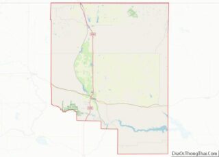
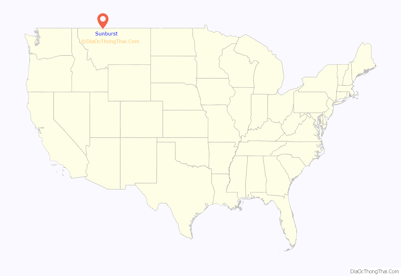
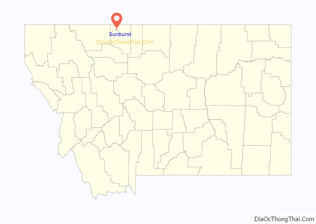
Sunburst location map. Where is Sunburst town?
History
Sunburst has its origins as a farming community and later saw significant population growth after oil development occurred in the 1920s. A refinery was built in 1922 with the discovery of oil in the Kevin Sunburst Oil Field. Since oil development in the area ceased in the 1970s, Sunburst has once again become a primarily agricultural town. The local high school gives homage to its past, as its students are known as the Sunburst Refiners. Its name comes from what is considered a dramatic sunrise that occurs when the sun comes over the Sweetgrass Hills and illuminates the local fields.
Sunburst incorporated in 1924.
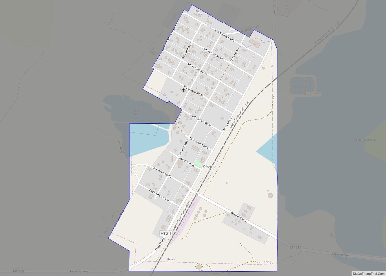
Sunburst Road Map
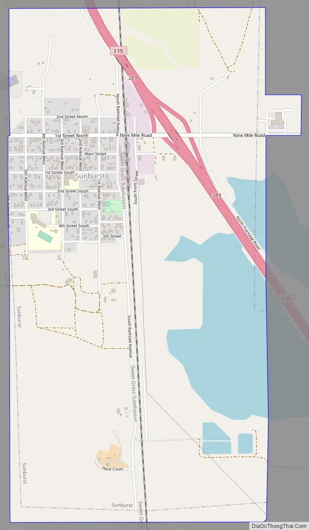
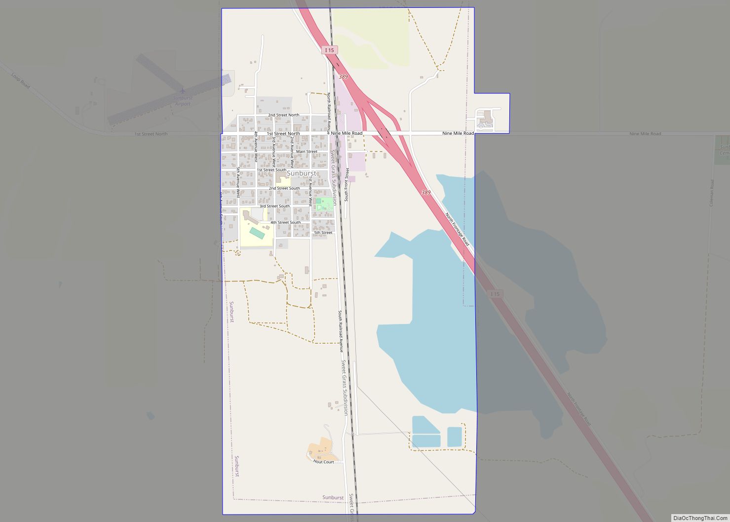
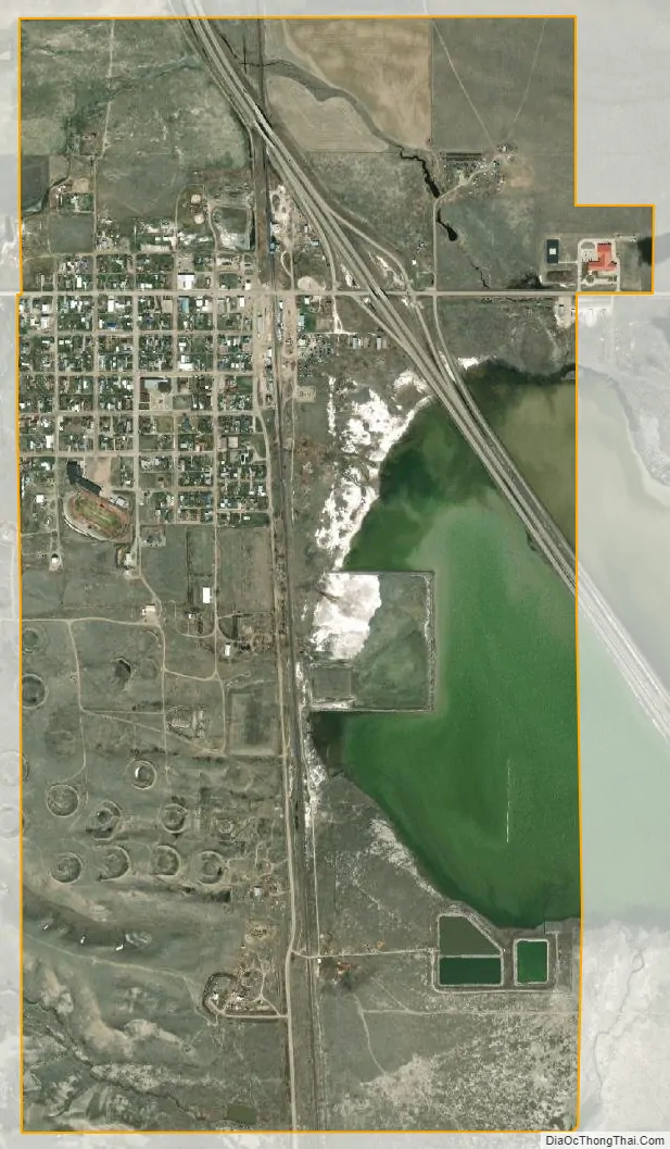
Sunburst city Satellite Map
Geography
Sunburst is located at 48°53′0″N 111°54′32″W / 48.88333°N 111.90889°W / 48.88333; -111.90889 (48.883255, -111.908754). Interstate 15 passes through the community, with access from Exit 389. The Long Lake Waterfowl Production Area is nearby.
According to the United States Census Bureau, the town has a total area of 1.99 square miles (5.15 km), of which 1.75 square miles (4.53 km) is land and 0.24 square miles (0.62 km) is water.
Climate
According to the Köppen Climate Classification system, Sunburst has a semi-arid climate, abbreviated “BSk” on climate maps.
See also
Map of Montana State and its subdivision:- Beaverhead
- Big Horn
- Blaine
- Broadwater
- Carbon
- Carter
- Cascade
- Chouteau
- Custer
- Daniels
- Dawson
- Deer Lodge
- Fallon
- Fergus
- Flathead
- Gallatin
- Garfield
- Glacier
- Golden Valley
- Granite
- Hill
- Jefferson
- Judith Basin
- Lake
- Lewis and Clark
- Liberty
- Lincoln
- Madison
- McCone
- Meagher
- Mineral
- Missoula
- Musselshell
- Park
- Petroleum
- Phillips
- Pondera
- Powder River
- Powell
- Prairie
- Ravalli
- Richland
- Roosevelt
- Rosebud
- Sanders
- Sheridan
- Silver Bow
- Stillwater
- Sweet Grass
- Teton
- Toole
- Treasure
- Valley
- Wheatland
- Wibaux
- Yellowstone
- Alabama
- Alaska
- Arizona
- Arkansas
- California
- Colorado
- Connecticut
- Delaware
- District of Columbia
- Florida
- Georgia
- Hawaii
- Idaho
- Illinois
- Indiana
- Iowa
- Kansas
- Kentucky
- Louisiana
- Maine
- Maryland
- Massachusetts
- Michigan
- Minnesota
- Mississippi
- Missouri
- Montana
- Nebraska
- Nevada
- New Hampshire
- New Jersey
- New Mexico
- New York
- North Carolina
- North Dakota
- Ohio
- Oklahoma
- Oregon
- Pennsylvania
- Rhode Island
- South Carolina
- South Dakota
- Tennessee
- Texas
- Utah
- Vermont
- Virginia
- Washington
- West Virginia
- Wisconsin
- Wyoming