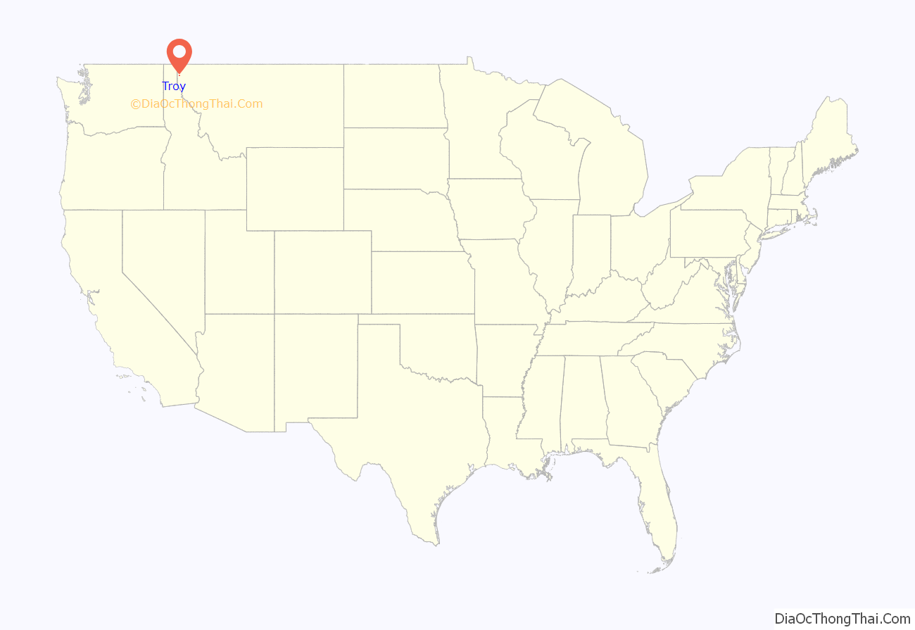
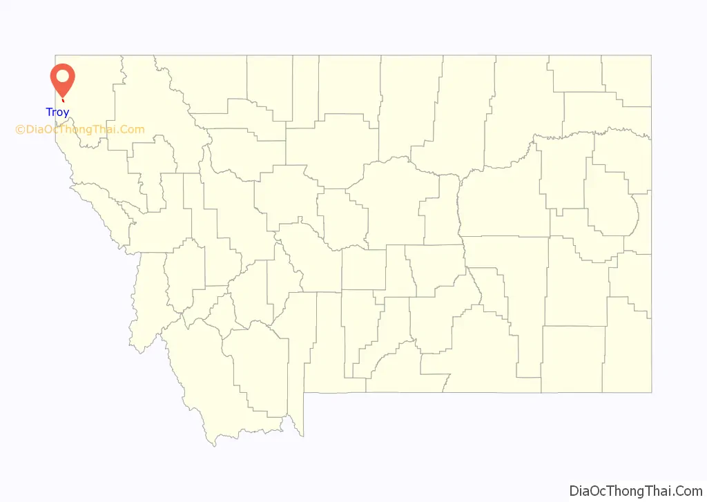
Troy is a city in Lincoln County, Montana, United States. The population was 797 at the 2020 census. It lies at the lowest elevation of any settlement in Montana. The town is on U.S. Route 2, near Montana Highway 56, in the Kootenai River gorge by the Kootenai National Forest.
Originally inhabited by the Kutenai, Salish, and Piegan Blackfeet tribes, the area was settled by miners in the 1880s. Troy was registered as a town in 1892 and grew quickly after the Great Northern Railway built a freight station there, leading to a boom in workers, miners, their families, and associates. The area narrowly missed wildfire damage in 1910 and expanded its services throughout the following years, though its population would drop due to a series of misfortunes in the late 1920s before rebounding in the following decades. Troy suffered from the area’s contamination from nearby vermiculite mines contaminated with particularly fragile asbestos, leading to the town’s inclusion in the United States Environmental Protection Agency’s (EPA) National Priorities List status in 2002 and Public Health Emergency event in 2009. According to the EPA, most risk was reduced by 2015.
Troy is on U.S. Route 2, between Yaak and Libby. Montana Highway 56 is three miles southeast and the Troy Airport is two miles northwest. The town’s economy has historically been supported by mining and logging, while in recent times, mining has remained, with the addition of education, retail, and tourism. Local natural features such as the Kootenai Falls have attracted tourism to the area and have been featured in movies such as The River Wild (1994) and The Revenant (2015). There is a public school district (which created ceramic ornaments used to decorate the National Christmas Tree in 2017) and a public library, and the town is in-district for Flathead Valley Community College.
| Name: | Troy city |
|---|---|
| LSAD Code: | 25 |
| LSAD Description: | city (suffix) |
| State: | Montana |
| County: | Lincoln County |
| Elevation: | 1,800 ft (500 m) |
| Total Area: | 0.85 sq mi (2.20 km²) |
| Land Area: | 0.85 sq mi (2.19 km²) |
| Water Area: | 0.01 sq mi (0.01 km²) |
| Total Population: | 797 |
| Population Density: | 942.08/sq mi (363.57/km²) |
| ZIP code: | 59935 |
| Area code: | 406 |
| FIPS code: | 3075025 |
| GNISfeature ID: | 0792409 |
| Website: | cityoftroymontana.com |
Online Interactive Map
Click on ![]() to view map in "full screen" mode.
to view map in "full screen" mode.
Troy location map. Where is Troy city?
History
Before the westward expansion of the United States, various indigenous peoples lived in the area, with the Kutenai and Salish as the most recent and the Piegan Blackfeet earlier. They lived in base camps and seasonal camps based on the availability of plants and fish: “lower elevations in the winter and … uplands in the summer and fall,” with spring camps near camas prairies, which had edible bulbs. Due to the area’s geography and settler fears of the Kutenai, the area remained unsettled until gold was discovered in the 1860s and galena and vermiculite in the 1880s. In 1886, the first miners arrived, prospecting on the Kootenai River at a tent camp first known as “Lake Camp, Lake Creek Camp, and Lake City”, and making land claims on Grouse Mountain. In 1892, a William O’Brien surveyed the Lake City claim, renaming it Troy.
Post American settlement
Throughout 1892, Troy was filed as a town in then-Missoula County and grew rapidly as the Great Northern Railway chose a nearby site as a “division yard”, or freight terminal, which was first renamed “West Troy” before just becoming Troy itself as the Lake City area was abandoned. The town’s first hotel, then called the Windsor Hotel, was built. One transplant described the town as such: “Fifteen saloons gaily lit filled to the doors with “wild men and wild women” yelling, singing, dancing, and cursing, with glasses held high, such was Troy. Two large dance halls were in evidence, one grocery store run by John Bowen, several ‘beaneries’ (called restaurants by some), one drug store owned by ‘Doc’ Sailey and many shacks and tents where the ‘wild women’ congregated. Fights and ribaldry were the order of the days and nights.” Another grocery store followed in 1893, the first one-room schoolhouse was built in 1894, and more mining companies, land claims, and support services such as ferries sprung up as gold was discovered on the Yaak River in 1895.
The 1910s brought change. After the Windsor Hotel had been destroyed by fire in 1906 and rebuilt in 1907, wildfires during the summer of 1910 narrowly missed Troy by a few miles but raged throughout the area, causing lasting damage to the newly-protected Kootenai National Forest. In 1912, Troy’s first bridge across the Kootenai River was built, along with bridges in Libby and Rexford, after a county vote. Previously, crossings were made on horseback – dangerous – or via ferries, which had started operating in 1892. Phone service reached the area in 1913. U.S. Route 2 was proposed and a volunteer fire department was created. The 1918 flu closed the local mill and schools temporarily. By 1920, there was a Chinese restaurant, a church, and an electric plant in town, and World War I increased the town’s mining activity; the rapid expansion and labor conditions sometimes led to strikes and labor conflicts.
The town’s population reached 1000 residents in 1924, and the same year, the town’s Lincoln Theatre opened. The population peaked around 1926, but in March of that year, the Great Northern Railway moved its freight terminal elsewhere, leaving “only three supervisors and [a] small force of Japanese [workers].” Fires destroyed a concentrator in 1927 and a sawmill in 1928, with neither rebuilt, and the region’s mines decreased in activity.
The population dropped to as low as 428 during 1930 in the Great Depression. Still, the Lincoln Theatre began playing talking movies and the Windsor Hotel was renamed to the Great Northern Hotel, which stood until it burned down (for the second time) in 1941. A coffee house and cable shop operate on its former location. The Lincoln Theatre was remodeled in 1994.
In 2006, the Troy Jail and the Theodore Roosevelt Memorial Bridge were added to the National Register of Historic Places.
Vermiculite cleanup
After citizens, media, and local government raised concerns, the United States Environmental Protection Agency began in 1999 to investigate the contamination of the area surrounding Libby and Troy from vermiculite mines in Libby, which were themselves contaminated with a toxic and easily crumbled form of tremolite-actinolite series asbestos, sometimes named Libby Amphibole asbestos (LA). Removal actions began in 2000, and in 2002 the site was moved to the EPA’s Superfund National Priorities List. In 2009, the EPA declared a Public Health Emergency (the first in the EPA’s history) “to provide federal health care assistance for victims of asbestos-related disease.”
In 2015, an EPA review of toxicity and risks found that the cleanups had managed asbestos exposure risk effectively. By the end of 2018, the EPA had removed “more than one million cubic yards of contaminated soil,” and area cleanup was completed that year, except for the location of the former mine, which is the disposal site of the contaminated soil. Contaminated construction materials were disposed of “in a specially designed landfill cell.” The remaining contamination is limited to the forests and property in or near the former mine, with cleanup plans pending and with controls for higher exposures during wildfire fighting.
The EPA transferred control of the site to the Montana Department of Environmental Quality in 2020.
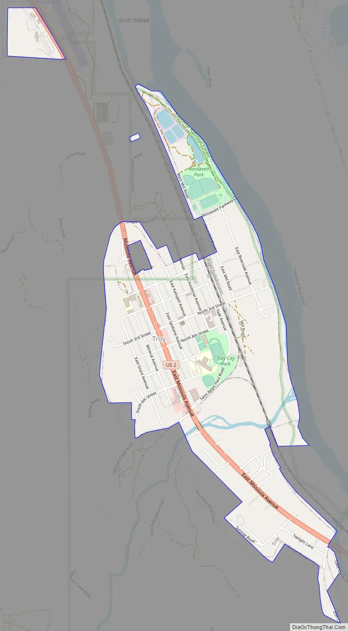
Troy Road Map
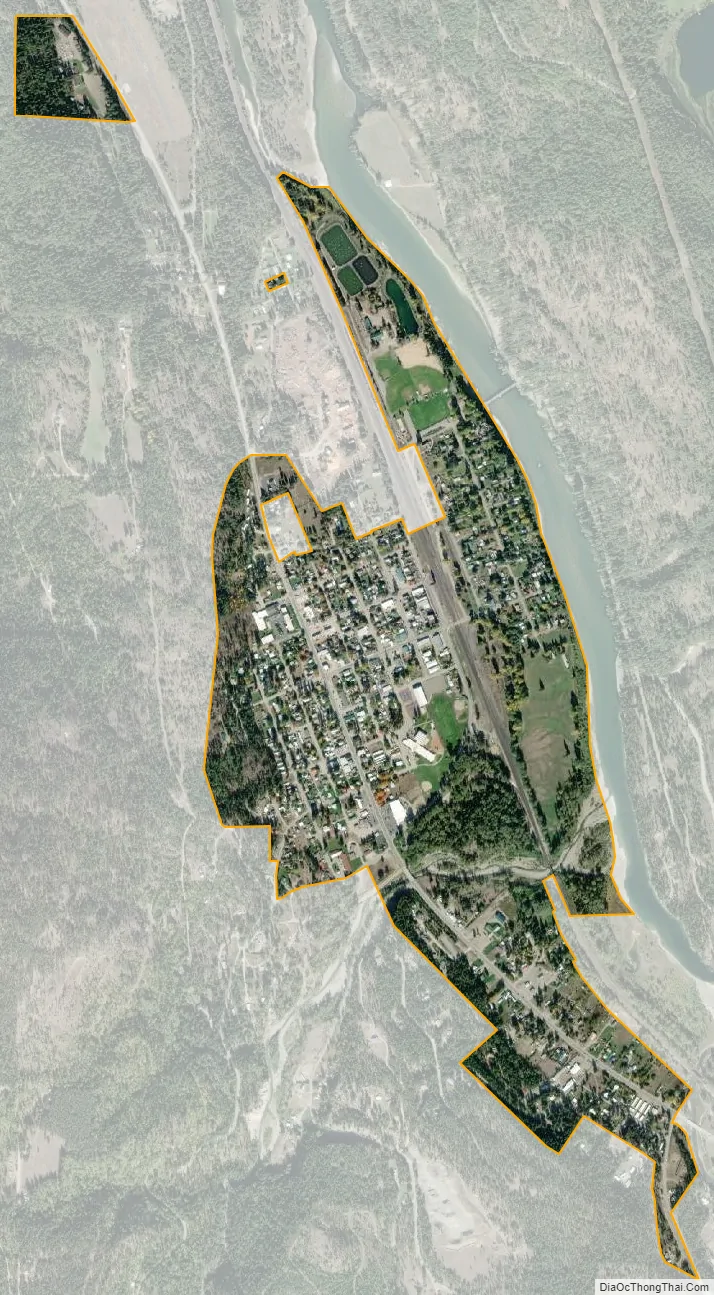
Troy city Satellite Map
Geography
Troy lies in a valley along the Kootenai River between the Purcell Mountains to the northeast and the Cabinet Mountains to the southwest.
According to the United States Census Bureau, the city has a total area of 0.78 square miles (2.02 km), of which 0.76 square miles (1.97 km) is land and 0.02 square miles (0.05 km) is water. Troy has an elevation of approximately 1,800 feet (550 m) above sea level and is the lowest town in elevation in Montana. Troy is 12 miles (19 km) from the border of Montana and Idaho. Troy’s next closest city is Libby, which is 18 miles (29 km) away.
The Troy Mine, which produced silver and copper, was scheduled for closure in February 2015.
An early worker described the original flora of the city site as “a carpet of velvety green grass, thickly studded with wild flowers of most every hue and color.” There are groves of ancient western red cedars nearby, some up to 12 feet (3.7 m) in diameter, which are a home for species of wildlife including pikas and flying squirrels.
Troy is located in the Kootenai River Gorge, which is geologically composed of “sandstone and thin layers of shale, with folds from compression that dates back 50 to 100 million years ago. The rock was deposited 1.5 million years ago, when much of Montana was covered by water. Ancient ripple marks and large stromatolites (the remains of algae mats) are visible in the canyon.”
Climate
This climatic region is typified by large seasonal temperature differences, with warm to hot (and often humid) summers and cold (sometimes severely cold) winters. According to the Köppen Climate Classification system, Troy has a humid continental climate, abbreviated “Dsb” on climate maps. Troy’s annual mean temperature is 46.4 °F (8.0 °C) and its annual mean precipitation is 24.6 inches (620 mm). Flooding is an issue for the area.
See also
Map of Montana State and its subdivision:- Beaverhead
- Big Horn
- Blaine
- Broadwater
- Carbon
- Carter
- Cascade
- Chouteau
- Custer
- Daniels
- Dawson
- Deer Lodge
- Fallon
- Fergus
- Flathead
- Gallatin
- Garfield
- Glacier
- Golden Valley
- Granite
- Hill
- Jefferson
- Judith Basin
- Lake
- Lewis and Clark
- Liberty
- Lincoln
- Madison
- McCone
- Meagher
- Mineral
- Missoula
- Musselshell
- Park
- Petroleum
- Phillips
- Pondera
- Powder River
- Powell
- Prairie
- Ravalli
- Richland
- Roosevelt
- Rosebud
- Sanders
- Sheridan
- Silver Bow
- Stillwater
- Sweet Grass
- Teton
- Toole
- Treasure
- Valley
- Wheatland
- Wibaux
- Yellowstone
- Alabama
- Alaska
- Arizona
- Arkansas
- California
- Colorado
- Connecticut
- Delaware
- District of Columbia
- Florida
- Georgia
- Hawaii
- Idaho
- Illinois
- Indiana
- Iowa
- Kansas
- Kentucky
- Louisiana
- Maine
- Maryland
- Massachusetts
- Michigan
- Minnesota
- Mississippi
- Missouri
- Montana
- Nebraska
- Nevada
- New Hampshire
- New Jersey
- New Mexico
- New York
- North Carolina
- North Dakota
- Ohio
- Oklahoma
- Oregon
- Pennsylvania
- Rhode Island
- South Carolina
- South Dakota
- Tennessee
- Texas
- Utah
- Vermont
- Virginia
- Washington
- West Virginia
- Wisconsin
- Wyoming


