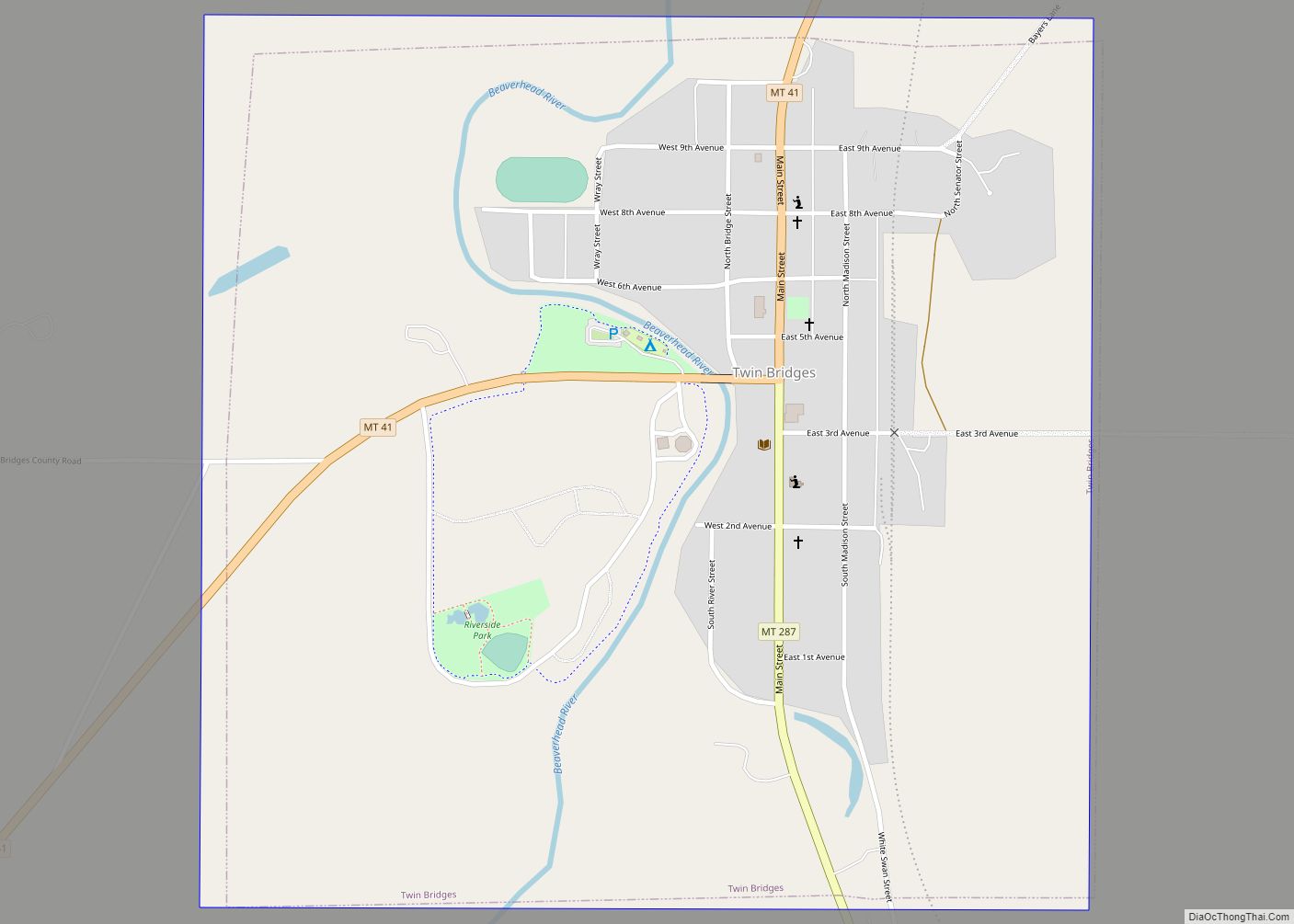
Twin Bridges is a town in Madison County, Montana, United States. It lies at the confluence of the Ruby, Beaverhead and Big Hole Rivers which form the Jefferson River. Twin Bridges is a well-known fly fishing mecca for trout anglers. The population was 330 at the 2020 census.
| Name: | Twin Bridges town |
|---|---|
| LSAD Code: | 43 |
| LSAD Description: | town (suffix) |
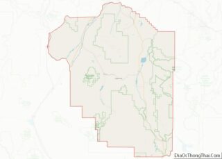
| State: | Montana |
| County: | Madison County |
| Elevation: | 4,626 ft (1,410 m) |
| Total Area: | 1.01 sq mi (2.63 km²) |
| Land Area: | 1.01 sq mi (2.63 km²) |
| Water Area: | 0.00 sq mi (0.00 km²) |
| Total Population: | 330 |
| Population Density: | 325.44/sq mi (125.61/km²) |
| ZIP code: | 59754 |
| Area code: | 406 |
| FIPS code: | 3075475 |
| GNISfeature ID: | 0792499 |
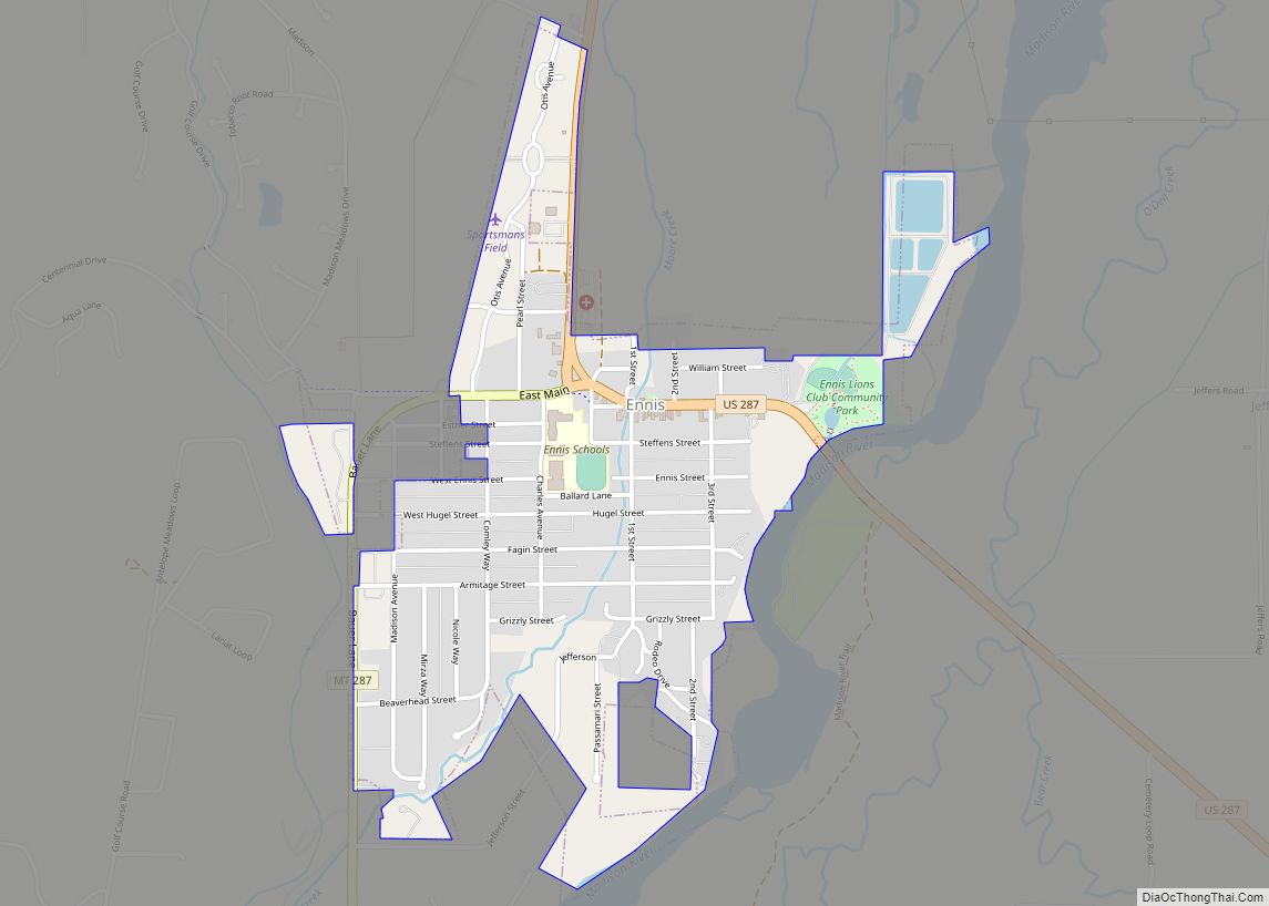
Online Interactive Map
Click on ![]() to view map in "full screen" mode.
to view map in "full screen" mode.
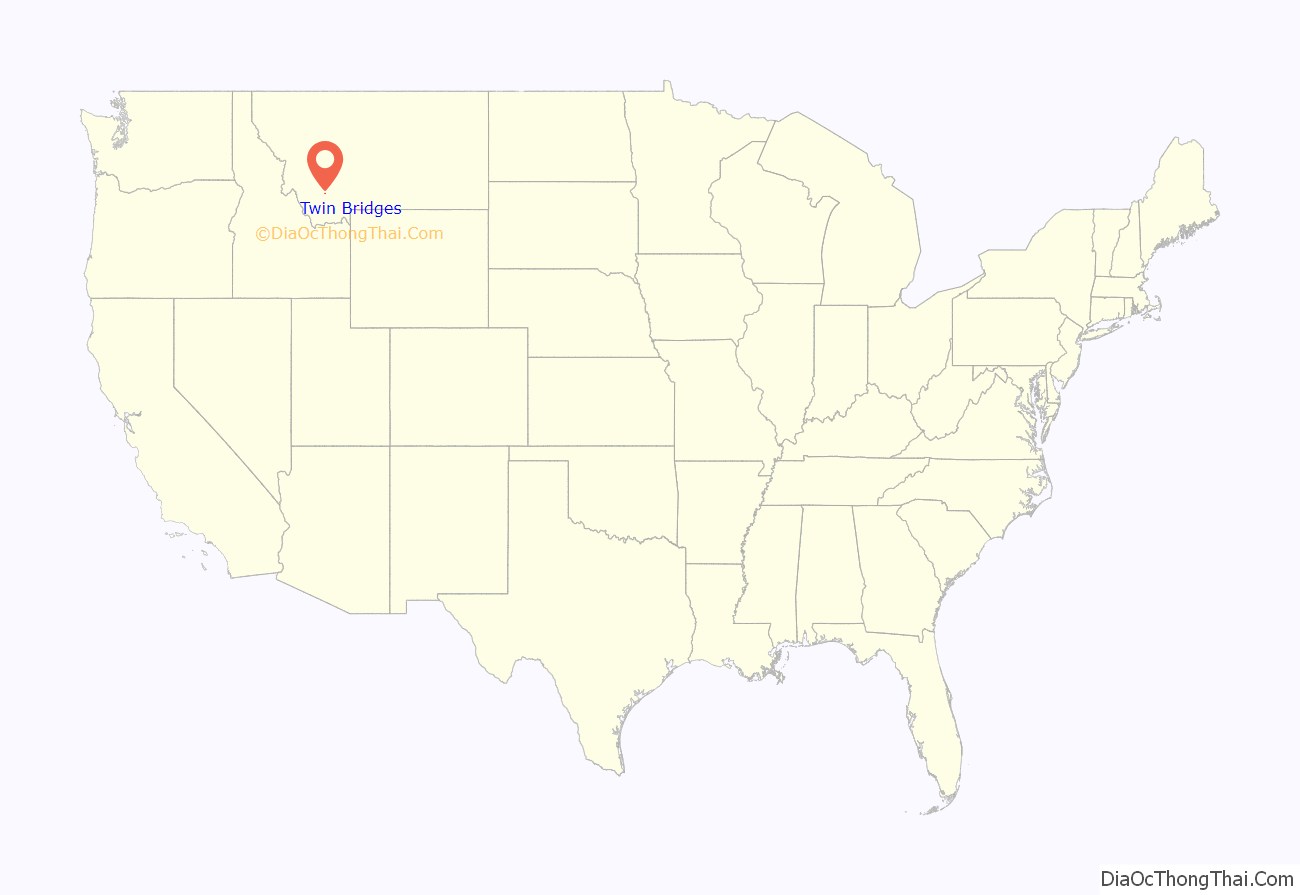
Twin Bridges location map. Where is Twin Bridges town?
History
Four Indian trails came together at a bend of the Beaverhead River north of the present school building in Twin Bridges. These trails were used by early settlers and freight companies, and helped to establish where the community of Twin Bridges would develop. Judge M.H. Lott came to Montana in 1862, and with his brother John T. Lott, settled in the Ruby Valley in 1864. In 1865 they built a bridge across the Beaverhead River, and later built another bridge across the Beaverhead at the Point of Rocks. The Lott brothers continued development of roads and promoted settlement of the town, which was incorporated in 1902, with M.H. Lott as the first mayor.
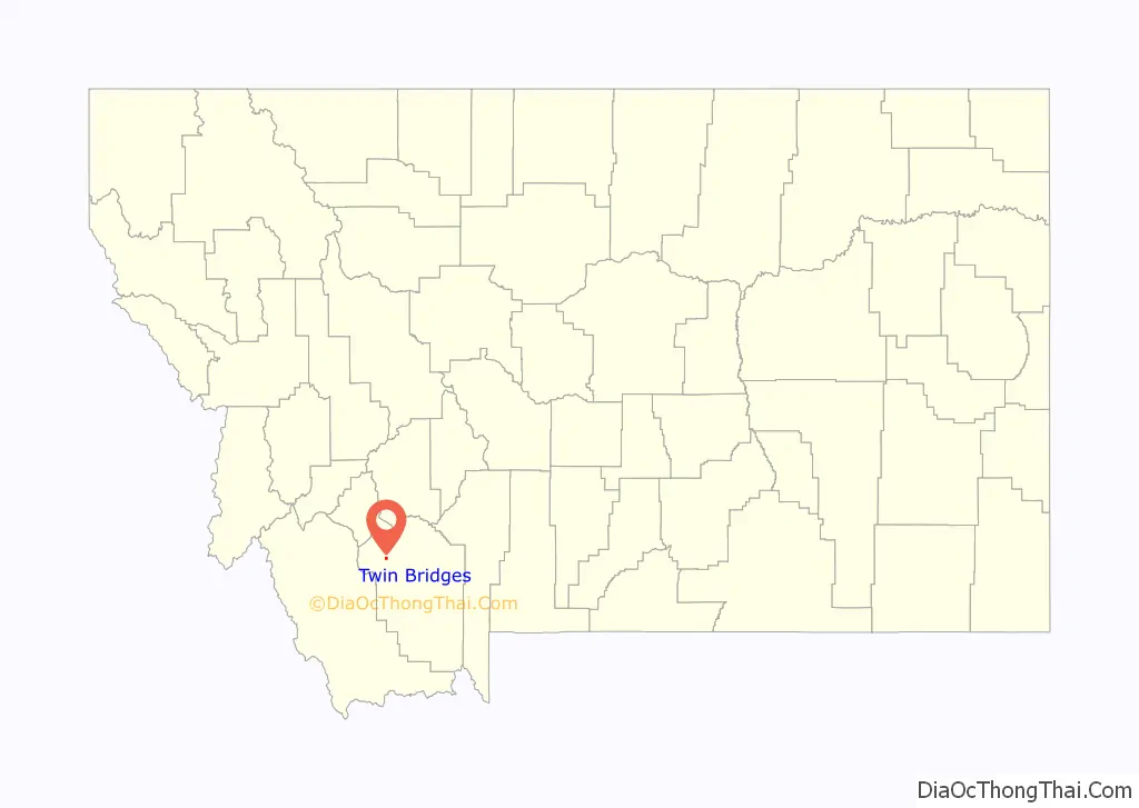
Twin Bridges Road Map
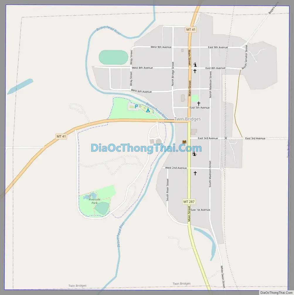
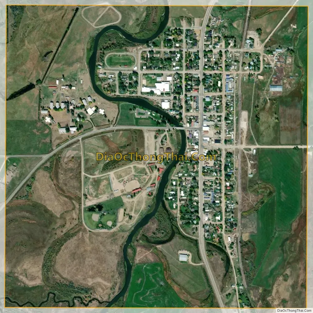
Twin Bridges city Satellite Map
Geography
According to the United States Census Bureau, the town has a total area of 0.96 square miles (2.49 km), all land.
Climate
According to the Köppen Climate Classification system, Twin Bridges has a semi-arid climate, abbreviated “BSk” on climate maps.
See also
Map of Montana State and its subdivision:- Beaverhead
- Big Horn
- Blaine
- Broadwater
- Carbon
- Carter
- Cascade
- Chouteau
- Custer
- Daniels
- Dawson
- Deer Lodge
- Fallon
- Fergus
- Flathead
- Gallatin
- Garfield
- Glacier
- Golden Valley
- Granite
- Hill
- Jefferson
- Judith Basin
- Lake
- Lewis and Clark
- Liberty
- Lincoln
- Madison
- McCone
- Meagher
- Mineral
- Missoula
- Musselshell
- Park
- Petroleum
- Phillips
- Pondera
- Powder River
- Powell
- Prairie
- Ravalli
- Richland
- Roosevelt
- Rosebud
- Sanders
- Sheridan
- Silver Bow
- Stillwater
- Sweet Grass
- Teton
- Toole
- Treasure
- Valley
- Wheatland
- Wibaux
- Yellowstone
- Alabama
- Alaska
- Arizona
- Arkansas
- California
- Colorado
- Connecticut
- Delaware
- District of Columbia
- Florida
- Georgia
- Hawaii
- Idaho
- Illinois
- Indiana
- Iowa
- Kansas
- Kentucky
- Louisiana
- Maine
- Maryland
- Massachusetts
- Michigan
- Minnesota
- Mississippi
- Missouri
- Montana
- Nebraska
- Nevada
- New Hampshire
- New Jersey
- New Mexico
- New York
- North Carolina
- North Dakota
- Ohio
- Oklahoma
- Oregon
- Pennsylvania
- Rhode Island
- South Carolina
- South Dakota
- Tennessee
- Texas
- Utah
- Vermont
- Virginia
- Washington
- West Virginia
- Wisconsin
- Wyoming