Wibaux (/ˈwiːboʊ/ WEE-boh) is a town in and the county seat of Wibaux County, Montana, United States. It is the only incorporated town in Wibaux County. The population was 589 at the 2020 census.
| Name: | Wibaux town |
|---|---|
| LSAD Code: | 43 |
| LSAD Description: | town (suffix) |
| State: | Montana |
| County: | Wibaux County |
| Elevation: | 2,654 ft (809 m) |
| Total Area: | 1.07 sq mi (2.78 km²) |
| Land Area: | 1.07 sq mi (2.78 km²) |
| Water Area: | 0.00 sq mi (0.00 km²) |
| Total Population: | 462 |
| Population Density: | 430.57/sq mi (166.26/km²) |
| ZIP code: | 59353 |
| Area code: | 406 |
| FIPS code: | 3080350 |
| GNISfeature ID: | 0778445 |
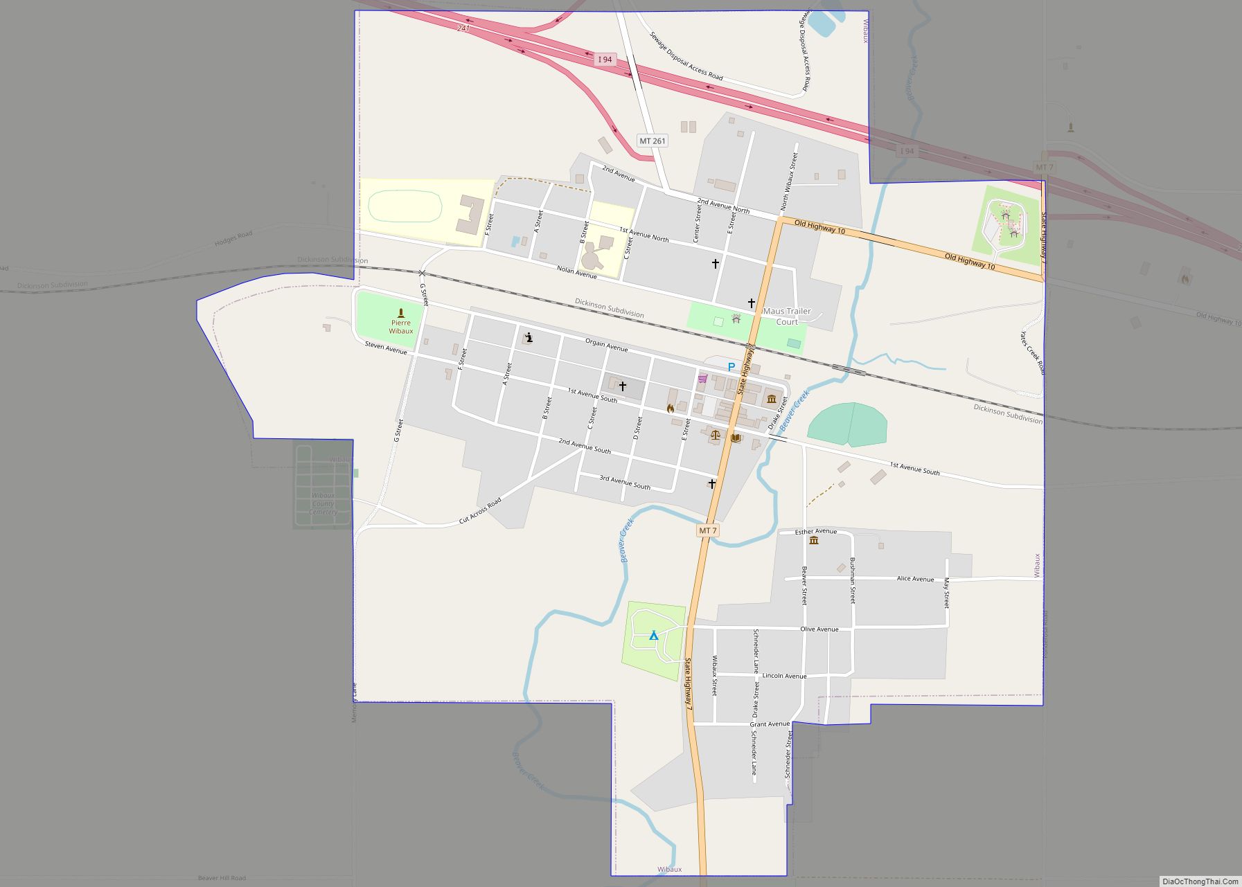
Online Interactive Map
Click on ![]() to view map in "full screen" mode.
to view map in "full screen" mode.
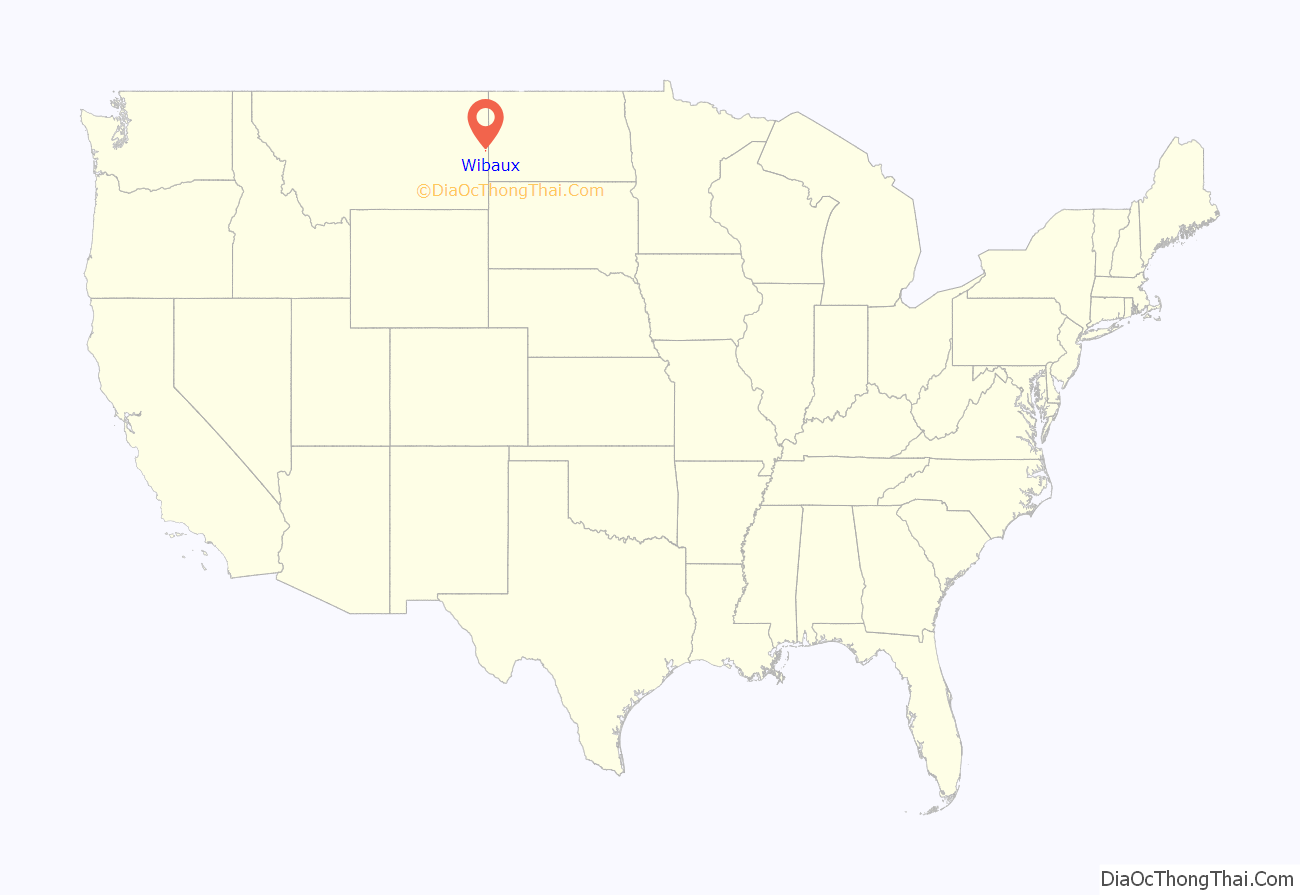
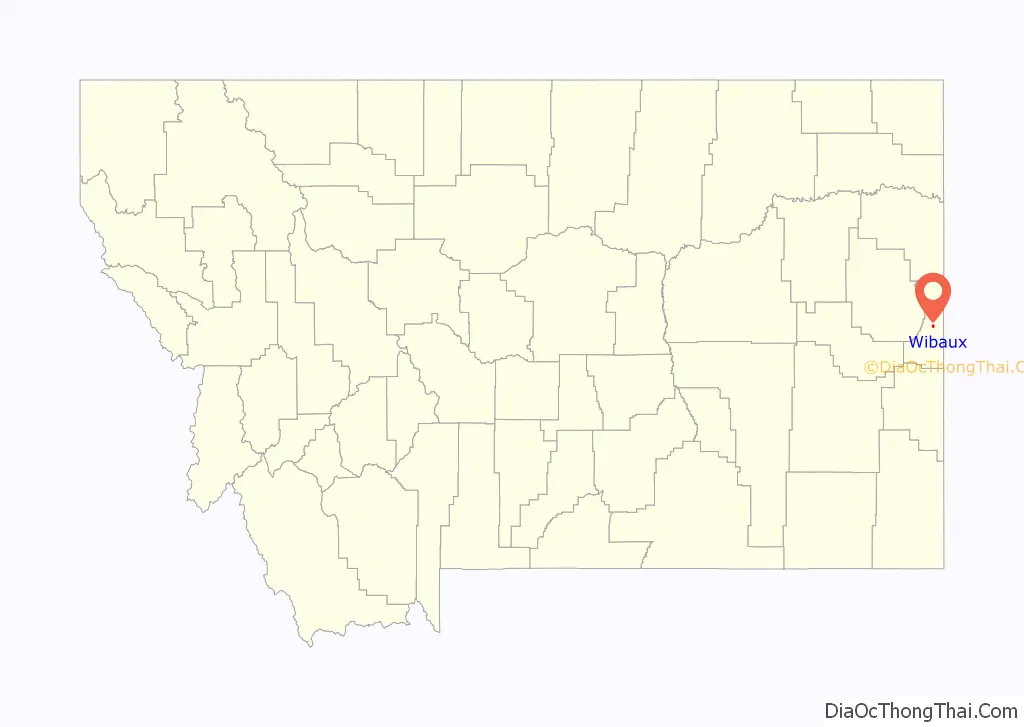
Wibaux location map. Where is Wibaux town?
History
The town originally had names such as Keith, Beaver, and Mingusville (named for Minnie and Gus Grisy, who ran the Post Office in the late 19th century). In 1895, the town was renamed for prominent local cattle rancher, Pierre Wibaux, who had immigrated to the area from France in 1883. Wibaux expanded his herds by buying stock from less fortunate ranchers.
After Wibaux’s arrival, the town became a major cattle shipping center for the Northern Pacific Railroad, notably receiving some of the cattle from Theodore Roosevelt’s Maltese Cross and Elkhorn ranches near Medora, North Dakota. The great cattle drives of the 1880s often passed by Wibaux on their way from Texas to the northern ranges.
Theodore Roosevelt had a famous encounter with a bully at Nolan’s Hotel in Wibaux (Mingusville, at the time) shortly after moving to the North Dakota Badlands in 1884. Arriving at the hotel late at night, Roosevelt was accosted by a drunk sheep herder carrying cocked revolvers in both hands, and ordered to buy drinks for the crowd. Roosevelt pretended to move towards the bar, then punched the man three times in quick succession, causing the drunk to fire his revolvers as he fell. The future president then took away the man’s guns before several other occupants of the hotel dragged him out into a shed.
The National Register of Historic Places has three entries in Wibaux: The Pierre Wibaux House, St. Peter’s Catholic Church, and the Wibaux Historical District.
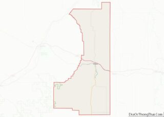
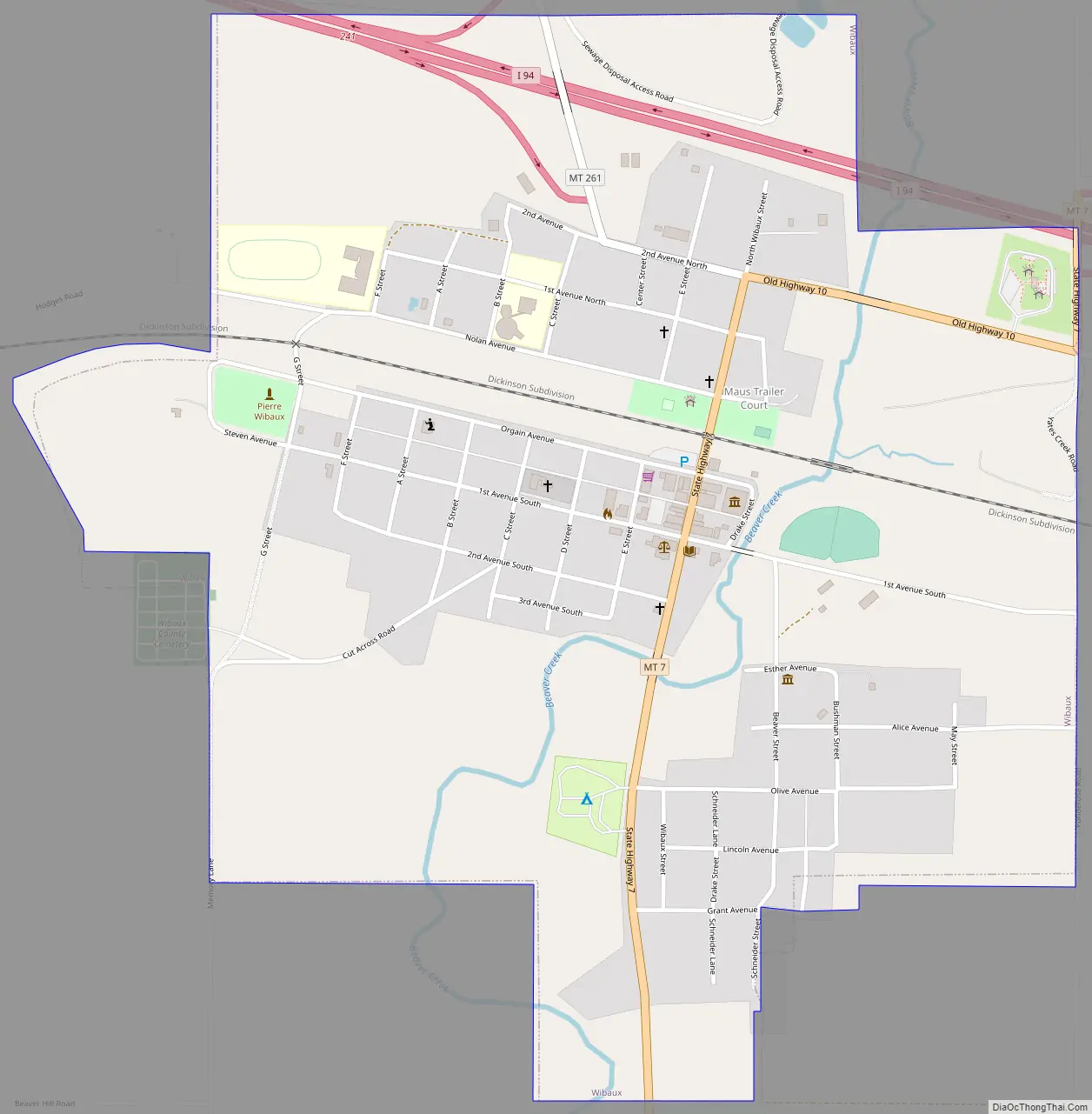
Wibaux Road Map
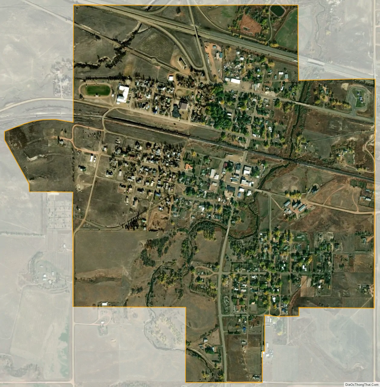
Wibaux city Satellite Map
Geography
Wibaux is located at 46°59′13″N 104°11′23″W / 46.98694°N 104.18972°W / 46.98694; -104.18972 (46.986991, -104.189848). It is the easternmost town in Montana along Interstate 94 and runs a rest stop/information center for motorists using the highway that is only open in the summer between May and September and is closed the rest of the year. According to the United States Census Bureau, the town has a total area of 1.08 square miles (2.80 km), all land.
Beaver Creek runs through the town and has been known to contain large Walleye and Northern Pike.
See also
Map of Montana State and its subdivision:- Beaverhead
- Big Horn
- Blaine
- Broadwater
- Carbon
- Carter
- Cascade
- Chouteau
- Custer
- Daniels
- Dawson
- Deer Lodge
- Fallon
- Fergus
- Flathead
- Gallatin
- Garfield
- Glacier
- Golden Valley
- Granite
- Hill
- Jefferson
- Judith Basin
- Lake
- Lewis and Clark
- Liberty
- Lincoln
- Madison
- McCone
- Meagher
- Mineral
- Missoula
- Musselshell
- Park
- Petroleum
- Phillips
- Pondera
- Powder River
- Powell
- Prairie
- Ravalli
- Richland
- Roosevelt
- Rosebud
- Sanders
- Sheridan
- Silver Bow
- Stillwater
- Sweet Grass
- Teton
- Toole
- Treasure
- Valley
- Wheatland
- Wibaux
- Yellowstone
- Alabama
- Alaska
- Arizona
- Arkansas
- California
- Colorado
- Connecticut
- Delaware
- District of Columbia
- Florida
- Georgia
- Hawaii
- Idaho
- Illinois
- Indiana
- Iowa
- Kansas
- Kentucky
- Louisiana
- Maine
- Maryland
- Massachusetts
- Michigan
- Minnesota
- Mississippi
- Missouri
- Montana
- Nebraska
- Nevada
- New Hampshire
- New Jersey
- New Mexico
- New York
- North Carolina
- North Dakota
- Ohio
- Oklahoma
- Oregon
- Pennsylvania
- Rhode Island
- South Carolina
- South Dakota
- Tennessee
- Texas
- Utah
- Vermont
- Virginia
- Washington
- West Virginia
- Wisconsin
- Wyoming