Zortman is a census-designated place and unincorporated community in Phillips County, Montana, United States. Its population was 69 as of the 2010 census. Zortman has a post office with ZIP code 59546.
The community includes the Zortman Motel and the Buckhorn Store and Cabins. The Buckhorn Store is the only store in the community. Zortman is a popular place for hunters to have dinner and stay while on their trip.
| Name: | Zortman CDP |
|---|---|
| LSAD Code: | 57 |
| LSAD Description: | CDP (suffix) |
| State: | Montana |
| County: | Phillips County |
| Elevation: | 4,032 ft (1,229 m) |
| Total Area: | 3.95 sq mi (10.24 km²) |
| Land Area: | 3.95 sq mi (10.24 km²) |
| Water Area: | 0.00 sq mi (0.00 km²) |
| Total Population: | 82 |
| Population Density: | 20.74/sq mi (8.01/km²) |
| ZIP code: | 59546 |
| Area code: | 406 |
| FIPS code: | 3082675 |
| GNISfeature ID: | 778765 |
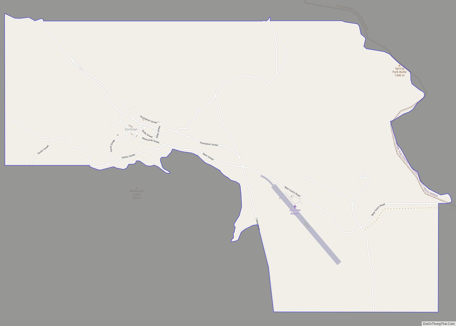
Online Interactive Map
Click on ![]() to view map in "full screen" mode.
to view map in "full screen" mode.
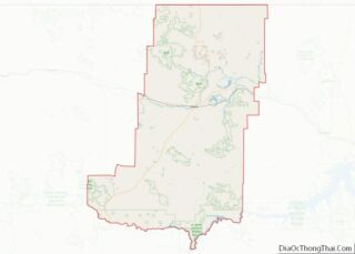
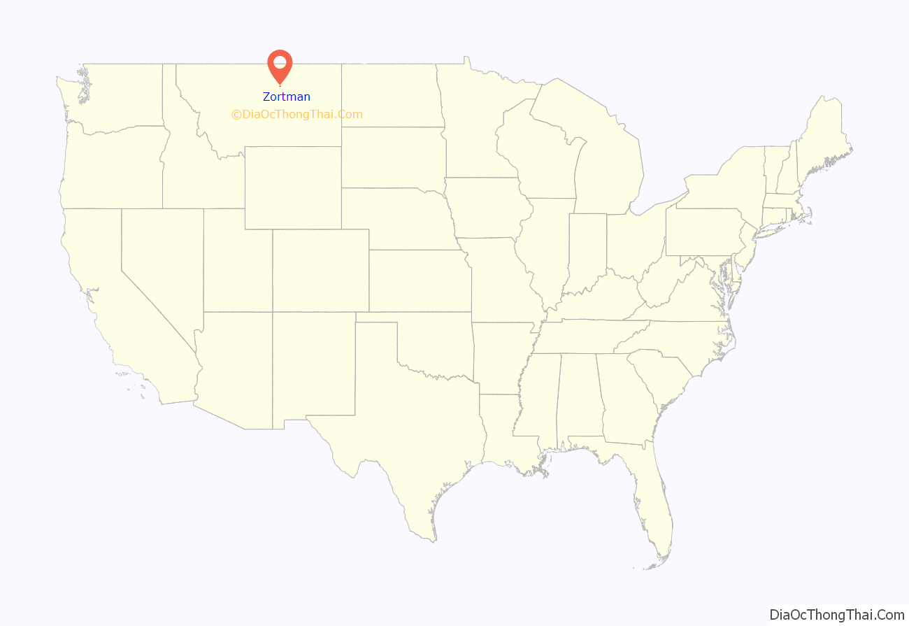
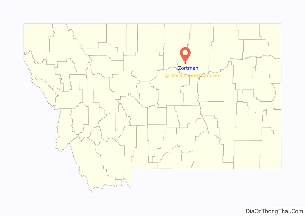
Zortman location map. Where is Zortman CDP?
History
Prospectors arrived in the Zortman area in 1868. About 2,000 men came to Zortman in 1884, when Pike Landusky and Dutch Louie discovered gold. By 1893, Pete Zortman and a partner owned the Alabama Mine. Other mines in the area were the Ruby Mine and the Little Ben Mine. It is estimated that local mines had produced $125 million in gold by 1949.
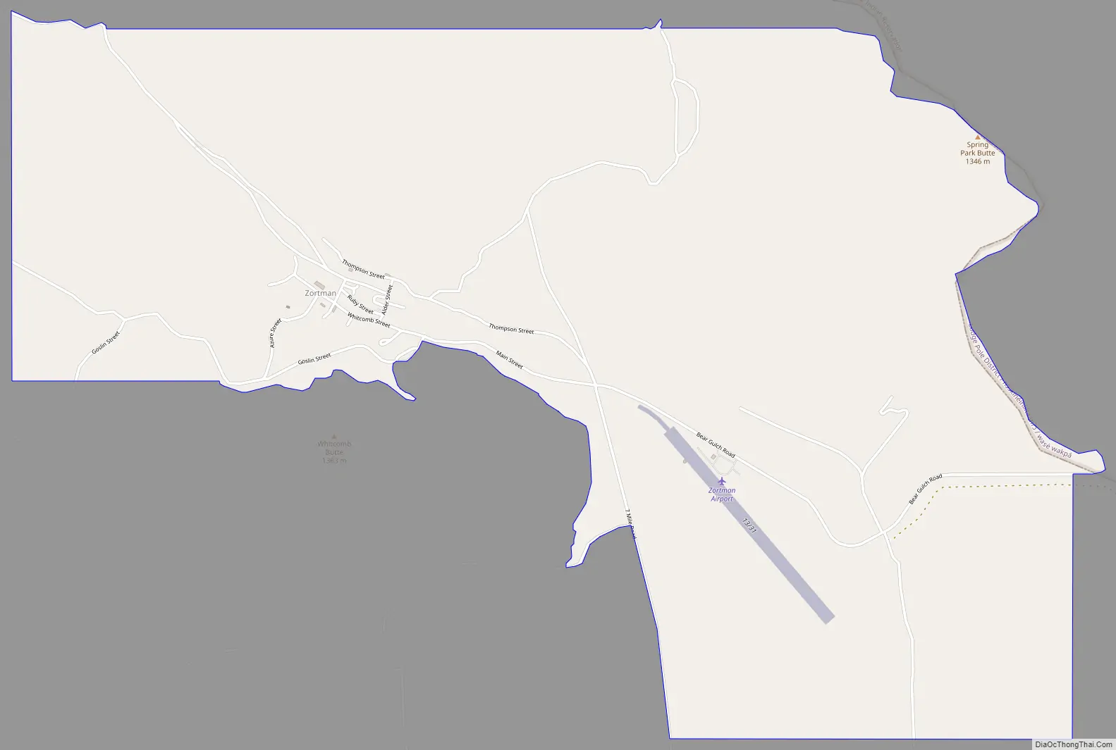
Zortman Road Map
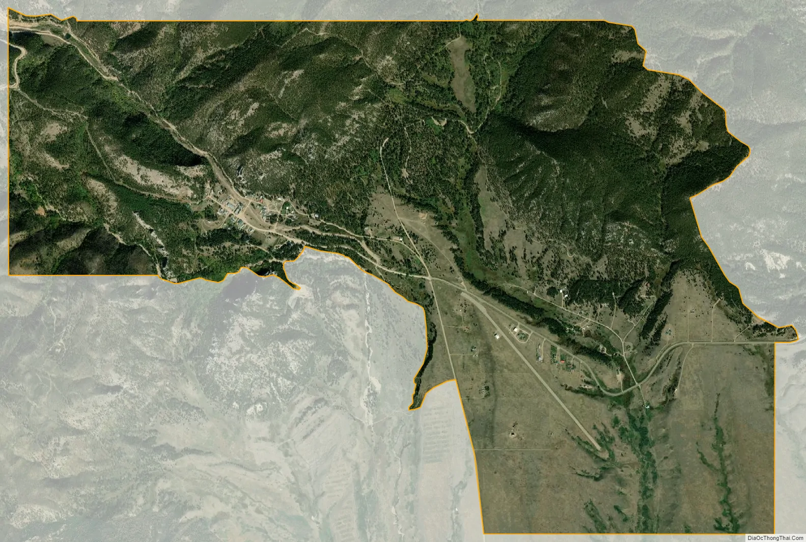
Zortman city Satellite Map
See also
Map of Montana State and its subdivision:- Beaverhead
- Big Horn
- Blaine
- Broadwater
- Carbon
- Carter
- Cascade
- Chouteau
- Custer
- Daniels
- Dawson
- Deer Lodge
- Fallon
- Fergus
- Flathead
- Gallatin
- Garfield
- Glacier
- Golden Valley
- Granite
- Hill
- Jefferson
- Judith Basin
- Lake
- Lewis and Clark
- Liberty
- Lincoln
- Madison
- McCone
- Meagher
- Mineral
- Missoula
- Musselshell
- Park
- Petroleum
- Phillips
- Pondera
- Powder River
- Powell
- Prairie
- Ravalli
- Richland
- Roosevelt
- Rosebud
- Sanders
- Sheridan
- Silver Bow
- Stillwater
- Sweet Grass
- Teton
- Toole
- Treasure
- Valley
- Wheatland
- Wibaux
- Yellowstone
- Alabama
- Alaska
- Arizona
- Arkansas
- California
- Colorado
- Connecticut
- Delaware
- District of Columbia
- Florida
- Georgia
- Hawaii
- Idaho
- Illinois
- Indiana
- Iowa
- Kansas
- Kentucky
- Louisiana
- Maine
- Maryland
- Massachusetts
- Michigan
- Minnesota
- Mississippi
- Missouri
- Montana
- Nebraska
- Nevada
- New Hampshire
- New Jersey
- New Mexico
- New York
- North Carolina
- North Dakota
- Ohio
- Oklahoma
- Oregon
- Pennsylvania
- Rhode Island
- South Carolina
- South Dakota
- Tennessee
- Texas
- Utah
- Vermont
- Virginia
- Washington
- West Virginia
- Wisconsin
- Wyoming