Covering an area of 1,285,216 sq.km (496,225 sq mi), Peru, located in Western South America, is the world’s 19th largest country and South America’s 3rd largest country.
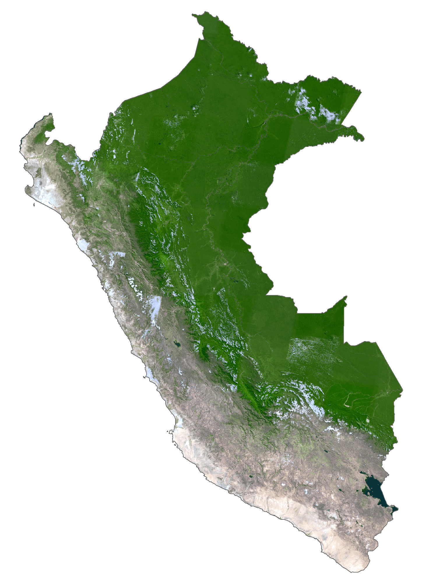
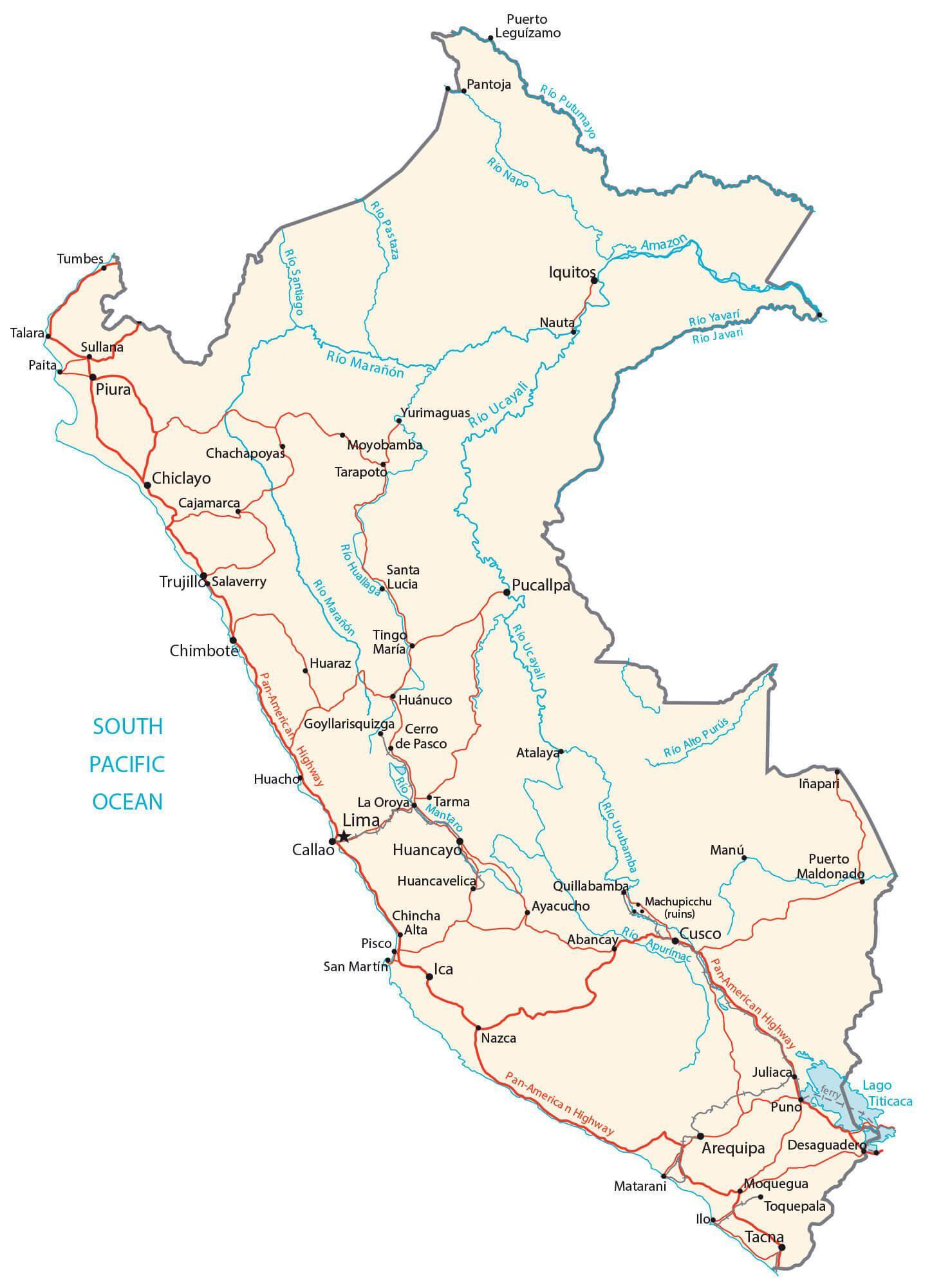
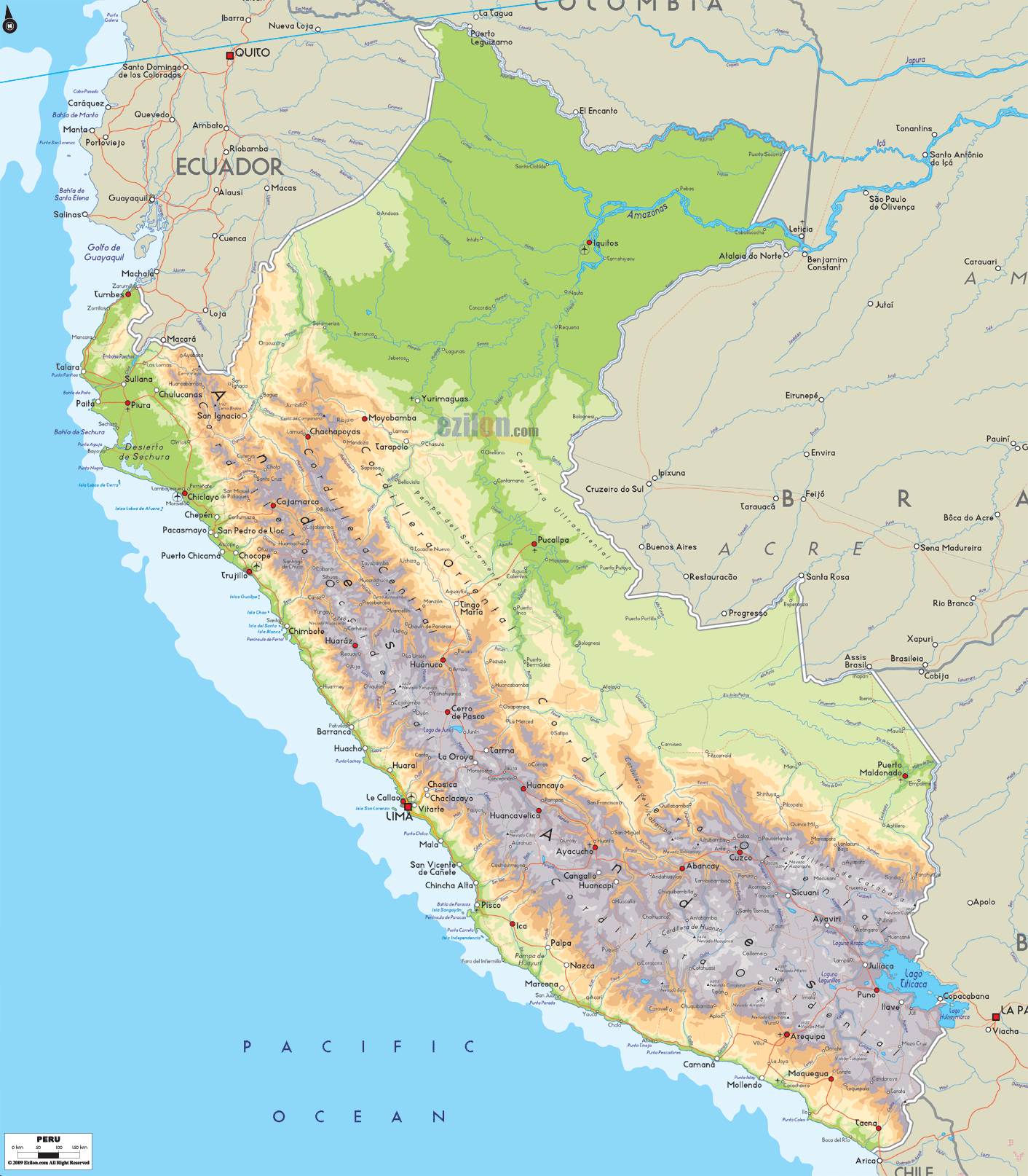
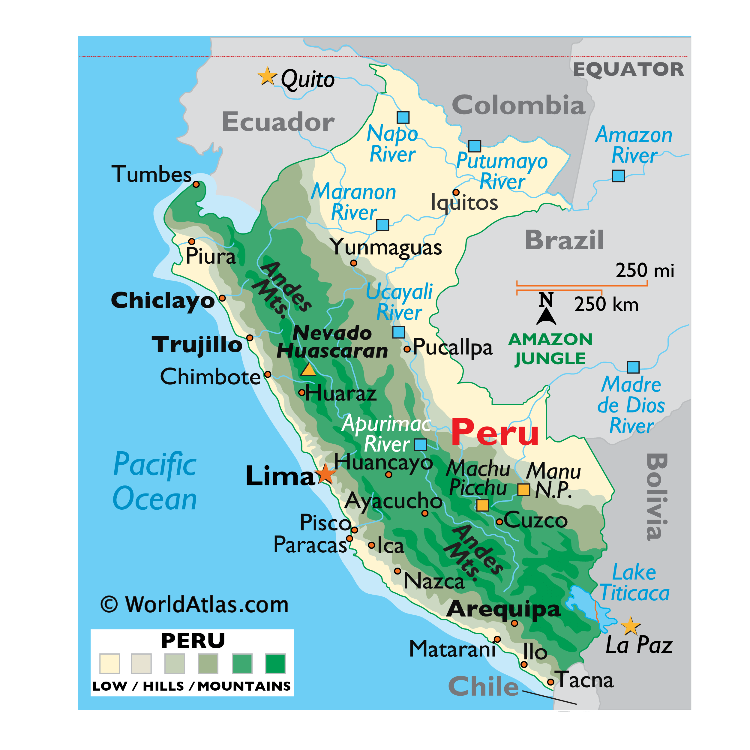
As observed on the physical map of Peru above, the rugged Andes Mountains cover almost 40% of Peru. Hundreds of snow-capped peaks jut skyward here, with many exceeding 20,000 ft.
The country’s highest peak – Mount Huascaran at 22,205ft (6,768 m) [as marked on the map as an upright yellow triangle], is situated in the Cordillera Blanca range of the western Andes. Fronting the Andes – from Ecuador to Chile, in the west, there’s an arid and rocky narrow coastline; in essence, it’s a sandy mountainous desert dissected by dozens of small rivers that flow into the Pacific.
To the east, the Andean Highlands slope gently down into the rivers and jungles of the Amazon. The tropical Amazon basin – a heavily forested, relatively flat area, occupying about three-fifths of Peru and stretching to its borders with Brazil and Chile. The lowest part of Peru is in the far northeast; here the fertile land and jungles are irrigated by tributaries of the massive Amazon River. The giant Amazon River- the longest river in the world, flows through 75% of the territory of Peru. And speaking of rivers, Peru is drained by many, including the Apurimac, Maranon, Napo and Ucayali – to name but a few.
It is to be noted that Peru shares control of Lake Titicaca – the world’s highest navigable lake, with the neighbouring country of Bolivia.
| Flag: |  |
|---|---|
| Legal Name: | Republic of Peru |
| Capital Value: | Lima |
| Official languages: | Spanish |
| Demonym(s): | Peruvian |
| Government: | Unitary semi-presidential republic |
| Legislature: | Congress of the Republic |
| Total Area: | 1,285,216 km² |
| Land Area: | 1,279,996 km² |
| Water Area: | 5,220 km² |
| Population: | 32,510,453 |
| Density: | 23/km (59.6/sq mi) (198th) |
| GDP: | $226.85 Billion |
| GDP Per Capita: | $6,977.70 |
| Currency Value: | Nuevo sol (PEN) |
| Driving side: | right |
| Calling code: | +51 |
| Internet TLD: | .pe |
Explore the beautiful country of Peru with this interactive map. Discover major cities, towns, roads, and rivers, as well as the Andes Mountains and Amazon Rainforest in an elevation map and satellite imagery. Get to know the vibrant culture and stunning landscapes of this incredible country and plan your next amazing adventure!
Online Interactive Political Map
Click on ![]() to view map in "full screen" mode.
to view map in "full screen" mode.
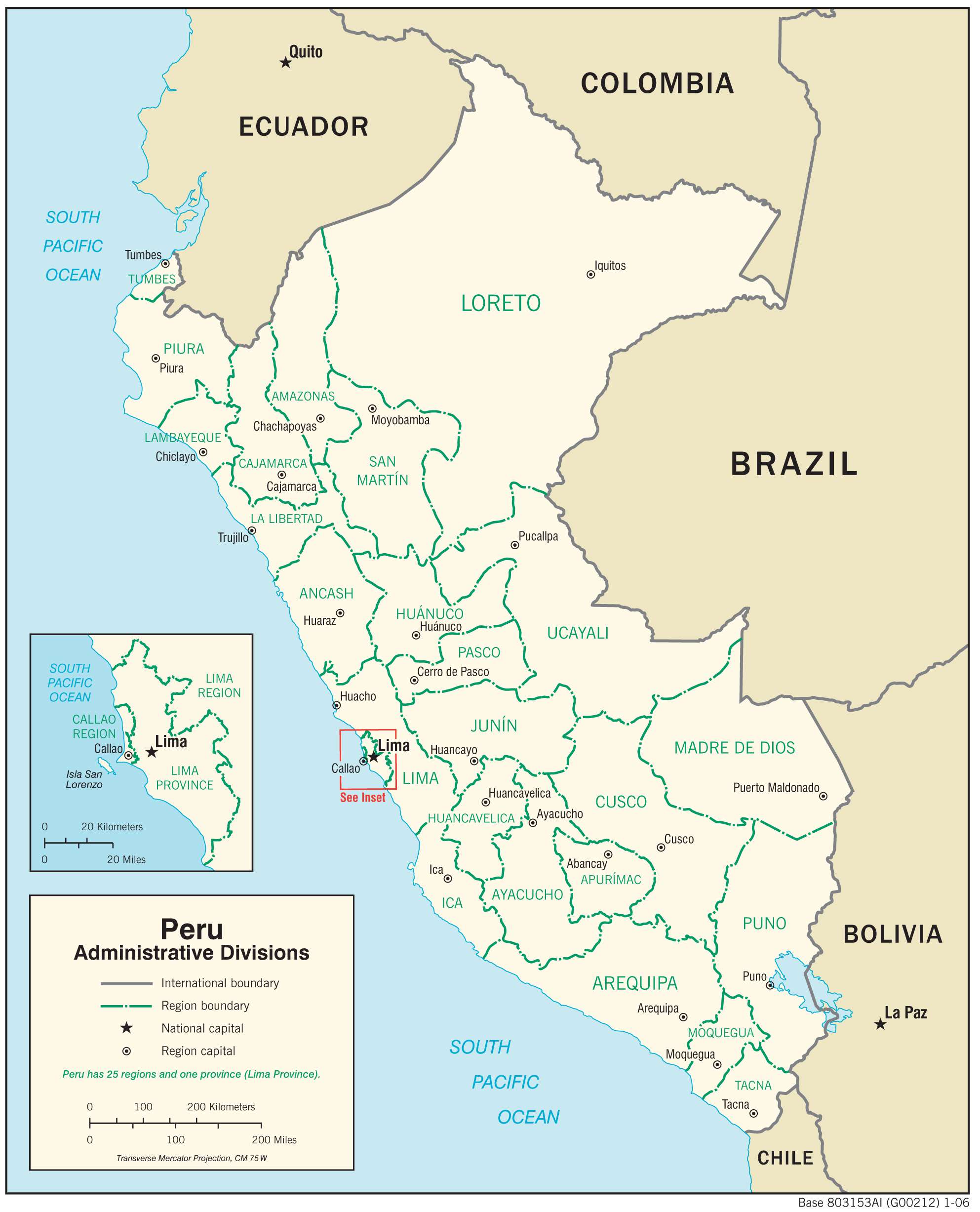
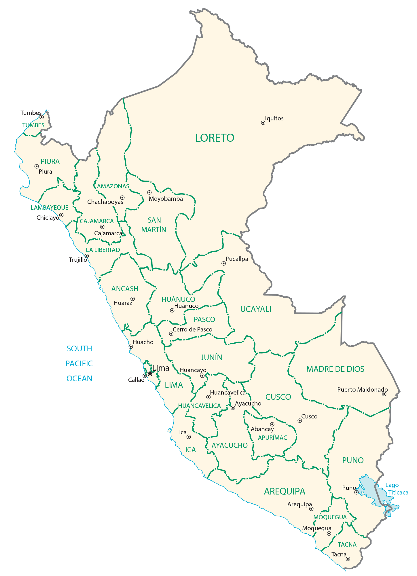
Peru (officially, the Republic of Peru) is divided into 25 regions (regiones, singular – region) and 1 province (provincia). In alphabetical order, the regions are: Amazonas, Ancash, Apurimac, Arequipa, Ayacucho, Cajamarca, Callao, Cusco, Huancavelica, Huanuco, Ica, Junin, La Libertad, Lambayeque, Lima, Loreto, Madre de Dios, Moquegua, Pasco, Piura, Puno, San Martin, Tacna, Tumbes and Ucayali. Lima is the province in Peru. The regions are further subdivided into a total of 196 provinces (provincies) and 1,869 districts (distritos). [Note: Callao, the largest port in Peru, is also referred to as a constitutional province, the only province of the Callao region].
Covering an area of 1,285,216 sq.km , Peru is South America’s 3rd largest country and the 19th largest country in the world. Located on the coast of the Pacific Ocean is, Lima – the capital, the largest and the most populous city of Peru. Lima is also the 4th largest city in South America and the 2nd largest city in the Americas. It is the administrative, cultural, educational, commercial and economic hub of the nation.
Location Maps
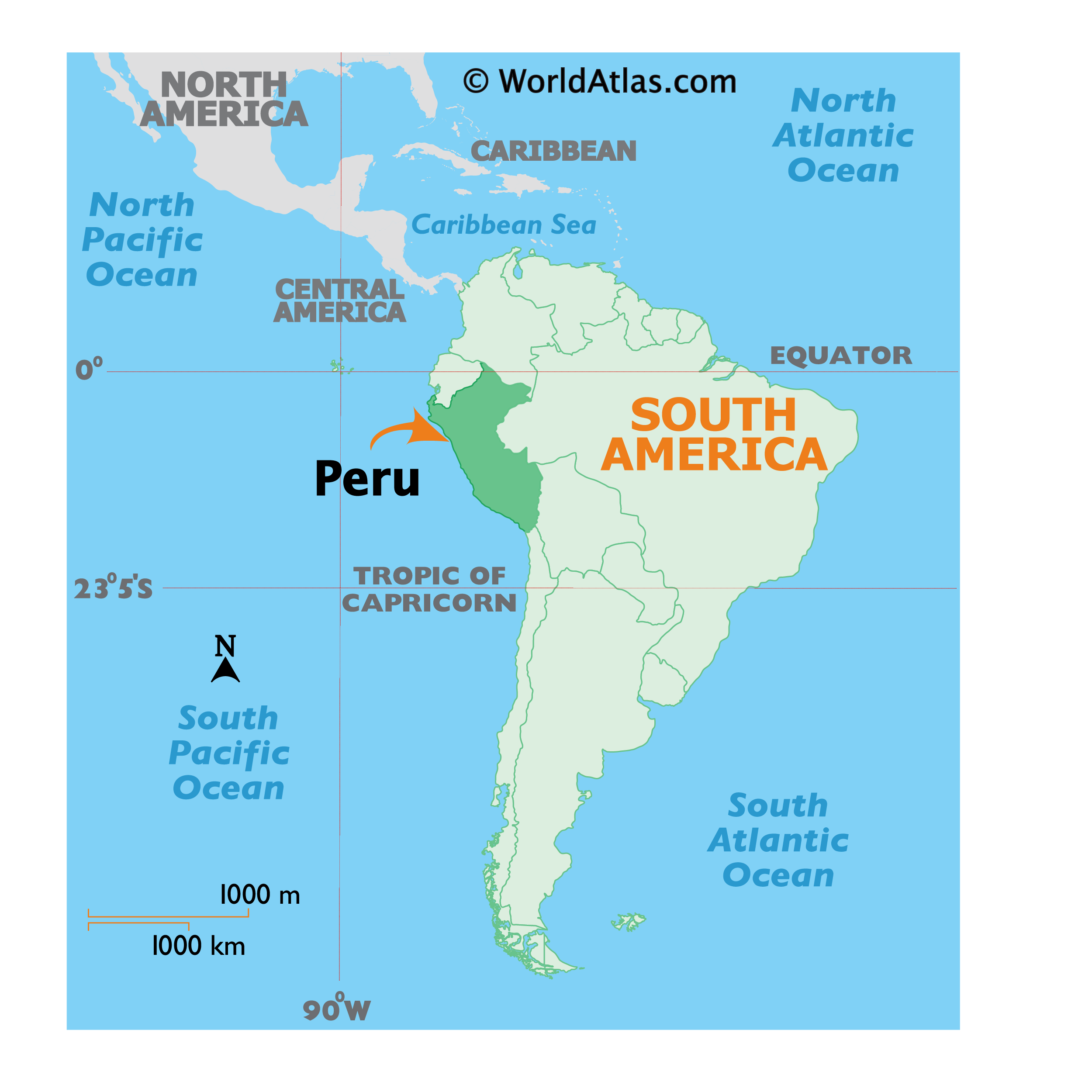
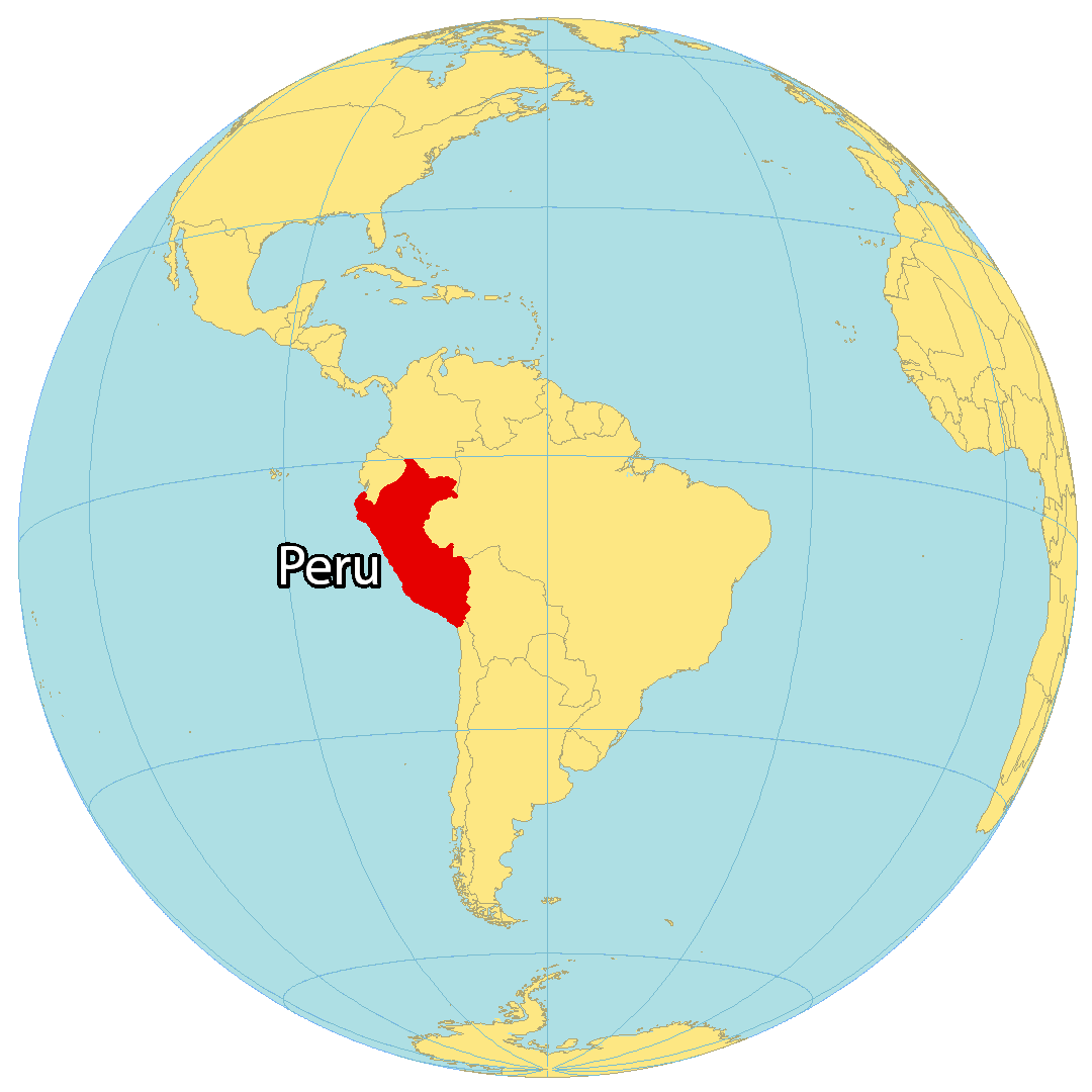
Where is Peru?
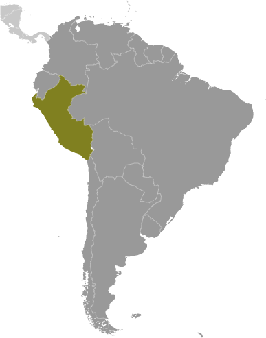
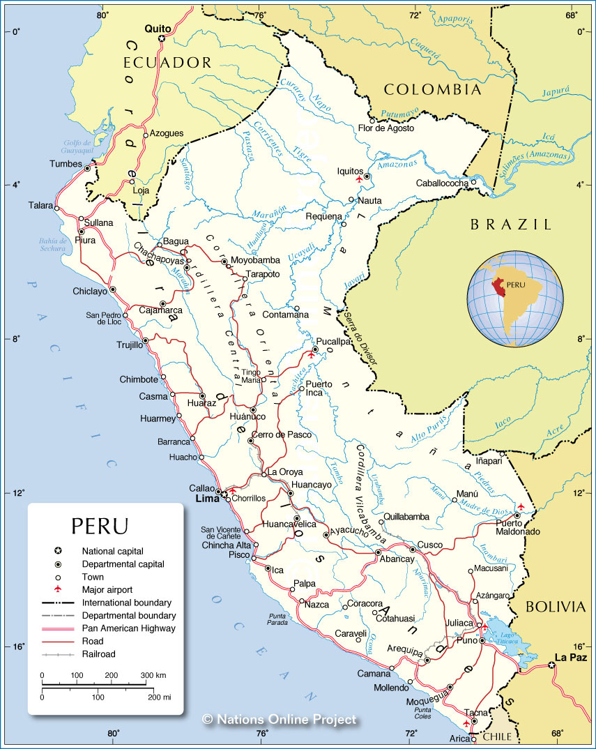
Peru is located in the western part of South America and it borders five countries, including Ecuador to the north, Colombia to the northeast, Brazil to the east, Bolivia to the southeast, and Chile to the south. It also has a coastline of 2,414 km (1,500 mi) along the South Pacific Ocean.
Peru is well-known for Machu Picchu, the Andes mountains, and the Amazon rainforest. It was also the administrative, political and military center of the Incan Empire. Lima is the capital and the largest city of Peru, while other major cities are Arequipa, Trujillo, and Chiclayo.
High Definition Political Map of Peru

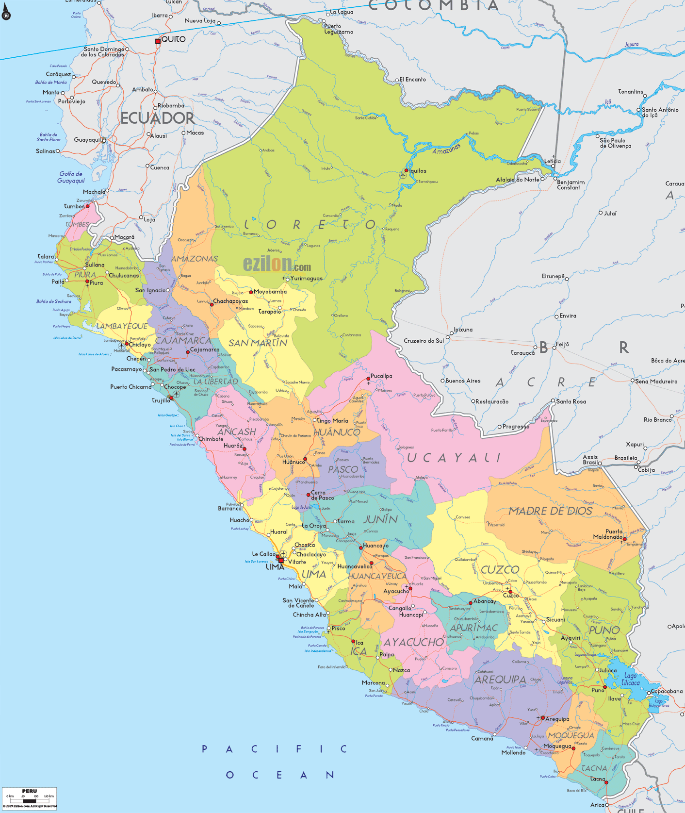
Peru Administrative Map
Physical Map of Peru
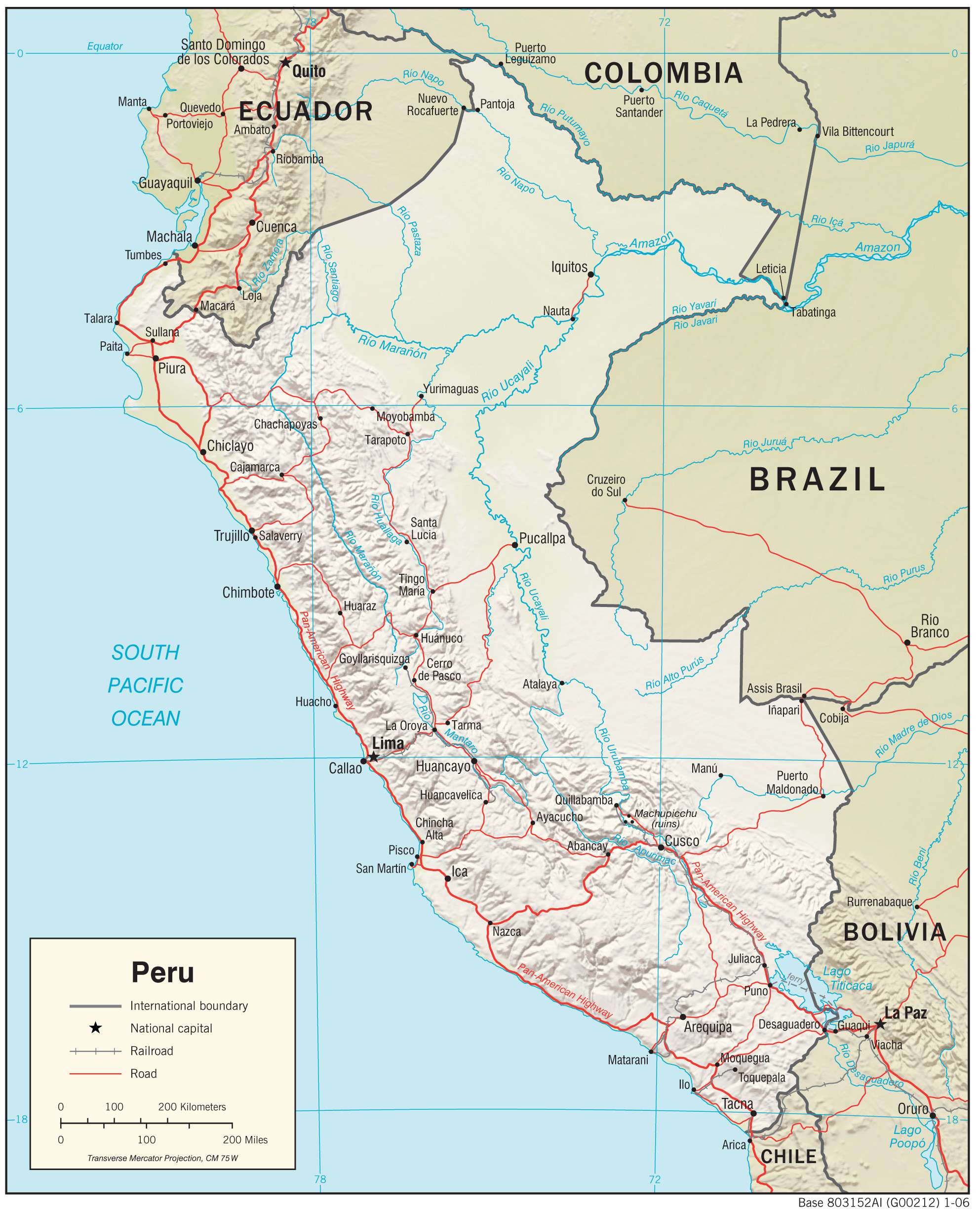
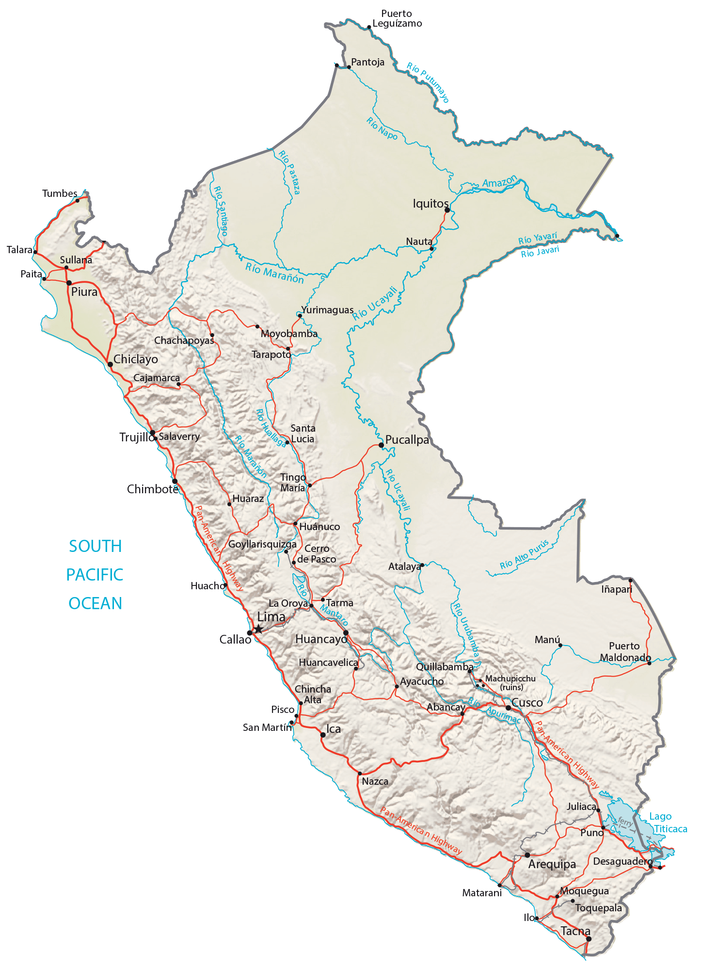
Transportation Map of Peru

Peru Satellite Map