Durham is a city in Washington County, Oregon, United States. Incorporated in 1966, the city is surrounded by Tigard and Tualatin and is adjacent to the Bridgeport Village shopping complex. The population was 1,351 at the 2010 census.
| Name: | Durham city |
|---|---|
| LSAD Code: | 25 |
| LSAD Description: | city (suffix) |
| State: | Oregon |
| County: | Washington County |
| Incorporated: | 1966 |
| Elevation: | 197 ft (60 m) |
| Total Area: | 0.41 sq mi (1.06 km²) |
| Land Area: | 0.41 sq mi (1.06 km²) |
| Water Area: | 0.00 sq mi (0.00 km²) |
| Total Population: | 1,944 |
| Population Density: | 4,741.46/sq mi (1,832.36/km²) |
| ZIP code: | 97224 |
| Area code: | 503 and 971 |
| FIPS code: | 4121250 |
| GNISfeature ID: | 1120224 |
| Website: | www.durham-oregon.us |
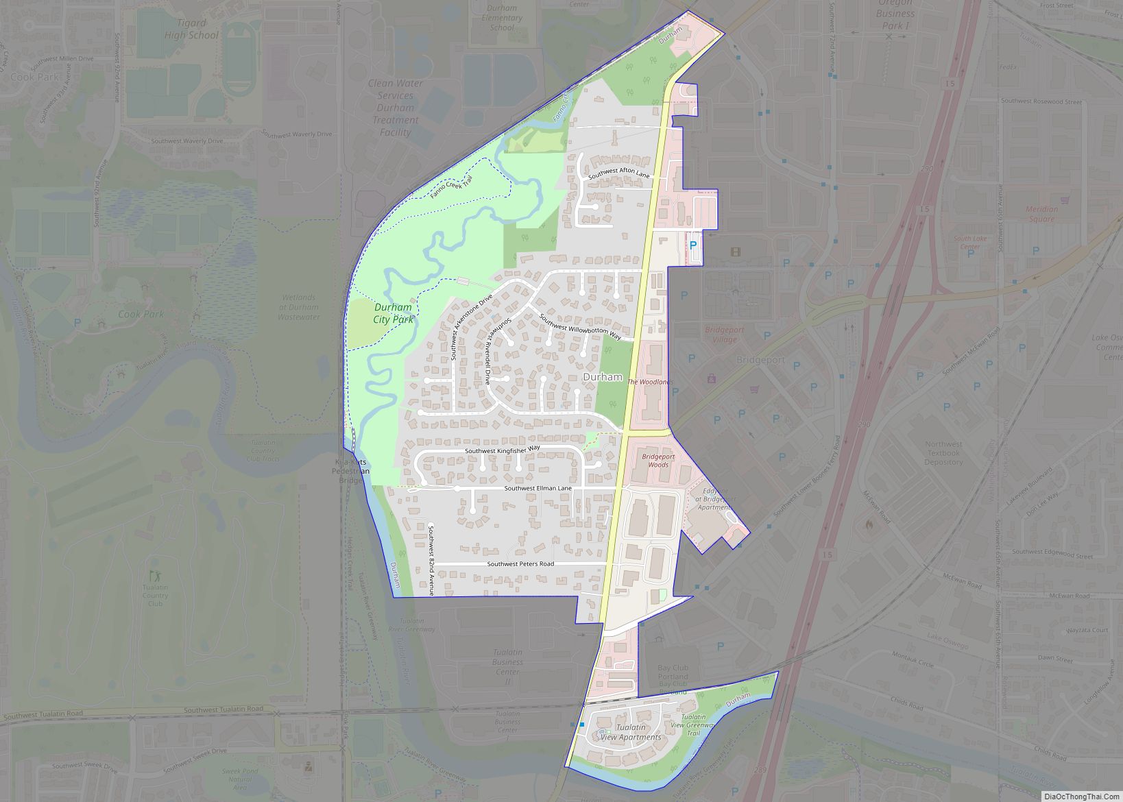
Online Interactive Map
Click on ![]() to view map in "full screen" mode.
to view map in "full screen" mode.
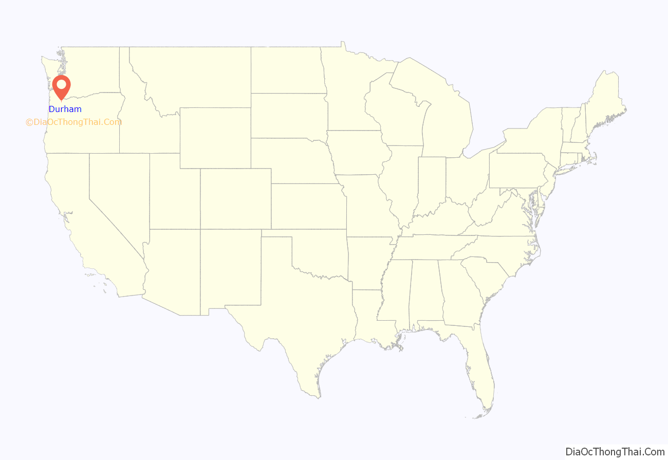
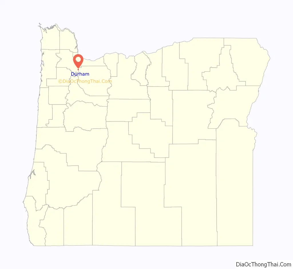
Durham location map. Where is Durham city?
History
The city was named for Albert Alonzo Durham, founder of the nearby town of Lake Oswego. Durham operated a sawmill and a flour mill on Fanno Creek, which flows through the city, from 1866 until his death in 1898. The site, located along the Boones Ferry Road to Portland, was originally known as Durhams Mills. In 1908, the Oregon Electric Railway established a stop called Durham at the location. Residents of the city voted for incorporation in 1966 to protect the location from industrialization of its residential areas. Today, the community is primarily residential.
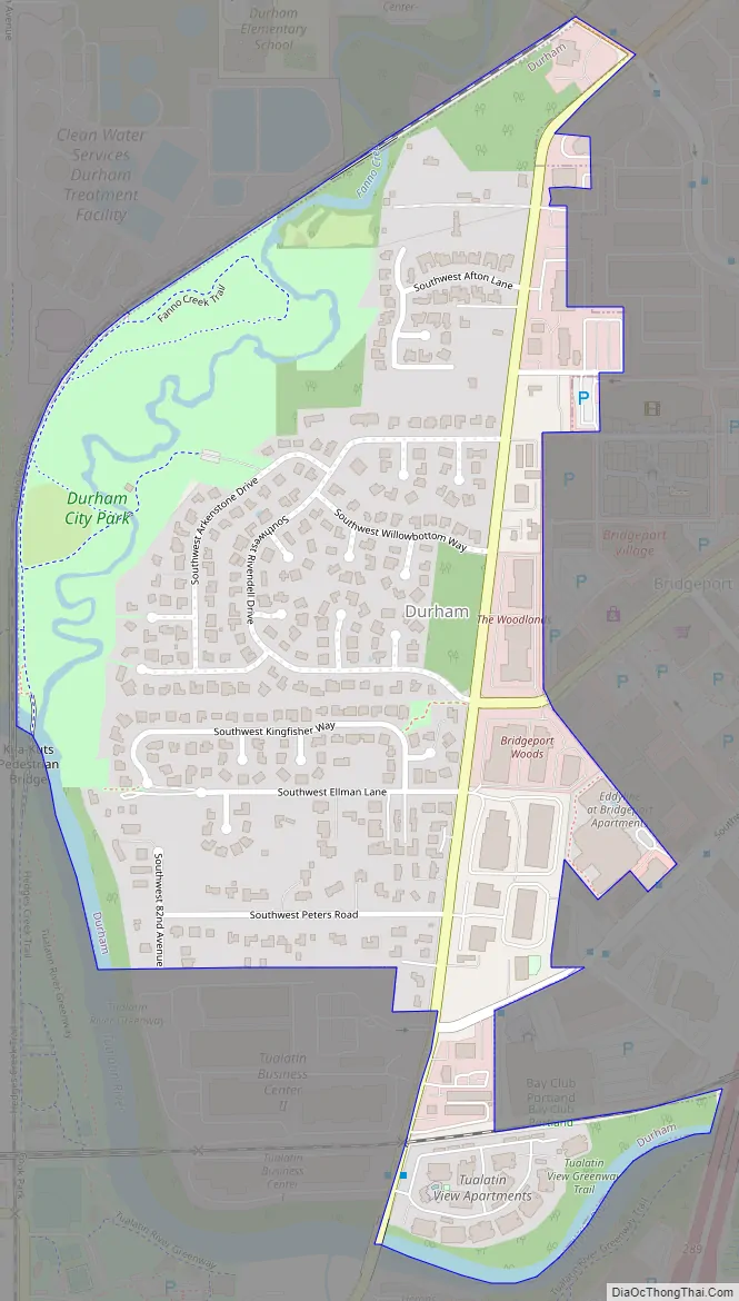
Durham Road Map
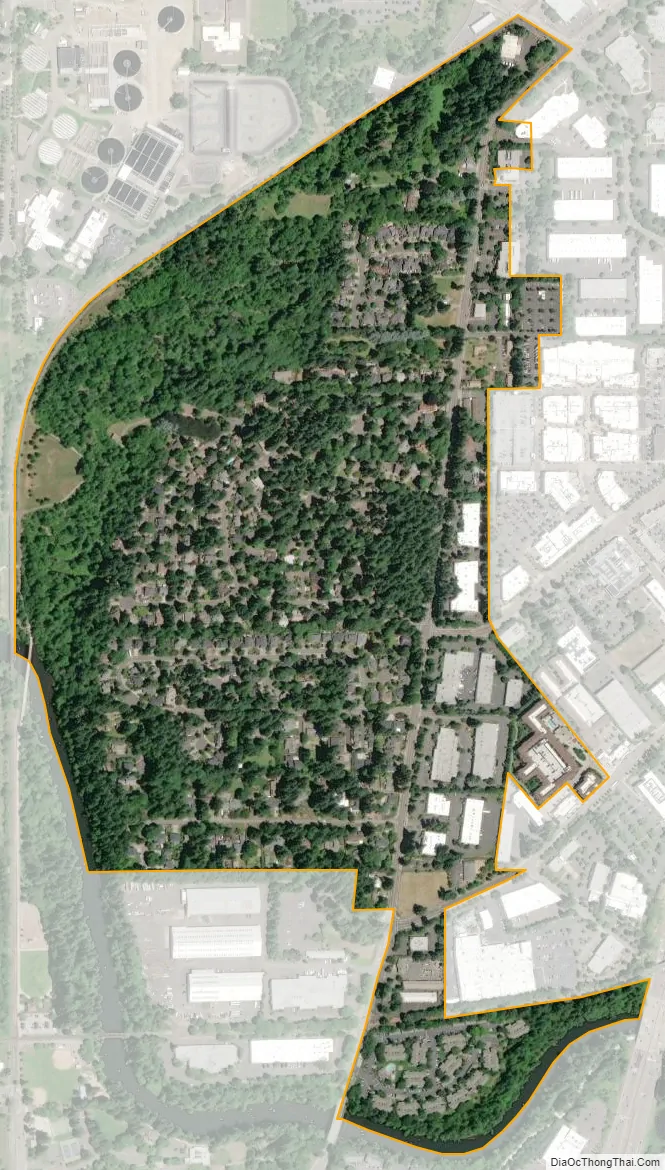
Durham city Satellite Map
Geography
According to the United States Census Bureau, the city has a total area of 0.41 square miles (1.06 km), all land. It sits at 197 feet (60 m) above sea-level. The main road through Durham is Upper Boones Ferry Road, with Interstate 5 approximately 0.5 miles (0.8 km) east of the city. Part of the western boundary of the city is the Tualatin River, with Durham City Park also on the western edge of Durham.
See also
Map of Oregon State and its subdivision: Map of other states:- Alabama
- Alaska
- Arizona
- Arkansas
- California
- Colorado
- Connecticut
- Delaware
- District of Columbia
- Florida
- Georgia
- Hawaii
- Idaho
- Illinois
- Indiana
- Iowa
- Kansas
- Kentucky
- Louisiana
- Maine
- Maryland
- Massachusetts
- Michigan
- Minnesota
- Mississippi
- Missouri
- Montana
- Nebraska
- Nevada
- New Hampshire
- New Jersey
- New Mexico
- New York
- North Carolina
- North Dakota
- Ohio
- Oklahoma
- Oregon
- Pennsylvania
- Rhode Island
- South Carolina
- South Dakota
- Tennessee
- Texas
- Utah
- Vermont
- Virginia
- Washington
- West Virginia
- Wisconsin
- Wyoming