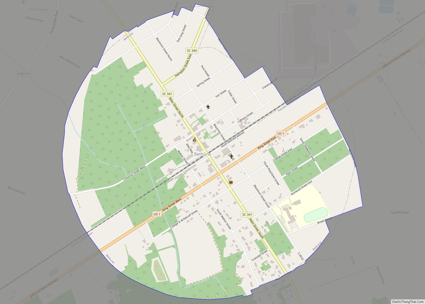
Bethune is a small town in Kershaw County, South Carolina, United States. The population was 334 at the 2010 census. It is part of the Columbia, South Carolina Metropolitan Statistical Area.
| Name: | Bethune town |
|---|---|
| LSAD Code: | 43 |
| LSAD Description: | town (suffix) |
| State: | South Carolina |
| County: | Kershaw County |
| Elevation: | 289 ft (88 m) |
| Total Area: | 1.10 sq mi (2.85 km²) |
| Land Area: | 1.10 sq mi (2.85 km²) |
| Water Area: | 0.00 sq mi (0.00 km²) |
| Total Population: | 315 |
| Population Density: | 285.84/sq mi (110.34/km²) |
| ZIP code: | 29009 |
| FIPS code: | 4506040 |
| GNISfeature ID: | 1246845 |
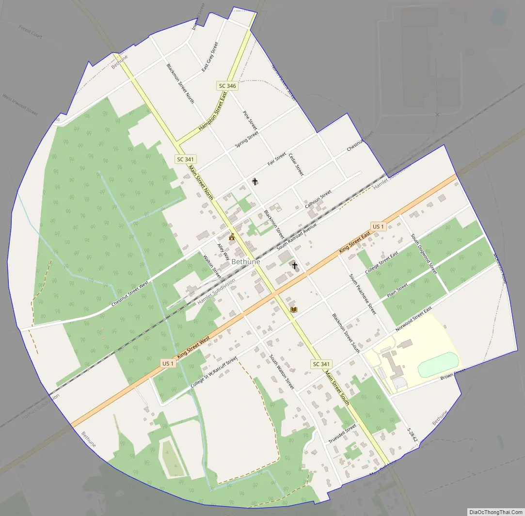
Online Interactive Map
Click on ![]() to view map in "full screen" mode.
to view map in "full screen" mode.
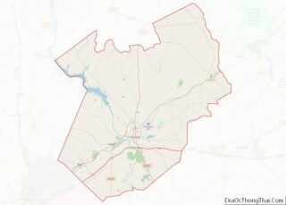
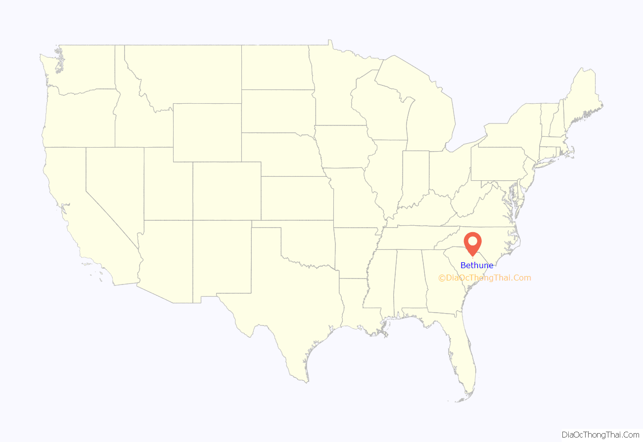
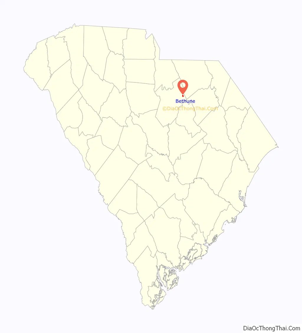
Bethune location map. Where is Bethune town?
History
Europeans first moved into the area in the early 1800s, finding members of the Kadapaw tribe living in the area. Originally, the settlers named the town “Lynchwood”, and in 1828 they established a post office. After the railroads came to the area, the town was officially chartered in 1900 and the name changed to honor Daniel Murdock Bethune.
Bethune Road Map
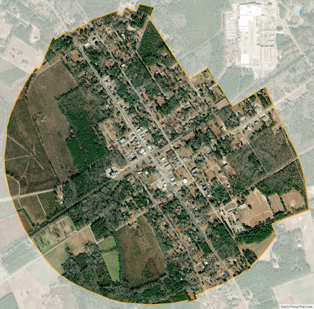
Bethune city Satellite Map
Geography
Bethune is located in northeastern Kershaw County at 34°24′54″N 80°20′51″W / 34.41500°N 80.34750°W / 34.41500; -80.34750 (34.414881, -80.347414), 20 miles (32 km) northeast of Camden, the county seat, and 35 miles (56 km) southwest of Cheraw along U.S. Route 1. South Carolina Highway 341 (Main Street) crosses US 1 in the center of town; it leads northwest 17 miles (27 km) to Kershaw and south 16 miles (26 km) to Bishopville.
According to the United States Census Bureau, the town of Bethune has a total area of 1.10 square miles (2.85 km), all land.
The Lynches River passes east of the town, and its tributary the Little Lynches River passes to the southwest. The rivers and the town are part of the watershed of the Great Pee Dee River.
The MAC-Hunter Astronomical Observatory, a cooperative project of South Carolina amateur astronomers in the Midlands Astronomy Club, is sited south of town.
See also
Map of South Carolina State and its subdivision:- Abbeville
- Aiken
- Allendale
- Anderson
- Bamberg
- Barnwell
- Beaufort
- Berkeley
- Calhoun
- Charleston
- Cherokee
- Chester
- Chesterfield
- Clarendon
- Colleton
- Darlington
- Dillon
- Dorchester
- Edgefield
- Fairfield
- Florence
- Georgetown
- Greenville
- Greenwood
- Hampton
- Horry
- Jasper
- Kershaw
- Lancaster
- Laurens
- Lee
- Lexington
- Marion
- Marlboro
- McCormick
- Newberry
- Oconee
- Orangeburg
- Pickens
- Richland
- Saluda
- Spartanburg
- Sumter
- Union
- Williamsburg
- York
- Alabama
- Alaska
- Arizona
- Arkansas
- California
- Colorado
- Connecticut
- Delaware
- District of Columbia
- Florida
- Georgia
- Hawaii
- Idaho
- Illinois
- Indiana
- Iowa
- Kansas
- Kentucky
- Louisiana
- Maine
- Maryland
- Massachusetts
- Michigan
- Minnesota
- Mississippi
- Missouri
- Montana
- Nebraska
- Nevada
- New Hampshire
- New Jersey
- New Mexico
- New York
- North Carolina
- North Dakota
- Ohio
- Oklahoma
- Oregon
- Pennsylvania
- Rhode Island
- South Carolina
- South Dakota
- Tennessee
- Texas
- Utah
- Vermont
- Virginia
- Washington
- West Virginia
- Wisconsin
- Wyoming