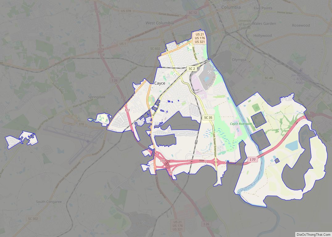
Cayce (/ˈkeɪsi/ KAY-see) is a city in the U.S. state of South Carolina, along the Congaree River. The population was 12,528 at the 2010 census and rose to 13,789 in the 2020 United States Census, and it is the third-most populated municipality in Lexington County. The city is primarily in Lexington County, with additional, predominantly rural land to the east in Richland County. Cayce is part of the Columbia Metropolitan Statistical Area and is within South Carolina’s Midlands region.
| Name: | Cayce city |
|---|---|
| LSAD Code: | 25 |
| LSAD Description: | city (suffix) |
| State: | South Carolina |
| County: | Lexington County, Richland County |
| Elevation: | 233 ft (71 m) |
| Total Area: | 17.74 sq mi (45.95 km²) |
| Land Area: | 16.88 sq mi (43.72 km²) |
| Water Area: | 0.86 sq mi (2.23 km²) |
| Total Population: | 13,781 |
| Population Density: | 816.36/sq mi (315.21/km²) |
| ZIP code: | 29033, 29169, 29170, 29171, 29172 |
| Area code: | 803, 839 |
| FIPS code: | 4512655 |
| GNISfeature ID: | 1247197 |
| Website: | cityofcayce-sc.gov |
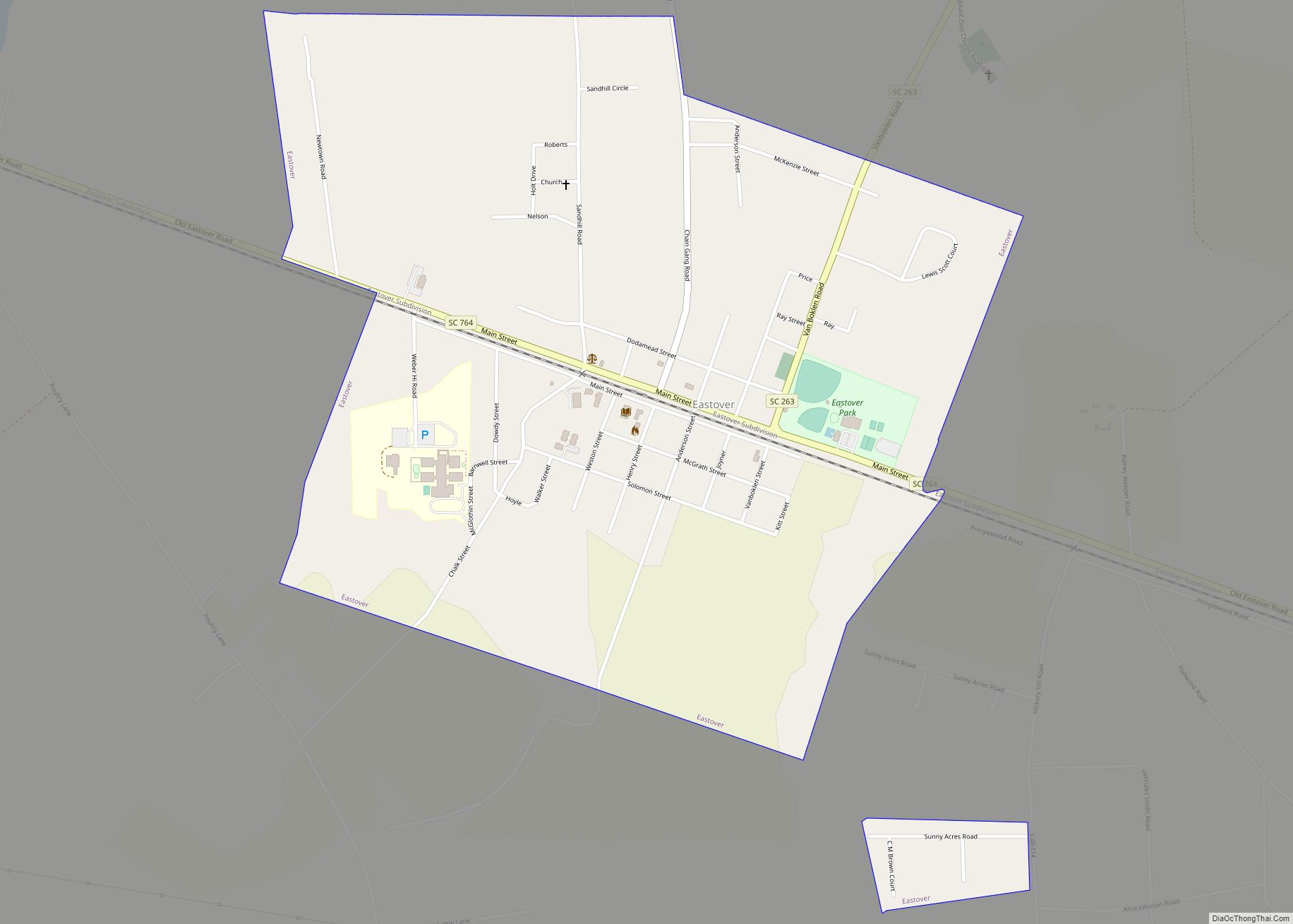
Online Interactive Map
Click on ![]() to view map in "full screen" mode.
to view map in "full screen" mode.
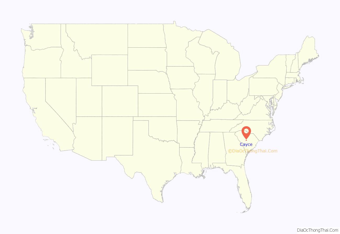
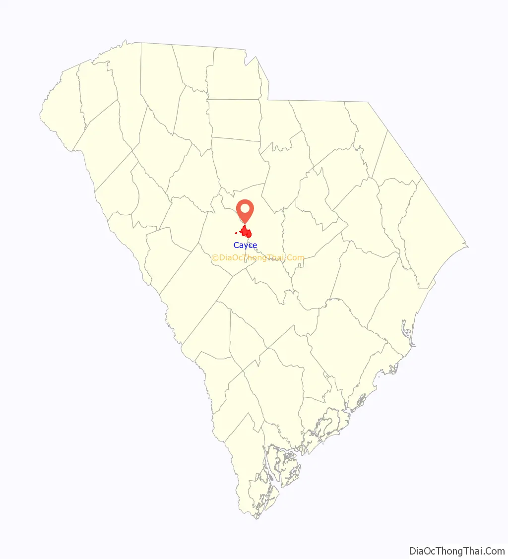
Cayce location map. Where is Cayce city?
History
What was to become Cayce was home to Native Americans for at least 12,000 years. This includes what are now known as the Manning Archeological Site, the SAM Site, and the Taylor Site.
Spanish explorer Hernando de Soto reached the area in 1540, encountering a large Native village at Congaree Creek, where Cayce now stands. Near the end of the 17th century, the explorer John Lawson visited and documented his trip. In 1718, during the colonial period, the English built the first permanent fort, the first structure built in the Midlands. A second fort was built on the river in 1748. These were referred to as Congaree Fort #1 and Congaree Fort #2 and became part of the Congarees Site in 1974.
The Guignard Brick Works were established on the west bank of the Congaree in 1803 and remained active for nearly two centuries.
The town includes the area that was once Granby, at one time the county seat and a flourishing community before it was abandoned by the end of the first quarter of the nineteenth century.
The town was incorporated in 1914 and named for local businessman William J. Cayce.
In December 2007, the city council voted to annex a 3,100-acre (13 km) floodplain in Richland County. Prior to this annexation, Cayce was entirely situated within Lexington County. The city planned to develop the annexed area, but after significant evaluations the city abandoned the project after determining that development was not suitable in the flood-prone area, leaving Cayce with a sizeable piece of sparely-populated land.
Cayce Road Map

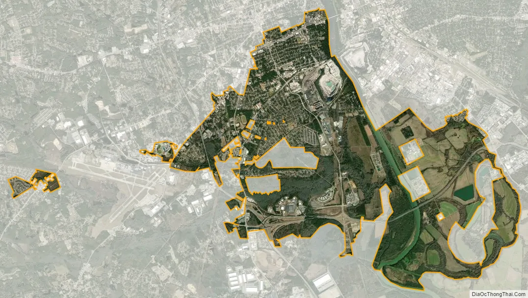
Cayce city Satellite Map
Geography
Cayce is in eastern Lexington County and western Richland County, with the traditional center of town on the west side of the Congaree River at 33°58’29” north, 81°3’6″ west. The Congaree divides the city from the state capital, Columbia, to the northeast. Cayce is also bordered by the city of West Columbia to the north, the town of Springdale to the northwest, and the town of Pine Ridge to the southwest.
According to the United States Census Bureau, the city has a total area of 17.6 square miles (45.5 km), of which 16.8 square miles (43.5 km) are land and 0.77 square miles (2.0 km), or 4.38%, are water.
See also
Map of South Carolina State and its subdivision:- Abbeville
- Aiken
- Allendale
- Anderson
- Bamberg
- Barnwell
- Beaufort
- Berkeley
- Calhoun
- Charleston
- Cherokee
- Chester
- Chesterfield
- Clarendon
- Colleton
- Darlington
- Dillon
- Dorchester
- Edgefield
- Fairfield
- Florence
- Georgetown
- Greenville
- Greenwood
- Hampton
- Horry
- Jasper
- Kershaw
- Lancaster
- Laurens
- Lee
- Lexington
- Marion
- Marlboro
- McCormick
- Newberry
- Oconee
- Orangeburg
- Pickens
- Richland
- Saluda
- Spartanburg
- Sumter
- Union
- Williamsburg
- York
- Alabama
- Alaska
- Arizona
- Arkansas
- California
- Colorado
- Connecticut
- Delaware
- District of Columbia
- Florida
- Georgia
- Hawaii
- Idaho
- Illinois
- Indiana
- Iowa
- Kansas
- Kentucky
- Louisiana
- Maine
- Maryland
- Massachusetts
- Michigan
- Minnesota
- Mississippi
- Missouri
- Montana
- Nebraska
- Nevada
- New Hampshire
- New Jersey
- New Mexico
- New York
- North Carolina
- North Dakota
- Ohio
- Oklahoma
- Oregon
- Pennsylvania
- Rhode Island
- South Carolina
- South Dakota
- Tennessee
- Texas
- Utah
- Vermont
- Virginia
- Washington
- West Virginia
- Wisconsin
- Wyoming