Duncan is a census-designated place (CDP) in Greenville County, South Carolina, United States. The population was 3,671 at the 2010 census, down from 4,158 in 2000. It is part of the Greenville–Mauldin–Easley Metropolitan Statistical Area.
| Name: | Dunean CDP |
|---|---|
| LSAD Code: | 57 |
| LSAD Description: | CDP (suffix) |
| State: | South Carolina |
| County: | Greenville County |
| Elevation: | 978 ft (298 m) |
| Total Area: | 1.57 sq mi (4.07 km²) |
| Land Area: | 1.57 sq mi (4.07 km²) |
| Water Area: | 0.00 sq mi (0.01 km²) |
| Total Population: | 3,740 |
| Population Density: | 2,380.65/sq mi (919.38/km²) |
| FIPS code: | 4521310 |
| GNISfeature ID: | 1231247 |
Online Interactive Map
Click on ![]() to view map in "full screen" mode.
to view map in "full screen" mode.
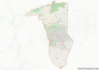
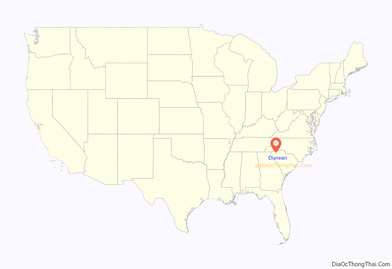
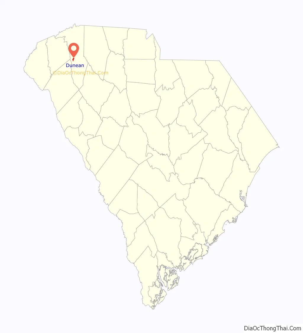
Dunean location map. Where is Dunean CDP?
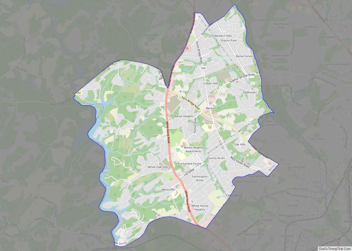
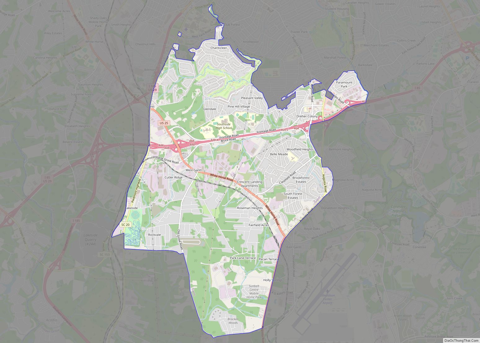
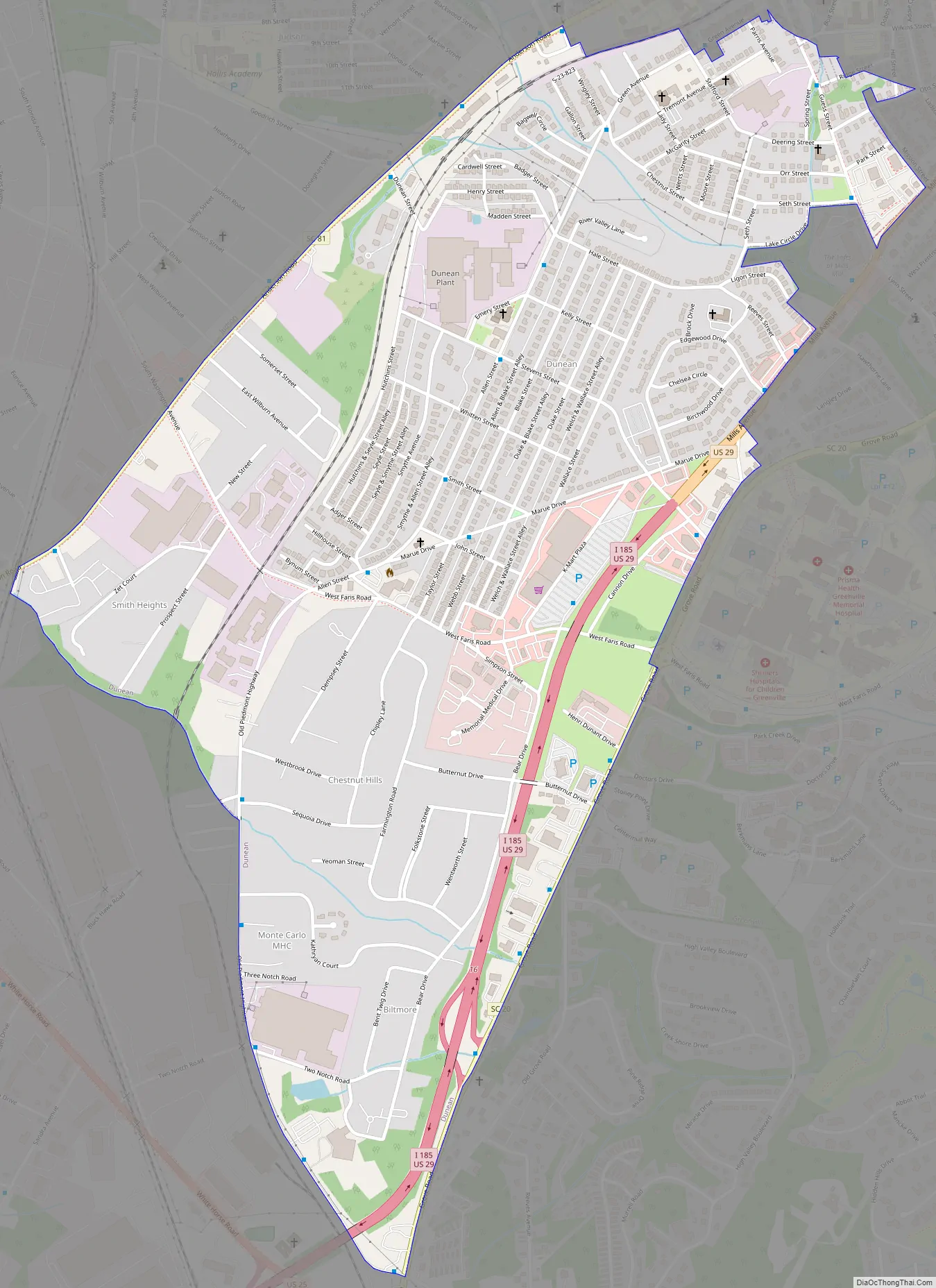
Dunean Road Map
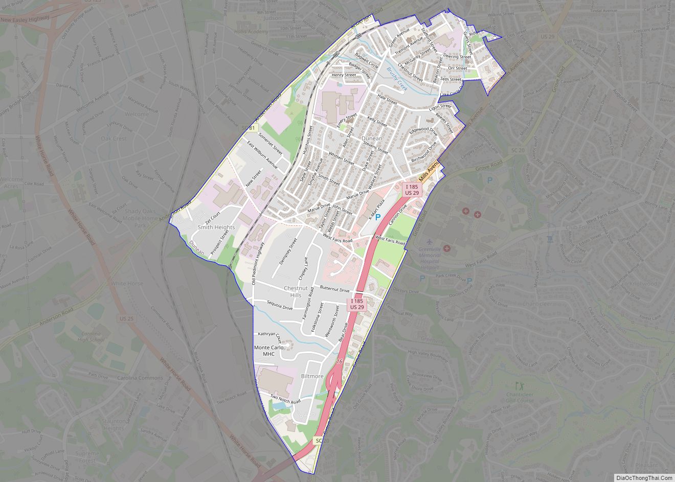
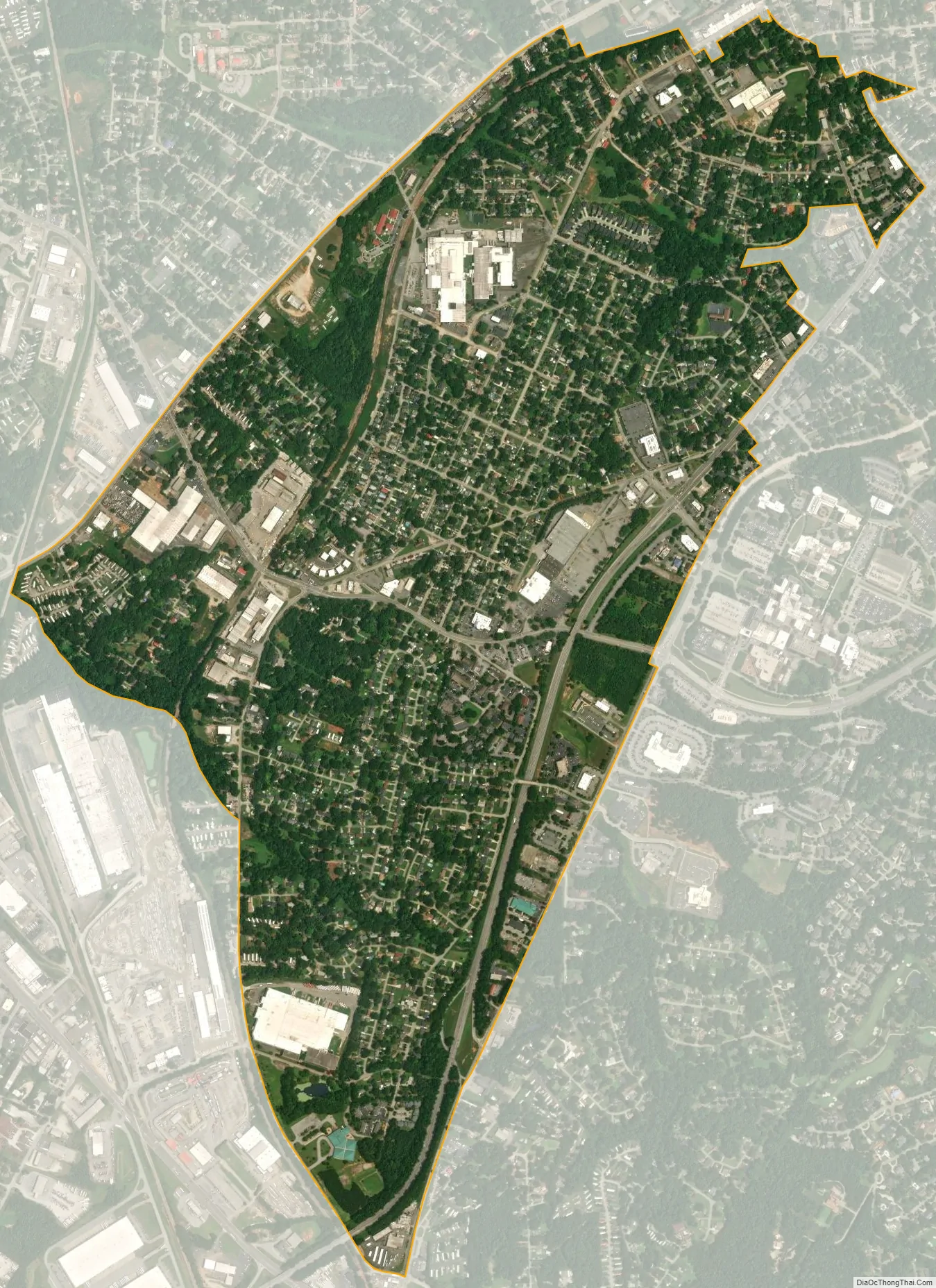
Dunean city Satellite Map
Geography
Dunean is located in central Greenville County at 34°49′24″N 82°25′13″W / 34.82333°N 82.42028°W / 34.82333; -82.42028 (34.823377, -82.420234). It is bordered to the northeast by the city of Greenville, to the north by unincorporated Judson, and to the south by Gantt, also unincorporated. Welcome is to the west. Interstate 185 runs along the southeastern edge of Dunean, turning into a surface highway (Mills Avenue/U.S. Route 29) east of the center of Dunean. I-185 leads southwest 2.5 miles (4.0 km) to its parent highway Interstate 85, and US 29 leads northeast 2.5 miles to the center of Greenville.
According to the United States Census Bureau, the Dunean CDP has a total area of 1.6 square miles (4.1 km), of which 1.87 acres (7,571 m), or 0.19%, are water.
See also
Map of South Carolina State and its subdivision:- Abbeville
- Aiken
- Allendale
- Anderson
- Bamberg
- Barnwell
- Beaufort
- Berkeley
- Calhoun
- Charleston
- Cherokee
- Chester
- Chesterfield
- Clarendon
- Colleton
- Darlington
- Dillon
- Dorchester
- Edgefield
- Fairfield
- Florence
- Georgetown
- Greenville
- Greenwood
- Hampton
- Horry
- Jasper
- Kershaw
- Lancaster
- Laurens
- Lee
- Lexington
- Marion
- Marlboro
- McCormick
- Newberry
- Oconee
- Orangeburg
- Pickens
- Richland
- Saluda
- Spartanburg
- Sumter
- Union
- Williamsburg
- York
- Alabama
- Alaska
- Arizona
- Arkansas
- California
- Colorado
- Connecticut
- Delaware
- District of Columbia
- Florida
- Georgia
- Hawaii
- Idaho
- Illinois
- Indiana
- Iowa
- Kansas
- Kentucky
- Louisiana
- Maine
- Maryland
- Massachusetts
- Michigan
- Minnesota
- Mississippi
- Missouri
- Montana
- Nebraska
- Nevada
- New Hampshire
- New Jersey
- New Mexico
- New York
- North Carolina
- North Dakota
- Ohio
- Oklahoma
- Oregon
- Pennsylvania
- Rhode Island
- South Carolina
- South Dakota
- Tennessee
- Texas
- Utah
- Vermont
- Virginia
- Washington
- West Virginia
- Wisconsin
- Wyoming