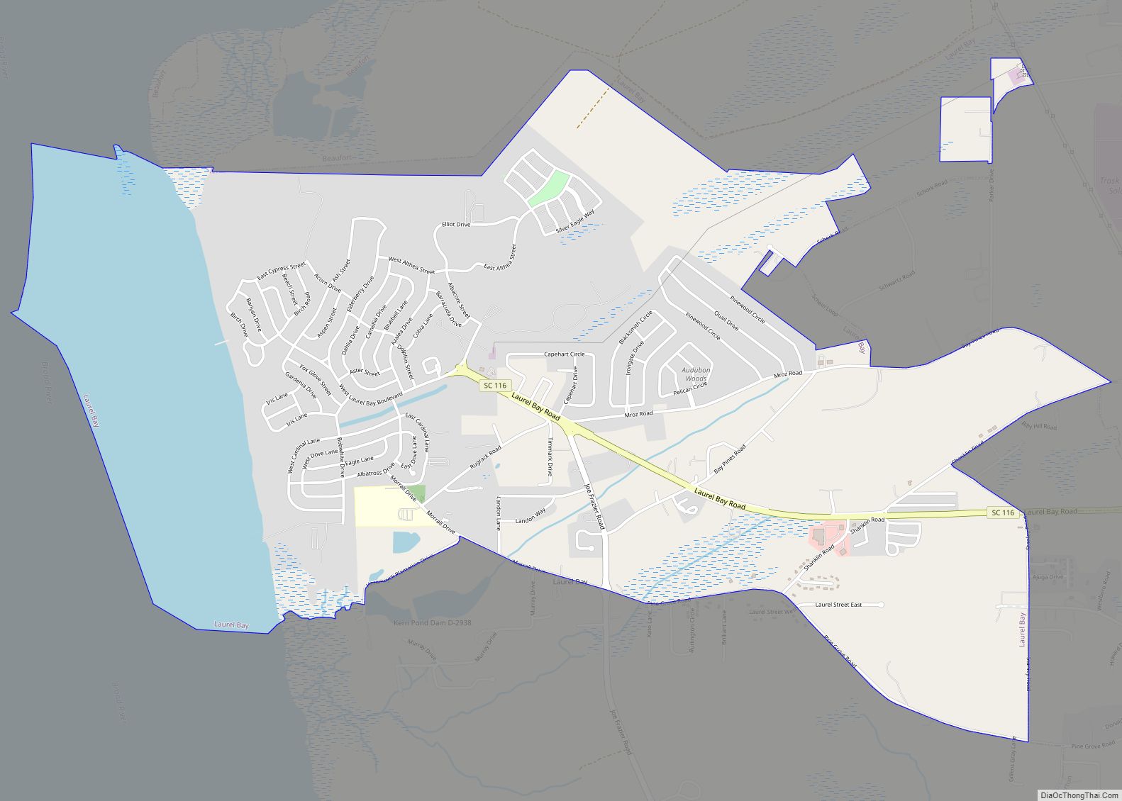
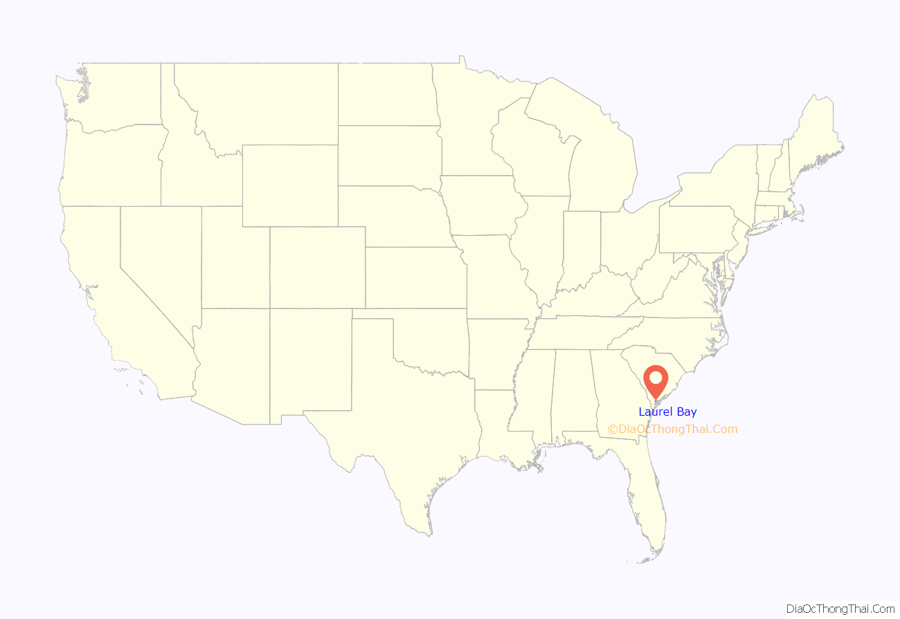
Laurel Bay is a census-designated place and military housing complex in Beaufort County, South Carolina, United States. The population was 5,891 at the 2010 census. As defined by the U.S. Census Bureau, Laurel Bay is included within the Hilton Head Island-Bluffton-Beaufort, SC Metropolitan Statistical Area.
The base primarily houses military personnel with families that are stationed at the nearby military bases: MCAS Beaufort, MCRD Parris Island, and USNH Beaufort. The housing area first opened in the mid-1950s.
| Name: | Laurel Bay CDP |
|---|---|
| LSAD Code: | 57 |
| LSAD Description: | CDP (suffix) |
| State: | South Carolina |
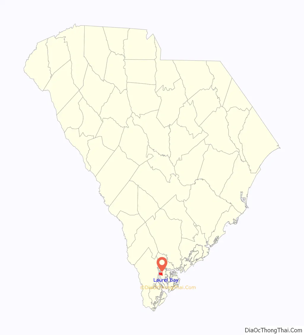
| County: | Beaufort County |
| Elevation: | 36 ft (11 m) |
| Total Area: | 5.05 sq mi (13.09 km²) |
| Land Area: | 4.16 sq mi (10.79 km²) |
| Water Area: | 0.89 sq mi (2.30 km²) |
| Total Population: | 5,082 |
| Population Density: | 1,220.46/sq mi (471.19/km²) |
| ZIP code: | 29906 |
| Area code: | 843, 854 |
| FIPS code: | 4540525 |
| GNISfeature ID: | 1227789 |
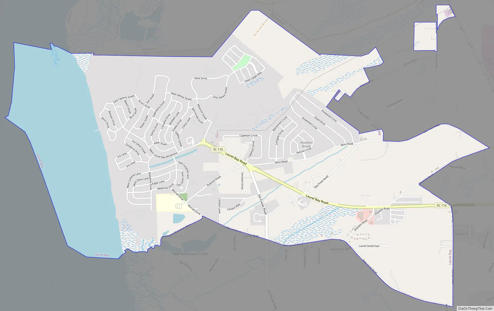
Online Interactive Map
Click on ![]() to view map in "full screen" mode.
to view map in "full screen" mode.
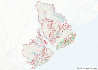
Laurel Bay location map. Where is Laurel Bay CDP?
History
Chester Field, located within the housing area, was listed on the National Register of Historic Places in 1970.
In February 2015, two former Laurel Bay residents expressed health concerns that their children are sick from leukemia cancer by living in the area on YouTube. The housing, in the past, had used heating oil storage tanks for access to heating oil and after the oil was replaced, the tanks were capped and filled with dirt while underground. Starting in 2007, all of the tanks were removed but some heating oil was released. These former residents are worried that benzene vapor, a known carcinogen, from the leaked heating oil made their kids sick. The Marine Corps performed testing at most of the sites and the soil gas tests so far are “within acceptable limits” and SC DHEC data indicates that the 29906 zip code, which includes all of Laurel Bay Housing, does not show an increased rate of cancer.
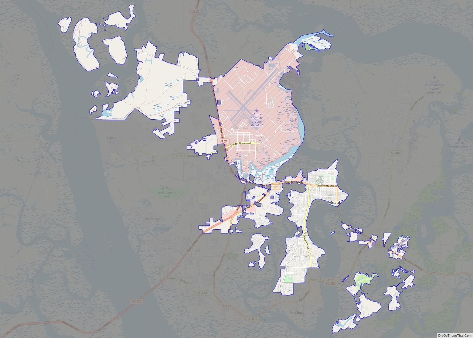
Laurel Bay Road Map
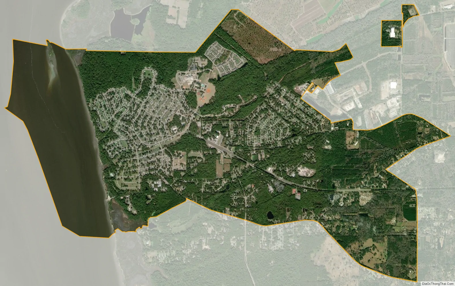
Laurel Bay city Satellite Map
Geography
Laurel Bay is located at 32°27′28″N 80°47′26″W / 32.45778°N 80.79056°W / 32.45778; -80.79056 (32.457905, -80.790501).
According to the United States Census Bureau, the census-designated place (CDP) has a total area of 5.4 square miles (14.0 km), of which 4.5 square miles (11.7 km) is land and 0.89 square miles (2.3 km), or 16.50%, is water.
See also
Map of South Carolina State and its subdivision:- Abbeville
- Aiken
- Allendale
- Anderson
- Bamberg
- Barnwell
- Beaufort
- Berkeley
- Calhoun
- Charleston
- Cherokee
- Chester
- Chesterfield
- Clarendon
- Colleton
- Darlington
- Dillon
- Dorchester
- Edgefield
- Fairfield
- Florence
- Georgetown
- Greenville
- Greenwood
- Hampton
- Horry
- Jasper
- Kershaw
- Lancaster
- Laurens
- Lee
- Lexington
- Marion
- Marlboro
- McCormick
- Newberry
- Oconee
- Orangeburg
- Pickens
- Richland
- Saluda
- Spartanburg
- Sumter
- Union
- Williamsburg
- York
- Alabama
- Alaska
- Arizona
- Arkansas
- California
- Colorado
- Connecticut
- Delaware
- District of Columbia
- Florida
- Georgia
- Hawaii
- Idaho
- Illinois
- Indiana
- Iowa
- Kansas
- Kentucky
- Louisiana
- Maine
- Maryland
- Massachusetts
- Michigan
- Minnesota
- Mississippi
- Missouri
- Montana
- Nebraska
- Nevada
- New Hampshire
- New Jersey
- New Mexico
- New York
- North Carolina
- North Dakota
- Ohio
- Oklahoma
- Oregon
- Pennsylvania
- Rhode Island
- South Carolina
- South Dakota
- Tennessee
- Texas
- Utah
- Vermont
- Virginia
- Washington
- West Virginia
- Wisconsin
- Wyoming