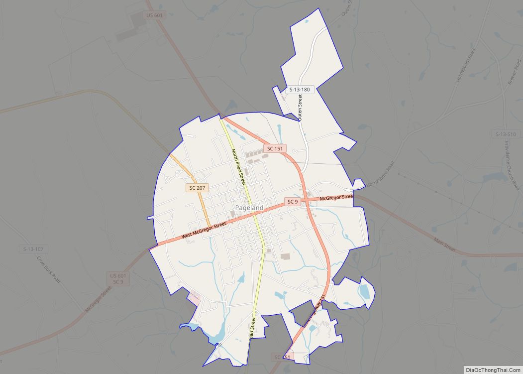
Pageland is a town in Chesterfield County, South Carolina, United States. It is the second largest town in Chesterfield County. The population was 2,760 at the 2010 census.
It is known as “The Watermelon Capital of World” because of the importance of watermelons to the town and its economy. The annual Pageland Watermelon Festival is held every July. Pageland’s water tower features a watermelon on the tank.
| Name: | Pageland town |
|---|---|
| LSAD Code: | 43 |
| LSAD Description: | town (suffix) |
| State: | South Carolina |
| County: | Chesterfield County |
| Elevation: | 656 ft (200 m) |
| Total Area: | 4.90 sq mi (12.69 km²) |
| Land Area: | 4.86 sq mi (12.58 km²) |
| Water Area: | 0.04 sq mi (0.11 km²) |
| Total Population: | 2,456 |
| Population Density: | 505.77/sq mi (195.27/km²) |
| ZIP code: | 29728 |
| Area code: | 843, 854 |
| FIPS code: | 4554025 |
| GNISfeature ID: | 1250011 |
| Website: | http://townofpageland.com |
Online Interactive Map
Click on ![]() to view map in "full screen" mode.
to view map in "full screen" mode.
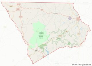
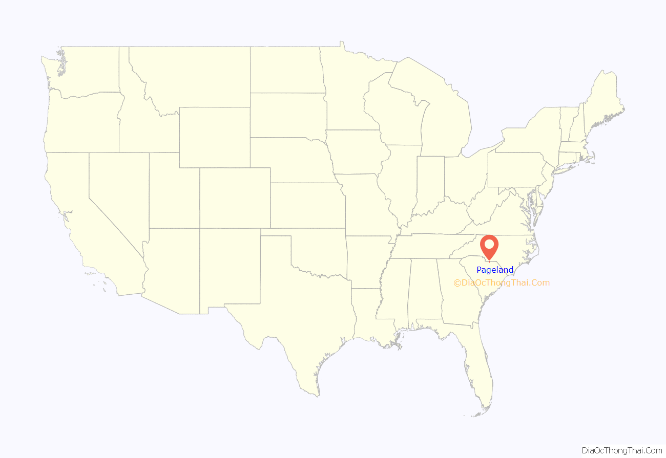
Pageland location map. Where is Pageland town?
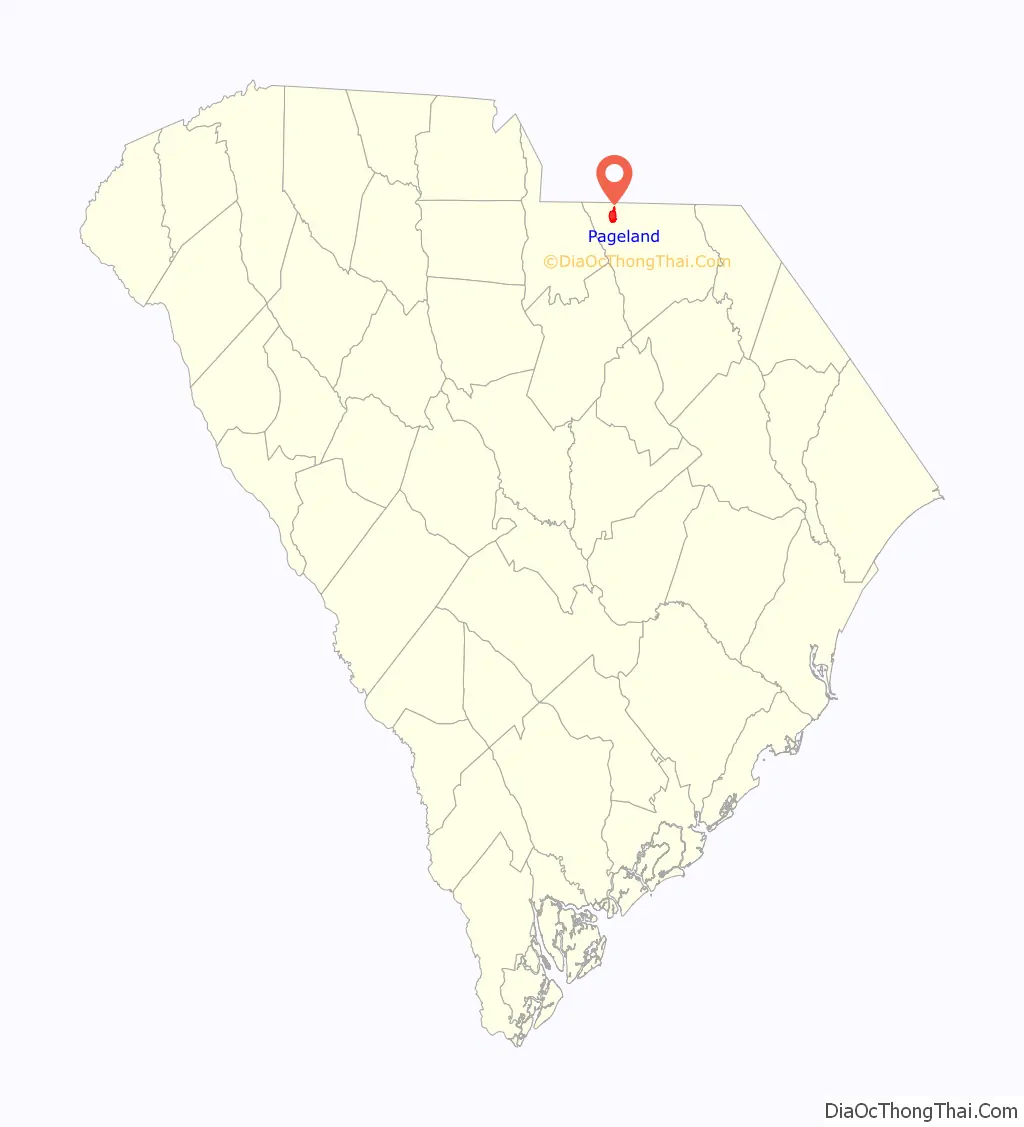
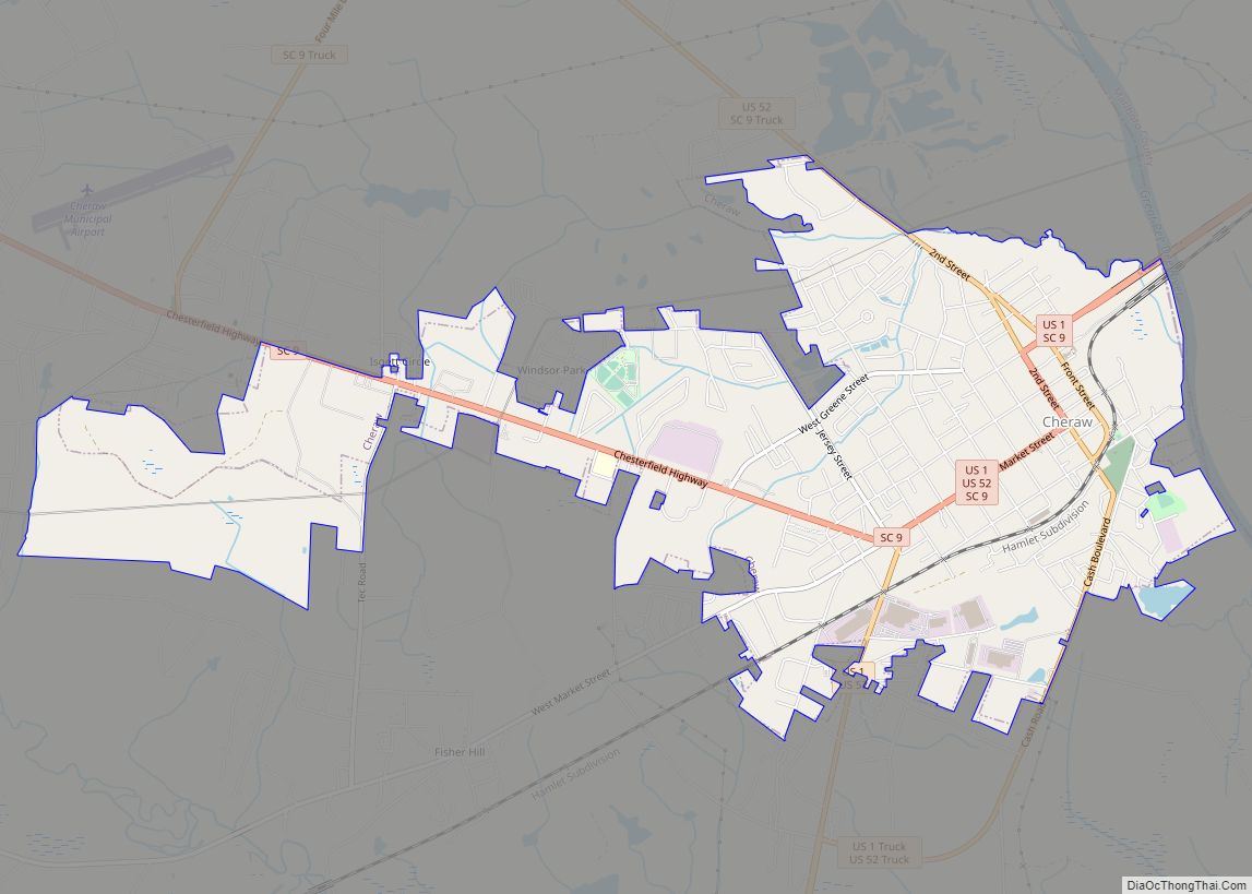
Pageland Road Map
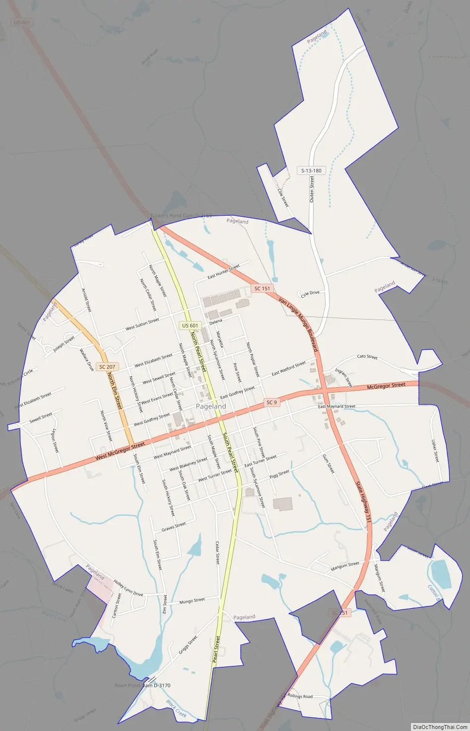
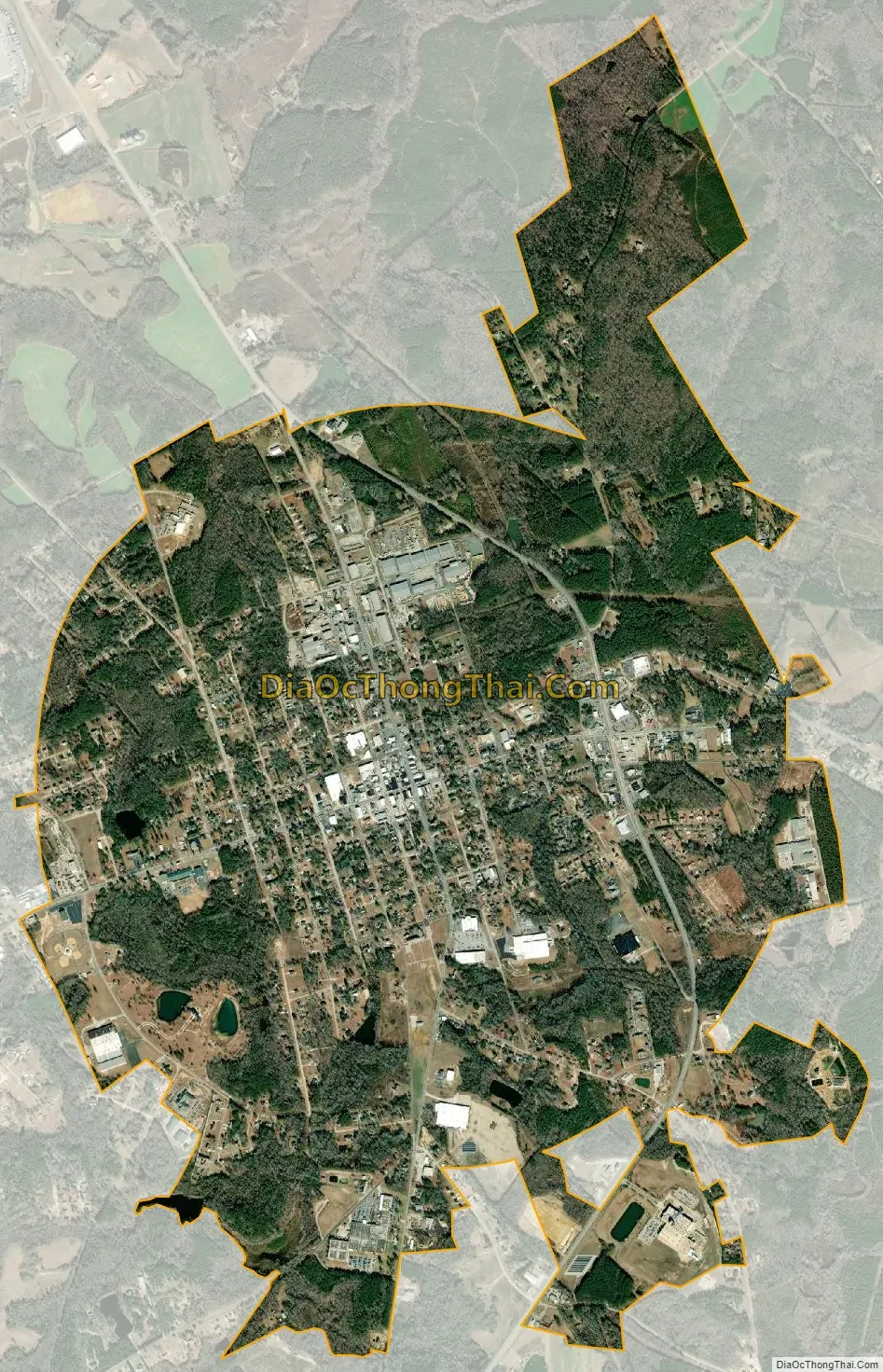
Pageland city Satellite Map
Geography
Pageland is located in northwestern Chesterfield County at 34°46′17″N 80°23′30″W / 34.77139°N 80.39167°W / 34.77139; -80.39167 (34.771272, -80.391630). U.S. Route 601 passes through the town, leading north 18 miles (29 km) to Monroe, North Carolina, and southwest 20 miles (32 km) to Kershaw. Charlotte, North Carolina, is 41 miles (66 km) to the northwest via US 601 and US 74. South Carolina Highway 9 leads east from Pageland 19 miles (31 km) to Chesterfield and west 23 miles (37 km) to Lancaster. South Carolina Highway 151 leads south 8 miles (13 km) to Jefferson.
According to the United States Census Bureau, Pageland has a total area of 4.4 square miles (11.4 km), of which 4.4 square miles (11.3 km) is land and 0.04 square miles (0.1 km), or 0.97%, is water.
Neighboring towns
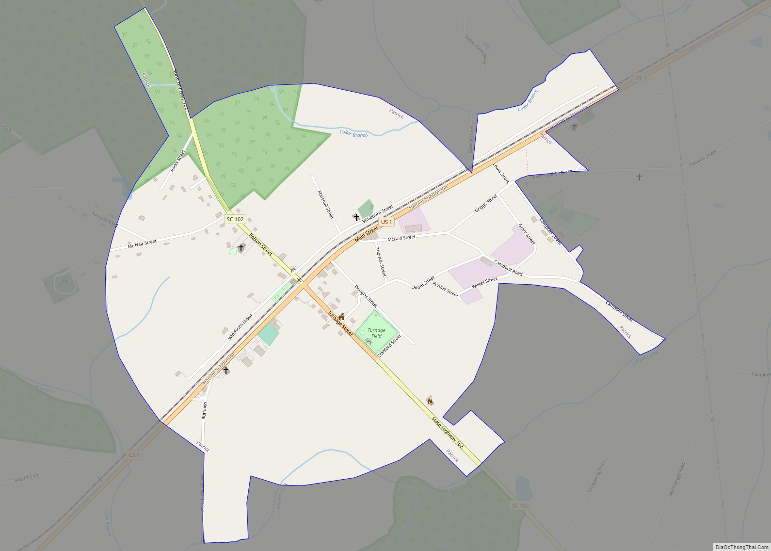
- Monroe, North Carolina – north
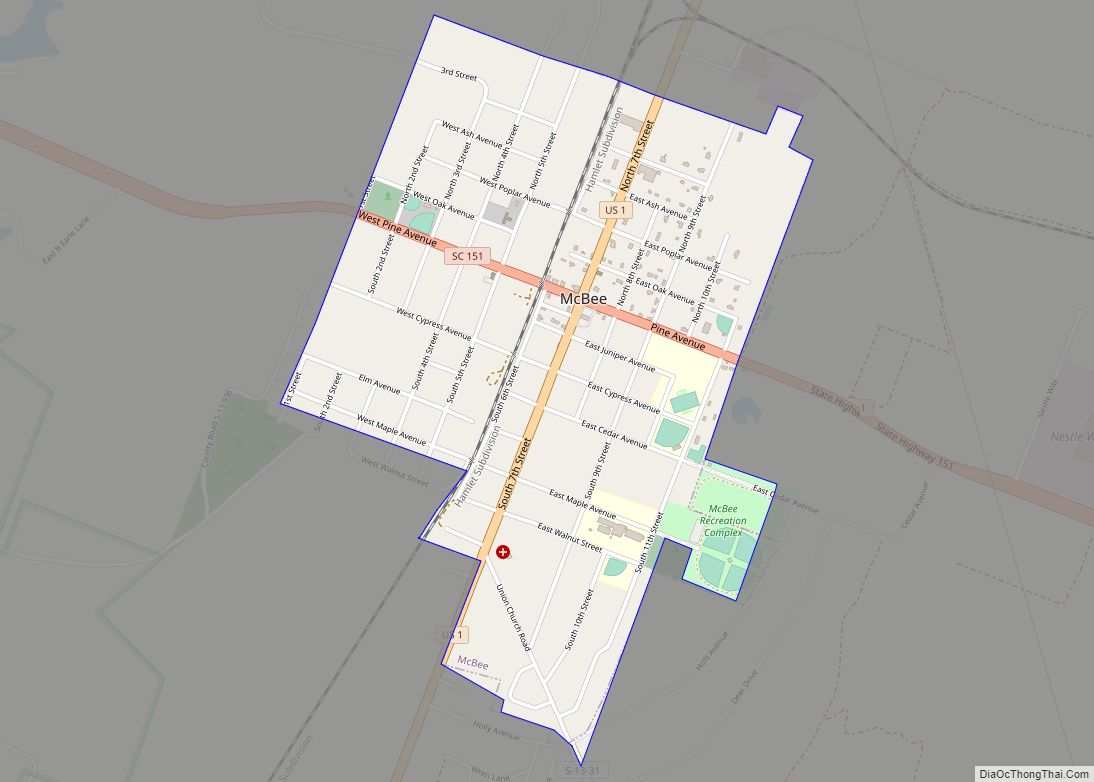
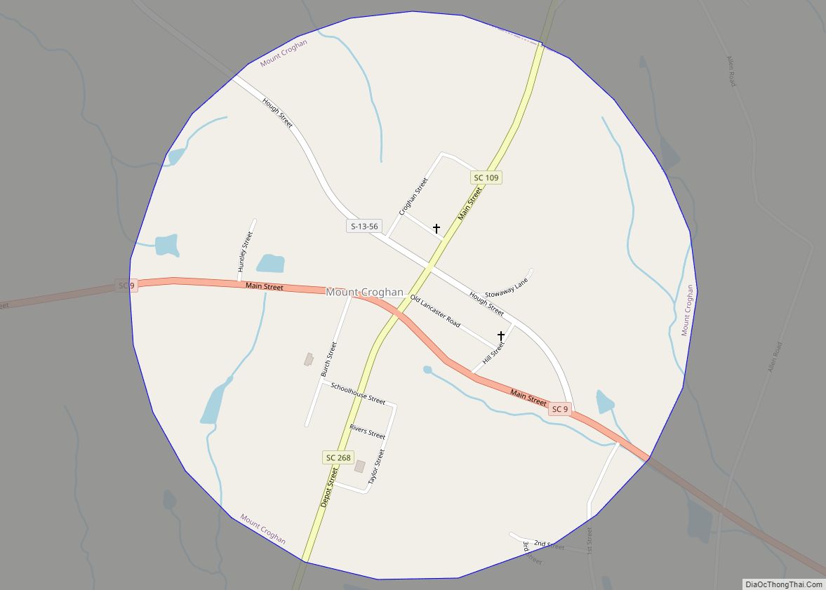
- Mount Croghan, South Carolina – east
- Jefferson, South Carolina – south
- Lancaster, South Carolina – west
Major highways
See also
Map of South Carolina State and its subdivision:- Abbeville
- Aiken
- Allendale
- Anderson
- Bamberg
- Barnwell
- Beaufort
- Berkeley
- Calhoun
- Charleston
- Cherokee
- Chester
- Chesterfield
- Clarendon
- Colleton
- Darlington
- Dillon
- Dorchester
- Edgefield
- Fairfield
- Florence
- Georgetown
- Greenville
- Greenwood
- Hampton
- Horry
- Jasper
- Kershaw
- Lancaster
- Laurens
- Lee
- Lexington
- Marion
- Marlboro
- McCormick
- Newberry
- Oconee
- Orangeburg
- Pickens
- Richland
- Saluda
- Spartanburg
- Sumter
- Union
- Williamsburg
- York
- Alabama
- Alaska
- Arizona
- Arkansas
- California
- Colorado
- Connecticut
- Delaware
- District of Columbia
- Florida
- Georgia
- Hawaii
- Idaho
- Illinois
- Indiana
- Iowa
- Kansas
- Kentucky
- Louisiana
- Maine
- Maryland
- Massachusetts
- Michigan
- Minnesota
- Mississippi
- Missouri
- Montana
- Nebraska
- Nevada
- New Hampshire
- New Jersey
- New Mexico
- New York
- North Carolina
- North Dakota
- Ohio
- Oklahoma
- Oregon
- Pennsylvania
- Rhode Island
- South Carolina
- South Dakota
- Tennessee
- Texas
- Utah
- Vermont
- Virginia
- Washington
- West Virginia
- Wisconsin
- Wyoming