Welcome is a census-designated place (CDP) in Greenville County, South Carolina, United States. The population was 6,668 at the 2010 census. It is part of the Greenville–Mauldin–Easley Metropolitan Statistical Area. Welcome has been noted for its colorful place name.
| Name: | Welcome CDP |
|---|---|
| LSAD Code: | 57 |
| LSAD Description: | CDP (suffix) |
| State: | South Carolina |
| County: | Greenville County |
| Elevation: | 984 ft (300 m) |
| Total Area: | 4.66 sq mi (12.07 km²) |
| Land Area: | 4.61 sq mi (11.95 km²) |
| Water Area: | 0.05 sq mi (0.12 km²) |
| Total Population: | 7,298 |
| Population Density: | 1,582.05/sq mi (610.82/km²) |
| ZIP code: | 29611 |
| Area code: | 864 |
| FIPS code: | 4575535 |
| GNISfeature ID: | 1231902 |
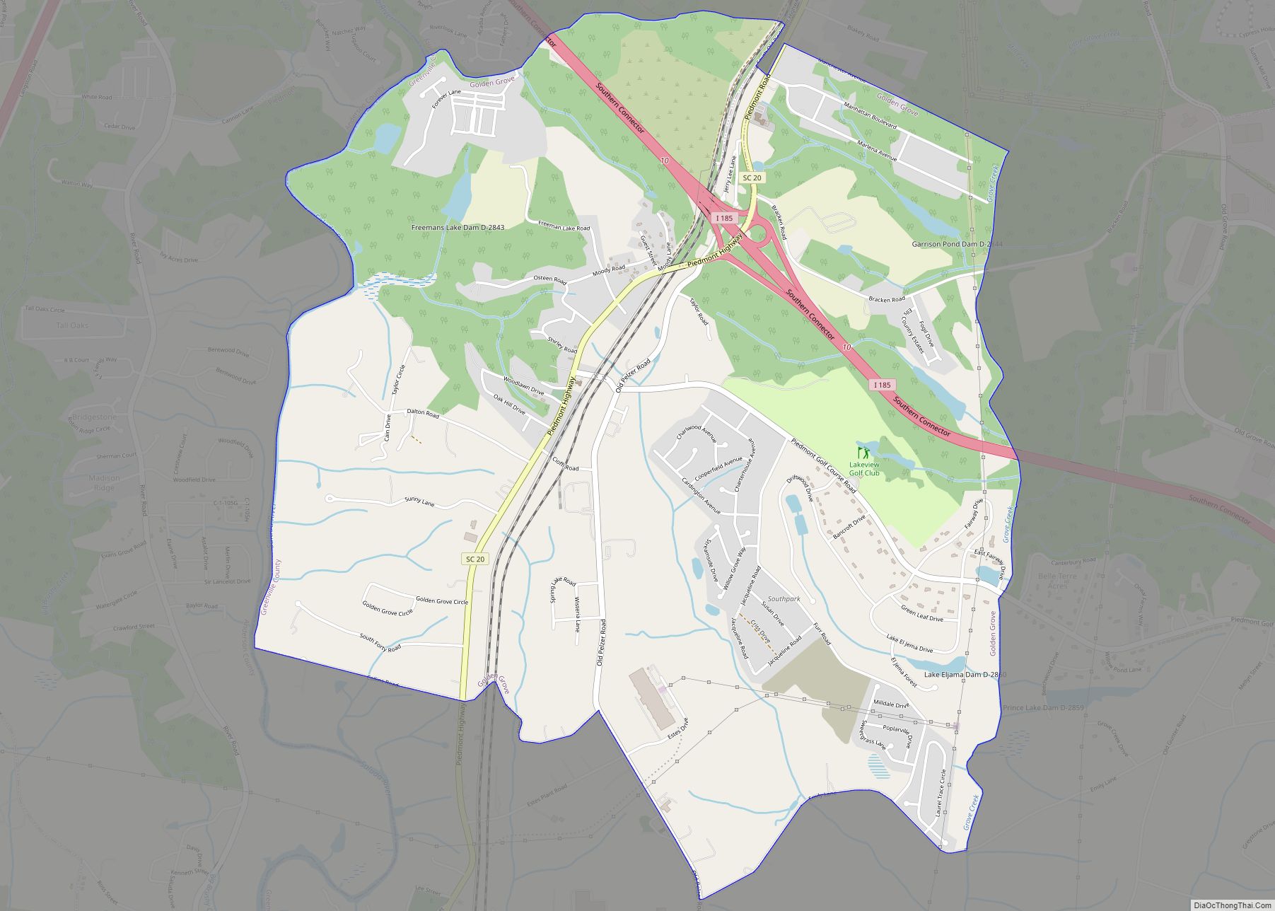
Online Interactive Map
Click on ![]() to view map in "full screen" mode.
to view map in "full screen" mode.
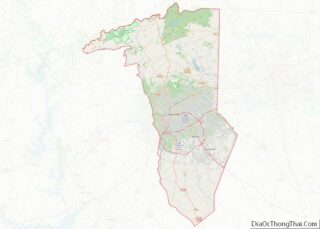
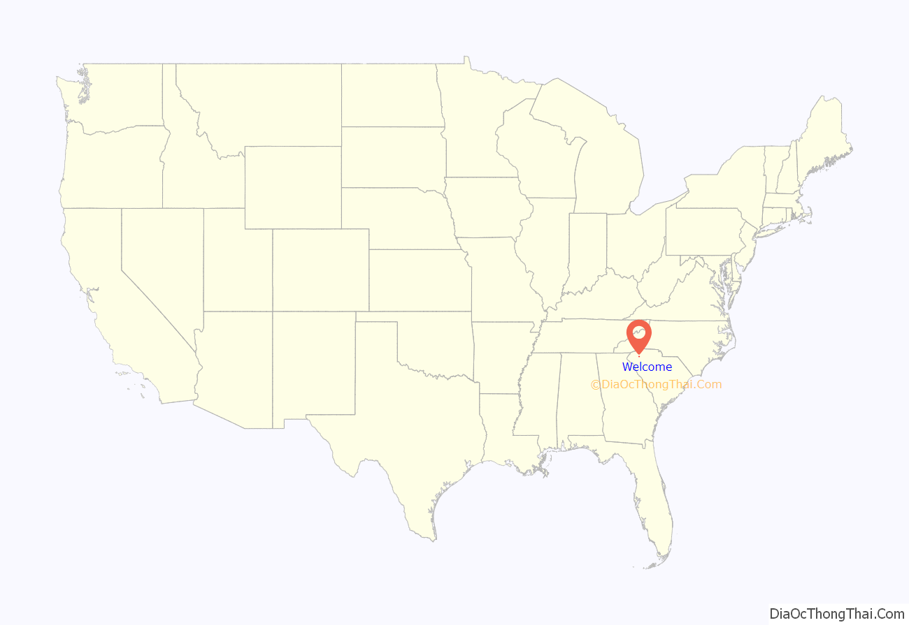
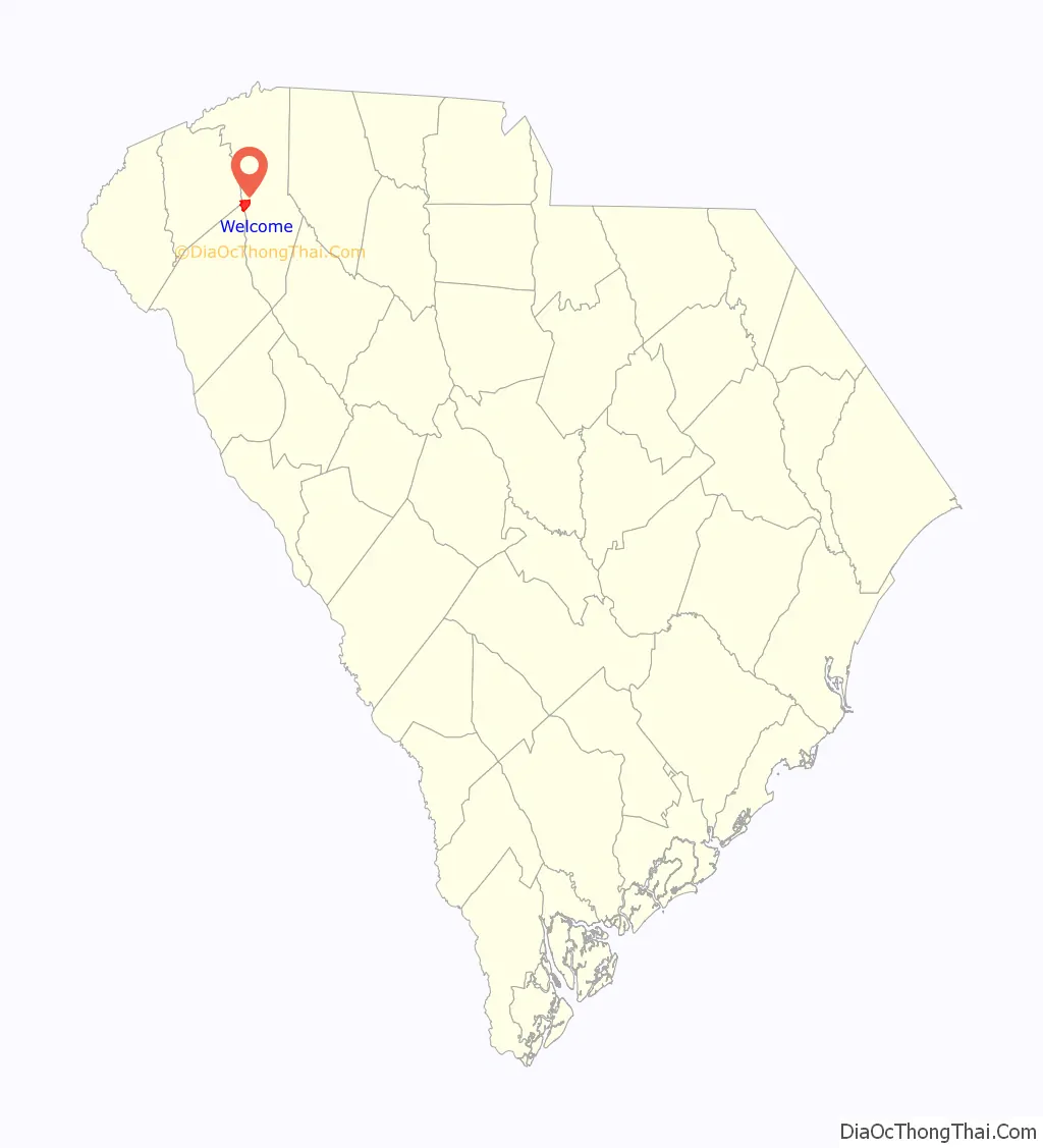
Welcome location map. Where is Welcome CDP?
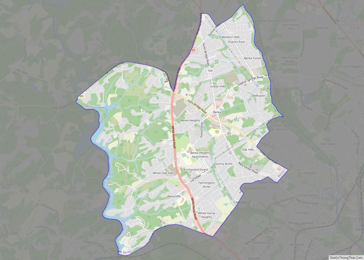
Welcome Road Map
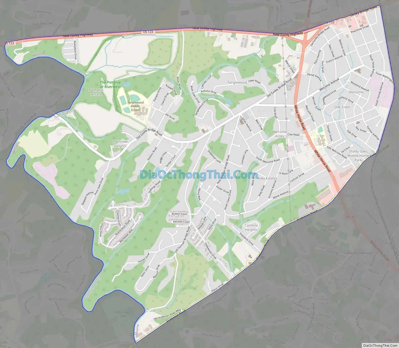
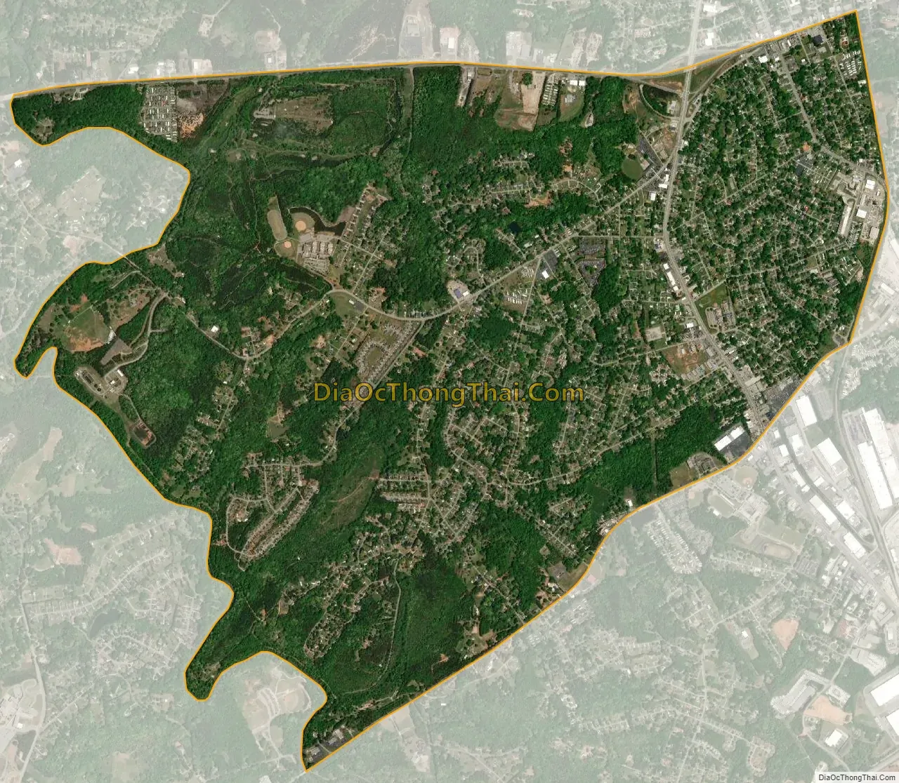
Welcome city Satellite Map
Geography
Welcome is located in west-central Greenville County at 34°49′20″N 82°26′54″W / 34.82222°N 82.44833°W / 34.82222; -82.44833 (34.822089, -82.448455). It is bordered to the north by Parker, to the east by Judson, to the southwest by Powdersville in Anderson County and to the west by Pickens County. The western border of the CDP follows the Saluda River, which forms the county line.
U.S. Route 123 (New Easley Highway) forms the northern edge of the CDP; the highway leads east 4 miles (6 km) to the center of Greenville and west 9 miles (14 km) to Easley. U.S. Route 25 (White Horse Road) passes through the east side of the CDP, leading north 10 miles (16 km) to Travelers Rest and south 4 miles (6 km) to Gantt.
According to the United States Census Bureau, the Welcome CDP has a total area of 4.7 square miles (12.1 km), of which 0.04 square miles (0.1 km), or 1.05%, are water.
See also
Map of South Carolina State and its subdivision:- Abbeville
- Aiken
- Allendale
- Anderson
- Bamberg
- Barnwell
- Beaufort
- Berkeley
- Calhoun
- Charleston
- Cherokee
- Chester
- Chesterfield
- Clarendon
- Colleton
- Darlington
- Dillon
- Dorchester
- Edgefield
- Fairfield
- Florence
- Georgetown
- Greenville
- Greenwood
- Hampton
- Horry
- Jasper
- Kershaw
- Lancaster
- Laurens
- Lee
- Lexington
- Marion
- Marlboro
- McCormick
- Newberry
- Oconee
- Orangeburg
- Pickens
- Richland
- Saluda
- Spartanburg
- Sumter
- Union
- Williamsburg
- York
- Alabama
- Alaska
- Arizona
- Arkansas
- California
- Colorado
- Connecticut
- Delaware
- District of Columbia
- Florida
- Georgia
- Hawaii
- Idaho
- Illinois
- Indiana
- Iowa
- Kansas
- Kentucky
- Louisiana
- Maine
- Maryland
- Massachusetts
- Michigan
- Minnesota
- Mississippi
- Missouri
- Montana
- Nebraska
- Nevada
- New Hampshire
- New Jersey
- New Mexico
- New York
- North Carolina
- North Dakota
- Ohio
- Oklahoma
- Oregon
- Pennsylvania
- Rhode Island
- South Carolina
- South Dakota
- Tennessee
- Texas
- Utah
- Vermont
- Virginia
- Washington
- West Virginia
- Wisconsin
- Wyoming