Lyon County is a county in the U.S. state of Minnesota. As of the 2020 census, the population was 25,269. Its county seat is Marshall.
Lyon County comprises the Marshall, MN Micropolitan Statistical Area.
| Name: | Lyon County |
|---|---|
| FIPS code: | 27-083 |
| State: | Minnesota |
| Founded: | March 6, 1868 March 2, 1869 |
| Named for: | Nathaniel Lyon |
| Seat: | Marshall |
| Largest city: | Marshall |
| Total Area: | 722 sq mi (1,870 km²) |
| Land Area: | 715 sq mi (1,850 km²) |
| Total Population: | 25,269 |
| Population Density: | 35.3/sq mi (13.6/km²) |
| Time zone: | UTC−6 (Central) |
| Summer Time Zone (DST): | UTC−5 (CDT) |
| Website: | www.lyonco.org |
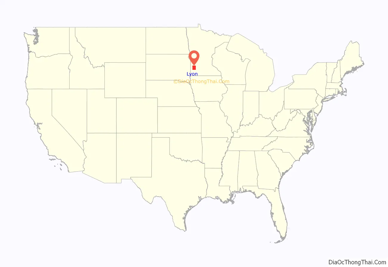
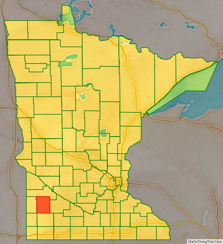
Lyon County location map. Where is Lyon County?
History
The county was established by two acts of the Minnesota state legislature, dated March 6, 1868, and March 2, 1869. The county seat was designated as Marshall. The county was named for Nathaniel Lyon, an Army officer who served in the Dakota and Minnesota territories before being killed in the Civil War in 1861. He had achieved the rank of general by his death. The county was much larger until an act passed on March 6, 1873, made the western 43% the new Lincoln County.
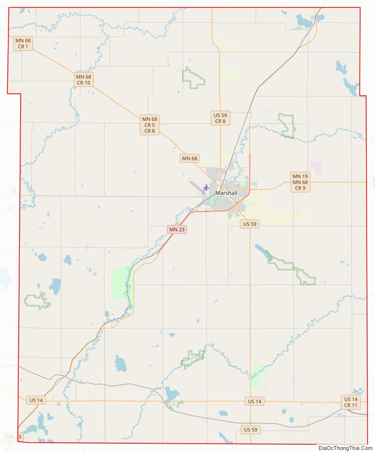
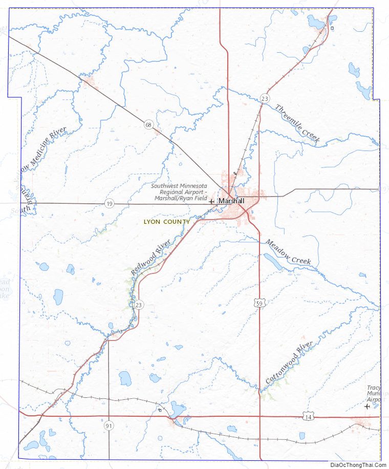
Lyon County Road Map
Geography
The Yellow Medicine River flows northeast through the upper portion of the county, the Redwood River flows northeast through the central part, and the Cottonwood River flows northeast through the lower part. The county’s terrain consists of low rolling hills, etched by drainages and gullies. It slopes to the north and east, with its highest point near its southwest corner, at 1,729′ (527m) ASL. The county has a total area of 722 square miles (1,870 km), of which 715 square miles (1,850 km) is land and 7.1 square miles (18 km) (1.0%) is water.
Lakes
- Clear Lake
- Cottonwood Lake
- Dead Coon Lake
- East Twin Lake
- Goose Lake
- Island Lake
- Lady Slipper Lake
- Lake Marshall
- Lake of the Hill
- Lake Yankton
- Lone Tree Lake (part)
- Long Lake (part)
- McKay Lake
- North Twin Lake
- Rock Lake
- School Grove Lake (part)
- Sham Lake
- South Twin Lake
- Swift Lake
- West Twin Lake
- Wood Lake
Major highways
- U.S. Highway 14
- U.S. Highway 59
- Minnesota State Highway 19
- Minnesota State Highway 23
- Minnesota State Highway 68
- Minnesota State Highway 91
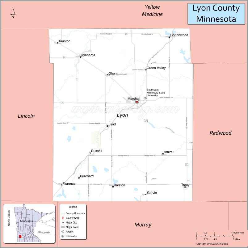
Airports
- Southwest Minnesota Regional Airport (MML)
- Tracy Municipal Airport (TKC)
Adjacent counties
- Yellow Medicine County – north
- Redwood County – east
- Murray County – south
- Pipestone County – southwest
- Lincoln County – west
Protected areas
- Camden State Park
- Gadwall State Wildlife Management Area
- Garvin State Park
- Grandview State Wildlife Management Area
- Greenhead State Wildlife Management Area
- Glynn Prairie Scientific and Natural Area
- Shelburne State Wildlife Management Area
- Vallers State Wildlife Management Area
Lyon County Topographic Map
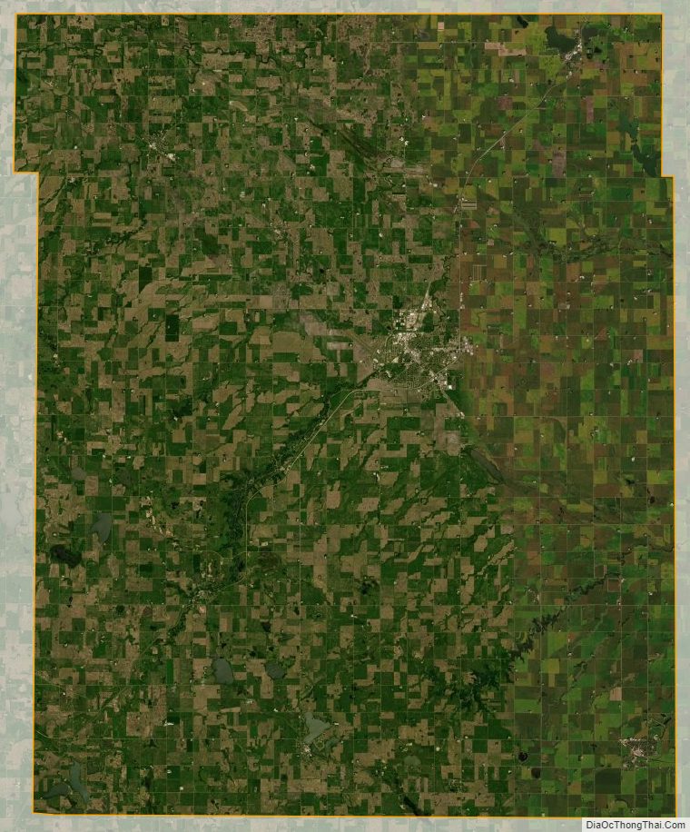
Lyon County Satellite Map
Lyon County Outline Map

See also
Map of Minnesota State and its subdivision:- Aitkin
- Anoka
- Becker
- Beltrami
- Benton
- Big Stone
- Blue Earth
- Brown
- Carlton
- Carver
- Cass
- Chippewa
- Chisago
- Clay
- Clearwater
- Cook
- Cottonwood
- Crow Wing
- Dakota
- Dodge
- Douglas
- Faribault
- Fillmore
- Freeborn
- Goodhue
- Grant
- Hennepin
- Houston
- Hubbard
- Isanti
- Itasca
- Jackson
- Kanabec
- Kandiyohi
- Kittson
- Koochiching
- Lac qui Parle
- Lake
- Lake of the Woods
- Lake Superior
- Le Sueur
- Lincoln
- Lyon
- Mahnomen
- Marshall
- Martin
- McLeod
- Meeker
- Mille Lacs
- Morrison
- Mower
- Murray
- Nicollet
- Nobles
- Norman
- Olmsted
- Otter Tail
- Pennington
- Pine
- Pipestone
- Polk
- Pope
- Ramsey
- Red Lake
- Redwood
- Renville
- Rice
- Rock
- Roseau
- Saint Louis
- Scott
- Sherburne
- Sibley
- Stearns
- Steele
- Stevens
- Swift
- Todd
- Traverse
- Wabasha
- Wadena
- Waseca
- Washington
- Watonwan
- Wilkin
- Winona
- Wright
- Yellow Medicine
- Alabama
- Alaska
- Arizona
- Arkansas
- California
- Colorado
- Connecticut
- Delaware
- District of Columbia
- Florida
- Georgia
- Hawaii
- Idaho
- Illinois
- Indiana
- Iowa
- Kansas
- Kentucky
- Louisiana
- Maine
- Maryland
- Massachusetts
- Michigan
- Minnesota
- Mississippi
- Missouri
- Montana
- Nebraska
- Nevada
- New Hampshire
- New Jersey
- New Mexico
- New York
- North Carolina
- North Dakota
- Ohio
- Oklahoma
- Oregon
- Pennsylvania
- Rhode Island
- South Carolina
- South Dakota
- Tennessee
- Texas
- Utah
- Vermont
- Virginia
- Washington
- West Virginia
- Wisconsin
- Wyoming