Pope County is a county in the U.S. state of Minnesota. As of the 2020 census, the population was 11,308. Its county seat is Glenwood. The county was formed in 1862 and organized in 1866.
| Name: | Pope County |
|---|---|
| FIPS code: | 27-121 |
| State: | Minnesota |
| Founded: | 1862 |
| Named for: | John Pope |
| Seat: | Glenwood |
| Largest city: | Glenwood |
| Total Area: | 717 sq mi (1,860 km²) |
| Land Area: | 670 sq mi (1,700 km²) |
| Total Population: | 11,308 |
| Population Density: | 16.9/sq mi (6.5/km²) |
| Time zone: | UTC−6 (Central) |
| Summer Time Zone (DST): | UTC−5 (CDT) |
| Website: | www.co.pope.mn.us |
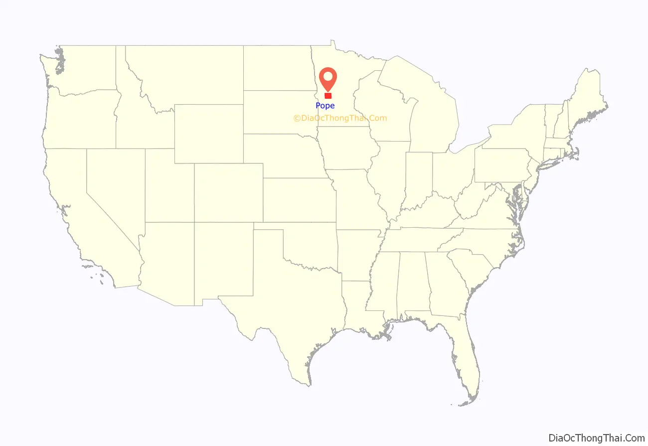
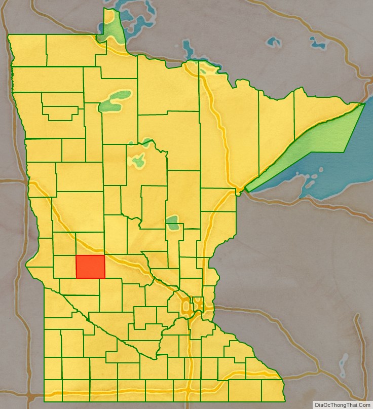
Pope County location map. Where is Pope County?
History
Pope County was identified by the state legislature in 1862 and named for John Pope, a Union Army general who had worked as a surveyor in the area. Its organization was effected in 1866.
Pope County was the location of several protests against the CU Powerline in the 1970s.
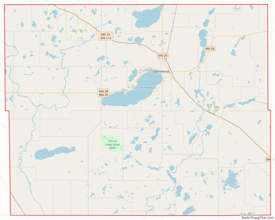
Pope County Road Map

Geography
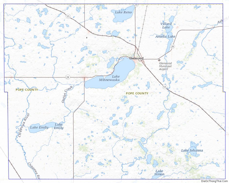
The Chippewa River flows south through the county’s western part. The Little Chippewa River flows south-southwest through its central part, discharging into the Chippewa southeast of Cyrus. The East Branch Chippewa River flows south-southwest through the eastern part of the county toward its union with the Chippewa in neighboring Swift County. The county terrain consists of low rolling hills, carved with drainages and dotted with lakes and ponds. The area is devoted to agriculture. The terrain slopes to the south and west, with its highest point near the northeast corner at 1,388′ (423m) ASL. The county has an area of 717 square miles (1,860 km), of which 670 square miles (1,700 km) is land and 47 square miles (120 km) (6.6%) is water.
Major highways
- Minnesota State Highway 9
- Minnesota State Highway 28
- Minnesota State Highway 29
- Minnesota State Highway 55
- Minnesota State Highway 104
- Minnesota State Highway 114
Airports
- Glenwood Municipal Airport (D32)
- Starbuck Municipal Airport (GHW)
Adjacent counties
- Douglas County – north
- Stearns County – east
- Kandiyohi County – southeast
- Swift County – south
- Stevens County – west
- Grant County – northwest
Protected areas
- Bruce Hitman Heron Rookery Scientific and Natural Area
- Farwell State Wildlife Management Area
- Glacial Lakes State Park
- Langhei Scientific and Natural Area
- Little Jo State Wildlife Management Area
- Lowry State Wildlife Management Area
- New Prairie State Wildlife Management Area
- Noordmans State Wildlife Management Area
- Skarpness State Wildlife Management Area
- Van Luik State Wildlife Management Area
- Wade State Wildlife Management Area
Major lakes
- Amelia Lake
- Goose Lake
- Lake Emily
- Lake Johanna
- Lake Minnewaska
- Lake Reno (part)
- Lake Simon
- Pelican Lake
- Pike Lake
- Scandinavian Lake
Pope County Topographic Map
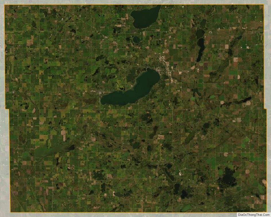
Pope County Satellite Map
Pope County Outline Map

See also
Map of Minnesota State and its subdivision:- Aitkin
- Anoka
- Becker
- Beltrami
- Benton
- Big Stone
- Blue Earth
- Brown
- Carlton
- Carver
- Cass
- Chippewa
- Chisago
- Clay
- Clearwater
- Cook
- Cottonwood
- Crow Wing
- Dakota
- Dodge
- Douglas
- Faribault
- Fillmore
- Freeborn
- Goodhue
- Grant
- Hennepin
- Houston
- Hubbard
- Isanti
- Itasca
- Jackson
- Kanabec
- Kandiyohi
- Kittson
- Koochiching
- Lac qui Parle
- Lake
- Lake of the Woods
- Lake Superior
- Le Sueur
- Lincoln
- Lyon
- Mahnomen
- Marshall
- Martin
- McLeod
- Meeker
- Mille Lacs
- Morrison
- Mower
- Murray
- Nicollet
- Nobles
- Norman
- Olmsted
- Otter Tail
- Pennington
- Pine
- Pipestone
- Polk
- Pope
- Ramsey
- Red Lake
- Redwood
- Renville
- Rice
- Rock
- Roseau
- Saint Louis
- Scott
- Sherburne
- Sibley
- Stearns
- Steele
- Stevens
- Swift
- Todd
- Traverse
- Wabasha
- Wadena
- Waseca
- Washington
- Watonwan
- Wilkin
- Winona
- Wright
- Yellow Medicine
- Alabama
- Alaska
- Arizona
- Arkansas
- California
- Colorado
- Connecticut
- Delaware
- District of Columbia
- Florida
- Georgia
- Hawaii
- Idaho
- Illinois
- Indiana
- Iowa
- Kansas
- Kentucky
- Louisiana
- Maine
- Maryland
- Massachusetts
- Michigan
- Minnesota
- Mississippi
- Missouri
- Montana
- Nebraska
- Nevada
- New Hampshire
- New Jersey
- New Mexico
- New York
- North Carolina
- North Dakota
- Ohio
- Oklahoma
- Oregon
- Pennsylvania
- Rhode Island
- South Carolina
- South Dakota
- Tennessee
- Texas
- Utah
- Vermont
- Virginia
- Washington
- West Virginia
- Wisconsin
- Wyoming