Center Point is a city and a former census-designated place (CDP) in northeastern Jefferson County, Alabama, United States. It is part of the Birmingham metropolitan area. At the 2020 census, the population was 16,406. However, after its incorporation in 2002, the city’s boundaries are much smaller than those of the CDP. As of the 2010 census, the population of the incorporated city was 16,921. The public high school for Center Point is Center Point High School grades 9th-12th. The public middle school for Center Point is Erwin Middle School grades 6th-8th. Center Point has 2 public elementary schools, Erwin Intermediate School grades 3rd-5th and Center Point Elementary School grades K-2nd.
| Name: | Center Point city |
|---|---|
| LSAD Code: | 25 |
| LSAD Description: | city (suffix) |
| State: | Alabama |
| County: | Jefferson County |
| Elevation: | 850 ft (260 m) |
| Total Area: | 6.22 sq mi (16.12 km²) |
| Land Area: | 6.21 sq mi (16.10 km²) |
| Water Area: | 0.01 sq mi (0.02 km²) |
| Total Population: | 16,406 |
| Population Density: | 2,639.74/sq mi (1,019.22/km²) |
| ZIP code: | 35215 |
| Area code: | 205 & 659 |
| FIPS code: | 0113264 |
| GNISfeature ID: | 2404020 |
| Website: | https://www.cityofcenterpoint.org/ |
Online Interactive Map
Click on ![]() to view map in "full screen" mode.
to view map in "full screen" mode.
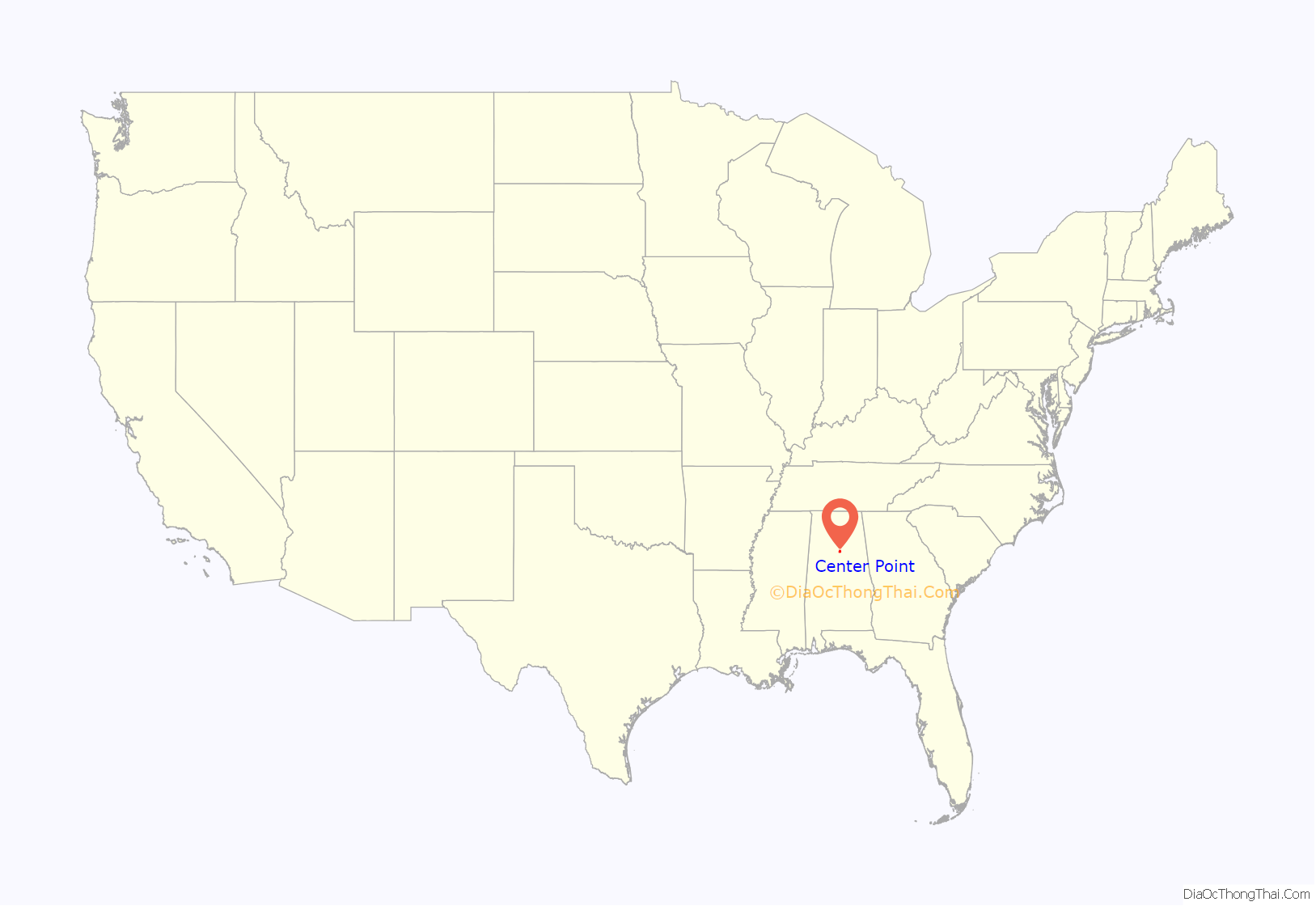
Center Point location map. Where is Center Point city?

History
The city of Center Point originally started as a small farm community, founded by the Reed family of North Carolina, which was around the same time other families were coming in to settle the towns of Trussville, Springville, Clay, and Pinson. By 1924, the Rock School was built, which now stands as the Center Point City Hall, as well as several business such as a post office and blacksmith shop. Center Point remained an unincorporated and small community from the 1920s through the 1950s, but in 1947 a viable water supply was discovered enabling Center Point to become self-sufficient and set up for further development. During the 1950s, there was steady growth in the area as more people continued to move eastward from the center of Birmingham, seeing the nearby neighborhoods East Lake, Huffman, and Roebuck swell with new houses and people. However by the 1960s, Center Point began to rapidly develop, with over 80% of all homes in city limits built within a ten year span from 1960-1970. The rapid growth soon overcrowded Hewitt-Trussville High School in nearby Trussville past capacity limit, which had been the high school serving Center Point for decades. Jefferson County Schools soon elected to introduce a new high school, E.B. Erwin High School in 1965. By 1967, Center Point was recognized as the largest census-designated place (CDP) in the United States with over 67,000 people. From the 1970s through mid-1990s, Center Point was a thriving suburb of Birmingham and was one of the largest surrounding communities. By the late 1990s however, urban blight, financial decay, and violence had already plagued Birmingham’s eastern neighborhoods such as Woodlawn and East Lake, which soon began to spill into still unincorporated Center Point. The decay was accelerated by the clearing/demolition of East Lake housing bordering Birmingham-Shuttlesworth International Airport, which the city of Birmingham was attempting to expand, as well as the rapid annexation attempts made by the city around Center Point and other areas in the 1980s-1990s. The city paid the East Lake homeowners relocation money as reimbursement for the house and property. The decay brought about a severe socioeconomic shift, which saw the complete demographic flip of the area addition to financial and retail losses to newly growing suburbs around Birmingham. The city incorporated in 2002 in a rush for control over their own fate and to deter any further control measures/annexation by the city of Birmingham. Eventually, this decay led to the area’s school quality decline and began to display the rarely-observed “suburban blight”. By 2020 according to the U.S. Census, the city had reached a point where over 1/3 of the city was below the poverty level, in addition to high crime rates, murder rates, and falling population.
Center Point Road Map
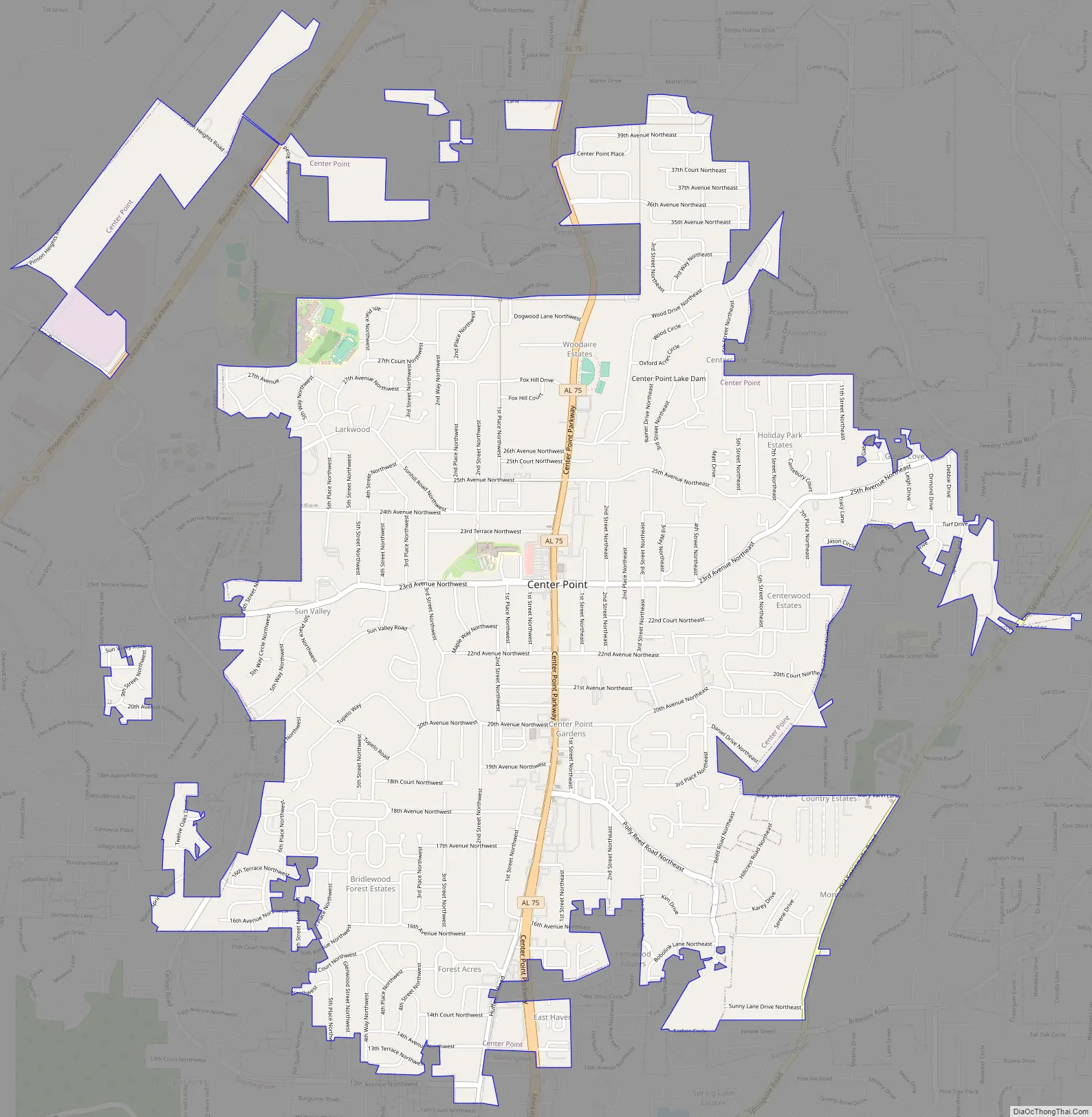
Center Point city Satellite Map

Geography
It is located at 33°38′41″N 86°41′07″W / 33.64472°N 86.68528°W / 33.64472; -86.68528.
According to the U.S. Census Bureau, the CDP had a total area of 8.1 square miles (21 km), of which 8.1 square miles (21 km) was land and 0.04 square miles (0.10 km) (0.25%) was water.
See also
Map of Alabama State and its subdivision:- Autauga
- Baldwin
- Barbour
- Bibb
- Blount
- Bullock
- Butler
- Calhoun
- Chambers
- Cherokee
- Chilton
- Choctaw
- Clarke
- Clay
- Cleburne
- Coffee
- Colbert
- Conecuh
- Coosa
- Covington
- Crenshaw
- Cullman
- Dale
- Dallas
- De Kalb
- Elmore
- Escambia
- Etowah
- Fayette
- Franklin
- Geneva
- Greene
- Hale
- Henry
- Houston
- Jackson
- Jefferson
- Lamar
- Lauderdale
- Lawrence
- Lee
- Limestone
- Lowndes
- Macon
- Madison
- Marengo
- Marion
- Marshall
- Mobile
- Monroe
- Montgomery
- Morgan
- Perry
- Pickens
- Pike
- Randolph
- Russell
- Saint Clair
- Shelby
- Sumter
- Talladega
- Tallapoosa
- Tuscaloosa
- Walker
- Washington
- Wilcox
- Winston
- Alabama
- Alaska
- Arizona
- Arkansas
- California
- Colorado
- Connecticut
- Delaware
- District of Columbia
- Florida
- Georgia
- Hawaii
- Idaho
- Illinois
- Indiana
- Iowa
- Kansas
- Kentucky
- Louisiana
- Maine
- Maryland
- Massachusetts
- Michigan
- Minnesota
- Mississippi
- Missouri
- Montana
- Nebraska
- Nevada
- New Hampshire
- New Jersey
- New Mexico
- New York
- North Carolina
- North Dakota
- Ohio
- Oklahoma
- Oregon
- Pennsylvania
- Rhode Island
- South Carolina
- South Dakota
- Tennessee
- Texas
- Utah
- Vermont
- Virginia
- Washington
- West Virginia
- Wisconsin
- Wyoming


