Altamonte Springs is a suburban city in central Florida in Seminole County, Florida, United States, which had a population of 46,231 at the 2020 United States Census. The city is in the northern suburbs of the Orlando–Kissimmee–Sanford Metropolitan Statistical Area, which the United States Census Bureau estimated had a population of 2,054,574 in 2008.
Dr. Washington Kilmer of Cincinnati was the first person of European background to settle into the area circa 1870, and he named the area Altamont (minus the “e” from the present spelling) after Altamont, New York, an area near his childhood home. In 1882, the Altamonte Land, Hotel and Navigation Company, founded by Thomas C. Simpson and four other Massachusetts businessmen, gave the area its present name: Altamonte Springs. The company developed the core community along Altamonte Avenue (today’s SR 436) between Maitland and Longwood Avenues (today’s Ronald Reagan Boulevard). On November 11, 1920, the residents of Altamonte Springs voted 38 to 7 in favor of incorporation.
| Name: | Altamonte Springs city |
|---|---|
| LSAD Code: | 25 |
| LSAD Description: | city (suffix) |
| State: | Florida |
| County: | Seminole County |
| Incorporated: | November 11th 1920 |
| Elevation: | 79 ft (24 m) |
| Total Area: | 9.70 sq mi (25.13 km²) |
| Land Area: | 9.10 sq mi (23.57 km²) |
| Water Area: | 0.60 sq mi (1.56 km²) |
| Total Population: | 46,231 |
| Population Density: | 5,080.89/sq mi (1,961.72/km²) |
| FIPS code: | 1200950 |
| GNISfeature ID: | 2403089 |
| Website: | www.altamonte.org |
Online Interactive Map
Click on ![]() to view map in "full screen" mode.
to view map in "full screen" mode.
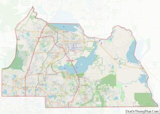
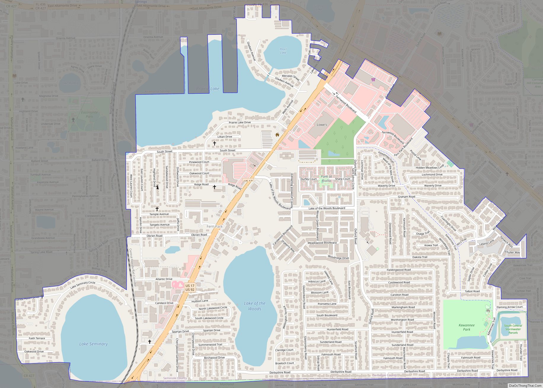
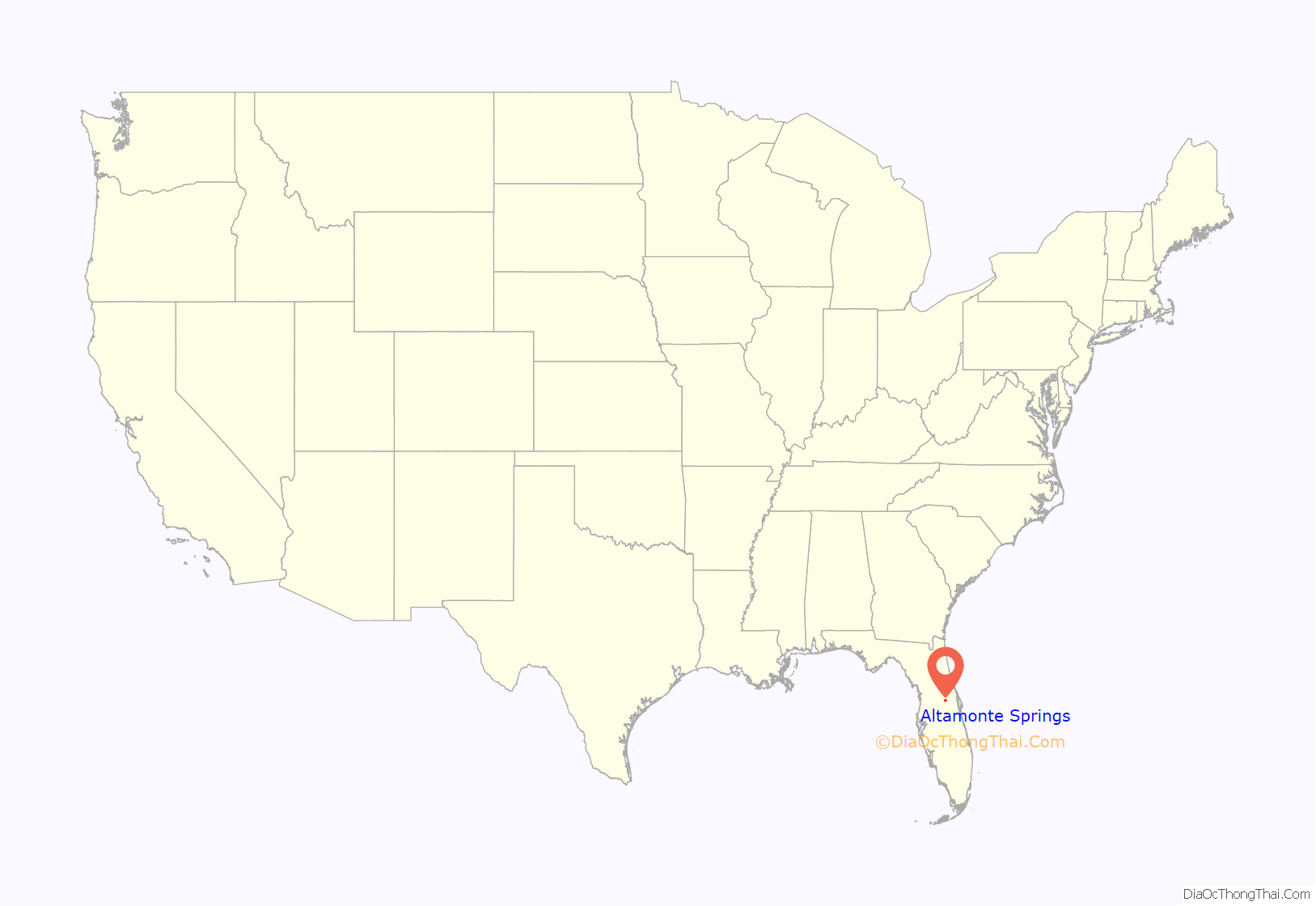
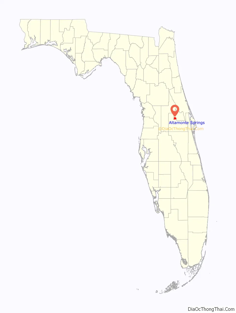
Altamonte Springs location map. Where is Altamonte Springs city?
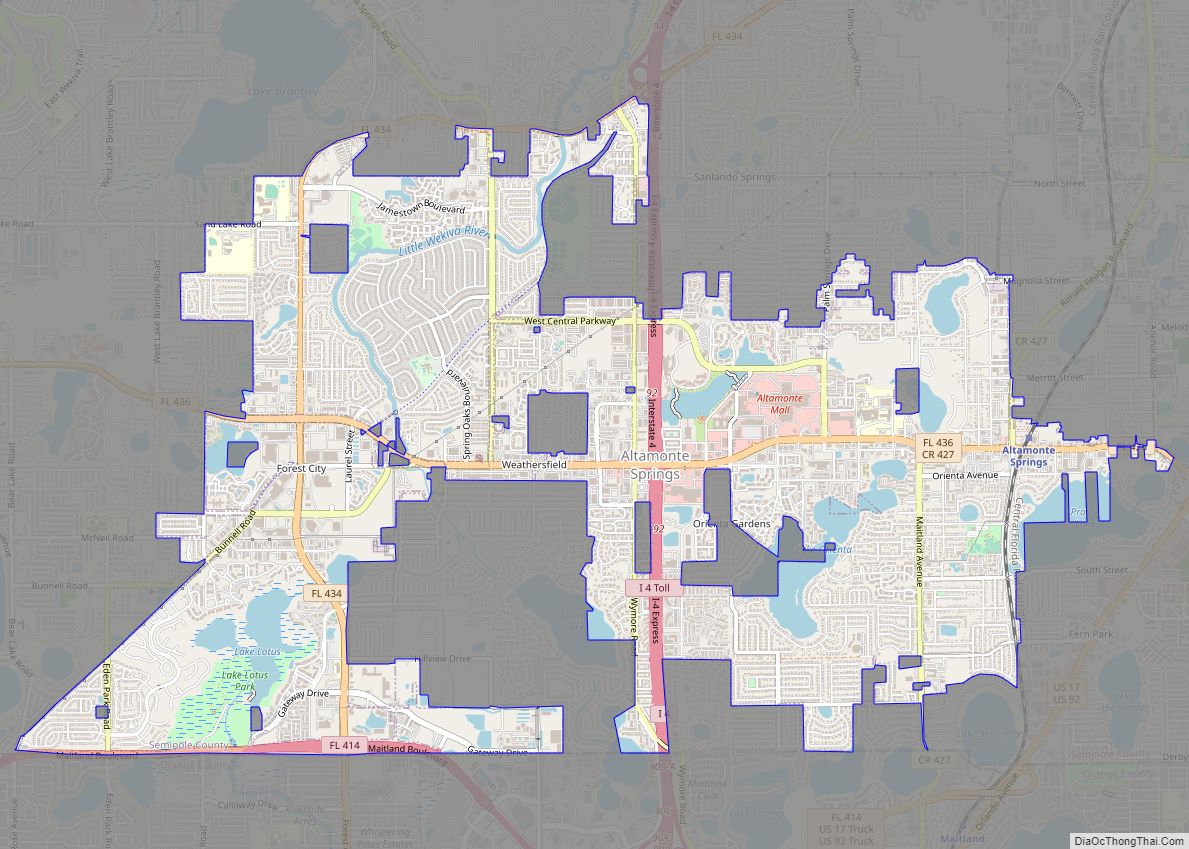
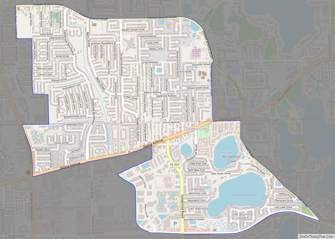
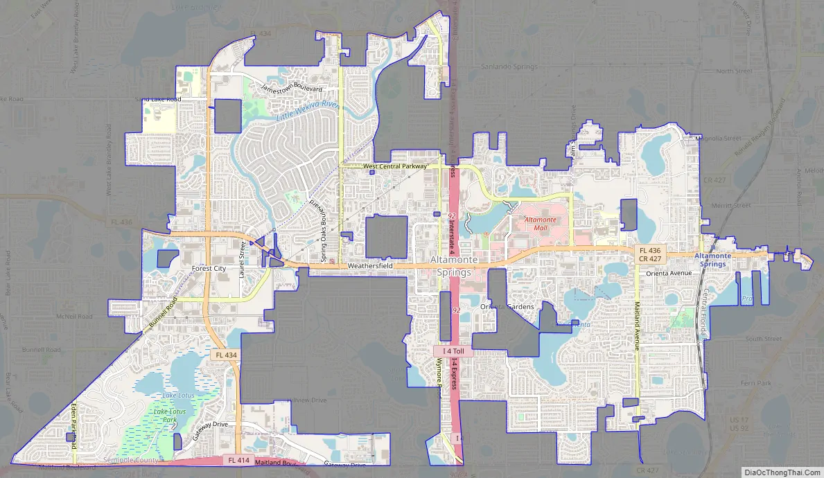
Altamonte Springs Road Map
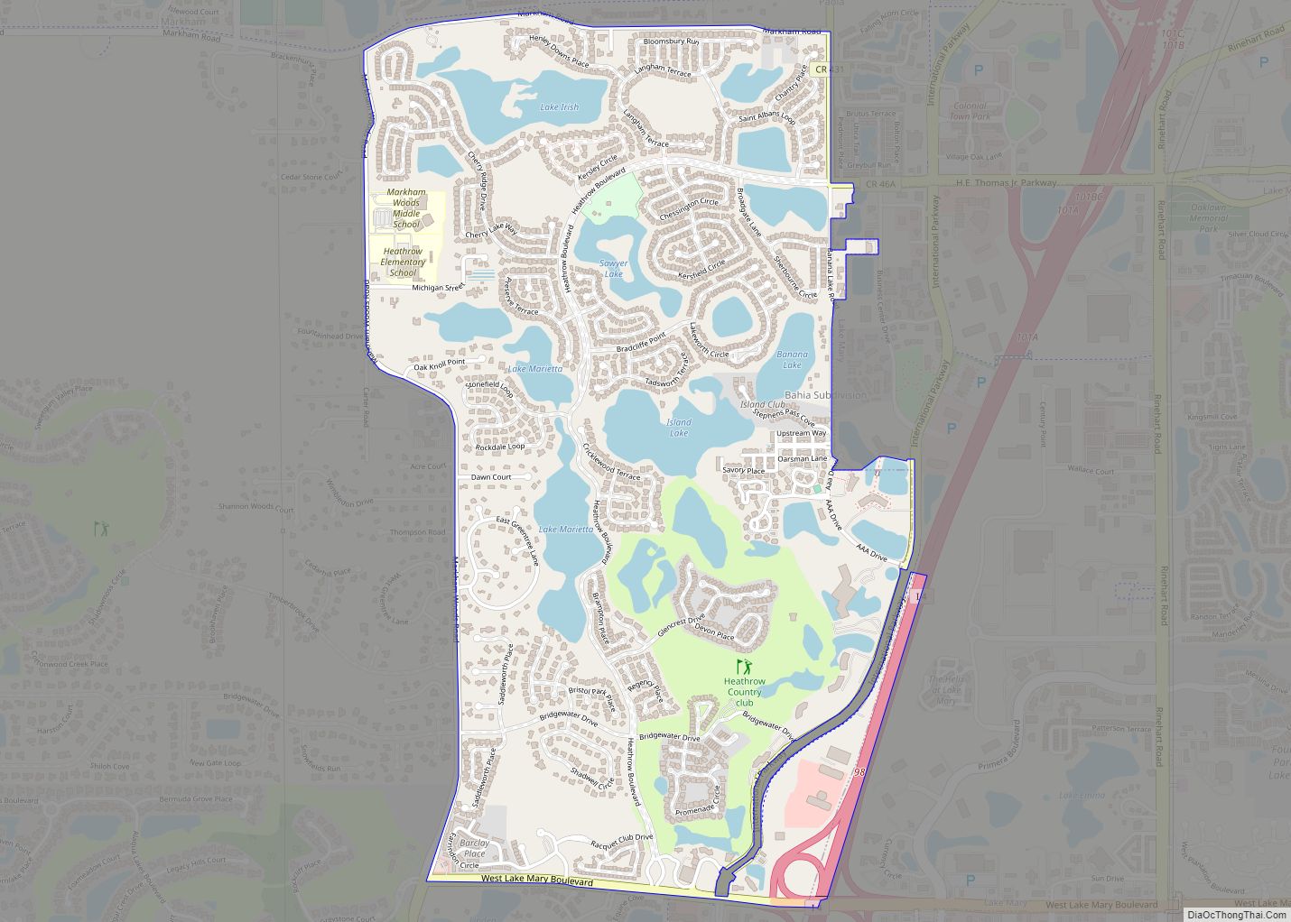
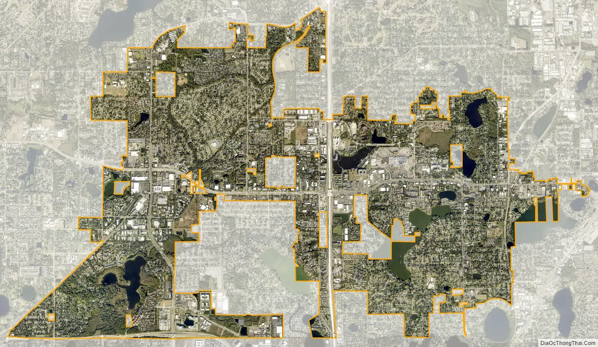
Altamonte Springs city Satellite Map
Geography
Altamonte Springs is located at 28°39′41″N 81°23′31″W / 28.661463°N 81.392016°W / 28.661463; -81.392016 (28.661463, –81.392016).
According to the United States Census Bureau, the city has a total area of 9.4 mi (24.5 km), of which 8.9 mi (23.1 km) is land and 0.6 mi (1.5 km) (5.93%) is water.
See also
Map of Florida State and its subdivision:- Alachua
- Baker
- Bay
- Bradford
- Brevard
- Broward
- Calhoun
- Charlotte
- Citrus
- Clay
- Collier
- Columbia
- Desoto
- Dixie
- Duval
- Escambia
- Flagler
- Franklin
- Gadsden
- Gilchrist
- Glades
- Gulf
- Hamilton
- Hardee
- Hendry
- Hernando
- Highlands
- Hillsborough
- Holmes
- Indian River
- Jackson
- Jefferson
- Lafayette
- Lake
- Lee
- Leon
- Levy
- Liberty
- Madison
- Manatee
- Marion
- Martin
- Miami-Dade
- Monroe
- Nassau
- Okaloosa
- Okeechobee
- Orange
- Osceola
- Palm Beach
- Pasco
- Pinellas
- Polk
- Putnam
- Saint Johns
- Saint Lucie
- Santa Rosa
- Sarasota
- Seminole
- Sumter
- Suwannee
- Taylor
- Union
- Volusia
- Wakulla
- Walton
- Washington
- Alabama
- Alaska
- Arizona
- Arkansas
- California
- Colorado
- Connecticut
- Delaware
- District of Columbia
- Florida
- Georgia
- Hawaii
- Idaho
- Illinois
- Indiana
- Iowa
- Kansas
- Kentucky
- Louisiana
- Maine
- Maryland
- Massachusetts
- Michigan
- Minnesota
- Mississippi
- Missouri
- Montana
- Nebraska
- Nevada
- New Hampshire
- New Jersey
- New Mexico
- New York
- North Carolina
- North Dakota
- Ohio
- Oklahoma
- Oregon
- Pennsylvania
- Rhode Island
- South Carolina
- South Dakota
- Tennessee
- Texas
- Utah
- Vermont
- Virginia
- Washington
- West Virginia
- Wisconsin
- Wyoming