Apopka is a city in Orange County, Florida. The city’s population was 55,000 at the 2020 census. It is part of the Orlando–Kissimmee–Sanford Metropolitan Statistical Area. Apopka comes from Seminole word Ahapopka for “Potato eating place”.
Apopka is referred to as the “Indoor Foliage Capital of the World” due to the many greenhouse nurseries there.
| Name: | Apopka city |
|---|---|
| LSAD Code: | 25 |
| LSAD Description: | city (suffix) |
| State: | Florida |
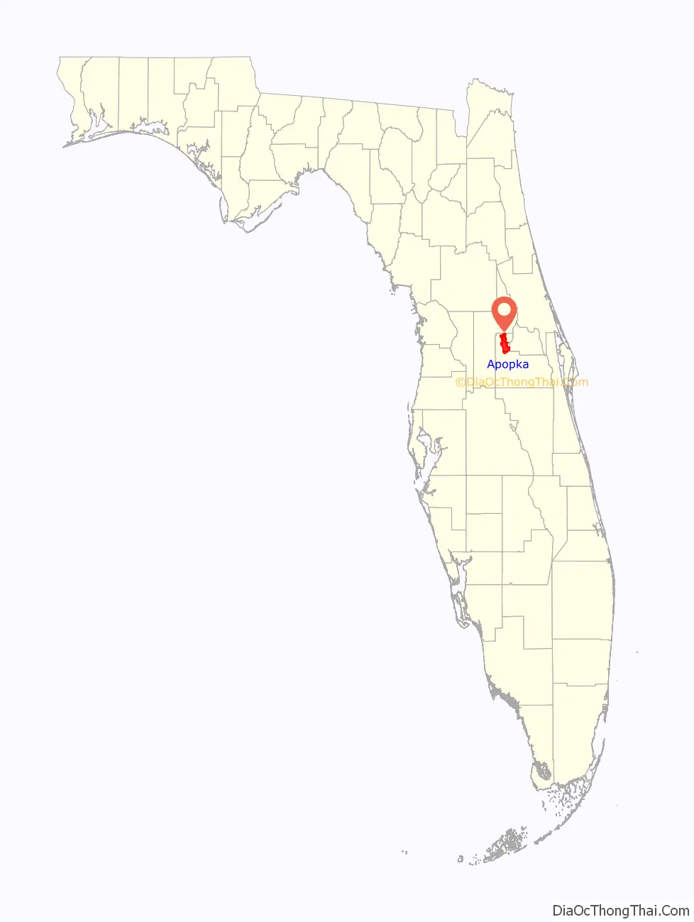
| County: | Orange County |
| Elevation: | 82 ft (25 m) |
| Total Area: | 35.97 sq mi (93.17 km²) |
| Land Area: | 34.59 sq mi (89.60 km²) |
| Water Area: | 1.38 sq mi (3.58 km²) 4.07% |
| Total Population: | 54,873 |
| Population Density: | 1,586.25/sq mi (612.44/km²) |
| FIPS code: | 1201700 |
| GNISfeature ID: | 2403103 |
| Website: | www.apopka.gov |
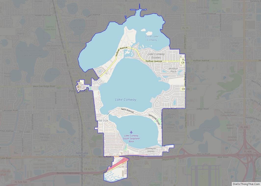
Online Interactive Map
Click on ![]() to view map in "full screen" mode.
to view map in "full screen" mode.
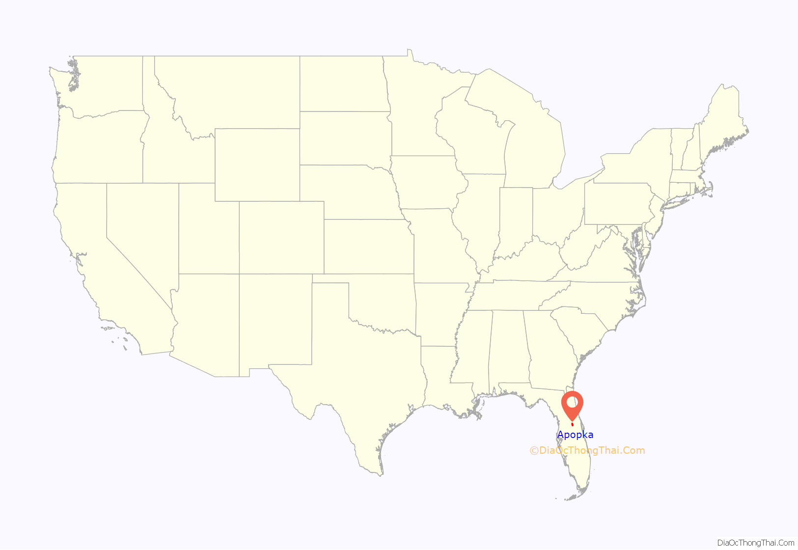
Apopka location map. Where is Apopka city?
History
The earliest known inhabitants of the Apopka area were the Acuera people, members of the Timucua confederation. They had disappeared by 1730, probably decimated by diseases transmitted through Florida by Spanish colonists.
The Acuera were succeeded by refugees from Alabama and Georgia, who formed the new Seminole Indian tribe. They called the area Ahapopka. Aha, meaning “Potato,” and papka, meaning “eating place”. By the 1830s, this settlement numbered about 200, and was the birthplace of the chief Coacoochee (known in English as “Wild Cat”).
At the conclusion of the Second Seminole War, the U.S. Congress passed the Armed Occupation Act of 1842, forcing surviving natives at Ahapopka to abandon their village and seek refuge deeper in the wilderness of the Florida peninsula.
The early American settlers built a major trading center on the foundations of the earlier Indian settlement. Their population was large enough by 1857 to support the establishment of a Masonic lodge. In 1859 the lodge erected a permanent meeting place at what is now the intersection of Main Street (U.S. Highway 441) and Alabama Avenue.
The Lodge
The settlers in the vicinity of “The Lodge” were largely isolated during the Civil War, but the area rebounded once peace was re-established, and a population boom followed the construction of railroad lines through the region.
In 1869, the Apopka Post Office opened.
Town of Apopka City
In 1882, the one mile in each direction of “The Lodge” or “Fudge Hall” was officially incorporated under the name “Town of Apopka City”. In the 1890s, the town was contracted in size more than once due to difficult times.
In 1905, the Apopka City Council authorized incorporation of the Apopka Water, Light, and Ice Company. Councilman A.M. Starbird was appointed its manager, but it was not until voters approved a $9,000 bond in 1914 that he was able to contract with International Harvester Corporation to construct a power plant, so electricity was not available in the city until February 10, 1915. This independent utility company was one of many that were acquired by the Florida Public Service Corporation in the 1920s. They continued to manage the city’s utility needs until the 1940s, when they sold off its ice plants to the Atlantic Company, its electric service to Florida Power Corporation, and its water services to Florida Utilities.
Between 1937 and 1968 a town ordinance forbade Black residents from living north of the railroad tracks.
Historic buildings
Five buildings in Apopka have been placed on the U.S. National Register of Historic Places through the Apopka Historical Society housed in the Museum of the Apopkans.
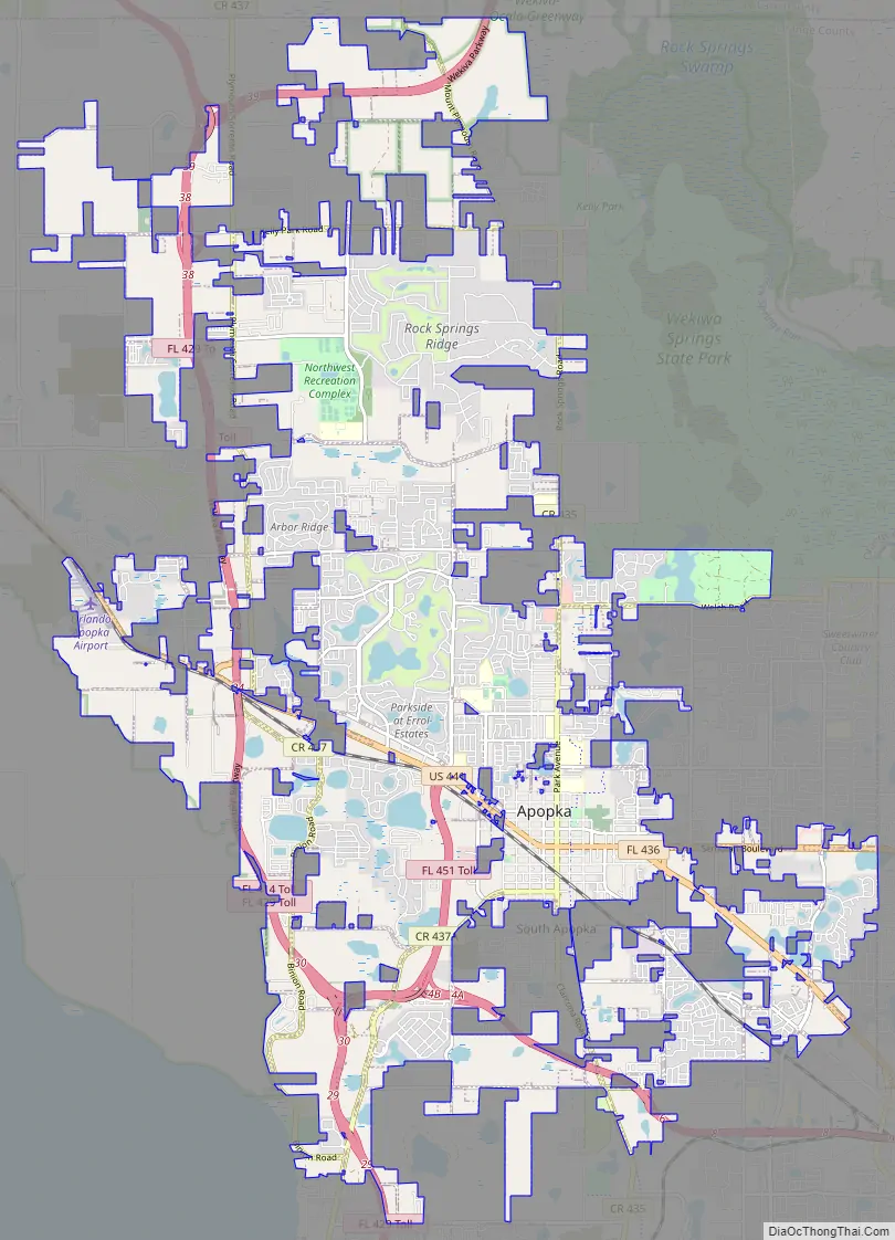
Apopka Road Map
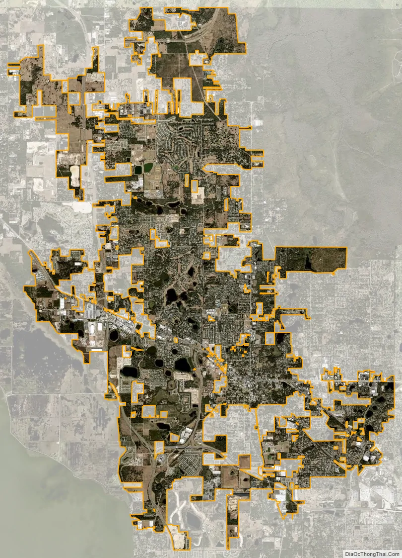
Apopka city Satellite Map
Geography
Apopka is about 16 miles northwest of Downtown Orlando.
According to the United States Census Bureau, the city has a total area of 32.6 square miles (84.4 km). 31.2 square miles (80.9 km) of it is land and 1.4 square miles (3.5 km) of it (4.15%) is water.
Climate
See also
Map of Florida State and its subdivision:- Alachua
- Baker
- Bay
- Bradford
- Brevard
- Broward
- Calhoun
- Charlotte
- Citrus
- Clay
- Collier
- Columbia
- Desoto
- Dixie
- Duval
- Escambia
- Flagler
- Franklin
- Gadsden
- Gilchrist
- Glades
- Gulf
- Hamilton
- Hardee
- Hendry
- Hernando
- Highlands
- Hillsborough
- Holmes
- Indian River
- Jackson
- Jefferson
- Lafayette
- Lake
- Lee
- Leon
- Levy
- Liberty
- Madison
- Manatee
- Marion
- Martin
- Miami-Dade
- Monroe
- Nassau
- Okaloosa
- Okeechobee
- Orange
- Osceola
- Palm Beach
- Pasco
- Pinellas
- Polk
- Putnam
- Saint Johns
- Saint Lucie
- Santa Rosa
- Sarasota
- Seminole
- Sumter
- Suwannee
- Taylor
- Union
- Volusia
- Wakulla
- Walton
- Washington
- Alabama
- Alaska
- Arizona
- Arkansas
- California
- Colorado
- Connecticut
- Delaware
- District of Columbia
- Florida
- Georgia
- Hawaii
- Idaho
- Illinois
- Indiana
- Iowa
- Kansas
- Kentucky
- Louisiana
- Maine
- Maryland
- Massachusetts
- Michigan
- Minnesota
- Mississippi
- Missouri
- Montana
- Nebraska
- Nevada
- New Hampshire
- New Jersey
- New Mexico
- New York
- North Carolina
- North Dakota
- Ohio
- Oklahoma
- Oregon
- Pennsylvania
- Rhode Island
- South Carolina
- South Dakota
- Tennessee
- Texas
- Utah
- Vermont
- Virginia
- Washington
- West Virginia
- Wisconsin
- Wyoming