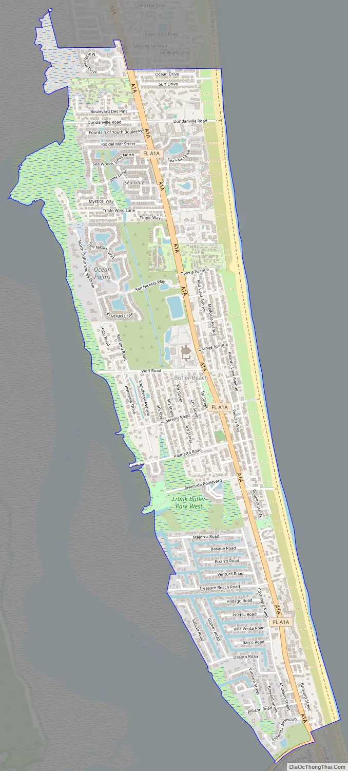
Butler Beach is a census-designated place (CDP) in St. Johns County, Florida, United States. The population was 4,978 at the time of the 2020 United States Census.
| Name: | Butler Beach CDP |
|---|---|
| LSAD Code: | 57 |
| LSAD Description: | CDP (suffix) |
| State: | Florida |
| County: | St. Johns County |
| Elevation: | 3 ft (1 m) |
| Total Area: | 2.66 sq mi (6.88 km²) |
| Land Area: | 2.54 sq mi (6.59 km²) |
| Water Area: | 0.11 sq mi (0.29 km²) |
| Total Population: | 4,978 |
| Population Density: | 1,956.76/sq mi (755.58/km²) |
| FIPS code: | 1209630 |
| GNISfeature ID: | 1867122 |
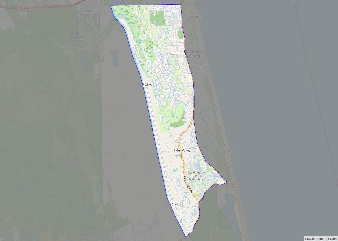
Online Interactive Map
Click on ![]() to view map in "full screen" mode.
to view map in "full screen" mode.
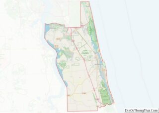
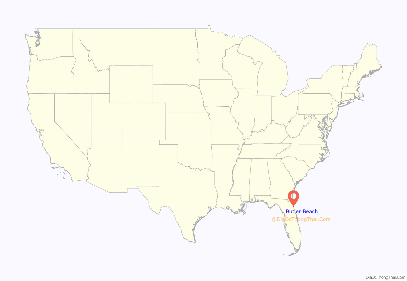
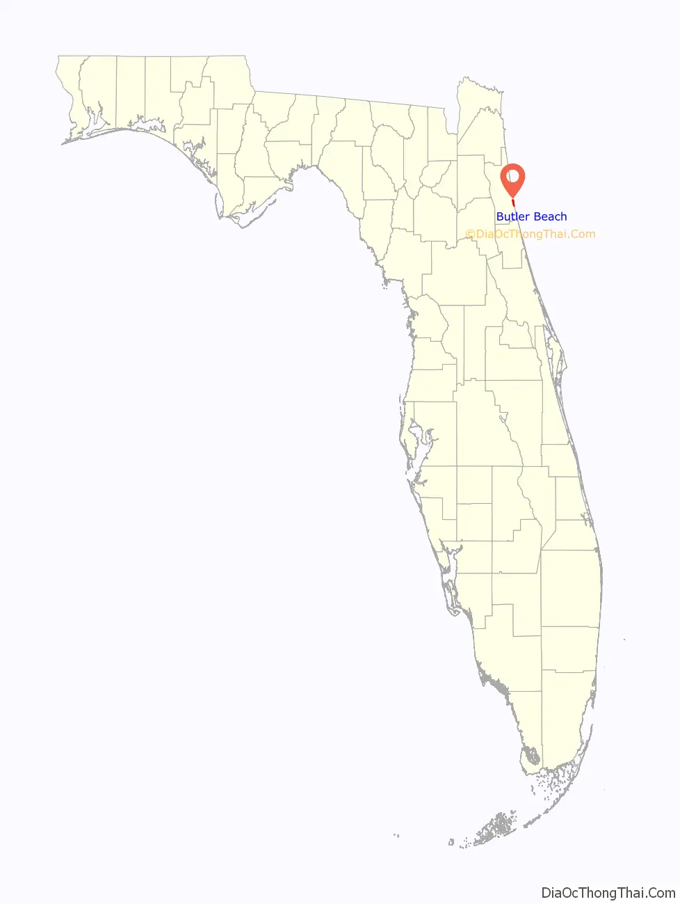
Butler Beach location map. Where is Butler Beach CDP?
History
Butler Beach was established by Frank B. Butler, who had been successful operating a grocery store and became a political activist. The Lincolnville businessman bought land in the area between the Atlantic Ocean and the Matanzas River, and offered beach access to African Americans. It was the only beach open to them between Jacksonville and Daytona Beach.
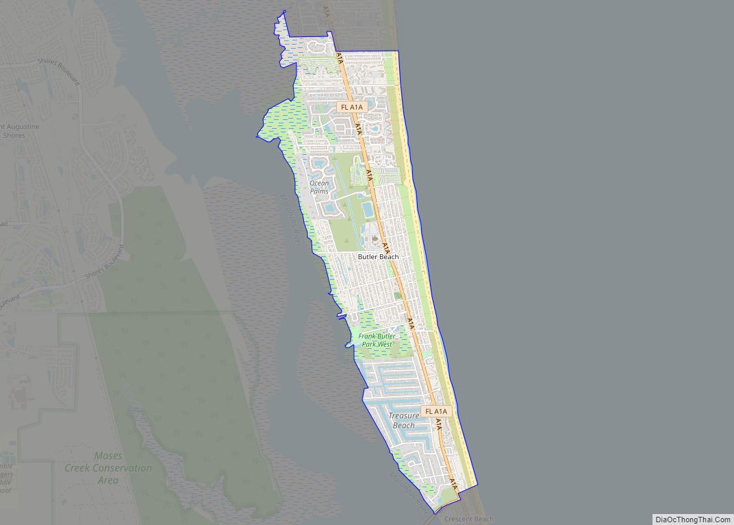
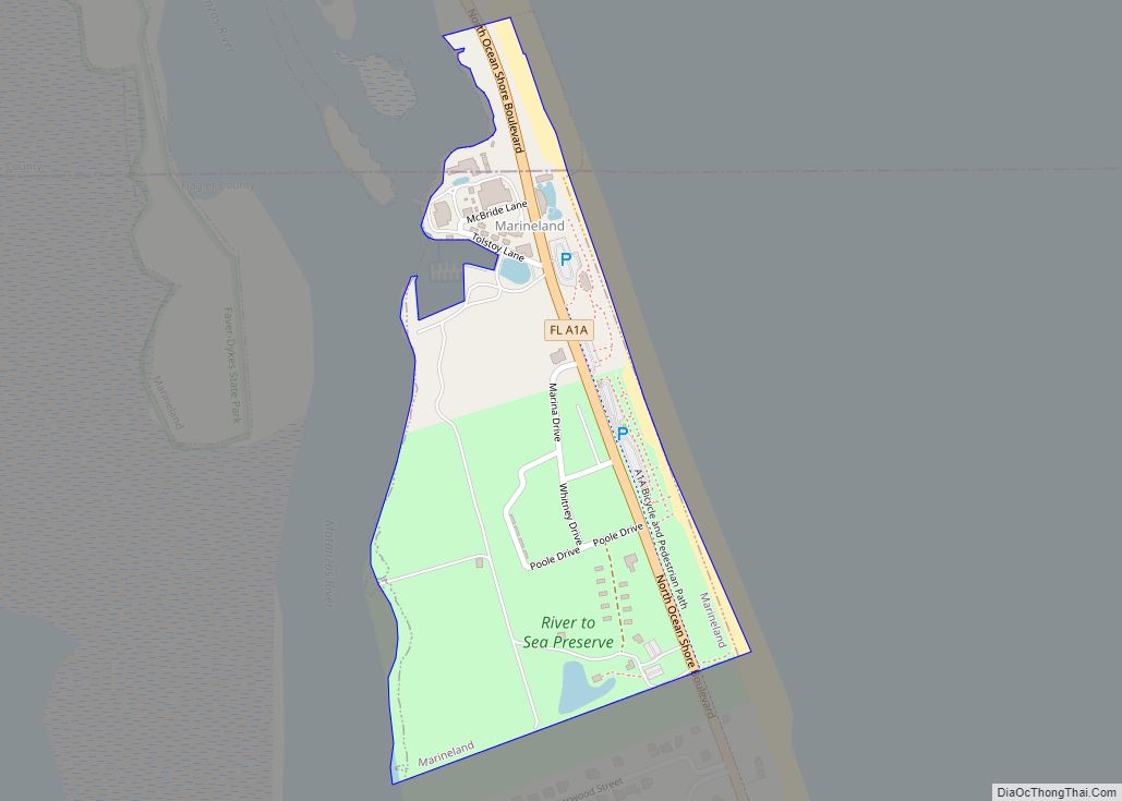
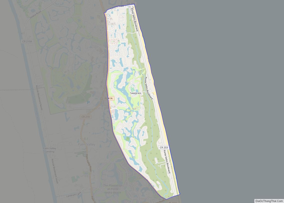
Butler Beach Road Map
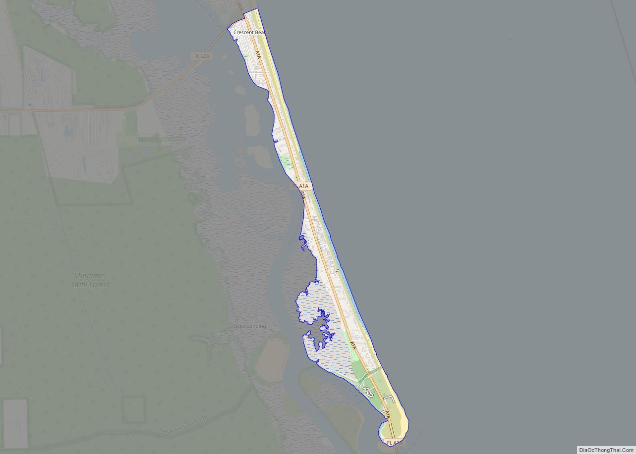
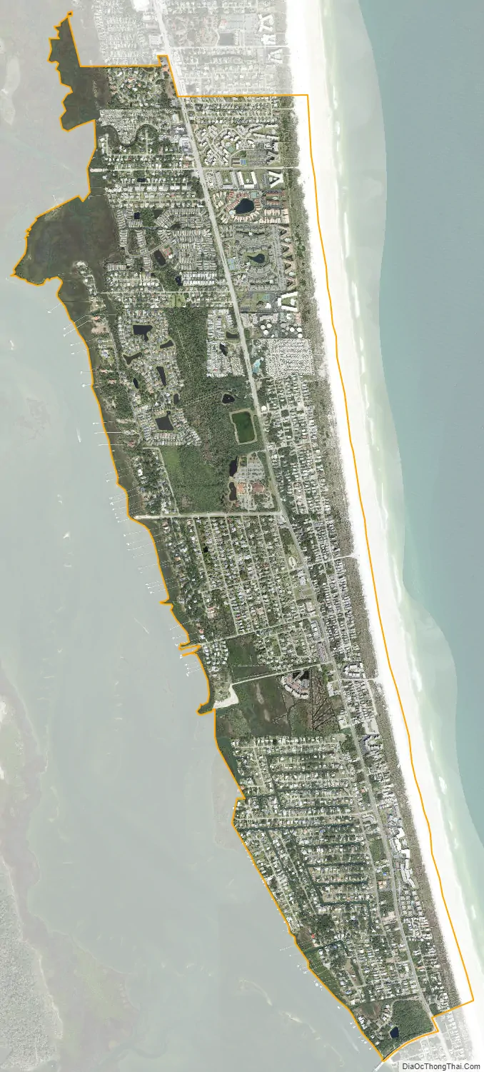
Butler Beach city Satellite Map
Geography
Butler Beach is located at 29°48′1″N 81°15′48″W / 29.80028°N 81.26333°W / 29.80028; -81.26333 (29.800353, -81.263425).
According to the United States Census Bureau, the CDP has a total area of 2.5 square miles (6.5 km), all land.
See also
Map of Florida State and its subdivision:- Alachua
- Baker
- Bay
- Bradford
- Brevard
- Broward
- Calhoun
- Charlotte
- Citrus
- Clay
- Collier
- Columbia
- Desoto
- Dixie
- Duval
- Escambia
- Flagler
- Franklin
- Gadsden
- Gilchrist
- Glades
- Gulf
- Hamilton
- Hardee
- Hendry
- Hernando
- Highlands
- Hillsborough
- Holmes
- Indian River
- Jackson
- Jefferson
- Lafayette
- Lake
- Lee
- Leon
- Levy
- Liberty
- Madison
- Manatee
- Marion
- Martin
- Miami-Dade
- Monroe
- Nassau
- Okaloosa
- Okeechobee
- Orange
- Osceola
- Palm Beach
- Pasco
- Pinellas
- Polk
- Putnam
- Saint Johns
- Saint Lucie
- Santa Rosa
- Sarasota
- Seminole
- Sumter
- Suwannee
- Taylor
- Union
- Volusia
- Wakulla
- Walton
- Washington
- Alabama
- Alaska
- Arizona
- Arkansas
- California
- Colorado
- Connecticut
- Delaware
- District of Columbia
- Florida
- Georgia
- Hawaii
- Idaho
- Illinois
- Indiana
- Iowa
- Kansas
- Kentucky
- Louisiana
- Maine
- Maryland
- Massachusetts
- Michigan
- Minnesota
- Mississippi
- Missouri
- Montana
- Nebraska
- Nevada
- New Hampshire
- New Jersey
- New Mexico
- New York
- North Carolina
- North Dakota
- Ohio
- Oklahoma
- Oregon
- Pennsylvania
- Rhode Island
- South Carolina
- South Dakota
- Tennessee
- Texas
- Utah
- Vermont
- Virginia
- Washington
- West Virginia
- Wisconsin
- Wyoming