Geneva is a community, census-designated place and unincorporated area in Seminole County, Florida, United States, with zip code 32732. The population was 2,913 at the 2020 Census. It is part of the Orlando–Kissimmee–Sanford Metropolitan Statistical Area.
Geneva is the home of the Little-Big Econ State Forest, home of the big and little Econlockhatchee Rivers.
| Name: | Geneva CDP |
|---|---|
| LSAD Code: | 57 |
| LSAD Description: | CDP (suffix) |
| State: | Florida |
| County: | Seminole County |
| Elevation: | 69 ft (21 m) |
| Total Area: | 13.65 sq mi (35.35 km²) |
| Land Area: | 12.73 sq mi (32.97 km²) |
| Water Area: | 0.92 sq mi (2.37 km²) |
| Total Population: | 2,913 |
| Population Density: | 228.81/sq mi (88.34/km²) |
| ZIP code: | 32732 |
| Area code: | 407, 689 |
| FIPS code: | 1225750 |
| GNISfeature ID: | 2402520 |
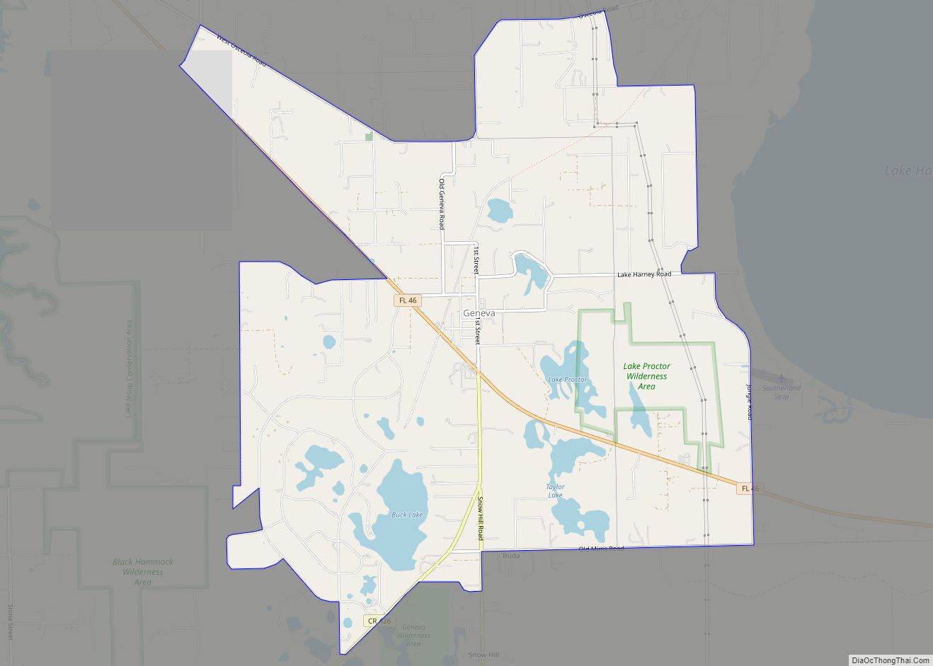
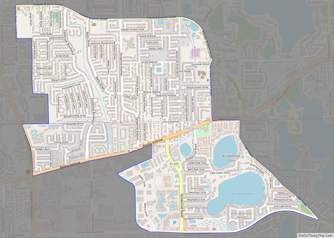
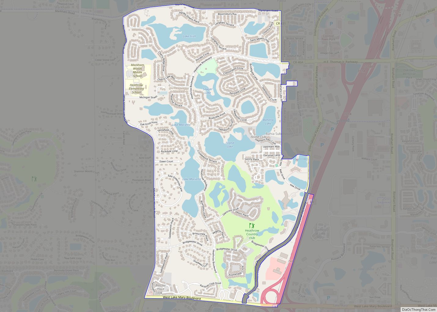
Online Interactive Map
Click on ![]() to view map in "full screen" mode.
to view map in "full screen" mode.
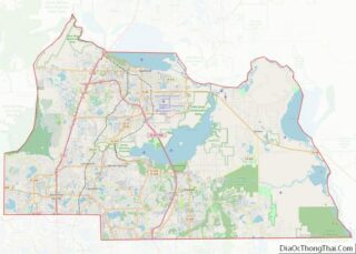
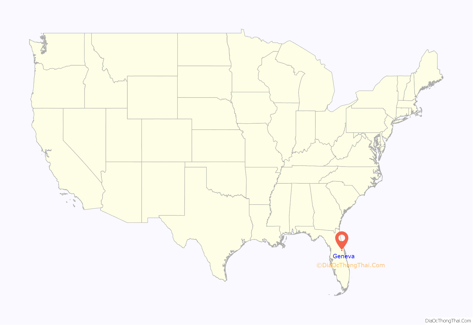
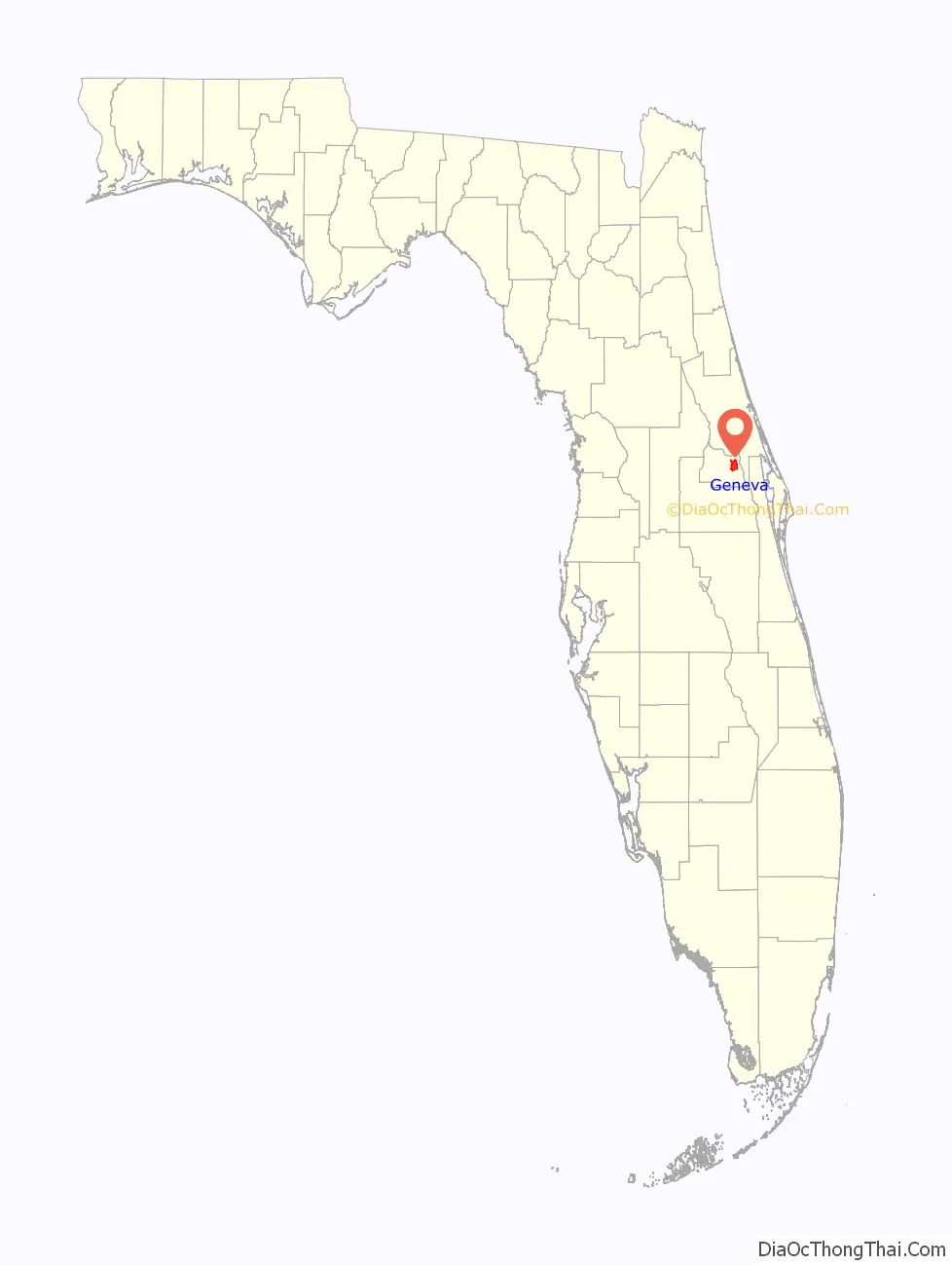
Geneva location map. Where is Geneva CDP?
History
John and William Bartram first documented Geneva’s history in 1765-66. Since then, there have been several other documentations: Anthropologist Daniel Britton in 1850, scientists of Harvard University in 1875 and by an Archeological Cultural Resources Study and an Architectural Resources Study.
The Geneva Cemetery is located on a piece of land that was donated by Progar Debogory. Debogory was the head of one of the Russian families that settled in the Geneva area in the 1800s. There are currently 17 U.S. Civil War soldiers buried in the Geneva Cemetery, 15 of these soldiers served in the confederacy and only 2 served in the union. There were originally 18 soldiers buried, however one soldier’s remains were removed by his family and placed in a different cemetery.
Early schools in Geneva were originally located in the homes of local residents. The first formal school was built in 1874 on land that was also donated by Progar Debogory. A new one-room school was built by 1903 in replacement of the original schoolhouse. In 1924, a new building was built out of bricks and had 4 rooms to accommodate more students. In 1941, principal W.L. Seig developed a unique 4-H program focused on the development of home economics and farming skills. This program was sponsored by Rollins College and this accomplishment is acknowledged and praised in the “History of the Seminole County Public Schools”. In 1988, an elementary school was built surrounding the old brick schoolhouse. The old schoolhouse was preserved for the community and in 1995 it served as a family resource center. Finally in 2008, the building was dedicated to the community to serve as a rural heritage center.
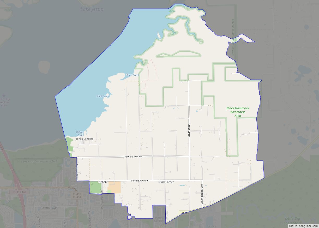
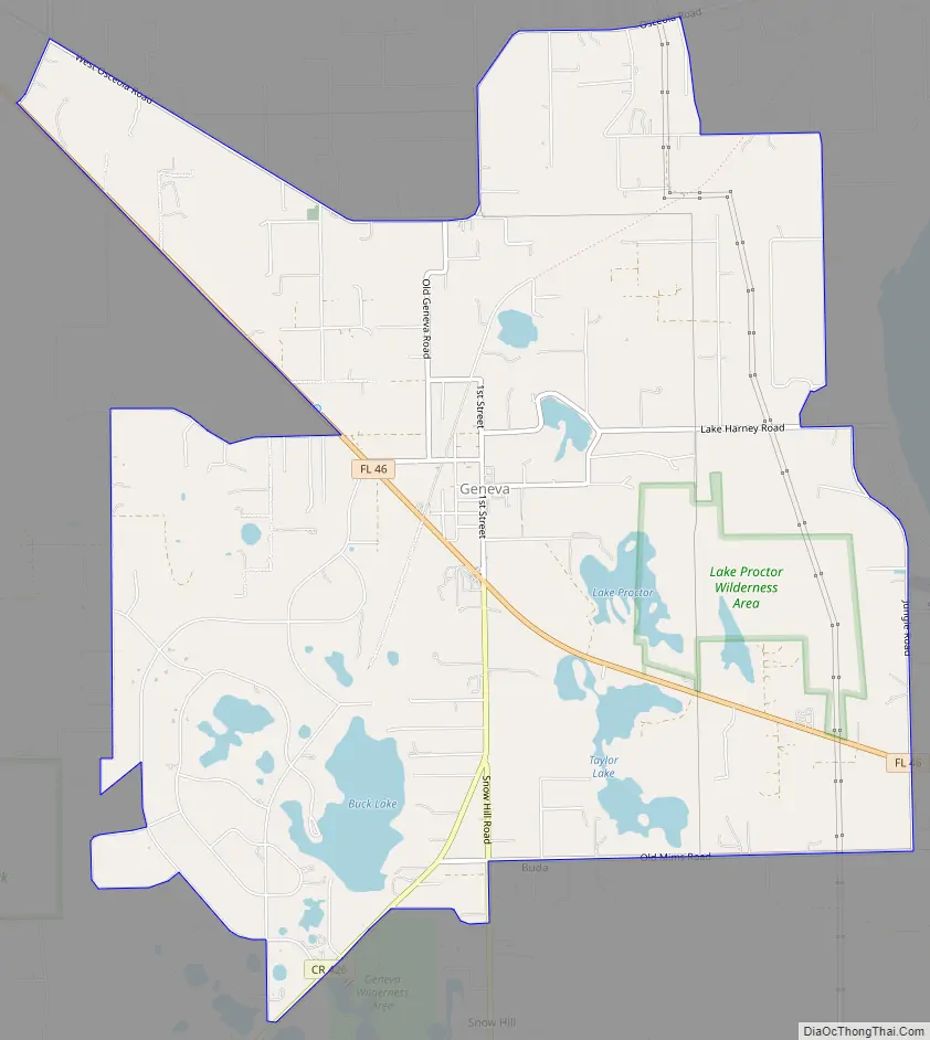
Geneva Road Map
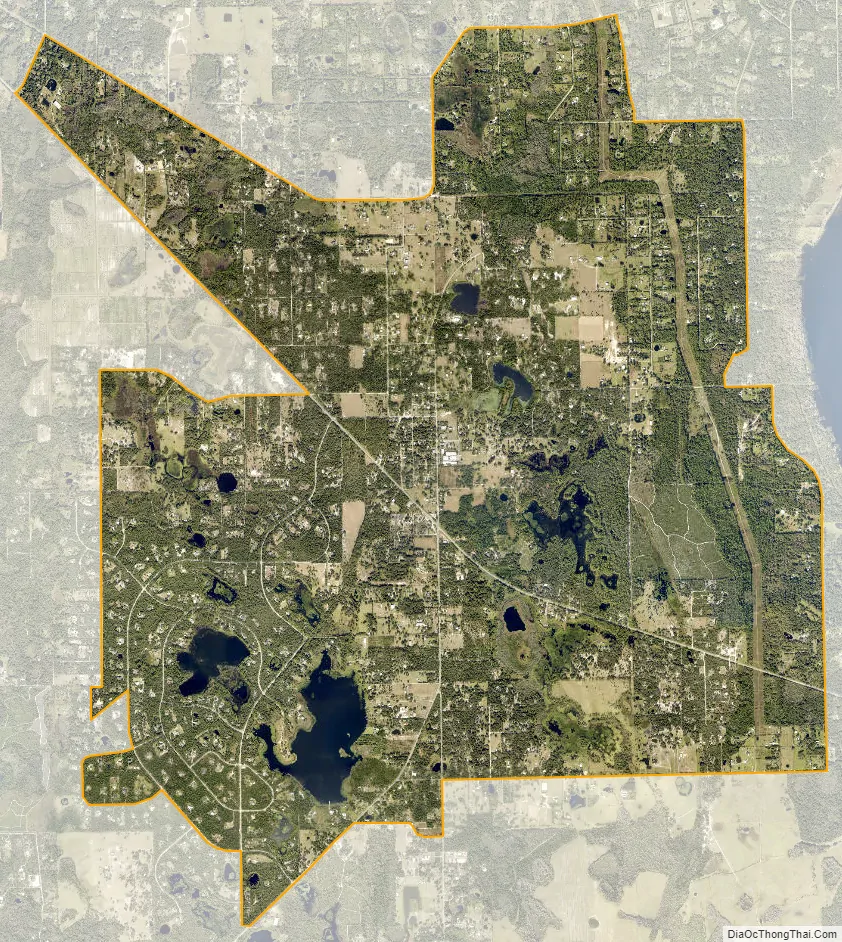
Geneva city Satellite Map
Geography
According to the United States Census Bureau, the CDP has a total area of 32.2 km (12.4 mi²), of which 29.5 km (11.4 mi²) is land and 2.7 km (1.0 mi²) (8.37%) is water.
Geneva is on State Road 46, located between Lake Harney and Lake Jesup.
See also
Map of Florida State and its subdivision:- Alachua
- Baker
- Bay
- Bradford
- Brevard
- Broward
- Calhoun
- Charlotte
- Citrus
- Clay
- Collier
- Columbia
- Desoto
- Dixie
- Duval
- Escambia
- Flagler
- Franklin
- Gadsden
- Gilchrist
- Glades
- Gulf
- Hamilton
- Hardee
- Hendry
- Hernando
- Highlands
- Hillsborough
- Holmes
- Indian River
- Jackson
- Jefferson
- Lafayette
- Lake
- Lee
- Leon
- Levy
- Liberty
- Madison
- Manatee
- Marion
- Martin
- Miami-Dade
- Monroe
- Nassau
- Okaloosa
- Okeechobee
- Orange
- Osceola
- Palm Beach
- Pasco
- Pinellas
- Polk
- Putnam
- Saint Johns
- Saint Lucie
- Santa Rosa
- Sarasota
- Seminole
- Sumter
- Suwannee
- Taylor
- Union
- Volusia
- Wakulla
- Walton
- Washington
- Alabama
- Alaska
- Arizona
- Arkansas
- California
- Colorado
- Connecticut
- Delaware
- District of Columbia
- Florida
- Georgia
- Hawaii
- Idaho
- Illinois
- Indiana
- Iowa
- Kansas
- Kentucky
- Louisiana
- Maine
- Maryland
- Massachusetts
- Michigan
- Minnesota
- Mississippi
- Missouri
- Montana
- Nebraska
- Nevada
- New Hampshire
- New Jersey
- New Mexico
- New York
- North Carolina
- North Dakota
- Ohio
- Oklahoma
- Oregon
- Pennsylvania
- Rhode Island
- South Carolina
- South Dakota
- Tennessee
- Texas
- Utah
- Vermont
- Virginia
- Washington
- West Virginia
- Wisconsin
- Wyoming