Hastings is an unincorporated community and agricultural center in St. Johns County, Florida, United States, 18 miles (29 km) southwest of St. Augustine. It was formerly an incorporated town, but it was dissolved in 2018 after a vote by residents. The population was 580 at the 2010 census. As of 2018, the population estimated by the U.S. Census Bureau to be 648.
| Name: | Hastings CDP |
|---|---|
| LSAD Code: | 57 |
| LSAD Description: | CDP (suffix) |
| State: | Florida |
| County: | St. Johns County |
| Incorporated: | 1909 |
| Elevation: | 7 ft (2 m) |
| Total Area: | 3.24 sq mi (8.40 km²) |
| Land Area: | 3.24 sq mi (8.39 km²) |
| Water Area: | 0.00 sq mi (0.01 km²) |
| Total Population: | 1,262 |
| Population Density: | 389.63/sq mi (150.41/km²) |
| Area code: | 904 |
| FIPS code: | 1229100 |
| GNISfeature ID: | 0307980 |
| Website: | www.hastings-fl.com |
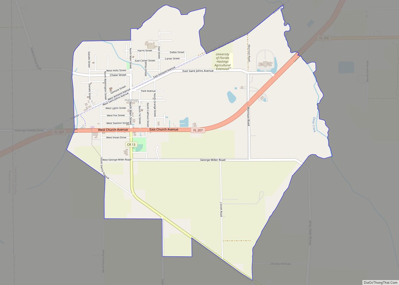
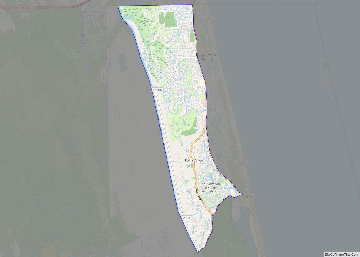
Online Interactive Map
Click on ![]() to view map in "full screen" mode.
to view map in "full screen" mode.
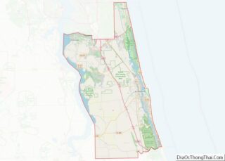
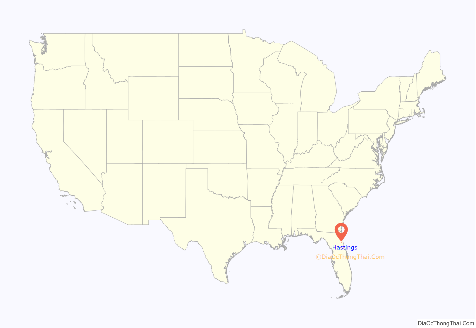
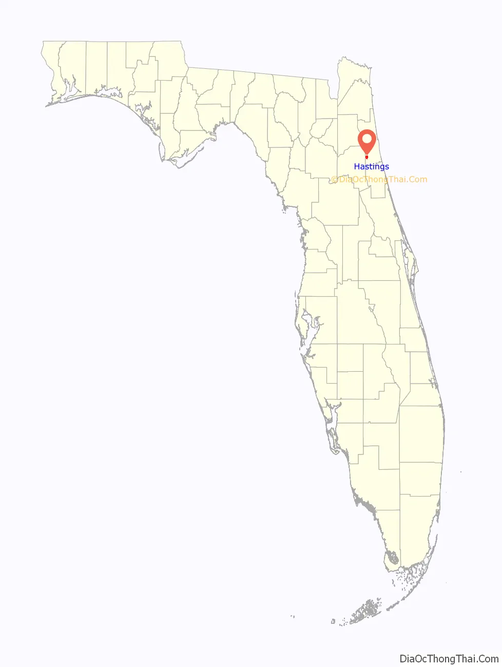
Hastings location map. Where is Hastings CDP?
History
Henry Morrison Flagler built tourist hotels at St. Augustine in the late 19th century, including the Ponce de León Hotel. He needed a local source of fresh vegetables for his guests, so he persuaded Thomas Horace Hastings, his cousin, to develop a farm. A small community evolved into a town, which was named for its founder in 1890. Hastings is known as the “Potato Capital of Florida” with 21,000 acres (85 km) of potato farms, but also produces cabbage, onions, eggplant and ornamental horticulture.
Hastings in 1910 was thriving town that was a stop on the Florida East Coast Railway. The population of approximately 1,200 supported several general stores, a bakery, drug stores, meat markets, an ice plant and cold storage. In addition to farming, two companies manufactured barrels and a grist mill ground grain. There was a bank and a hotel, three doctors and a dentist. The town had water and sewer utilities, telephone and telegraph service. The local public school was good. Today the former FEC line is part of the Palatka-to-St. Augustine State Trail, and a trailhead can be found in the community within the Cora C. Harrison Preserve.
On November 7, 2017, the voters of Hastings elected to dissolve the city with an 82% majority vote. St. Johns County officially took control of the area on March 1, 2018.
The United States Census Bureau designated Hastings as a census-designated place in the 2020 census.
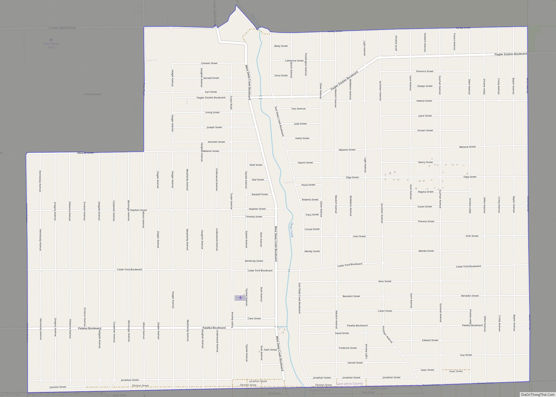
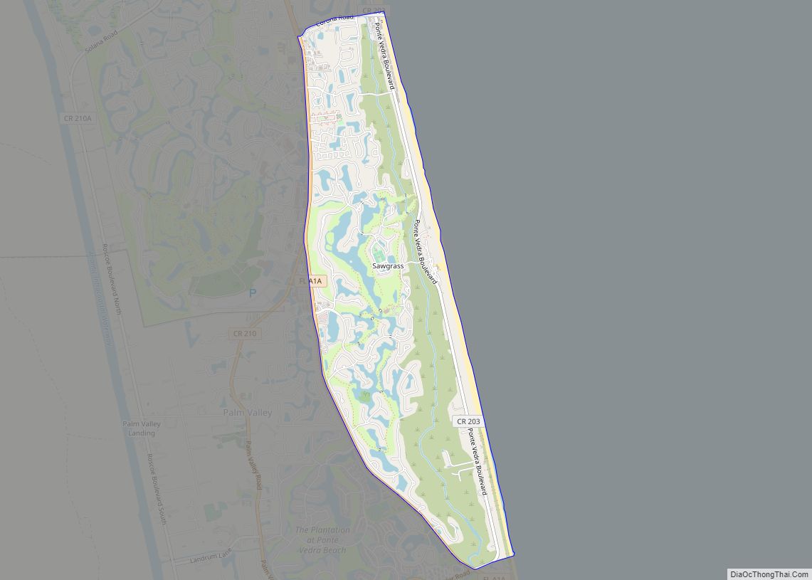
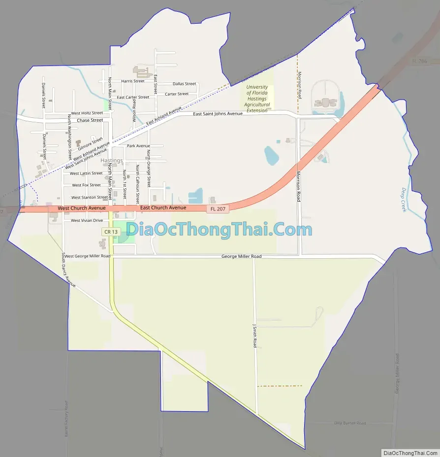
Hastings Road Map
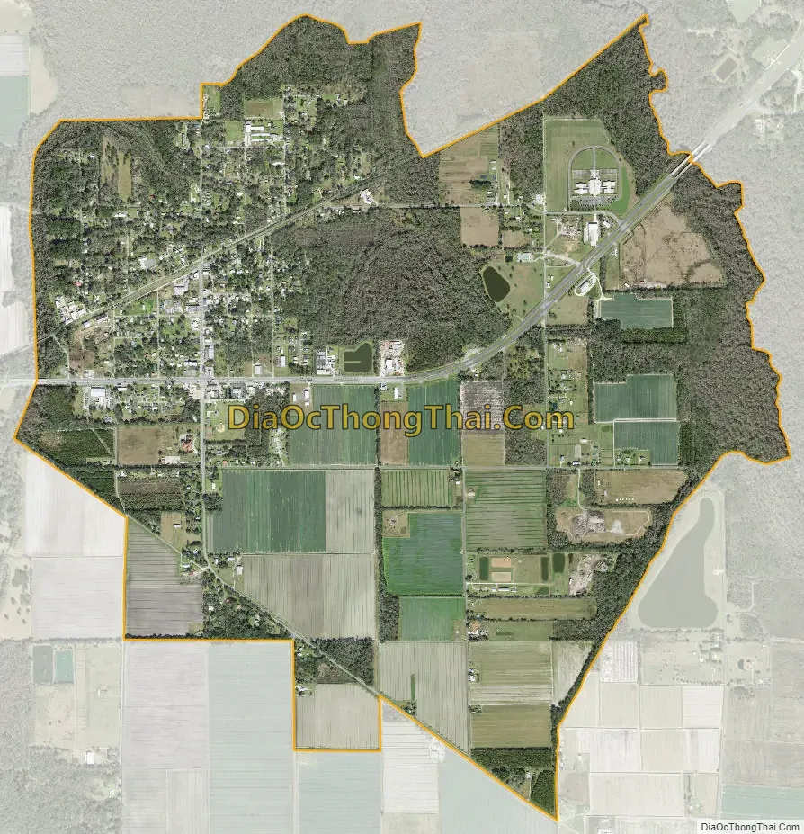
Hastings city Satellite Map
Geography
Hastings is located at 29°43′5″N 81°30′29″W / 29.71806°N 81.50806°W / 29.71806; -81.50806 (29.7180, -81.5081).
According to the United States Census Bureau, the town had a total area of 0.7 square miles (1.8 km), all land.
Climate
See also
Map of Florida State and its subdivision:- Alachua
- Baker
- Bay
- Bradford
- Brevard
- Broward
- Calhoun
- Charlotte
- Citrus
- Clay
- Collier
- Columbia
- Desoto
- Dixie
- Duval
- Escambia
- Flagler
- Franklin
- Gadsden
- Gilchrist
- Glades
- Gulf
- Hamilton
- Hardee
- Hendry
- Hernando
- Highlands
- Hillsborough
- Holmes
- Indian River
- Jackson
- Jefferson
- Lafayette
- Lake
- Lee
- Leon
- Levy
- Liberty
- Madison
- Manatee
- Marion
- Martin
- Miami-Dade
- Monroe
- Nassau
- Okaloosa
- Okeechobee
- Orange
- Osceola
- Palm Beach
- Pasco
- Pinellas
- Polk
- Putnam
- Saint Johns
- Saint Lucie
- Santa Rosa
- Sarasota
- Seminole
- Sumter
- Suwannee
- Taylor
- Union
- Volusia
- Wakulla
- Walton
- Washington
- Alabama
- Alaska
- Arizona
- Arkansas
- California
- Colorado
- Connecticut
- Delaware
- District of Columbia
- Florida
- Georgia
- Hawaii
- Idaho
- Illinois
- Indiana
- Iowa
- Kansas
- Kentucky
- Louisiana
- Maine
- Maryland
- Massachusetts
- Michigan
- Minnesota
- Mississippi
- Missouri
- Montana
- Nebraska
- Nevada
- New Hampshire
- New Jersey
- New Mexico
- New York
- North Carolina
- North Dakota
- Ohio
- Oklahoma
- Oregon
- Pennsylvania
- Rhode Island
- South Carolina
- South Dakota
- Tennessee
- Texas
- Utah
- Vermont
- Virginia
- Washington
- West Virginia
- Wisconsin
- Wyoming