Hunter’s Creek is a master planned, unincorporated community and census-designated place in Orange County, Florida, United States. It is part of the Orlando–Kissimmee–Sanford, Florida Metropolitan Statistical Area. The population was 14,321 at the 2010 census. It has grown up around a large planned community named Hunter’s Creek, though the CDP name given by the United States Census Bureau lacks the apostrophe.
| Name: | Hunters Creek CDP |
|---|---|
| LSAD Code: | 57 |
| LSAD Description: | CDP (suffix) |
| State: | Florida |
| County: | Orange County |
| Elevation: | 89 ft (27 m) |
| Total Area: | 7.07 sq mi (18.32 km²) |
| Land Area: | 7.05 sq mi (18.25 km²) |
| Water Area: | 0.03 sq mi (0.07 km²) |
| Total Population: | 24,433 |
| Population Density: | 3,467.64/sq mi (1,338.91/km²) |
| Area code: | 407, 321 |
| FIPS code: | 1232967 |
| GNISfeature ID: | 1853258 |
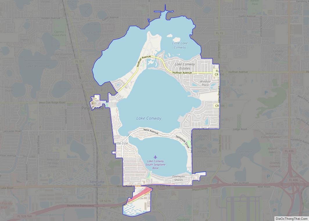
Online Interactive Map
Click on ![]() to view map in "full screen" mode.
to view map in "full screen" mode.
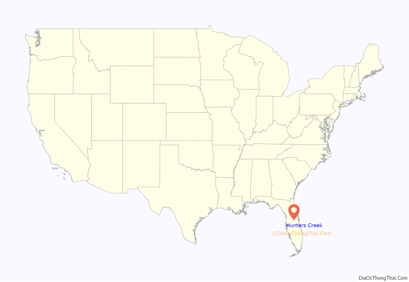
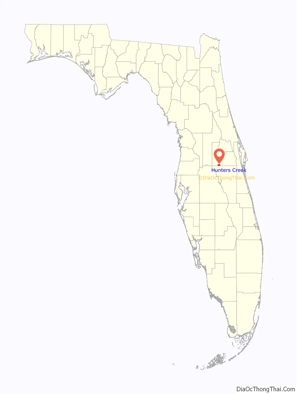
Hunters Creek location map. Where is Hunters Creek CDP?
History
Genstar Development Company based out of Canada owned a massive tract of land in south Orange County Florida totaling up to 3,840 acres. Planning of the upscale community began as early as 1984 with an official kick-off construction announcement in 1986, noting that this was a 15- to 20-year project. Genstar sold much of the remaining development in 1987 for $25,832,000 to American Newland Associates, a California general partnership. August 1997 AG Land Associates, LLC (f/k/a American Newland Associates) sells some of the undeveloped acreages to Westbrook Hunter’s Creek, LP for $42,589,200. The majority of the community was built in the late 1980s and 1990s, and some of the community is still under construction.
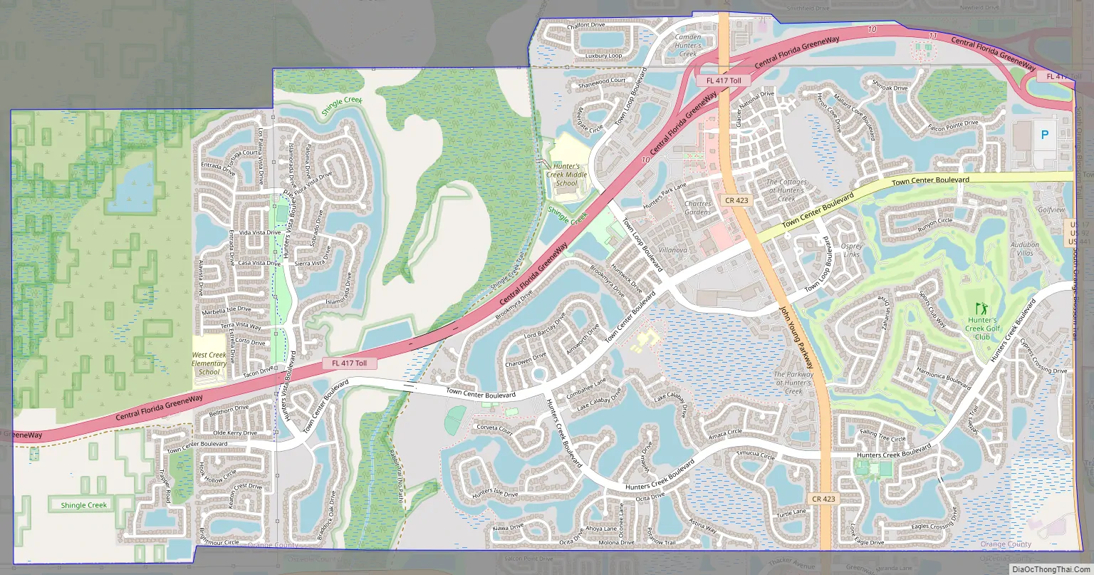
Hunters Creek Road Map
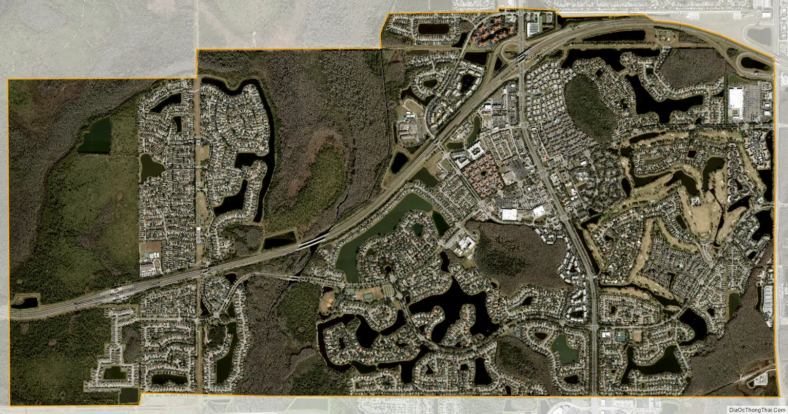
Hunters Creek city Satellite Map
Geography
Hunter’s Creek is located at 28°21′26″N 81°25′42″W / 28.35722°N 81.42833°W / 28.35722; -81.42833 (28.357105, -81.428453).
According to the United States Census Bureau, the CDP has a total area of 3.8 square miles (9.9 km), all land.
See also
Map of Florida State and its subdivision:- Alachua
- Baker
- Bay
- Bradford
- Brevard
- Broward
- Calhoun
- Charlotte
- Citrus
- Clay
- Collier
- Columbia
- Desoto
- Dixie
- Duval
- Escambia
- Flagler
- Franklin
- Gadsden
- Gilchrist
- Glades
- Gulf
- Hamilton
- Hardee
- Hendry
- Hernando
- Highlands
- Hillsborough
- Holmes
- Indian River
- Jackson
- Jefferson
- Lafayette
- Lake
- Lee
- Leon
- Levy
- Liberty
- Madison
- Manatee
- Marion
- Martin
- Miami-Dade
- Monroe
- Nassau
- Okaloosa
- Okeechobee
- Orange
- Osceola
- Palm Beach
- Pasco
- Pinellas
- Polk
- Putnam
- Saint Johns
- Saint Lucie
- Santa Rosa
- Sarasota
- Seminole
- Sumter
- Suwannee
- Taylor
- Union
- Volusia
- Wakulla
- Walton
- Washington
- Alabama
- Alaska
- Arizona
- Arkansas
- California
- Colorado
- Connecticut
- Delaware
- District of Columbia
- Florida
- Georgia
- Hawaii
- Idaho
- Illinois
- Indiana
- Iowa
- Kansas
- Kentucky
- Louisiana
- Maine
- Maryland
- Massachusetts
- Michigan
- Minnesota
- Mississippi
- Missouri
- Montana
- Nebraska
- Nevada
- New Hampshire
- New Jersey
- New Mexico
- New York
- North Carolina
- North Dakota
- Ohio
- Oklahoma
- Oregon
- Pennsylvania
- Rhode Island
- South Carolina
- South Dakota
- Tennessee
- Texas
- Utah
- Vermont
- Virginia
- Washington
- West Virginia
- Wisconsin
- Wyoming